Commons:Wiki Loves Monuments in Switzerland/Thurgau/T-Z
Jump to navigation
Jump to search
Tägerwilen
| Location | Upload | Photo | Object | Cat. | Coordinates | KGS-Nr | |
|---|---|---|---|---|---|---|---|
| Tägerwilen | 
|
Schloss Castell | A | 47°38′44″N 9°07′59″E / 47.6456°N 9.13306°E | 5177 | ||
| Tägerwilen | 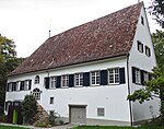
|
Gut Hochstrass | B | 47°39′02″N 9°09′28″E / 47.650628°N 9.157745°E | 13811 | ||
| Tägerwilen | 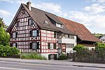
|
Müller-Thurgau-Haus | B | 47°39′16″N 9°08′06″E / 47.654454°N 9.134863°E | 13809 | ||
| Tägerwilen | 
|
Okenfiner Haus | B | 47°39′18″N 9°08′18″E / 47.654936°N 9.138246°E | 13810 | ||
| Tägerwilen | 
|
Reformierte Kirche | B | 47°39′18″N 9°08′12″E / 47.654914°N 9.136635°E | 5178 | ||
| Tägerwilen | 
|
Unter-Chastel, Burgruine Chastel | B | 47°38′42″N 9°08′03″E / 47.645127°N 9.134205°E | 13887 | ||
| Tägerwilen | 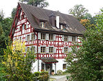
|
Wohnhaus Obermühle | B | 47°39′16″N 9°07′27″E / 47.654474°N 9.124239°E | 11057 | ||
Thundorf
| Location | Upload | Photo | Object | Cat. | Coordinates | KGS-Nr | |
|---|---|---|---|---|---|---|---|
| Thundorf | 
|
Stählibuckturm | B | 47°32′56″N 8°56′22″E / 47.54883°N 8.93955°E | 13833 | ||
| Thundorf | 
|
Reformierte Kirche St. Afra und St. Nikolaus | B | 47°33′01″N 8°59′11″E / 47.550364°N 8.98647°E | 13832 | ||
| Thundorf | 
|
Reformierte Kirche St. Peter | B | 47°32′59″N 8°57′25″E / 47.549585°N 8.956885°E | 5180 | ||
| Thundorf | 
|
Schloss Spiegelberg | B | 47°31′54″N 8°59′40″E / 47.531762°N 8.994443°E | 13888 | ||
| Thundorf | 
|
Lustdorf | ISOS | 47°33′02″N 8°59′13″E / 47.550555555°N 8.986944444°E | |||
Tobel-Tägerschen
| Location | Upload | Photo | Object | Cat. | Coordinates | KGS-Nr | |
|---|---|---|---|---|---|---|---|
| Tobel-Tägerschen | 
|
Johanniterkommende Tobel | B | 47°30′53″N 9°02′09″E / 47.5147°N 9.0358°E | 5181 | ||
| Tobel-Tägerschen | 
|
Bauernhaus | B | 47°30′32″N 9°01′47″E / 47.509009°N 9.029783°E | 13836 | ||
| Tobel-Tägerschen | 
|
Bauernhaus Kaufmann / Pilgerherberge | B | 47°30′54″N 9°02′05″E / 47.514868°N 9.034779°E | 13838 | ||
| Tobel-Tägerschen | 
|
Ehemalige Taverne Im Loch | B | 47°30′54″N 9°02′03″E / 47.51493°N 9.03421°E | 13837 | ||
| Tobel-Tägerschen | 
|
Freisitz Tägerschen | B | 47°30′32″N 9°01′46″E / 47.508958°N 9.029503°E | 13835 | ||
| Tobel-Tägerschen | 
|
Ehemaliges Arzthaus | B | 47°30′33″N 9°01′42″E / 47.509099°N 9.028472°E | 13834 | ||
| Tobel-Tägerschen | 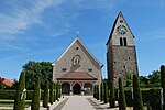
|
Katholische Kirche St. Johann mit freistehendem Kirchturm | B | 47°30′54″N 9°02′12″E / 47.514868°N 9.036744°E | 5182 | ||
| Tobel-Tägerschen | 
|
Wohnhaus Frohburg | B | 47°30′52″N 9°01′53″E / 47.514428°N 9.031446°E | 11058 | ||
Uesslingen-Buch
| Location | Upload | Photo | Object | Cat. | Coordinates | KGS-Nr | |
|---|---|---|---|---|---|---|---|
| Uesslingen-Buch | 
|
Iselisberg | ISOS | 47°35′11″N 8°49′36″E / 47.5864°N 8.82668°E | |||
| Uesslingen-Buch | 
|
Katholische St. Sebastianskapelle | A | 47°35′58″N 8°50′16″E / 47.599378°N 8.837847°E | 4949 | ||
| Uesslingen-Buch | 
|
Bauernhaus | B | 47°34′49″N 8°49′47″E / 47.580199°N 8.829777°E | 10251 | ||
| Uesslingen-Buch | 
|
Paritätische Kirche St. Peter und Paul | B | 47°34′48″N 8°49′49″E / 47.579951°N 8.830209°E | 11060 | ||
| Uesslingen-Buch | 
|
Zehntenkeller der Kartause Ittingen | B | 47°35′11″N 8°48′50″E / 47.586261°N 8.813981°E | 13839 | ||
Uttwil
| Location | Upload | Photo | Object | Cat. | Coordinates | KGS-Nr | |
|---|---|---|---|---|---|---|---|
| Uttwil | 
|
Gasthaus Frohsinn | B | 47°34′58″N 9°20′32″E / 47.582824°N 9.342146°E | 13840 | ||
| Uttwil | 
|
Reformierte Kirche | B | 47°35′01″N 9°20′27″E / 47.583484°N 9.340962°E | 5190 | ||
| Uttwil | 
|
Schloss Uttwil | B | 47°35′09″N 9°20′42″E / 47.585754°N 9.345125°E | 5191 | ||
| Uttwil | 
|
Wohnhaus Seeburg | B | 47°35′08″N 9°20′41″E / 47.58558°N 9.34476°E | 13841 | ||
| Uttwil | 
|
Wohnhaus Wacht | B | 47°35′01″N 9°20′29″E / 47.58373°N 9.34129°E | 11061 | ||
Wagenhausen
| Location | Upload | Photo | Object | Cat. | Coordinates | KGS-Nr | |
|---|---|---|---|---|---|---|---|
| Wagenhausen | 
|
Ehemalige Propstei-Trotte | A | 47°39′38″N 8°50′56″E / 47.66051°N 8.848845°E | 10253 | ||
| Wagenhausen | 
|
Ehemaliges Benediktinerpriorat mit Mühle | A | 47°39′41″N 8°50′52″E / 47.661448°N 8.847832°E | 5192 | ||
| Wagenhausen | 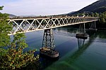
|
Eisenbahnbrücke der Nationalbahn | B | 47°40′22″N 8°50′03″E / 47.672722°N 8.834148°E | 13842 | ||
| Wagenhausen | 
|
Obere Mühle und Alte Sägerei | B | 47°39′11″N 8°50′34″E / 47.653001°N 8.842775°E | 5077 | ||
| Wagenhausen | 
|
Wohnhaus Schlössli | B | 47°39′35″N 8°51′08″E / 47.659822°N 8.852142°E | 5194 | ||
| Wagenhausen | 
|
Wohnhaus zum Wasen | B | 47°39′32″N 8°51′02″E / 47.658959°N 8.850588°E | 5193 | ||
Wäldi
| Location | Upload | Photo | Object | Cat. | Coordinates | KGS-Nr | |
|---|---|---|---|---|---|---|---|
| Wäldi | 
|
Bauernhaus | B | 47°36′57″N 9°03′18″E / 47.615817°N 9.054909°E | 13844 | ||
| Wäldi | 
|
Bauernhaus Birkenhof | B | 47°36′57″N 9°03′23″E / 47.615787°N 9.056372°E | 13843 | ||
| Wäldi | 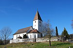
|
Reformierte Kirche | B | 47°37′01″N 9°03′11″E / 47.617067°N 9.053005°E | 5095 | ||
| Wäldi | 
|
Reformiertes Pfarrhaus | B | 47°37′01″N 9°03′13″E / 47.617039°N 9.053696°E | 13845 | ||
Wängi
Warth-Weiningen
| Location | Upload | Photo | Object | Cat. | Coordinates | KGS-Nr | |
|---|---|---|---|---|---|---|---|
| Warth-Weiningen | 
|
Kartause Ittingen | A+ISOS | 47°35′02″N 8°52′02″E / 47.5839°N 8.86722°E | 5199 | ||
| Warth-Weiningen | 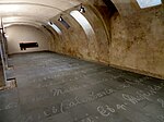
|
Kunstmuseum Thurgau | A | 47°35′01″N 8°52′01″E / 47.58355°N 8.86691°E | 8467 | ||
| Warth-Weiningen | 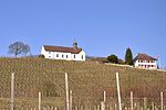
|
Katholische Kirche St. Martin | B | 47°35′06″N 8°52′13″E / 47.584888°N 8.870211°E | 5201 | ||
| Warth-Weiningen | 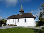
|
Reformierte Kapelle St. Nikolaus | B | 47°35′19″N 8°53′29″E / 47.588566°N 8.891251°E | 5210 | ||
| Warth-Weiningen | 
|
Wohnhaus Geiges | B | 47°35′04″N 8°52′32″E / 47.584389°N 8.875622°E | 5200 | ||
| Warth-Weiningen | 
|
Wohnhaus Lenzberg | B | 47°35′12″N 8°52′27″E / 47.586765°N 8.874091°E | 11065 | ||
Weinfelden
Wigoltingen
| Location | Upload | Photo | Object | Cat. | Coordinates | KGS-Nr | |
|---|---|---|---|---|---|---|---|
| Wigoltingen | 
|
Bauernhaus Gebharte-Haus | B | 47°36′04″N 9°01′46″E / 47.601201°N 9.029421°E | 5212 | ||
| Wigoltingen | 
|
Bauernhaus Meisen-Haus Schloss Altenklingen | B | 47°36′08″N 9°04′44″E / 47.602283°N 9.078917°E | 13904 | ||
| Wigoltingen | 
|
Ehemaliges Trottengebäude Schloss Altenklingen | B | 47°36′11″N 9°04′42″E / 47.602968°N 9.07822°E | 13905 | ||
| Wigoltingen | 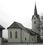
|
Reformierte Kirche St. Georg | B | 47°35′45″N 9°01′52″E / 47.595709°N 9.031052°E | 13864 | ||
| Wigoltingen | 
|
Schopf Schloss Altenklingen | B | 47°36′11″N 9°04′44″E / 47.603174°N 9.078944°E | 13906 | ||
| Wigoltingen | 
|
Taverne Zum Schäfli | B | 47°35′45″N 9°01′56″E / 47.595754°N 9.032356°E | 13863 | ||
| Wigoltingen | 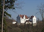
|
Schloss Altenklingen | A | 47°36′08″N 9°04′41″E / 47.602222222°N 9.078055555°E | 4984 | ||
Wuppenau
| Location | Upload | Photo | Object | Cat. | Coordinates | KGS-Nr | |
|---|---|---|---|---|---|---|---|
| Wuppenau | 
|
Bauernhaus | B | 47°29′11″N 9°07′14″E / 47.486307°N 9.120517°E | 13866 | ||
| Wuppenau | 
|
Ehemalige Wirtschaft Linde | B | 47°29′49″N 9°07′36″E / 47.496877°N 9.126705°E | 11073 | ||
| Wuppenau | 
|
Haus Zum Bären | B | 47°29′50″N 9°06′30″E / 47.497296°N 9.1084°E | 13867 | ||
| Wuppenau | 
|
Katholische Kapelle St. Martin | B | 47°29′18″N 9°05′14″E / 47.488352°N 9.087163°E | 13868 | ||
| Wuppenau | 
|
Katholische Kirche St. Johannes Nepomuk | B | 47°29′58″N 9°09′25″E / 47.49949°N 9.157002°E | 5216 | ||
| Wuppenau | 
|
Katholische Kirche St. Laurentius | B | 47°29′53″N 9°07′32″E / 47.49818°N 9.125565°E | 5217 | ||
| Wuppenau | 
|
Restaurant Traube | B | 47°29′32″N 9°09′09″E / 47.4921°N 9.152423°E | 13865 | ||
Zihlschlacht-Sitterdorf
| Location | Upload | Photo | Object | Cat. | Coordinates | KGS-Nr | |
|---|---|---|---|---|---|---|---|
| Zihlschlacht-Sitterdorf | 
|
Gartenanlage Schloss Blidegg | A | 47°30′02″N 9°17′44″E / 47.500427°N 9.295628°E | 5158 | ||
| Zihlschlacht-Sitterdorf | 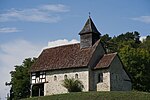
|
Kapelle St. Nikolaus und St. Magdalena | A | 47°30′13″N 9°17′44″E / 47.503478°N 9.295562°E | 10410 | ||
| Zihlschlacht-Sitterdorf | 
|
Altes katholisches Pfarrhaus | B | 47°30′19″N 9°14′55″E / 47.505346°N 9.248574°E | 13869 | ||
| Zihlschlacht-Sitterdorf | 
|
Bauernhaus | B | 47°31′23″N 9°15′37″E / 47.523°N 9.260411°E | 13876 | ||
| Zihlschlacht-Sitterdorf | 
|
Ehemaliges Gerichtshaus | B | 47°31′12″N 9°15′29″E / 47.520041°N 9.258105°E | 5218 | ||
| Zihlschlacht-Sitterdorf | 
|
Gasthaus Zur Krone | B | 47°31′20″N 9°15′33″E / 47.522184°N 9.259081°E | 13875 | ||
| Zihlschlacht-Sitterdorf | 
|
Katholische Kirche St. Maria Königin | B | 47°30′24″N 9°14′37″E / 47.506532°N 9.243476°E | 13872 | ||
| Zihlschlacht-Sitterdorf | 
|
Primarschulhaus / Kindergarten | B | 47°31′15″N 9°15′28″E / 47.520921°N 9.257643°E | 13873 | ||
| Zihlschlacht-Sitterdorf | 
|
Reformierte Kirche | B | 47°30′18″N 9°14′55″E / 47.504878°N 9.248611°E | 5159 | ||
| Zihlschlacht-Sitterdorf | 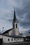
|
Reformierte Kirche | B | 47°31′16″N 9°15′28″E / 47.521196°N 9.257852°E | 13874 | ||
| Zihlschlacht-Sitterdorf | 
|
Reformiertes Pfarrhaus | B | 47°30′20″N 9°15′03″E / 47.505554°N 9.250785°E | 13870 | ||
| Zihlschlacht-Sitterdorf | 
|
Schloss Bildegg | B | 47°30′12″N 9°17′44″E / 47.503244°N 9.295567°E | 13871 | ||


