namn ID
inom det administrativa området plats geografiska koordinater bild
Ammuslataamo (historisk militärbas tyghus
1232
. . Kuopio
Upload an image of this heritage site
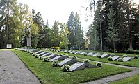
Q30560050 (begravningsplats )
1091
. . Kuopio Puijo
62°53′54″N 27°40′18″E / 62.8982°N 27.6718°E / 62.8982; 27.6718
Great Cemetery of Kuopio (and Kuopio Heroes Park) (stadslandskap )
1091
. . Kuopio
Upload an image of this heritage site
Gustav Adolfs kyrka (kyrka )
1088
. . Idensalmi
63°34′48″N 27°10′18″E / 63.5801°N 27.1717°E / 63.5801; 27.1717 63°34′48″N 27°10′18″E / 63.58007578°N 27.17173414°E / 63.58007578; 27.17173414 63°34′48″N 27°10′18″E / 63.5800842°N 27.1717292°E / 63.5800842; 27.1717292
Haminanlax (by
179
. . Kuopio
62°51′00″N 27°31′17″E / 62.849943845°N 27.521272378°E / 62.849943845; 27.521272378
Herrgårdar i Jorois (gårdsmiljö
1149
. . Jorois
Upload an image of this heritage site
Huutokoski järnvägsstation (järnvägsstation bangård junction station
1445
. Huutokoski Jorois
62°12′37″N 27°41′21″E / 62.210277777778°N 27.689166666667°E / 62.210277777778; 27.689166666667
Idensalmi järnvägsstation (järnvägsstation junction station
4212
. . Idensalmi
63°33′42″N 27°12′01″E / 63.561663°N 27.200346°E / 63.561663; 27.200346
Iisalmen kirkkoaukio ja puistoakselit (stadslandskap )
4325
. . Idensalmi
Upload an image of this heritage site
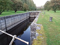
Iisalmen reitin kanavat (water traffic site
1230
. . Kuopio
Iisvesi factory and railway station area (industriminne järnvägsstation )
1044
. . Suonenjoki
Upload an image of this heritage site
Kangaslammin kirkonkylä (kyrkby
1131
. Kangaslampi Varkaus
Upload an image of this heritage site
Q30509911 (stadslandskap )
4381
. . Varkaus
62°18′54″N 27°52′32″E / 62.314943223°N 27.875533717°E / 62.314943223; 27.875533717
Keiteleen-Iisveden reitin kanavat (water traffic site
1077
. . Rautalampi
Upload an image of this heritage site
Kirkkosaari (ö )
1094
. . Pielavesi
63°15′00″N 26°40′30″E / 63.25°N 26.675°E / 63.25; 26.675
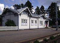
Kiuruvesi järnvägsstation (järnvägsstation )
4213
. . Kiuruvesi
63°38′28″N 26°36′42″E / 63.641111111111°N 26.611666666667°E / 63.641111111111; 26.611666666667
Koljonvirta Historical Landscape (kulturlandskap
929
. . Idensalmi
Upload an image of this heritage site
Kommila-Kosulanniemen asuinalue (bostadsområde )
1054
. . Varkaus
Konnuksen kanavat (water traffic site
1058
. . Leppävirta
Upload an image of this heritage site
Koskenjoen kylä (by
1070
. . Kiuruvesi
63°41′13″N 26°32′38″E / 63.686919897°N 26.543980246°E / 63.686919897; 26.543980246 Upload an image of this heritage site
Kotalahti gruva (nickelgruva organisation
1454
. . Leppävirta
62°34′48″N 27°36′29″E / 62.57994444°N 27.60808333°E / 62.57994444; 27.60808333
Kuopio Barracks (kasern historisk militärbas
4126
. . Kuopio
62°53′41″N 27°40′10″E / 62.894780761°N 27.669334167°E / 62.894780761; 27.669334167
Q55836674 (begravningsplats )
1091
. . Kuopio Multimäki
62°53′37″N 27°40′26″E / 62.8937°N 27.6739°E / 62.8937; 27.6739
Q11873587 (marknadsplats torg
634
. Multimäki Kuopio
62°53′32″N 27°40′42″E / 62.892222222222°N 27.678333333333°E / 62.892222222222; 27.678333333333
Q11873591 (anstalt )
398
. . Kuopio
62°53′49″N 27°41′33″E / 62.896944444444°N 27.6925°E / 62.896944444444; 27.6925 Upload an image of this heritage site
Kuopio provincial hospital (sjukhus )
4677
. . Kuopio
62°53′28″N 27°40′00″E / 62.8910734°N 27.6666289°E / 62.8910734; 27.6666289
Kuopion Piispanpuiston ympäristö ja kuurojen koulu (stadslandskap )
632
. . Kuopio
Upload an image of this heritage site
Kuopion rautatieympäristöt (railway environment
646
. . Kuopio
Kuopion rännikatuverkko (stadslandskap )
934
. . Kuopio
Könönpellon asevelikylä (by
1085
. Könönpelto Varkaus
62°18′06″N 27°56′41″E / 62.301591367°N 27.94460839°E / 62.301591367; 27.94460839
Lapinlahden kirkonseutu (kyrkplats
4313
. . Lapinlahti
Upload an image of this heritage site
Q5407064 (järnvägsstation )
4214
. Lapinlahti kyrkoby Lapinlahti
63°21′39″N 27°23′38″E / 63.3608°N 27.3939°E / 63.3608; 27.3939
Q11875597 (museum hus
1305
. . Pielavesi
63°13′17″N 26°47′01″E / 63.221388888889°N 26.783611111111°E / 63.221388888889; 26.783611111111
Leppälahden ja Kuivaniemen kylät (hajakylä
2025
. . Kuopio
Upload an image of this heritage site
Leppävirta kyrka (kyrka )
1093
. . Leppävirta
62°29′26″N 27°47′17″E / 62.4904834°N 27.788175°E / 62.4904834; 27.788175
Linnanpellon asuinalue ja sokeainkoulu (bostadsområde )
4127
. . Kuopio
Niirala (stadsdel i Kuopio
2026
. . Kuopio
62°53′20″N 27°39′05″E / 62.888888888889°N 27.651388888889°E / 62.888888888889; 27.651388888889
Q20914385 (väg )
1057
. . Leppävirta
62°28′08″N 27°46′28″E / 62.46888889°N 27.77444444°E / 62.46888889; 27.77444444
Niuvanniemi sjukhus (sjukhus mentalsjukhus
633
. Niuva Kuopio
62°54′54″N 27°37′25″E / 62.915°N 27.62361111°E / 62.915; 27.62361111
Nuutila (by
1087
. . Suonenjoki
62°33′21″N 27°09′49″E / 62.555701573°N 27.163474785°E / 62.555701573; 27.163474785 Upload an image of this heritage site
Paavo Ruotsalaisen Aholansaari (kulturminnesplats
1074
. Aholansaari . Kuopio
63°19′00″N 28°02′55″E / 63.316544834°N 28.048508486°E / 63.316544834; 28.048508486 Upload an image of this heritage site
Parc Snellman, cathédrale de Kuopio et quartiers en bois (stadslandskap )
631
. . Kuopio
Upload an image of this heritage site
Peltosalmi (samhälle
931
. . Idensalmi
63°31′05″N 27°14′39″E / 63.51808333°N 27.24406667°E / 63.51808333; 27.24406667
Q11873588 (Category:Inland ports and harbours )
635
. . Kuopio
62°53′34″N 27°41′50″E / 62.892817°N 27.697193°E / 62.892817; 27.697193
Päiviönsaari center in Varkaus (stadsmiljö
1052
. . Varkaus
62°18′48″N 27°53′24″E / 62.313279°N 27.889982°E / 62.313279; 27.889982
Rautalammin kirkko ja keskusraitti (kyrkplats
1720
. . Rautalampi
Upload an image of this heritage site
Rautalammin suurtilat (jordbruksmiljö
2027
. . Rautalampi
Upload an image of this heritage site
Q30560256 (historiskt hus/museum hembygdsmuseum lokalt museum
1050
. Riuttala Kuopio
62°59′09″N 27°06′31″E / 62.985875°N 27.108749°E / 62.985875; 27.108749
Runnin kylpylä ja Saarikosken kanava (water traffic site
932
. . Idensalmi
Upload an image of this heritage site
Q30560637 (historisk väg Category:Museum roads in Finland )
1078
. . Rautalampi
Sorsakosken tehtaat ja tehdasyhdyskunta (industriminne
1059
. Sorsakoski . Leppävirta
Strömsdals bruk (fabrik )
892
. . Strömsdal
63°04′05″N 28°20′27″E / 63.068056°N 28.340833°E / 63.068056; 28.340833 Upload an image of this heritage site
Sukeva Prison (anstalt )
399
. . Sonkajärvi
63°54′37″N 27°29′48″E / 63.910278°N 27.496667°E / 63.910278; 27.496667 Upload an image of this heritage site
Suonenjoen rautatieasema ympäristöineen ja ratavartijan talo (railway environment
639
. . Suonenjoki
Upload an image of this heritage site
Taipale kanal (kanal )
1055
. . Varkaus
62°18′11″N 27°54′36″E / 62.30305556°N 27.91°E / 62.30305556; 27.91
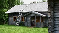
Q7697345 (friluftsmuseum
1048
. . Kaavi
63°02′20″N 28°29′32″E / 63.0389°N 28.4922°E / 63.0389; 28.4922
Tiilikanjoen uittorakenteet (kulturlandskap
2020
. . Lapinlahti Rautavaara
Upload an image of this heritage site
Tuovilanlahti (by i Finland
3921
. . Kuopio
63°13′46″N 27°06′42″E / 63.229331788°N 27.111770475°E / 63.229331788; 27.111770475
Varkaus bruk (industriminne pappersbruk )
1051
. . Varkaus
62°19′05″N 27°53′45″E / 62.318056°N 27.895833°E / 62.318056; 27.895833
Väinölänniemi (park
2231
. . Kuopio
62°53′05″N 27°41′51″E / 62.884694444444°N 27.6975°E / 62.884694444444; 27.6975
Väisälänmäki (by
1056
. . Lapinlahti
63°20′24″N 27°14′05″E / 63.339953°N 27.234617°E / 63.339953; 27.234617
limonite based Ironworks of Savonia (industriminne
2031
. . Kuopio Vieremä Sonkajärvi
Upload an image of this heritage site
museibro ()
4845
. . Sonkajärvi


