Name
ID
Place
District
Coordinates
Image
Hattuvaara (village
1101
. . Ilomantsi
62°55′55″N 31°16′54″E / 62.93194444°N 31.28166667°E / 62.93194444; 31.28166667 Upload an image of this heritage site
Heinävaaran vaara-asutus (residential area )
1102
. Heinävaara . Joensuu
Upload an image of this heritage site
Heinäveden reitin kanavat ja rakenteet (water traffic site
1133
. . Heinävesi
Upload an image of this heritage site
Heinävesi Monasteries (landscape of religious buildings
1152
. . Heinävesi
Upload an image of this heritage site
Ilomantsin Kauppatien ja Kotimäen alue (historic road
4460
. . Ilomantsi
62°40′30″N 30°55′44″E / 62.675027656°N 30.928772732°E / 62.675027656; 30.928772732 Upload an image of this heritage site
Ilomantsin Pappilanvaara (landscape of religious buildings
1097
. . Ilomantsi
Upload an image of this heritage site
Joensuun luterilainen ja ortodoksinen kirkko (landscape of religious buildings
4053
. . Joensuu
Upload an image of this heritage site
Joensuun rantapuistovyöhyke (park
1111
. . Joensuu
Upload an image of this heritage site
Joensuun rautatieasema ja sen ympäristö (railway environment
4188
. . Joensuu
Upload an image of this heritage site
Kakonahon kylämaisema (village
4482
. . Ilomantsi
62°43′43″N 30°39′59″E / 62.728546798°N 30.666329302°E / 62.728546798; 30.666329302 Upload an image of this heritage site
Kaprakka (sanatorium
3983
. . Liperi
62°37′54″N 29°22′25″E / 62.6315463°N 29.3735891°E / 62.6315463; 29.3735891 Upload an image of this heritage site
Kiihtelysvaara Church (church building )
1373
. . Joensuu
62°29′38″N 30°15′08″E / 62.493888055556°N 30.25212°E / 62.493888055556; 30.25212 62°29′38″N 30°15′08″E / 62.49393502°N 30.25216567°E / 62.49393502; 30.25216567
Kiteen kirkko ja pappila (landscape of religious buildings
2014
. . Kitee
Upload an image of this heritage site
Mekrijärven kylä ja Sissolan talo (village
1098
. . Ilomantsi
62°46′11″N 30°58′34″E / 62.769774051°N 30.976172584°E / 62.769774051; 30.976172584 Upload an image of this heritage site
Murtovaara House Museum (historic house museum
1108
. Sivakka Halmejärvi Valtimo
63°47′51″N 28°54′27″E / 63.7975°N 28.9075°E / 63.7975; 28.9075
Mätäsvaaran kaivosyhdyskunta (industrial heritage site
1453
. Mätäsvaara Lieksa
63°26′34″N 29°34′43″E / 63.442661695°N 29.578580798°E / 63.442661695; 29.578580798 Upload an image of this heritage site
Möhkö Ironworks (industrial landscape museum bruk
905
. . Ilomantsi
62°38′27″N 31°17′18″E / 62.64094°N 31.288286°E / 62.64094; 31.288286 Upload an image of this heritage site
Mönnin ja Selkien vaarakylät (Vaarakylä
1105
. . Kontiolahti
Upload an image of this heritage site
Nurmeksen vanhan kauppalan alue (village
1257
. . Nurmes
Upload an image of this heritage site
Nurmes railway station (railway station rail yard
5171
. . Nurmes
63°32′28″N 29°08′17″E / 63.541111111111°N 29.138055555556°E / 63.541111111111; 29.138055555556
Ostronsaaren Jeskalan pihapiiri (cultural landscape
4483
. . Ilomantsi
62°29′43″N 31°09′05″E / 62.49537°N 31.15148°E / 62.49537; 31.15148 Upload an image of this heritage site
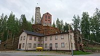
Outokummun vanha kaivosalue ja Keretin kaivostorni (industrial heritage site
1112
. . Outokumpu
Pankakosken tehdas- ja asuntoalueet (residential area )
911
. Pankakoski Lieksa
Upload an image of this heritage site
Pielinen Museum (open-air museum art museum
2230
2 Pappilantie Lieksa
63°18′40″N 30°01′53″E / 63.311094°N 30.031344°E / 63.311094; 30.031344
Pielisjoen kanavat (heritage site
1106
. . Joensuu Kontiolahti
Upload an image of this heritage site
Pohjois-Karjalan hovit (manor environment
1110
. . Kitee Lieksa Liperi Rääkkylä Tohmajärvi
Upload an image of this heritage site
Puhoksen historiallinen teollisuusympäristö (industrial heritage site
1104
. . Kitee
Upload an image of this heritage site
Pyhäselän uittolaitteet (industrial heritage site
1304
. . Liperi
Upload an image of this heritage site
Rasimäki (village in Finland
1261
. . Valtimo
Upload an image of this heritage site
Rääkkylän kirkko ympäristöineen (landscape of religious buildings
2015
. . Rääkkylä
Upload an image of this heritage site
Salpa Line (historical military facility fortified line
2021
. . Joensuu Ilomantsi Lieksa
Tohmajärven Kirkkoniemi (landscape of religious buildings
1109
. . Tohmajärvi
Upload an image of this heritage site
Totkunniemen kylä (village
4391
. . Kitee
61°51′18″N 29°51′58″E / 61.855100224°N 29.866098183°E / 61.855100224; 29.866098183 Upload an image of this heritage site
Uimaharju railway station (railway station )
1446
. Uimaharju . Joensuu
62°54′44″N 30°14′30″E / 62.912222222222°N 30.241666666667°E / 62.912222222222; 30.241666666667
Utran kanava ja historiallinen teollisuusalue (industrial heritage site
1107
. . Joensuu
Upload an image of this heritage site
Viinijärvi railway station area (railway station junction station
4189
. Viinijärvi . Liperi
62°38′29″N 29°14′13″E / 62.641388888889°N 29.236944444444°E / 62.641388888889; 29.236944444444
Vornantie (museum road )
1096
. . Joensuu Lieksa
63°03′15″N 30°06′37″E / 63.05402778°N 30.11013889°E / 63.05402778; 30.11013889 Upload an image of this heritage site
Ylikylä (village
4248
. . Nurmes
63°38′02″N 29°03′56″E / 63.63389°N 29.0656°E / 63.63389; 29.0656 Upload an image of this heritage site
museum bridge ()
4845
. . Joensuu
old center of the Juuka parish village (village with a church
1103
. Juuka parish village Juuka
Upload an image of this heritage site
Äyhkyrin talonpoikaistila (agricultural environment
1399
. . Juuka
Upload an image of this heritage site 


