Commons:Wiki Loves Monuments 2024 in Palestine/List
Jump to navigation
Jump to search
Hebron
Jenin
| Wikidata | Name | Type | Location | Coordinates | Photo | Commons Category |
|---|---|---|---|---|---|---|
| Q125116746 | Khirbet Balama | Archaeological | Jenin, West Bank | 32°27′08″N 35°17′16″E / 32.452128°N 35.287817°E |  |
|
| Q5000301 | Burqin Church | Religious | Jenin, West BanK | 32°27′26″N 35°15′36″E / 32.457222°N 35.26°E |  |
|
| Q5437849 | Fatima Khatun Mosque | Religious | Jenin, West BanK | 32°27′44″N 35°18′05″E / 32.46225°N 35.30146°E |  |
|
| Q125967866 | Abd al-Hadi Palaces | Historical | Jenin, West BanK | - | - | |
| Q12233444 | Sanur Citadel | Historical | Jenin, West BanK | 32°21′21″N 35°14′58″E / 32.3558934°N 35.2494638°E | - |
Tulkarem
| Wikidata | Name | Type | Location | Coordinates | Photo | Commons Category |
|---|---|---|---|---|---|---|
| Q124649837 | The Shrine of Jacob's Daughters | Religious | Tulkarem, West Bank | 35°00′51″N 32°17′42″E / 35.014083°N 32.295083°E | ||
| Q60914939 | Church of Saint George (Tulkarm) | Historical | Tulkarem, West Bank | 35°01′36″N 32°18′45″E / 35.026665°N 32.312564°E |  |
Church of Saint George (Tulkarm) |
Qalqilya
| Wikidata | Name | Type | Location | Coordinates | Photo | Commons Category |
|---|---|---|---|---|---|---|
| Q126285232 | Cave of Umm Al-Balabil | Archaeological | Qalqilya, West Bank | 32°11′08″N 35°05′29″E / 32.1854352°N 35.0914715°E | - | |
| Q130050558 | Hajjah Mosque | Religious | Qalqilya, West Bank | 32°07′45″N 35°02′48″E / 32.1290508°N 35.0467933°E | - | |
| Q126128148 | Mosque of Sanniriya | Historical | Qalqilya, West Bank | 32°12′16″N 35°07′53″E / 32.2045607°N 35.1314629°E | - | |
| Q7525889 | Khirbet Sir | Historical | Qalqilya, West Bank | 32°11′49″N 35°03′38″E / 32.196944°N 35.060556°E | - |
Ramallah and Al-Bireh
| Wikidata | Name | Type | Location | Coordinates | Photo | Commons Category |
|---|---|---|---|---|---|---|
| Q12236330 | Al-Bireh Church | Religious | Al-Bireh, West Bank | 31°54′18″N 35°12′08″E / 31.9049529°N 35.2023174°E |  |
|
| Q7505195 | Shuqba cave | Archaeological | Ramallah, West Bank | 35°02′37″N 31°58′55″E / 35.043611°N 31.981944°E |  |
Shuqba cave |
| Q128257096 | The Church of St. George - Al-Taybeh | Religious | Ramallah, West Bank | 35°18′05″N 31°57′12″E / 35.301472°N 31.953324°E | - | |
| Q125973483 | Qalʻat Āl Samḥān | Historical | Ramallah, West Bank | - |  |
Salfit
| Wikidata | Name | Type | Location | Coordinates | Photo | Commons Category |
|---|---|---|---|---|---|---|
| Q125949083 | Abu Hijleh Palace - Deir Istiya | Archaeological | Salfit, West Bank | 35°08′28″N 32°07′48″E / 35.141065°N 32.129919°E | - | |
| Q6983511 | Dayr Qala | Archaeological | Salfit, West Bank | 35°02′44″N 32°03′29″E / 35.045449°N 32.058161°E |  |
|
| Q98454829 | Khirbet Kurkush | Archaeological | Salfit, West Bank | 35°06′54″N 32°05′16″E / 35.115138°N 32.087837°E |  |
Khirbet Kurkush |
| Q12407388 | Deir Samaan | Archaeological | Salfit, West Bank | 35°03′05″N 32°04′06″E / 35.051448°N 32.068464°E |  |
Deir Sam'an |
| Q56376617 | Maqām al-Nabī Dhī al-Kifl | Relegious | Salfit, West Bank | 35°09′25″N 32°07′10″E / 35.156899°N 32.119545°E | - |
Jerusalem
| Wikidata | Name | Type | Location | Coordinates | Photo | Commons Category |
|---|---|---|---|---|---|---|
| Q425281 | Al-Aqsa Mosque | Relegious | Jerusalem, West Bank | 335°14′09″N 31°46′34″E / 335.235833°N 31.776111°E |  |
Al-Qibli Chapel |
| Q172077 | Dome of the Rock | Relegious | Jerusalem, West Bank | 35°14′07″N 31°46′41″E / 35.235278°N 31.778056°E |  |
Dome of the Rock |
| Q187702 | Church of the Holy Sepulchre | Relegious | Jerusalem, West Bank | 35°13′47″N 31°46′42″E / 35.22975°N 31.778444°E |  |
Church of the Holy Sepulchre (Jerusalem) |
| Q333594 | Church of Mary Magdalene | Relegious | Jerusalem, West Bank | 35°14′27″N 31°46′44″E / 35.240745°N 31.77889°E |  |
Saint Mary Magdalene Church (Jerusalem) |
| Q1331689 | Church of All Nations | Relegious | Jerusalem, West Bank | 35°14′23″N 31°46′45″E / 35.239628°N 31.779227°E |  |
Church of All Nations (Jerusalem) |
Gaza
Bethlehem
Nablus
| Wikidata | Name | Type | Location | Coordinates | Photo | Commons Category |
|---|---|---|---|---|---|---|
| Q4702683 | Al-Khadra Mosque | Archaeological | Nablus, Westbank | 35°16′15″N 32°12′44″E / 35.270889°N 32.212356°E |  |
Al-Khadra Mosque |
| Q4022315 | Great Mosque of Nablus | Historical | Nablus, Westbank | 35°16′10″N 32°13′05″E / 35.269344°N 32.218006°E |  |
Great Mosque of Nablus |
| Q124877207 | Jacob’s Well | Archaeological | Nablus, Westbank | 335°17′08″N 32°12′34″E / 335.285556°N 32.209444°E |  |
|
| Q2918480 | Sebastia, Nablus | Archaeological | Nablus, Westbank | 35°11′00″N 32°16′00″E / 35.183333°N 32.266667°E |  |
Sebastia, Nablus |
| Q12204244 | Al-Satoun Mosque | Archaeological | Nablus, Westbank | - | - | |
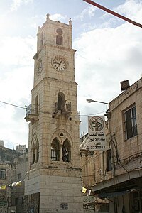
| Q6746951 | Manara Clock Tower | Historical | Nablus, Westbank | 35°15′41″N 32°13′08″E / 35.261409°N 32.218887°E |  |
Manara Clock Tower |
| Q12215660 | Sarāyā al-ḥukm al-Turkī | Historical | Nablus, Westbank | - | - | |
| Q12233017 | Al-Nimr Palace | Historical | Nablus, Westbank | 35°16′01″N 32°13′13″E / 35.267077°N 32.220364°E | ||
| Q4664555 | Abd al-Hadi Palace | Historical | Nablus, Westbank | 35°15′33″N 32°13′04″E / 35.259167°N 32.217778°E |  |
Abd al-Hadi Palace |
| Q1297538 | The Shrine of Joseph (Yusuf) | Archaeological | Nablus, Westbank | 35°17′08″N 32°12′46″E / 35.285473°N 32.21269°E |  |
Joseph's Tomb |
| Q97119900 | Touqan Palace | Historical | Nablus, Westbank |  |
Touqan Palace |
Jericho
| Wikidata | Name | Type | Location | Coordinates | Photo | Commons Category |
|---|---|---|---|---|---|---|
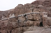
| Q10742877 | Mount of Temptation | Archaeological | Jericho, Westbank | 335°25′50″N 31°52′29″E / 335.430556°N 31.874722°E |  |
Mount of Temptation |
| Q2402267 | Tell es-Sultan | Archaeological | Jericho, Westbank | 35°26′40″N 31°52′18″E / 35.444564°N 31.871719°E |  |
Tell es-Sultan |
| Q2668745 | Monastery of the Temptation | Archaeological | Jericho, Westbank | 35°25′56″N 31°52′29″E / 35.43215°N 31.874642°E |  |
Monastery of the Temptation |
| Q2456319 | Hisham's Palace | Archaeological | Jericho, Westbank | 35°27′36″N 31°52′55″E / 35.459969°N 31.881883°E |  |
Khirbat al Mafjar |
| Q223399 | Qumran | Archaeological | Jericho, Westbank | 35°27′31″N 31°44′28″E / 35.458631°N 31.74105°E |  |
Qumran |
| Q2909131 | Nabi Musa | Relegious | Jericho, Westbank | 35°26′00″N 31°47′00″E / 35.433333°N 31.783333°E |  |
Nabi Musa |


