| Name
|
Heritage list
|
Place
|
Street address
|
Coordinates
|
place_id
|
Image
|
| Tom Collins House site (Q66976504)
|
State Registered Place
|
Cottesloe
|
|
31°58′59″S 115°46′00″E / 31.982918°S 115.76657°E / -31.982918; 115.76657
|
602
|
|
| Tom Collins House, Allen Park (Q66976506)
|
State Registered Place
|
Swanbourne
|
|
31°58′42″S 115°45′42″E / 31.978294°S 115.761703°E / -31.978294; 115.761703
|
2368
|

|
| Toodyay Fire Station (Q17026426)
|
State Registered Place
|
|
|
31°33′02″S 116°27′52″E / 31.550636°S 116.464512°E / -31.550636; 116.464512
31°33′01″S 116°28′05″E / 31.55034°S 116.46813°E / -31.55034; 116.46813
|
2568
|

|
| Toodyay Post Office and Residence (Q66976507)
|
State Registered Place
|
Toodyay
|
|
31°33′01″S 116°28′01″E / 31.55039°S 116.467022°E / -31.55039; 116.467022
|
2576
|
|
| Toodyay Public Library (Q16901863)
|
State Registered Place
|
Toodyay
|
|
31°33′01″S 116°28′11″E / 31.55022°S 116.46968°E / -31.55022; 116.46968
|
2566
|
|
| Toodyay Red Hill Convict Road Station Ruins (Q66976509)
|
State Registered Place
|
Red Hill
|
|
31°50′05″S 116°04′51″E / 31.834597°S 116.080708°E / -31.834597; 116.080708
|
3548
|
|
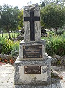
| Toodyay War Memorial (Q66976511)
|
State Registered Place
|
Toodyay
|
|
31°33′08″S 116°27′57″E / 31.552116°S 116.465943°E / -31.552116; 116.465943
|
14373
|
|
| Tower House, Northbridge (Q66976513)
|
State Registered Place
|
Northbridge
|
|
31°56′48″S 115°51′22″E / 31.946607°S 115.856243°E / -31.946607; 115.856243
|
4317
|
|
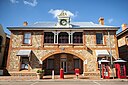
| Town Council Offices & Library, Northam (Q66976514)
|
State Registered Place
|
Northam
|
|
31°39′21″S 116°40′05″E / 31.65587°S 116.668193°E / -31.65587; 116.668193
|
10907
|
|
| Trades Hall (Q66976516)
|
State Registered Place
|
Kalgoorlie
|
|
30°44′46″S 121°28′39″E / 30.746219°S 121.477418°E / -30.746219; 121.477418
|
1325
|
|
| Trafalgar House (Q66976519)
|
State Registered Place
|
Cottesloe
|
|
31°59′50″S 115°45′29″E / 31.997259°S 115.757922°E / -31.997259; 115.757922
|
7468
|

|
| Tranby House (Q7833356)
|
State Registered Place
|
|
|
31°56′34″S 115°54′37″E / 31.942727°S 115.910351°E / -31.942727; 115.910351
|
2411
|

|
| Trayning Police Station & former Police Quarters (Q66976521)
|
State Registered Place
|
Trayning
|
|
31°06′46″S 117°47′38″E / 31.112722°S 117.793856°E / -31.112722; 117.793856
|
2596
|
|
| Treasury Buildings, Perth (Q48797181)
|
State Registered Place
|
Perth
|
|
31°57′21″S 115°51′38″E / 31.9559°S 115.86057°E / -31.9559; 115.86057
|
4275
|
|
| Tree at Old Fish Cannery (Q66976524)
|
State Registered Place
|
Chadwick
|
|
33°51′01″S 121°54′02″E / 33.850215°S 121.90069°E / -33.850215; 121.90069
|
23789
|
|
| Trefusis, Chapman & Jose Factory (Q66976528)
|
State Registered Place
|
Geraldton
|
|
28°46′45″S 114°36′22″E / 28.779219°S 114.606093°E / -28.779219; 114.606093
|
13200
|
|
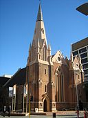
| Trinity Church, Perth (Q29300446)
|
State Registered Place
|
Perth
|
|
31°57′18″S 115°51′29″E / 31.9549°S 115.858°E / -31.9549; 115.858
|
2105
|

|
| Tudor Lodge (Q66976531)
|
State Registered Place
|
Mount Lawley
|
|
31°56′09″S 115°52′02″E / 31.935894°S 115.867214°E / -31.935894; 115.867214
|
17150
|

|
| Tukurua (Q66976533)
|
State Registered Place
|
Cottesloe
|
|
32°00′16″S 115°45′10″E / 32.004494°S 115.752819°E / -32.004494; 115.752819
|
3453
|

|
| Turner Cottage (Q66976535)
|
State Registered Place
|
Serpentine
|
|
32°21′48″S 115°59′26″E / 32.363309°S 115.990571°E / -32.363309; 115.990571
|
2360
|

|
| Two Attached Houses (Q56085120)
|
State Registered Place
|
Northbridge
|
|
31°56′52″S 115°52′00″E / 31.947776782781°S 115.86664615624856°E / -31.947776782781013; 115.86664615624856
|
15791
|
|
| Two Attached Houses & Separate House (Q56054278)
|
State Registered Place
|
Northbridge
|
|
31°56′46″S 115°51′36″E / 31.94609462°S 115.8601138°E / -31.94609462; 115.8601138
|
3854
|

|
| Two Attached Houses, 103-105 Parry Street (Q66976537)
|
State Registered Place
|
Perth
|
|
31°56′54″S 115°52′03″E / 31.948333°S 115.867565°E / -31.948333; 115.867565
|
15795
|
|
| Two Attached Houses, 107-109 Parry Street (Q66976538)
|
State Registered Place
|
Perth
|
|
31°56′54″S 115°52′03″E / 31.948195°S 115.86747°E / -31.948195; 115.86747
|
15794
|
|
| Two Attached Houses, 139-141 Parry Street (Q56054276)
|
State Registered Place
|
Perth
|
|
31°56′52″S 115°51′59″E / 31.94778804°S 115.8664649°E / -31.94778804; 115.8664649
|
15790
|
|
| Two Conjoined Houses, 143 Parry Street (Q56054279)
|
State Registered Place
|
Perth
|
|
31°56′52″S 115°51′59″E / 31.94774031°S 115.8663597°E / -31.94774031; 115.8663597
|
15789
|
|
| Two Dwellings, Tower Street, Gwalia (Q56054280)
|
State Registered Place
|
|
|
28°54′45″S 121°19′50″E / 28.9125639°S 121.3304974°E / -28.9125639; 121.3304974
|
10956
|
|
| Two Houses (Q66976540)
|
State Registered Place
|
Fremantle
|
|
32°03′23″S 115°44′47″E / 32.056375°S 115.746389°E / -32.056375; 115.746389
|
1011
|
|
| Two Houses (former) (Q56054286)
|
State Registered Place
|
Northbridge
|
|
31°56′41″S 115°51′21″E / 31.94483114°S 115.8557769°E / -31.94483114; 115.8557769
|
11488
|
|
| Two Houses, 18-20 Nairn Street, Fremantle (Q66976541)
|
State Registered Place
|
Fremantle
|
|
32°03′21″S 115°44′48″E / 32.055806°S 115.746581°E / -32.055806; 115.746581
|
965
|
|
| Two Obelisks and Commemorative Plaques (Q56054288)
|
State Registered Place
|
Port Denison
|
|
29°16′38″S 114°54′55″E / 29.277189°S 114.9151676°E / -29.277189; 114.9151676
|
1242
|

|
| Two Railway Houses & Trees (Q66976543)
|
State Registered Place
|
Coolgardie
|
|
30°57′23″S 121°09′34″E / 30.956291°S 121.159468°E / -30.956291; 121.159468
|
1738
|
|
| Two Terrace Houses, 14-16 Nairn Street, Fremantle (Q66976545)
|
State Registered Place
|
Fremantle
|
|
32°03′21″S 115°44′47″E / 32.055854°S 115.746427°E / -32.055854; 115.746427
|
964
|
|
| US Navy Submariners' Memorial, Albany (Q111848757)
|
State Registered Place
|
|
|
35°01′53″S 117°54′48″E / 35.031501205246°S 117.9133354955188°E / -35.0315012052457; 117.9133354955188
|
15618
|
|
| Union Bank of Australia Building (Q28225173)
|
State Registered Place
|
Fremantle
|
|
32°03′16″S 115°44′44″E / 32.054521°S 115.745675°E / -32.054521; 115.745675
|
924
|

|
| Union Bank, Fremantle (Q7885380)
|
State Registered Place
|
Fremantle
|
|
32°03′20″S 115°44′32″E / 32.055667°S 115.742246°E / -32.055667; 115.742246
|
899
|

|
| Union Stores Building (Q28225179)
|
State Registered Place
|
Fremantle
|
|
32°03′19″S 115°44′40″E / 32.05525°S 115.744333°E / -32.05525; 115.744333
|
915
|

|
| Uniting Church & Hall, Northam (Q66976550)
|
State Registered Place
|
Northam
|
|
31°39′26″S 116°40′20″E / 31.657178°S 116.672325°E / -31.657178; 116.672325
|
16300
|
|
| Uniting Church, Broome (Q66976552)
|
State Registered Place
|
Broome
|
|
17°57′44″S 122°14′12″E / 17.962303°S 122.236591°E / -17.962303; 122.236591
|
292
|
|
| Uniting Church, Katanning (Q66976553)
|
State Registered Place
|
Katanning
|
|
33°41′17″S 117°33′11″E / 33.68804°S 117.553154°E / -33.68804; 117.553154
|
1358
|
|
| Upper Gascoyne Road Board Office (Q66976556)
|
State Registered Place
|
Gascoyne Junction
|
|
25°03′16″S 115°12′33″E / 25.054529°S 115.209028°E / -25.054529; 115.209028
|
15408
|

|
| Upton House (Q66976559)
|
State Registered Place
|
Australind
|
|
33°16′37″S 115°42′57″E / 33.276865°S 115.715769°E / -33.276865; 115.715769
|
1187
|
|
| Uralia (Q66976561)
|
State Registered Place
|
Northam
|
|
31°39′33″S 116°40′37″E / 31.659233°S 116.677005°E / -31.659233; 116.677005
|
1876
|
|
| Vacant Lot, 27A Fothergill Street (Q66976562)
|
State Registered Place
|
Fremantle
|
|
32°03′23″S 115°45′28″E / 32.056283°S 115.757705°E / -32.056283; 115.757705
|
22816
|
|
| Vancouver House (Q24972021)
|
State Registered Place
|
Albany
|
|
35°01′37″S 117°53′08″E / 35.026990405392°S 117.88556672623544°E / -35.02699040539163; 117.88556672623544
|
64
|

|
| Victoria Hall (Q7926747)
|
State Registered Place
|
|
|
32°03′13″S 115°45′00″E / 32.0536°S 115.75°E / -32.0536; 115.75
|
935
|

|
| Victoria Park Police Station (Q66976564)
|
State Registered Place
|
Victoria Park
|
|
31°58′33″S 115°53′53″E / 31.975741°S 115.898159°E / -31.975741; 115.898159
|
2219
|

|
| Victoria Park Post Office (Q38161966)
|
State Registered Place
|
Victoria Park
|
|
31°58′29″S 115°53′53″E / 31.974822°S 115.89793°E / -31.974822; 115.89793
|
2222
|

|
| Victoria Park Primary School (Q66976566)
|
State Registered Place
|
Victoria Park
|
|
31°58′17″S 115°53′31″E / 31.971448°S 115.892051°E / -31.971448; 115.892051
|
3459
|
|
| Victoria Pavilion (Q7926953)
|
State Registered Place
|
|
|
32°03′22″S 115°45′00″E / 32.056°S 115.75011111111°E / -32.056; 115.75011111111
|
874
|

|
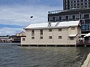
| Victoria Quay (Q7926981)
|
State Registered Place
|
|
|
32°03′13″S 115°44′25″E / 32.053715°S 115.740168°E / -32.053715; 115.740168
|
3602
|
|
| Victoria Reservoir (Q21931992)
|
State Registered Place
|
Carmel
|
|
32°02′40″S 116°04′09″E / 32.04433°S 116.0693°E / -32.04433; 116.0693
|
3510
|
|
| Victoria Square Cottages (Q66976569)
|
State Registered Place
|
Perth
|
|
31°57′19″S 115°51′56″E / 31.955311°S 115.865423°E / -31.955311; 115.865423
|
2121
|
|
| Villa Carlotta (Q66976571)
|
State Registered Place
|
Busselton
|
|
33°38′46″S 115°21′14″E / 33.646078°S 115.354027°E / -33.646078; 115.354027
|
386
|

|
| Vlaming Head Radar (Q56054307)
|
State Registered Place
|
|
|
21°48′28″S 114°06′40″E / 21.80768305°S 114.1110493°E / -21.80768305; 114.1110493
|
10640
|
|
| Vlamingh Head Lighthouse (Q66976572)
|
State Registered Place
|
Exmouth
|
|
21°48′31″S 114°06′37″E / 21.808484°S 114.110263°E / -21.808484; 114.110263
|
24419
|

|
| Vlamingh Head Lighthouse Quarters (Q56054308)
|
State Registered Place
|
|
|
21°48′30″S 114°06′52″E / 21.80834965°S 114.1145804°E / -21.80834965; 114.1145804
|
23799
|
|
| Vlamingh Head lighthouse (Q28375586)
|
State Registered Place
|
|
|
21°48′30″S 114°06′37″E / 21.80829391061°S 114.11037070007433°E / -21.808293910610075; 114.11037070007433
|
837
|
|
| W D & H O Wills Warehouse (former) (Q56054309)
|
State Registered Place
|
|
|
31°57′01″S 115°51′07″E / 31.95027382°S 115.8520241°E / -31.95027382; 115.8520241
|
1330
|

|
| W D Moore & Co Warehouse (Q7958477)
|
State Registered Place
|
Fremantle
|
|
32°03′23″S 115°44′42″E / 32.05634°S 115.744871°E / -32.05634; 115.744871
|
890
|
|
| W.A. Trustee Co & Royal Insurance Co Bld (Q56054310)
|
State Registered Place
|
|
|
31°57′16″S 115°51′19″E / 31.95453588°S 115.8551658°E / -31.95453588; 115.8551658
|
2113
|
|
| WA Bank (former), Bunbury (Q56054312)
|
State Registered Place
|
|
|
33°19′27″S 115°38′12″E / 33.32421819°S 115.636625°E / -33.32421819; 115.636625
|
371
|
|
| WA Christmas Tree (Q56054313)
|
State Registered Place
|
|
|
35°01′03″S 117°53′24″E / 35.01739619°S 117.8899707°E / -35.01739619; 117.8899707
|
4344
|
|
| WA School for Deaf Children (Q56054314)
|
State Registered Place
|
Cottesloe
|
|
32°00′34″S 115°45′17″E / 32.00936294°S 115.7546345°E / -32.00936294; 115.7546345
|
594
|

|
| WAGR Chief Mechanical Engineer's Office (Q63258852)
|
State Registered Place
|
Midland
|
|
31°53′36″S 116°00′13″E / 31.893396°S 116.003571°E / -31.893396; 116.003571
|
2517
|

|
| WAREHOUSE, (FMR TIMOTHY'S TOYS), LOT 11, 1 CROKE LANE (Q56054340)
|
State Registered Place
|
|
|
32°03′24″S 115°44′33″E / 32.05669864°S 115.7425693°E / -32.05669864; 115.7425693
|
22542
|

|
| WAREHOUSE, 56 Pakenham Street (Q56054344)
|
State Registered Place
|
|
|
32°03′22″S 115°44′44″E / 32.05610142°S 115.7456431°E / -32.05610142; 115.7456431
|
22570
|
|
| Wadjemup Lighthouse (Q7959291)
|
State Registered Place
|
|
|
32°00′27″S 115°30′14″E / 32.00754029°S 115.5039937°E / -32.00754029; 115.5039937
|
3254
|

|
| Wagin Post Office (Q56054315)
|
State Registered Place
|
|
|
33°18′31″S 117°20′38″E / 33.30868141°S 117.3437558°E / -33.30868141; 117.3437558
|
2640
|
|
| Wagin Town Hall (Q66976573)
|
State Registered Place
|
Wagin
|
|
33°18′35″S 117°20′41″E / 33.309612°S 117.344768°E / -33.309612; 117.344768
|
2642
|

|
| Wake's Garage Group (Q66976577)
|
State Registered Place
|
Katanning
|
|
33°41′20″S 117°33′15″E / 33.688786°S 117.554167°E / -33.688786; 117.554167
|
7083
|

|
| Walcott Centre (Q66976578)
|
State Registered Place
|
Mount Lawley
|
|
31°56′19″S 115°52′34″E / 31.938594°S 115.876186°E / -31.938594; 115.876186
|
15731
|

|
| Walebing (Q56085283)
|
State Registered Place
|
|
|
30°41′32″S 116°12′50″E / 30.692327238954°S 116.2139574208364°E / -30.692327238954327; 116.2139574208364
|
3268
|

|
| Walkaway CWA Rooms (Q66976580)
|
State Registered Place
|
Walkaway
|
|
28°56′25″S 114°48′03″E / 28.94038°S 114.800928°E / -28.94038; 114.800928
|
13926
|
|
| Walkaway Railway Station Museum (Q66976582)
|
State Registered Place
|
Walkaway
|
|
28°56′19″S 114°48′06″E / 28.938626°S 114.801736°E / -28.938626; 114.801736
|
1170
|

|
| Wallal Downs Station Group (Q66976584)
|
State Registered Place
|
Eighty Mile Beach
|
|
19°46′47″S 120°38′28″E / 19.779652°S 120.641031°E / -19.779652; 120.641031
|
305
|
|
| Wandana Apartment Block (Q66976585)
|
State Registered Place
|
Subiaco
|
|
31°56′59″S 115°50′01″E / 31.949639°S 115.833619°E / -31.949639; 115.833619
|
9186
|
|
| Wanslea (Q66976587)
|
State Registered Place
|
Cottesloe
|
|
31°59′18″S 115°45′56″E / 31.988401°S 115.76558°E / -31.988401; 115.76558
|
598
|

|
| War Memorial (Q66976588)
|
State Registered Place
|
Mount Lawley
|
|
31°55′51″S 115°52′15″E / 31.930912°S 115.870915°E / -31.930912; 115.870915
|
16608
|

|
| Warden's Court (Q66976590)
|
State Registered Place
|
Coolgardie
|
|
30°57′14″S 121°09′52″E / 30.953998°S 121.164552°E / -30.953998; 121.164552
|
568
|

|
| Warder's Cottages, 7–17 Henderson Street (Q66976592)
|
State Registered Place
|
Fremantle
|
|
32°03′21″S 115°44′57″E / 32.055919°S 115.749234°E / -32.055919; 115.749234
|
24704
|

|
| Warder's Cottages, 7–41 Henderson Street (Q66976593)
|
State Registered Place
|
Fremantle
|
|
32°03′20″S 115°44′58″E / 32.055577°S 115.749523°E / -32.055577; 115.749523
|
877
|

|
| Warders' Cottages, 19–29 Henderson Street (Q66976595)
|
State Registered Place
|
Fremantle
|
|
32°03′20″S 115°44′58″E / 32.055510456496°S 115.7494106944629°E / -32.055510456496066; 115.7494106944629
|
24674
|

|
| Warders' Cottages, 31–41 Henderson Street (Q66976597)
|
State Registered Place
|
Fremantle
|
|
32°03′18″S 115°44′59″E / 32.055131090341°S 115.74968005308008°E / -32.05513109034054; 115.74968005308008
|
24893
|

|
| Warders' Terrace (Q66976599)
|
State Registered Place
|
Fremantle
|
|
32°03′15″S 115°45′05″E / 32.05424°S 115.751397°E / -32.05424; 115.751397
|
940
|
|
| Warehouse at 43 Pakenham Street, Fremantle (Q56054343)
|
State Registered Place
|
|
|
32°03′22″S 115°44′43″E / 32.05622532°S 115.745234°E / -32.05622532; 115.745234
|
23018
|
|
| Warehouse, 2 Leake Street (Q56054341)
|
State Registered Place
|
|
|
32°03′14″S 115°44′44″E / 32.05379681°S 115.7455213°E / -32.05379681; 115.7455213
|
22556
|
|
| Warehouse, 30-32 Henry Street (Q66976602)
|
State Registered Place
|
Fremantle
|
|
32°03′20″S 115°44′40″E / 32.05543°S 115.744484°E / -32.05543; 115.744484
|
887
|
|
| Warren River Railway Bridge, Picton to Northcliffe Railway (Q56054346)
|
State Registered Place
|
|
|
34°29′54″S 116°03′12″E / 34.49830441°S 116.0532598°E / -34.49830441; 116.0532598
|
15404
|
|
| Warribanno Smelter Complex Ruin (Q66976604)
|
State Registered Place
|
Northampton
|
|
27°53′05″S 114°37′54″E / 27.884662°S 114.631773°E / -27.884662; 114.631773
|
1900
|
|
| Warwick (Q117337761)
|
State Registered Place
|
|
|
32°03′35″S 115°45′29″E / 32.059807203269°S 115.75796520206494°E / -32.059807203268875; 115.75796520206494
|
2906
|

|
| Water Police Station & Quarters, Fremantle (Q66976606)
|
State Registered Place
|
Fremantle
|
|
32°03′26″S 115°44′36″E / 32.057258°S 115.743367°E / -32.057258; 115.743367
|
945
|
|
| Water Supply Office (Q66976607)
|
State Registered Place
|
Midland
|
|
31°53′21″S 116°00′09″E / 31.889099°S 116.002388°E / -31.889099; 116.002388
|
2530
|
|
| Watermark Kilns, Northcliffe (Q66976609)
|
State Registered Place
|
Northcliffe
|
|
34°33′15″S 116°10′53″E / 34.55404°S 116.181493°E / -34.55404; 116.181493
|
16654
|
|
| Wearne Hostel (Q66976611)
|
State Registered Place
|
Cottesloe
|
|
32°00′34″S 115°45′11″E / 32.009573°S 115.753002°E / -32.009573; 115.753002
|
603
|

|
| Weighbridge (Q66976613)
|
State Registered Place
|
Fremantle
|
|
32°03′18″S 115°44′31″E / 32.054917°S 115.741934°E / -32.054917; 115.741934
|
985
|

|
| Welbourne House (Q66976615)
|
State Registered Place
|
Guildford
|
|
31°53′54″S 115°57′43″E / 31.898221°S 115.962023°E / -31.898221; 115.962023
|
2468
|
|
| Weld Club (Q112078948)
|
State Registered Place
|
|
|
31°57′24″S 115°51′33″E / 31.956683090452°S 115.85910498140282°E / -31.956683090452493; 115.85910498140282
|
1950
|

|
| Weld Hall Theatre (Q66976616)
|
State Registered Place
|
Busselton
|
|
33°38′51″S 115°20′39″E / 33.647555°S 115.344133°E / -33.647555; 115.344133
|
404
|

|
| Well beneath the Hudson Building (Q66976618)
|
State Registered Place
|
Fremantle
|
|
32°03′15″S 115°44′34″E / 32.054302°S 115.742771°E / -32.054302; 115.742771
|
4143
|
|
| Wellington Buildings (Q66976620)
|
State Registered Place
|
Perth
|
|
31°57′06″S 115°51′29″E / 31.951547°S 115.858187°E / -31.951547; 115.858187
|
2140
|

|
| Wellington Dam Hydro Power Station (Q47144299)
|
State Registered Place
|
|
|
33°23′52″S 115°59′27″E / 33.39768°S 115.9907°E / -33.39768; 115.9907
|
6344
|

|
| Wellsteads' Homestead Group (Q66976621)
|
State Registered Place
|
Bremer Bay
|
|
34°26′06″S 119°21′47″E / 34.435073°S 119.363032°E / -34.435073; 119.363032
|
11696
|
|
| Wentworth Hotel (Q48797270)
|
State Registered Place
|
Perth
|
|
31°57′08″S 115°51′26″E / 31.952101°S 115.857264°E / -31.952101; 115.857264
|
2067
|

|
| Wesfarmers Building (Q66976625)
|
State Registered Place
|
Perth
|
|
31°57′04″S 115°51′22″E / 31.950992°S 115.856237°E / -31.950992; 115.856237
|
2143
|

|
| Wesley Church (Q66976627)
|
State Registered Place
|
Fremantle
|
|
32°03′13″S 115°44′46″E / 32.053564°S 115.746247°E / -32.053564; 115.746247
|
955
|

|
| Wesley Church and Manse (Q66976630)
|
State Registered Place
|
Guildford
|
|
31°54′00″S 115°58′22″E / 31.899891°S 115.972896°E / -31.899891; 115.972896
|
2462
|

|
| Wesley Church, Albany (Q24191453)
|
State Registered Place
|
Albany
|
|
35°01′35″S 117°52′52″E / 35.026260992257°S 117.8811496209132°E / -35.02626099225738; 117.8811496209132
|
21
|

|
| Wesley Church, Perth (Q7983881)
|
State Registered Place
|
Perth
|
|
31°57′12″S 115°51′25″E / 31.9533°S 115.857°E / -31.9533; 115.857
|
2003
|
|
| Wesley College, Chapel & Memorial Rose Garden (Q66976634)
|
State Registered Place
|
South Perth
|
|
31°58′49″S 115°51′54″E / 31.980299°S 115.865038°E / -31.980299; 115.865038
|
2379
|

|
| Wesley Methodist Chapel (Q66976635)
|
State Registered Place
|
Greenough
|
|
28°57′08″S 114°44′18″E / 28.952302°S 114.738318°E / -28.952302; 114.738318
|
1167
|
|
| West Australian Rowing Club (Q66976637)
|
State Registered Place
|
Perth
|
|
31°57′35″S 115°51′35″E / 31.959584°S 115.859772°E / -31.959584; 115.859772
|
2090
|
|
| West Leederville Primary School (Q66976639)
|
State Registered Place
|
West Leederville
|
|
31°56′21″S 115°49′58″E / 31.939127°S 115.832911°E / -31.939127; 115.832911
|
2208
|
|
| West Leederville Railway Footbridge (Q56054370)
|
State Registered Place
|
Subiaco
|
|
31°56′34″S 115°49′58″E / 31.94269693°S 115.8329067°E / -31.94269693; 115.8329067
|
3290
|
|
| Westbrook Homestead (Q56054372)
|
State Registered Place
|
|
|
33°41′33″S 115°14′12″E / 33.69237566°S 115.2367238°E / -33.69237566; 115.2367238
|
5372
|
|
| Western Australian Bank (Q56054374)
|
State Registered Place
|
|
|
31°53′28″S 116°00′27″E / 31.89098588°S 116.0076337°E / -31.89098588; 116.0076337
|
2529
|
|
| Western Australian Bank (fmr), Kalgoorlie (Q56054375)
|
State Registered Place
|
|
|
30°44′42″S 121°28′29″E / 30.74495884°S 121.4746171°E / -30.74495884; 121.4746171
|
1284
|
|
| Western Australian Bank, Albany Branch (Q24884357)
|
State Registered Place
|
|
|
35°01′36″S 117°53′03″E / 35.026777°S 117.884294°E / -35.026777; 117.884294
|
60
|

|
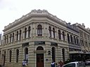
| Western Australian Club (Q56054376)
|
State Registered Place
|
|
|
31°57′19″S 115°51′25″E / 31.95526809°S 115.8569788°E / -31.95526809; 115.8569788
|
2110
|

|
| Western Australian Police Service Complex (Q56054377)
|
State Registered Place
|
|
|
31°57′40″S 115°52′44″E / 31.96118679°S 115.8788523°E / -31.96118679; 115.8788523
|
3048
|

|
| Weston Grave (Q56054378)
|
State Registered Place
|
Carmel
Canning Mills
|
|
32°01′53″S 116°04′23″E / 32.03133965°S 116.0730887°E / -32.03133965; 116.0730887
|
10486
|
|
| Westpac Bank Building, Fremantle (Q28428554)
|
State Registered Place
|
Fremantle
|
|
32°03′19″S 115°44′36″E / 32.055326°S 115.743363°E / -32.055326; 115.743363
|
908
|

|
| Westpac Bank, 66-70 High Street (Q66976641)
|
State Registered Place
|
Fremantle
|
|
32°03′17″S 115°44′42″E / 32.054718°S 115.745052°E / -32.054718; 115.745052
|
919
|
|
| Whaling Cove (Ruins) (Q66976644)
|
State Registered Place
|
Albany
|
|
35°03′24″S 117°55′36″E / 35.05669°S 117.926667°E / -35.05669; 117.926667
|
2994
|
|
| Whaling Station, Cheyne Beach (Q66976646)
|
State Registered Place
|
Albany
|
|
34°52′47″S 118°24′30″E / 34.879647°S 118.408447°E / -34.879647; 118.408447
|
1796
|
|
| Wharfingers House, Derby (Q66976648)
|
State Registered Place
|
Derby
|
|
17°18′02″S 123°37′35″E / 17.300574°S 123.626283°E / -17.300574; 123.626283
|
691
|
|
| Whitby Falls Hostel (Q7994164)
|
State Registered Place
|
Whitby
|
|
32°17′32″S 116°01′07″E / 32.29210489°S 116.0184952°E / -32.29210489; 116.0184952
|
8604
|
|
| White Star Hotel (Q24041510)
|
State Registered Place
|
|
|
35°01′38″S 117°53′06″E / 35.02717°S 117.884871°E / -35.02717; 117.884871
|
67
|
|
| Wickepin Nursing Post (Q66976650)
|
State Registered Place
|
Wickepin
|
|
32°46′56″S 117°30′27″E / 32.782128°S 117.507366°E / -32.782128; 117.507366
|
2722
|
|
| Wilhelmsen House (Q28225097)
|
State Registered Place
|
|
|
32°03′19″S 115°44′32″E / 32.05531°S 115.7421°E / -32.05531; 115.7421
|
854
|

|
| Wilkinson Homestead (Q66976651)
|
State Registered Place
|
Gosnells
|
|
32°03′50″S 115°58′55″E / 32.063868646772°S 115.98190494899455°E / -32.063868646771894; 115.98190494899455
|
1127
|

|
| Wilkinson's Orchard (Q66976654)
|
State Registered Place
|
Gosnells
|
|
32°03′48″S 115°58′55″E / 32.063455°S 115.982041°E / -32.063455; 115.982041
|
13830
|

|
| William & Wellington Street Precinct (Q66976656)
|
State Registered Place
|
Perth
|
|
31°57′08″S 115°51′28″E / 31.952099°S 115.857786°E / -31.952099; 115.857786
|
16743
|

|
| William Buckingham's Homestead (Q66976657)
|
State Registered Place
|
Roleystone
|
|
32°07′54″S 116°05′51″E / 32.131538°S 116.097551°E / -32.131538; 116.097551
|
3563
|
|
| William Street Precinct (Q66976659)
|
State Registered Place
|
Northbridge
|
|
31°56′58″S 115°51′34″E / 31.949552°S 115.859318°E / -31.949552; 115.859318
|
3795
|

|
| Willow Gully (Q66976661)
|
State Registered Place
|
Sandy Gully
|
|
28°23′41″S 114°29′09″E / 28.394722°S 114.485702°E / -28.394722; 114.485702
|
1914
|
|
| Willshire and Feely Building (Q66976663)
|
State Registered Place
|
Fremantle
|
|
32°03′17″S 115°44′40″E / 32.054625°S 115.744553°E / -32.054625; 115.744553
|
22567
|

|
| Wiluna District Hospital Group (Q66976664)
|
State Registered Place
|
Wiluna
|
|
26°35′49″S 120°13′44″E / 26.596882°S 120.228829°E / -26.596882; 120.228829
|
3635
|
|
| Windarra, Moonyoonooka (Q66976666)
|
State Registered Place
|
Moonyoonooka
|
|
28°46′56″S 114°45′22″E / 28.782154°S 114.756125°E / -28.782154; 114.756125
|
13929
|
|
| Windmill & Wishing Well (Q66976668)
|
State Registered Place
|
Victoria Park
|
|
31°58′10″S 115°53′27″E / 31.969437°S 115.890823°E / -31.969437; 115.890823
|
3898
|
|
| Windsor Hall (Q56054399)
|
State Registered Place
|
Mount Lawley
|
|
31°55′56″S 115°52′31″E / 31.9323205°S 115.8753856°E / -31.9323205; 115.8753856
|
3320
|

|
| Windsor Hotel (Q8024639)
|
State Registered Place
|
South Perth
|
|
31°58′23″S 115°51′09″E / 31.97301816°S 115.8524846°E / -31.97301816; 115.8524846
|
2392
|
|
| Wireless Hill Museum (Q76529991)
|
State Registered Place
|
|
|
32°01′49″S 115°49′41″E / 32.030388°S 115.828011°E / -32.030388; 115.828011
|
3825
|

|
| Wireless Hill Park (Q8026838)
|
State Registered Place
|
|
|
32°01′45″S 115°49′39″E / 32.02920666°S 115.8275832°E / -32.02920666; 115.8275832
|
3518
|
|
| Wireless Hill Park Museum Group (Q56054401)
|
State Registered Place
|
Ardross
|
|
32°01′50″S 115°49′41″E / 32.03049822°S 115.8280361°E / -32.03049822; 115.8280361
|
3823
|

|
| Wireless Masts (Q56054402)
|
State Registered Place
|
Ardross
|
|
32°01′50″S 115°49′40″E / 32.0305191°S 115.8276572°E / -32.0305191; 115.8276572
|
3827
|
|
| Wirra Willa Gardens (Q56054403)
|
State Registered Place
|
Mount Nasura
|
|
32°08′55″S 116°01′21″E / 32.14867968°S 116.0224389°E / -32.14867968; 116.0224389
|
4686
|

|
| Wittenoom Street Railway Houses (Q56054404)
|
State Registered Place
|
|
|
30°44′35″S 121°28′10″E / 30.743063°S 121.469358°E / -30.743063; 121.469358
|
15865
|
|
| Wollaston House (Q56054405)
|
State Registered Place
|
|
|
35°01′36″S 117°52′48″E / 35.02665105°S 117.8799174°E / -35.02665105; 117.8799174
|
20
|

|
| Wongan Hills Hospital (former) (Q56054406)
|
State Registered Place
|
|
|
30°53′41″S 116°43′19″E / 30.89467701°S 116.7219932°E / -30.89467701; 116.7219932
|
2749
|
|
| Wongan Hills Railway Barracks (Q98866298)
|
State Registered Place
|
|
|
30°53′31″S 116°42′57″E / 30.891972°S 116.715821°E / -30.891972; 116.715821
|
12414
|

|
| Wonnerup Precinct (Q66976669)
|
State Registered Place
|
Wonnerup
|
|
33°37′42″S 115°25′55″E / 33.628211°S 115.432011°E / -33.628211; 115.432011
|
424
|
|
| Wonnerup School & Teacher's House (Q66976671)
|
State Registered Place
|
Wonnerup
|
|
33°37′48″S 115°25′45″E / 33.630048°S 115.429249°E / -33.630048; 115.429249
|
425
|
|
| Woodbridge (Q56085281)
|
State Registered Place
|
|
|
31°53′20″S 115°59′12″E / 31.889018°S 115.986725°E / -31.889018; 115.986725
|
2528
|

|
| Woodlawn (Q66976673)
|
State Registered Place
|
East Fremantle
|
|
32°02′24″S 115°46′11″E / 32.040061°S 115.769839°E / -32.040061; 115.769839
|
805
|

|
| Woodloes Homestead (Q63389382)
|
State Registered Place
|
Cannington
|
|
32°01′38″S 115°56′31″E / 32.027341728735°S 115.94191119420871°E / -32.02734172873521; 115.94191119420871
|
433
|

|
| Woodman Point Lighthouse (Q8033084)
|
State Registered Place
|
Woodman Point
|
|
32°07′51″S 115°46′11″E / 32.13089424°S 115.7697291°E / -32.13089424; 115.7697291
|
24424
|

|
| Woodman Point Munitions Magazines (Q66976679)
|
State Registered Place
|
Coogee
|
|
32°07′37″S 115°46′00″E / 32.126833°S 115.766702°E / -32.126833; 115.766702
|
4626
|

|
| Woodside Hospital (Q66976681)
|
State Registered Place
|
East Fremantle
|
|
32°02′28″S 115°46′18″E / 32.041229°S 115.771717°E / -32.041229; 115.771717
|
792
|

|
| Wooroloo Cemetery (Q66976683)
|
State Registered Place
|
Wooroloo
|
|
31°48′37″S 116°19′37″E / 31.810217°S 116.326986°E / -31.810217; 116.326986
|
8571
|
|
| Wooroloo Sanatorium (Q38250775)
|
State Registered Place
|
Wooroloo
|
|
31°48′54″S 116°20′21″E / 31.81504286°S 116.3391108°E / -31.81504286; 116.3391108
|
8566
|
|
| Wubin Wheatbin (Q66976685)
|
State Registered Place
|
Wubin
|
|
30°06′24″S 116°37′50″E / 30.106684°S 116.630672°E / -30.106684; 116.630672
|
666
|

|
| Wyalkatchem Railway Barracks (Q66976688)
|
State Registered Place
|
Wyalkatchem
|
|
31°10′53″S 117°22′47″E / 31.181506°S 117.379858°E / -31.181506; 117.379858
|
16989
|

|
| Wyalkatchem Railway Station (Q66976691)
|
State Registered Place
|
Wyalkatchem
|
|
31°10′52″S 117°22′50″E / 31.180987°S 117.380628°E / -31.180987; 117.380628
|
23931
|

|
| Wyalkatchem Railway and CBH Precinct (Q66976686)
|
State Registered Place
|
Wyalkatchem
|
|
31°10′49″S 117°22′46″E / 31.180192°S 117.379579°E / -31.180192; 117.379579
|
15755
|
|
| Wyening Mission Group (Q66976694)
|
State Registered Place
|
Wyening
|
|
31°09′38″S 116°32′52″E / 31.16042°S 116.547823°E / -31.16042; 116.547823
|
2968
|
|
| Wyening Mission House (Q66976696)
|
State Registered Place
|
Wyening
|
|
31°09′41″S 116°32′39″E / 31.1613°S 116.544253°E / -31.1613; 116.544253
|
2617
|
|
| YNP Administration Building (Q66976710)
|
State Registered Place
|
Yanchep
|
|
31°32′50″S 115°41′04″E / 31.547162°S 115.684429°E / -31.547162; 115.684429
|
2683
|

|
| YNP Army Bunkers - Radar Installation (Q66976711)
|
State Registered Place
|
Yanchep
|
|
31°32′02″S 115°41′26″E / 31.533916°S 115.690685°E / -31.533916; 115.690685
|
2682
|

|
| YNP Avenue of Trees (Q66976713)
|
State Registered Place
|
Yanchep
|
|
31°33′09″S 115°41′18″E / 31.552468°S 115.688206°E / -31.552468; 115.688206
|
9531
|
|
| YNP Crystal Caves (Q66976714)
|
State Registered Place
|
Yanchep
|
|
31°32′51″S 115°41′35″E / 31.547481°S 115.693007°E / -31.547481; 115.693007
|
9529
|

|
| YNP Generator Bunkers - Radar Installation (Q66976716)
|
State Registered Place
|
Yanchep
|
|
31°32′10″S 115°41′12″E / 31.535999°S 115.686712°E / -31.535999; 115.686712
|
14278
|
|
| YNP Ghost House Ruin, Chauffeur's Room and Garage (Q56054432)
|
State Registered Place
|
Yanchep National Park
|
|
31°30′56″S 115°39′50″E / 31.51550322°S 115.6639175°E / -31.51550322; 115.6639175
|
2681
|
|
| YNP Gloucester Lodge and Pool (Q56054433)
|
State Registered Place
|
Yanchep National Park
|
|
31°32′34″S 115°41′16″E / 31.54286215°S 115.6876988°E / -31.54286215; 115.6876988
|
2677
|

|
| YNP McNess Guest House (Q56054434)
|
State Registered Place
|
Yanchep National Park
|
|
31°32′48″S 115°41′02″E / 31.54657146°S 115.6839666°E / -31.54657146; 115.6839666
|
2680
|

|
| YNP Recreation Hall Site (Q56054435)
|
State Registered Place
|
Yanchep National Park
|
|
31°32′40″S 115°40′58″E / 31.54443052°S 115.6826409°E / -31.54443052; 115.6826409
|
2685
|
|
| YNP Tram Cottage (Q56054436)
|
State Registered Place
|
Yanchep National Park
|
|
31°32′35″S 115°41′17″E / 31.54302144°S 115.6879944°E / -31.54302144; 115.6879944
|
2679
|

|
| YNP Yanchep Golf Clubhouse (Q56054437)
|
State Registered Place
|
Yanchep National Park
|
|
31°32′31″S 115°40′59″E / 31.54200266°S 115.6831054°E / -31.54200266; 115.6831054
|
17950
|

|
| YNP Yanchep War Memorial (Q56054439)
|
State Registered Place
|
Yanchep National Park
|
|
31°32′40″S 115°41′02″E / 31.54437955°S 115.683751°E / -31.54437955; 115.683751
|
14275
|
|
| Yalgoo Justice Precinct (Q66976697)
|
State Registered Place
|
Yalgoo
|
|
28°20′29″S 116°40′54″E / 28.341408°S 116.681782°E / -28.341408; 116.681782
|
2770
|

|
| Yalgoo Railway Station Group (Q66976699)
|
State Registered Place
|
Yalgoo
|
|
28°20′48″S 116°40′55″E / 28.34675°S 116.682056°E / -28.34675; 116.682056
|
2778
|

|
| Yanchep Inn (Q56054438)
|
State Registered Place
|
Yanchep National Park
|
|
31°32′39″S 115°41′00″E / 31.54429505°S 115.6832371°E / -31.54429505; 115.6832371
|
2678
|

|
| Yanchep National Park Precinct (Q66976701)
|
State Registered Place
|
Yanchep
|
|
31°32′45″S 115°40′58″E / 31.545799°S 115.682713°E / -31.545799; 115.682713
|
4151
|

|
| Yardarino School (ruin) (Q66976702)
|
State Registered Place
|
Yardarino
|
|
29°13′58″S 115°03′30″E / 29.232804°S 115.058457°E / -29.232804; 115.058457
|
1245
|

|
| Yarloop Workshops (Q8049363)
|
State Registered Place
|
Yarloop
|
|
32°57′33″S 115°54′00″E / 32.9593°S 115.9°E / -32.9593; 115.9
32°57′35″S 115°54′02″E / 32.959795°S 115.900597°E / -32.959795; 115.900597
|
1203
|

|
| Ye Olde Narrogin Inne (Q66976706)
|
State Registered Place
|
Armadale
|
|
32°09′01″S 116°01′20″E / 32.150292°S 116.022304°E / -32.150292; 116.022304
|
92
|

|
| Yellowdine Catchment & Dams (Q66976708)
|
State Registered Place
|
Yellowdine
|
|
31°17′14″S 119°38′21″E / 31.287162°S 119.639137°E / -31.287162; 119.639137
|
10069
|
|
| York Courthouse Complex (Q65052696)
|
State Registered Place
|
|
|
31°53′19″S 116°46′07″E / 31.888647°S 116.768651°E / -31.888647; 116.768651
|
2852
|

|
| York Fire Station (Q56755041)
|
State Registered Place
|
|
|
31°53′15″S 116°46′06″E / 31.887627°S 116.768245°E / -31.887627; 116.768245
|
2860
|

|
| York Flour Mill (Q66116152)
|
State Registered Place
|
|
|
31°53′38″S 116°45′59″E / 31.893903°S 116.766307°E / -31.893903; 116.766307
|
2872
|

|
| York Hotel (Q17059469)
|
State Registered Place
|
|
|
30°44′54″S 121°28′20″E / 30.74840189°S 121.4721412°E / -30.74840189; 121.4721412
|
1307
|

|
| York Post Office (Q55163999)
|
State Registered Place
|
|
|
31°53′18″S 116°46′08″E / 31.888397°S 116.76893°E / -31.888397; 116.76893
|
2855
|
|
| York Primary School (Q96419689)
|
State Registered Place
|
|
|
31°53′22″S 116°46′00″E / 31.889407°S 116.766773°E / -31.889407; 116.766773
|
2877
|
|
| York Town Hall (Q28225082)
|
State Registered Place
|
|
|
31°53′30″S 116°46′05″E / 31.8916°S 116.76818°E / -31.8916; 116.76818
|
2880
|

|
| York War Memorial (Q65951636)
|
State Registered Place
|
|
|
31°53′29″S 116°45′58″E / 31.891415°S 116.76616°E / -31.891415; 116.76616
|
2891
|
|
| York railway station (Q20718191)
|
State Registered Place
|
|
|
31°53′31″S 116°45′57″E / 31.8919°S 116.765876°E / -31.8919; 116.765876
|
2899
|

|
| Young Australia League and House (Q66976718)
|
State Registered Place
|
Perth
|
|
31°57′17″S 115°51′50″E / 31.95477°S 115.863788°E / -31.95477; 115.863788
|
2052
|

|
| Yowangup Homestead Group (Q66976719)
|
State Registered Place
|
Moojebing
|
|
33°38′47″S 117°30′31″E / 33.64643°S 117.508581°E / -33.64643; 117.508581
|
4604
|
|


.jpg)
.jpg)


.jpg)


_03.jpg)


.JPG)
_01.JPG)


.jpg)


.jpg)

_(Frank_Hurley)_(9781161676).jpg)


