| Name
|
Heritage list
|
Place
|
Street address
|
Coordinates
|
place_id
|
Image
|
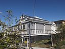
| Glendalough, Rosewood (Q19945967)
|
listed on the Queensland Heritage Register
|
|
|
27°38′02″S 152°35′20″E / 27.634°S 152.589°E / -27.634; 152.589
|
600735
|

|
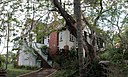
| Glengallan Homestead (Q24089841)
|
listed on the Queensland Heritage Register
|
|
|
28°06′09″S 152°03′28″E / 28.1024°S 152.0579°E / -28.1024; 152.0579
|
600007
|

|
| Glengariff, Hendra (Q19873746)
|
listed on the Queensland Heritage Register
|
|
|
27°25′12″S 153°04′05″E / 27.42°S 153.068°E / -27.42; 153.068
|
600222
|

|
| Glengarry Homestead (Q24090274)
|
listed on the Queensland Heritage Register
|
|
|
24°11′53″S 151°14′29″E / 24.1981°S 151.2415°E / -24.1981; 151.2415
|
600386
|

|
| Glenmore Homestead (Q5568628)
|
listed on the Queensland Heritage Register
|
|
|
23°18′53″S 150°29′13″E / 23.3147°S 150.487°E / -23.3147; 150.487
|
600823
|

|
| Glennie Hall (Q21017086)
|
listed on the Queensland Heritage Register
|
|
|
28°13′05″S 152°02′06″E / 28.2181°S 152.035°E / -28.2181; 152.035
|
601505
|

|
| Glentworth, Paddington (Q19873758)
|
listed on the Queensland Heritage Register
|
|
|
27°28′06″S 152°59′49″E / 27.4682°S 152.997°E / -27.4682; 152.997
|
600287
|

|
| Glenugie (Q25247526)
|
listed on the Queensland Heritage Register
|
|
|
27°28′15″S 153°02′39″E / 27.4708°S 153.0443°E / -27.4708; 153.0443
|
600262
|

|
| Golden Gate Mining and Town Complex (Q25323998)
|
listed on the Queensland Heritage Register
|
|
|
18°09′25″S 142°12′01″E / 18.1569°S 142.2004°E / -18.1569; 142.2004
|
645605
|

|
| Goldsborough Mort Woolstore (Q19873806)
|
listed on the Queensland Heritage Register
|
|
|
27°27′30″S 153°03′00″E / 27.4584°S 153.05°E / -27.4584; 153.05
|
600323
|

|
| Goldsbrough Mort Building, Rockhampton (Q24185619)
|
listed on the Queensland Heritage Register
|
|
|
23°22′49″S 150°30′57″E / 23.3802°S 150.5158°E / -23.3802; 150.5158
|
601489
|

|
| Gona Barracks (Q19873820)
|
listed on the Queensland Heritage Register
|
|
|
27°27′21″S 153°00′50″E / 27.4558°S 153.014°E / -27.4558; 153.014
|
601966
|

|
| Gooloowan (Q24089879)
|
listed on the Queensland Heritage Register
|
|
|
27°37′17″S 152°45′31″E / 27.6213°S 152.7585°E / -27.6213; 152.7585
|
600593
|

|
| Goombungee War Memorial (Q18345401)
|
listed on the Queensland Heritage Register
|
|
|
27°18′22″S 151°51′07″E / 27.3062°S 151.852°E / -27.3062; 151.852
|
600826
|

|
| Goomeri Hall of Memory (Q23002909)
|
listed on the Queensland Heritage Register
|
|
|
26°10′59″S 152°04′13″E / 26.1831°S 152.0702°E / -26.1831; 152.0702
|
600641
|

|
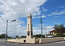
| Goomeri War Memorial Clock (Q23002911)
|
listed on the Queensland Heritage Register
|
|
|
26°10′56″S 152°04′05″E / 26.1823°S 152.0681°E / -26.1823; 152.0681
|
600642
|
|
| Goondiwindi Civic Centre (Q24997956)
|
listed on the Queensland Heritage Register
|
|
|
28°32′50″S 150°18′24″E / 28.5472°S 150.3067°E / -28.5472; 150.3067
|
600531
|

|
| Goondiwindi War Memorial (Q14934813)
|
listed on the Queensland Heritage Register
|
|
|
28°32′45″S 150°18′09″E / 28.545942°S 150.302525°E / -28.545942; 150.302525
|
600532
|

|
| Gordon's Mine and Mill (Q24998015)
|
listed on the Queensland Heritage Register
|
|
|
12°42′55″S 143°17′52″E / 12.7153°S 143.2977°E / -12.7153; 143.2977
|
601860
|

|
| Government Bond Store, Maryborough (Q24090204)
|
listed on the Queensland Heritage Register
|
|
|
25°32′19″S 152°42′21″E / 25.5386°S 152.7058°E / -25.5386; 152.7058
|
600716
|
|
| Government House, Brisbane (Q747133)
|
listed on the Queensland Heritage Register
|
|
|
27°27′46″S 152°59′24″E / 27.4629°S 152.99°E / -27.4629; 152.99
|
600275
|

|
| Government Printing Office, Brisbane (Q19873866)
|
listed on the Queensland Heritage Register
|
|
|
27°28′23″S 153°01′30″E / 27.4731°S 153.025°E / -27.4731; 153.025
|
600114
|

|
| Gowrie House (Q18345641)
|
listed on the Queensland Heritage Register
|
|
|
27°33′35″S 151°58′01″E / 27.5597°S 151.967°E / -27.5597; 151.967
|
601307
|

|
| Gracemere Homestead (Q24090287)
|
listed on the Queensland Heritage Register
|
|
|
23°25′36″S 150°26′46″E / 23.4267°S 150.446°E / -23.4267; 150.446
|
600508
|

|
| Graceville Memorial Park (Q18754781)
|
listed on the Queensland Heritage Register
|
|
|
27°31′03″S 152°58′37″E / 27.5176°S 152.977°E / -27.5176; 152.977
|
602443
|

|
| Graceville Uniting Church (Q19873872)
|
listed on the Queensland Heritage Register
|
|
|
27°31′14″S 152°58′44″E / 27.5205°S 152.979°E / -27.5205; 152.979
|
601584
|

|
| Graceville railway station (Q5591479)
|
listed on the Queensland Heritage Register
|
|
|
27°31′14″S 152°58′33″E / 27.5206°S 152.9759°E / -27.5206; 152.9759
|
602717
|

|
| Grand Hotel, Childers (Q24090246)
|
listed on the Queensland Heritage Register
|
|
|
25°14′13″S 152°16′39″E / 25.2369°S 152.2774°E / -25.2369; 152.2774
|
600608
|

|
| Grand Hotel, Mount Morgan (Q24090289)
|
listed on the Queensland Heritage Register
|
|
|
23°38′42″S 150°23′14″E / 23.645°S 150.3872°E / -23.645; 150.3872
|
600743
|

|
| Grand View Hotel (Q19873894)
|
listed on the Queensland Heritage Register
|
|
|
27°31′23″S 153°17′10″E / 27.523°S 153.286°E / -27.523; 153.286
|
600771
|

|
| Grandchester Sawmills (Q19873900)
|
listed on the Queensland Heritage Register
|
|
|
27°39′36″S 152°28′05″E / 27.66°S 152.468°E / -27.66; 152.468
|
600730
|

|
| Grandchester railway station (Q19873897)
|
listed on the Queensland Heritage Register
|
|
|
27°39′46″S 152°27′58″E / 27.6627°S 152.466°E / -27.6627; 152.466
|
600729
|

|
| Grangehill (Q19873904)
|
listed on the Queensland Heritage Register
|
|
|
27°27′12″S 153°01′41″E / 27.4534°S 153.028°E / -27.4534; 153.028
|
601668
|

|
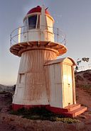
| Grassy Hill Light (Q1543590)
|
listed on the Queensland Heritage Register
|
|
|
15°27′39″S 145°15′18″E / 15.4607°S 145.255°E / -15.4607; 145.255
|
601241
|
|
| Great Court, University of Queensland (Q19817753)
|
listed on the Queensland Heritage Register
|
University of Queensland, St Lucia campus
|
|
27°29′48″S 153°00′47″E / 27.4968°S 153.013°E / -27.4968; 153.013
|
601025
|

|
| Great Northern Hotel, Townsville (Q24189874)
|
listed on the Queensland Heritage Register
|
|
|
19°15′47″S 146°48′53″E / 19.263°S 146.8147°E / -19.263; 146.8147
|
600908
|

|
| Great Northern Mine (Q25248238)
|
listed on the Queensland Heritage Register
|
|
|
17°23′01″S 145°23′24″E / 17.3837°S 145.3901°E / -17.3837; 145.3901
|
600542
|

|
| Greenmount Homestead (Q24185673)
|
listed on the Queensland Heritage Register
|
|
|
21°10′24″S 149°01′56″E / 21.1734°S 149.0321°E / -21.1734; 149.0321
|
600987
|

|
| Greenmount War Memorial (Q18346129)
|
listed on the Queensland Heritage Register
|
|
|
27°47′12″S 151°54′22″E / 27.7867°S 151.906°E / -27.7867; 151.906
|
600390
|

|
| Greycliffe Homestead (Q28184101)
|
listed on the Queensland Heritage Register
|
|
|
24°23′47″S 150°31′11″E / 24.3963°S 150.5198°E / -24.3963; 150.5198
|
600017
|

|
| Greylands, Indooroopilly (Q19874001)
|
listed on the Queensland Heritage Register
|
|
|
27°30′23″S 152°58′52″E / 27.5065°S 152.981°E / -27.5065; 152.981
|
600230
|

|
| Greystaines (Q18754805)
|
listed on the Queensland Heritage Register
|
|
|
27°26′20″S 153°03′18″E / 27.4389°S 153.055°E / -27.4389; 153.055
|
602551
|

|
| Grove Street Pensioners' Cottages (Q48815433)
|
listed on the Queensland Heritage Register
|
|
|
16°54′56″S 145°45′42″E / 16.9156°S 145.7618°E / -16.9156; 145.7618
|
602832
|

|
| Gunnawarra Homestead (Q24887363)
|
listed on the Queensland Heritage Register
|
|
|
17°56′12″S 145°09′54″E / 17.9366°S 145.1651°E / -17.9366; 145.1651
|
600544
|

|
| Gympie Ambulance Station (Q24090165)
|
listed on the Queensland Heritage Register
|
|
|
26°11′42″S 152°40′17″E / 26.195°S 152.6714°E / -26.195; 152.6714
|
602794
|

|
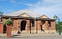
| Gympie Court House (Q24090070)
|
listed on the Queensland Heritage Register
|
|
|
26°11′13″S 152°39′33″E / 26.187°S 152.6593°E / -26.187; 152.6593
|
600533
|

|
| Gympie Lands Office (Q24090079)
|
listed on the Queensland Heritage Register
|
|
|
26°11′16″S 152°39′31″E / 26.1878°S 152.6587°E / -26.1878; 152.6587
|
602778
|

|
| Gympie Memorial Park (Q23002920)
|
listed on the Queensland Heritage Register
|
|
|
26°11′27″S 152°39′40″E / 26.1909°S 152.6611°E / -26.1909; 152.6611
|
602729
|

|
| Gympie School of Arts (Q24090068)
|
listed on the Queensland Heritage Register
|
|
|
26°11′17″S 152°39′37″E / 26.1881°S 152.6604°E / -26.1881; 152.6604
|
601910
|

|
| Gympie State High School (Q64684395)
|
listed on the Queensland Heritage Register
|
|
|
26°11′20″S 152°40′46″E / 26.18883535°S 152.67937776°E / -26.18883535; 152.67937776
|
650064
|
|
| Gympie Stock Exchange (Q22908784)
|
listed on the Queensland Heritage Register
|
|
|
26°11′20″S 152°39′31″E / 26.1889°S 152.6587°E / -26.1889; 152.6587
|
602772
|

|
| Gympie Town Hall (Q24090071)
|
listed on the Queensland Heritage Register
|
|
|
26°11′24″S 152°39′57″E / 26.19°S 152.6659°E / -26.19; 152.6659
|
602789
|

|
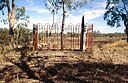
| Gympie and Widgee War Memorial Gates (Q23002917)
|
listed on the Queensland Heritage Register
|
|
|
26°11′24″S 152°39′39″E / 26.19°S 152.6609°E / -26.19; 152.6609
|
600535
|

|
| Gympie railway station (Q5625149)
|
listed on the Queensland Heritage Register
|
|
|
26°11′15″S 152°40′16″E / 26.1874°S 152.671°E / -26.1874; 152.671
|
602036
|

|
| H2 Hinde Tree (Q19874059)
|
listed on the Queensland Heritage Register
|
|
|
28°02′37″S 153°17′17″E / 28.0437°S 153.288°E / -28.0437; 153.288
|
602649
|

|
| Habana Tramline Causeway and Wharf Site (Q24189359)
|
listed on the Queensland Heritage Register
|
|
|
20°59′33″S 149°02′21″E / 20.9925°S 149.0392°E / -20.9925; 149.0392
|
602749
|
|
| Haddon Corner (Q1567380)
|
listed on the Queensland Heritage Register
|
|
|
25°59′47″S 140°59′56″E / 25.9964°S 140.999°E / -25.9964; 140.999
|
602807
|
|
| Halse Lodge (Q24090151)
|
listed on the Queensland Heritage Register
|
|
|
26°23′21″S 153°05′32″E / 26.3891°S 153.0923°E / -26.3891; 153.0923
|
601393
|

|
| Hamilton State School (Q83303065)
|
listed on the Queensland Heritage Register
|
|
|
27°25′58″S 153°04′27″E / 27.4327°S 153.0741°E / -27.4327; 153.0741
|
650088
|
|
| Hamilton Town Hall, Brisbane (Q18704806)
|
listed on the Queensland Heritage Register
|
|
|
27°26′16″S 153°03′50″E / 27.4378°S 153.064°E / -27.4378; 153.064
|
602444
|

|
| Hann Family Grave (Q24895649)
|
listed on the Queensland Heritage Register
|
|
|
19°41′15″S 145°32′27″E / 19.6875°S 145.5407°E / -19.6875; 145.5407
|
601789
|
|
| Hanworth (Q19817755)
|
listed on the Queensland Heritage Register
|
|
|
27°28′45″S 153°02′53″E / 27.4793°S 153.048°E / -27.4793; 153.048
|
601026
|

|
| Hardware Store, Childers (Q24090254)
|
listed on the Queensland Heritage Register
|
|
|
25°14′12″S 152°16′42″E / 25.2368°S 152.2784°E / -25.2368; 152.2784
|
600624
|

|
| Hardy Brothers Building (Q16892108)
|
listed on the Queensland Heritage Register
|
|
|
27°28′12″S 153°01′30″E / 27.4699°S 153.025°E / -27.4699; 153.025
|
600138
|

|
| Harlaxton House (Q18348441)
|
listed on the Queensland Heritage Register
|
|
|
27°31′48″S 151°57′36″E / 27.5299°S 151.96°E / -27.5299; 151.96
|
600839
|

|
| Harlin Rail Bridge (Q22329512)
|
listed on the Queensland Heritage Register
|
|
|
26°58′30″S 152°21′51″E / 26.975°S 152.3641°E / -26.975; 152.3641
|
602636
|

|
| Harris Terrace, Brisbane (Q19874128)
|
listed on the Queensland Heritage Register
|
|
|
27°28′26″S 153°01′34″E / 27.4739°S 153.026°E / -27.4739; 153.026
|
600121
|

|
| Harristown State High School Buildings (Q48818083)
|
listed on the Queensland Heritage Register
|
|
|
27°34′22″S 151°55′56″E / 27.5729°S 151.9323°E / -27.5729; 151.9323
|
650037
|

|
| Hawthorne ferry wharf (Q14935434)
|
listed on the Queensland Heritage Register
|
|
|
27°27′42″S 153°03′13″E / 27.4616°S 153.0535°E / -27.4616; 153.0535
|
602212
|

|
| Heckelmanns Building (Q19874210)
|
listed on the Queensland Heritage Register
|
|
|
27°28′12″S 153°01′37″E / 27.47°S 153.027°E / -27.47; 153.027
|
600104
|

|
| Hefferan Park Air Raid Shelter (Q19817756)
|
listed on the Queensland Heritage Register
|
|
|
27°30′01″S 153°01′44″E / 27.5004°S 153.029°E / -27.5004; 153.029
|
602472
|

|
| Heiner Road Railway Overpass (Q24089920)
|
listed on the Queensland Heritage Register
|
|
|
27°36′32″S 152°45′36″E / 27.609°S 152.7601°E / -27.609; 152.7601
|
602467
|

|
| Hellesvere (Q19520691)
|
listed on the Queensland Heritage Register
|
|
|
27°28′01″S 153°00′43″E / 27.467°S 153.012°E / -27.467; 153.012
|
600280
|

|
| Hemmant Christian Community Church (Q19874221)
|
listed on the Queensland Heritage Register
|
|
|
27°26′56″S 153°07′34″E / 27.449°S 153.126°E / -27.449; 153.126
|
600221
|
|
| Hemmant Gun Battery (Q19874224)
|
listed on the Queensland Heritage Register
|
|
|
27°27′52″S 153°07′52″E / 27.4644°S 153.131°E / -27.4644; 153.131
|
601353
|

|
| Hemmant State School (Q22908873)
|
listed on the Queensland Heritage Register
|
|
|
27°26′52″S 153°07′38″E / 27.4479°S 153.1271°E / -27.4479; 153.1271
|
602382
|

|
| Henlein & Co Building (Q24190055)
|
listed on the Queensland Heritage Register
|
|
|
19°15′41″S 146°48′58″E / 19.2613°S 146.8161°E / -19.2613; 146.8161
|
600907
|

|
| Herberton School of Arts (Q24885849)
|
listed on the Queensland Heritage Register
|
|
|
17°23′03″S 145°23′08″E / 17.3843°S 145.3856°E / -17.3843; 145.3856
|
600540
|

|
| Herberton Uniting Church (Q24885883)
|
listed on the Queensland Heritage Register
|
|
|
17°22′56″S 145°23′10″E / 17.3821°S 145.386°E / -17.3821; 145.386
|
601788
|
|
| Herberton War Memorial (Q23002929)
|
listed on the Queensland Heritage Register
|
|
|
17°23′07″S 145°23′13″E / 17.3853°S 145.3869°E / -17.3853; 145.3869
|
600541
|

|
| Heritage Tavern (Q24185608)
|
listed on the Queensland Heritage Register
|
|
|
23°22′47″S 150°30′56″E / 23.3797°S 150.5155°E / -23.3797; 150.5155
|
600810
|

|
| Herries Private Hospital (Q24190311)
|
listed on the Queensland Heritage Register
|
|
|
16°54′54″S 145°45′54″E / 16.9149°S 145.7651°E / -16.9149; 145.7651
|
602137
|

|
| Hester Villa (Q19874267)
|
listed on the Queensland Heritage Register
|
|
|
27°28′50″S 153°02′38″E / 27.4806°S 153.044°E / -27.4806; 153.044
|
600190
|

|
| Hibernian Hall, Roma (Q28183883)
|
listed on the Queensland Heritage Register
|
|
|
26°34′21″S 148°47′19″E / 26.5726°S 148.7885°E / -26.5726; 148.7885
|
601689
|

|
| Hides Hotel (Q24190586)
|
listed on the Queensland Heritage Register
|
|
|
16°55′21″S 145°46′33″E / 16.9226°S 145.7757°E / -16.9226; 145.7757
|
600382
|

|
| Hillside, Warwick (Q24089842)
|
listed on the Queensland Heritage Register
|
|
|
28°12′13″S 152°01′45″E / 28.2036°S 152.0292°E / -28.2036; 152.0292
|
600942
|
|
| Hillyards Shop House (Q19874306)
|
listed on the Queensland Heritage Register
|
|
|
27°29′09″S 153°01′48″E / 27.4859°S 153.03°E / -27.4859; 153.03
|
601059
|

|
| History of Rockhampton Base Hospital (Q24185634)
|
listed on the Queensland Heritage Register
|
|
|
23°22′44″S 150°29′43″E / 23.379°S 150.4952°E / -23.379; 150.4952
|
601967
|

|
| Hodgkinson's Marked Tree (Q28183475)
|
listed on the Queensland Heritage Register
|
|
|
19°51′14″S 138°06′22″E / 19.854°S 138.1062°E / -19.854; 138.1062
|
600741
|
|
| Holman Street ferry wharf (Q5883263)
|
listed on the Queensland Heritage Register
|
|
|
27°27′57″S 153°02′01″E / 27.4657°S 153.0336°E / -27.4657; 153.0336
|
602445
|

|
| Holy Cross Laundry (Q19874373)
|
listed on the Queensland Heritage Register
|
|
|
27°25′23″S 153°02′28″E / 27.4231°S 153.041°E / -27.4231; 153.041
|
600359
|

|
| Holy Name Cathedral, Brisbane (Q2942922)
|
listed on the Queensland Heritage Register
|
|
|
27°27′48″S 153°01′44″E / 27.4634°S 153.029°E / -27.4634; 153.029
|
600208
|

|
| Holy Triad Temple, Albion (Q19874377)
|
listed on the Queensland Heritage Register
|
|
|
27°26′21″S 153°02′42″E / 27.4393°S 153.045°E / -27.4393; 153.045
|
600056
|

|
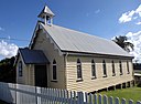
| Holy Trinity Anglican Church (Q19874379)
|
listed on the Queensland Heritage Register
|
|
|
27°29′17″S 153°01′52″E / 27.4881°S 153.031°E / -27.4881; 153.031
|
601875
|

|
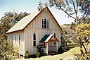
| Holy Trinity Anglican Church, Herberton (Q24885560)
|
listed on the Queensland Heritage Register
|
|
|
17°22′49″S 145°23′05″E / 17.3802°S 145.3846°E / -17.3802; 145.3846
|
600538
|

|
| Holy Trinity Church, Fortitude Valley (Q19817757)
|
listed on the Queensland Heritage Register
|
|
|
27°27′15″S 153°02′17″E / 27.4542°S 153.038°E / -27.4542; 153.038
|
600202
|
|
| Holy Trinity Church, Mackay (Q24189363)
|
listed on the Queensland Heritage Register
|
|
|
21°08′37″S 149°11′10″E / 21.1437°S 149.1861°E / -21.1437; 149.1861
|
601111
|
|
| Holy Trinity Church, Saibai Island (Q26258319)
|
listed on the Queensland Heritage Register
|
|
|
9°22′49″S 142°37′10″E / 9.3803°S 142.6194°E / -9.3803; 142.6194
|
600874
|
|
| Holy Trinity Parish Hall, Fortitude Valley (Q16844481)
|
listed on the Queensland Heritage Register
|
|
|
27°27′15″S 153°02′17″E / 27.4541°S 153.038°E / -27.4541; 153.038
|
600203
|

|
| Holy Trinity Rectory, Fortitude Valley (Q19817758)
|
listed on the Queensland Heritage Register
|
|
|
27°27′15″S 153°02′17″E / 27.4541°S 153.038°E / -27.4541; 153.038
|
600201
|

|
| Home Hill Powerhouse (Q16884951)
|
listed on the Queensland Heritage Register
|
|
|
19°40′11″S 147°24′45″E / 19.6697°S 147.4125°E / -19.6697; 147.4125
|
601718
|
|
| Homebush Mission Hall (Q24185666)
|
listed on the Queensland Heritage Register
|
|
|
21°16′16″S 149°03′48″E / 21.2712°S 149.0633°E / -21.2712; 149.0633
|
601705
|

|
| Homeward Bound Battery and Dam (Q25248367)
|
listed on the Queensland Heritage Register
|
|
|
18°08′56″S 142°16′19″E / 18.1488°S 142.2719°E / -18.1488; 142.2719
|
600439
|

|
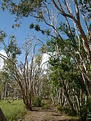
| Hoop Pines, Bald Hills (Q19874392)
|
listed on the Queensland Heritage Register
|
|
|
27°18′54″S 153°00′14″E / 27.3151°S 153.004°E / -27.3151; 153.004
|
602346
|

|
| Hornibrook Bridge (Q5904379)
|
listed on the Queensland Heritage Register
|
|
|
27°16′43″S 153°04′00″E / 27.278748°S 153.066802°E / -27.278748; 153.066802
|
601246
|

|
| Hotel Cecil, North Ipswich (Q24089921)
|
listed on the Queensland Heritage Register
|
|
|
27°36′24″S 152°45′39″E / 27.6068°S 152.7608°E / -27.6068; 152.7608
|
600603
|

|
| Hotel Childers (Q24090242)
|
listed on the Queensland Heritage Register
|
|
|
25°14′09″S 152°16′44″E / 25.2359°S 152.279°E / -25.2359; 152.279
|
600614
|

|
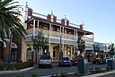
| Hotel Corones (Q28184281)
|
listed on the Queensland Heritage Register
|
|
|
26°24′09″S 146°14′28″E / 26.4025°S 146.2411°E / -26.4025; 146.2411
|
601282
|

|
| Hotel Francis (Q24090203)
|
listed on the Queensland Heritage Register
|
|
|
25°32′22″S 152°42′16″E / 25.5394°S 152.7044°E / -25.5394; 152.7044
|
600696
|
|
| Hotel Metropole, West Ipswich (Q20085685)
|
listed on the Queensland Heritage Register
|
|
|
27°36′53″S 152°45′14″E / 27.6146°S 152.754°E / -27.6146; 152.754
|
600567
|

|
| Hou Wang Temple (Q2640189)
|
listed on the Queensland Heritage Register
|
|
|
17°16′40″S 145°28′16″E / 17.2778°S 145.471°E / -17.2778; 145.471
|
600010
|

|
| Howard Smith Wharves (Q5920894)
|
listed on the Queensland Heritage Register
|
|
|
27°27′47″S 153°02′17″E / 27.463°S 153.038°E / -27.463; 153.038
|
601781
|

|
| Howard War Memorial (Q21369218)
|
listed on the Queensland Heritage Register
|
|
|
25°19′03″S 152°33′45″E / 25.3176°S 152.5624°E / -25.3176; 152.5624
|
600545
|
|
| Hughesville, Eight Mile Plains (Q19874471)
|
listed on the Queensland Heritage Register
|
|
|
27°34′35″S 153°05′31″E / 27.5763°S 153.092°E / -27.5763; 153.092
|
600191
|

|
| Humphery Railway Bridge (Q28184097)
|
listed on the Queensland Heritage Register
|
|
|
25°36′54″S 151°27′13″E / 25.6151°S 151.4536°E / -25.6151; 151.4536
|
600518
|

|
| Humphreys Boat Shed (Q19874479)
|
listed on the Queensland Heritage Register
|
|
|
27°58′18″S 153°25′41″E / 27.9718°S 153.428°E / -27.9718; 153.428
|
602324
|
|
| Hunter's Emporium (Q28183871)
|
listed on the Queensland Heritage Register
|
|
|
26°34′19″S 148°47′21″E / 26.572°S 148.7893°E / -26.572; 148.7893
|
601775
|

|
| Hunters Buildings (Q19874507)
|
listed on the Queensland Heritage Register
|
|
|
27°28′17″S 153°01′26″E / 27.4713°S 153.024°E / -27.4713; 153.024
|
600116
|

|
| Hydrographic Survey Bench Mark, East Trinity (Q24190430)
|
listed on the Queensland Heritage Register
|
|
|
16°54′12″S 145°48′43″E / 16.9034°S 145.8119°E / -16.9034; 145.8119
|
602833
|

|
| Idavine (Q24089928)
|
listed on the Queensland Heritage Register
|
|
|
27°36′58″S 152°45′10″E / 27.6161°S 152.7528°E / -27.6161; 152.7528
|
600572
|

|
| Ideraway Creek Railway Bridge (Q28184087)
|
listed on the Queensland Heritage Register
|
|
|
25°34′58″S 151°36′58″E / 25.5828°S 151.616°E / -25.5828; 151.616
|
600519
|

|
| Ilfracombe, Maryborough (Q24090205)
|
listed on the Queensland Heritage Register
|
|
|
25°31′39″S 152°42′41″E / 25.5276°S 152.7114°E / -25.5276; 152.7114
|
600703
|

|
| Imbil Railway Bridge (Q22329515)
|
listed on the Queensland Heritage Register
|
|
|
26°27′30″S 152°40′32″E / 26.4583°S 152.6756°E / -26.4583; 152.6756
|
602791
|

|
| Imperial Hotel, Ravenswood (Q24885199)
|
listed on the Queensland Heritage Register
|
|
|
20°06′01″S 146°53′24″E / 20.1004°S 146.8901°E / -20.1004; 146.8901
|
600446
|

|
| Inchcolm, Spring Hill (Q19874558)
|
listed on the Queensland Heritage Register
|
|
|
27°27′51″S 153°01′37″E / 27.4643°S 153.027°E / -27.4643; 153.027
|
600170
|

|
| Indooroopilly State High School Buildings (Q48818263)
|
listed on the Queensland Heritage Register
|
|
|
27°30′04″S 152°59′06″E / 27.5012°S 152.9851°E / -27.5012; 152.9851
|
650035
|

|
| Industrial Ruins, Macleay Island (Q19874604)
|
listed on the Queensland Heritage Register
|
|
|
27°37′56″S 153°21′43″E / 27.6321°S 153.362°E / -27.6321; 153.362
|
601062
|

|
| Ingham Court House (Q24190109)
|
listed on the Queensland Heritage Register
|
|
|
18°39′04″S 146°09′22″E / 18.6512°S 146.1562°E / -18.6512; 146.1562
|
601546
|

|
| Innisfail Courthouse (Q6035841)
|
listed on the Queensland Heritage Register
|
|
|
17°31′28″S 146°01′55″E / 17.5244°S 146.032°E / -17.5244; 146.032
|
601578
|

|
| Innisfail Water Tower (Q24190248)
|
listed on the Queensland Heritage Register
|
|
|
17°31′43″S 146°02′03″E / 17.5286°S 146.0343°E / -17.5286; 146.0343
|
602757
|

|
| Inverness residence, Toogoolawah (Q24089932)
|
listed on the Queensland Heritage Register
|
|
|
27°05′19″S 152°22′18″E / 27.0887°S 152.3718°E / -27.0887; 152.3718
|
600498
|

|
| Ipswich & West Moreton Building Society building (Q24089908)
|
listed on the Queensland Heritage Register
|
|
|
27°36′55″S 152°45′37″E / 27.6153°S 152.7604°E / -27.6153; 152.7604
|
600574
|

|
| Ipswich Central Mission (Q24089875)
|
listed on the Queensland Heritage Register
|
|
|
27°36′53″S 152°45′26″E / 27.6147°S 152.7572°E / -27.6147; 152.7572
|
600578
|

|
| Ipswich Club House (Q24089876)
|
listed on the Queensland Heritage Register
|
|
|
27°37′15″S 152°45′43″E / 27.6209°S 152.7619°E / -27.6209; 152.7619
|
600581
|

|
| Ipswich Girls' Grammar School Buildings (Q28220364)
|
listed on the Queensland Heritage Register
|
|
|
27°36′51″S 152°46′12″E / 27.6141°S 152.7699°E / -27.6141; 152.7699
|
600565
|

|
| Ipswich Grammar School Buildings (Q28220368)
|
listed on the Queensland Heritage Register
|
|
|
27°36′46″S 152°45′08″E / 27.6127°S 152.7521°E / -27.6127; 152.7521
|
600601
|

|
| Ipswich Mental Hospital (Q24089904)
|
listed on the Queensland Heritage Register
|
|
|
27°37′42″S 152°45′20″E / 27.6284°S 152.7555°E / -27.6284; 152.7555
|
601821
|

|
| Ipswich North State School (Q48817741)
|
listed on the Queensland Heritage Register
|
|
|
27°36′09″S 152°45′46″E / 27.6025°S 152.7629°E / -27.6025; 152.7629
|
650021
|

|
| Ipswich Railway Workshops War Memorial (Q23002952)
|
listed on the Queensland Heritage Register
|
North Ipswich Railway Workshops
|
|
27°35′50″S 152°45′35″E / 27.5973°S 152.7596°E / -27.5973; 152.7596
|
600605
|
|
| Ipswich Town Hall (Q18165805)
|
listed on the Queensland Heritage Register
|
|
|
27°36′52″S 152°45′32″E / 27.6145°S 152.759°E / -27.6145; 152.759
|
600566
|

|
| Ipswich Town Wharves (Q24089922)
|
listed on the Queensland Heritage Register
|
|
|
27°36′40″S 152°45′38″E / 27.6111°S 152.7606°E / -27.6111; 152.7606
|
602567
|
|
| Ipswich West State School (Q22905895)
|
listed on the Queensland Heritage Register
|
|
|
27°37′13″S 152°45′04″E / 27.6204°S 152.7512°E / -27.6204; 152.7512
|
600606
|

|
| Irlam's Ant Bed Building (Q24185661)
|
listed on the Queensland Heritage Register
|
|
|
22°49′03″S 147°28′34″E / 22.8175°S 147.4761°E / -22.8175; 147.4761
|
602010
|

|
| Ironside State School (Q83303097)
|
listed on the Queensland Heritage Register
|
|
|
|
650060
|
|
| Irvinebank School of Arts Hall (Q24883576)
|
listed on the Queensland Heritage Register
|
|
|
17°25′43″S 145°12′16″E / 17.4285°S 145.2044°E / -17.4285; 145.2044
|
601619
|

|
| Irvinebank State School (Q48806877)
|
listed on the Queensland Heritage Register
|
|
|
17°25′35″S 145°12′16″E / 17.4265°S 145.2044°E / -17.4265; 145.2044
|
602850
|

|
| Irvinebank State Treatment Works (Q24883526)
|
listed on the Queensland Heritage Register
|
|
|
17°25′47″S 145°12′09″E / 17.4298°S 145.2025°E / -17.4298; 145.2025
|
600679
|

|
| Isis District War Memorial and Shire Council Chambers (Q23002954)
|
listed on the Queensland Heritage Register
|
|
|
25°14′08″S 152°16′51″E / 25.2355°S 152.2807°E / -25.2355; 152.2807
|
601507
|

|
| Isis Downs Woolshed (Q28184214)
|
listed on the Queensland Heritage Register
|
|
|
24°13′08″S 144°37′39″E / 24.219°S 144.6275°E / -24.219; 144.6275
|
602544
|
|
| Isis Masonic Lodge (Q24090247)
|
listed on the Queensland Heritage Register
|
|
|
25°14′16″S 152°16′42″E / 25.2378°S 152.2782°E / -25.2378; 152.2782
|
602123
|

|
| Ithaca Creek State School (Q48816084)
|
listed on the Queensland Heritage Register
|
|
|
27°27′08″S 152°59′32″E / 27.4521°S 152.9923°E / -27.4521; 152.9923
|
650022
|
|
| Ithaca Embankments (Q18619615)
|
listed on the Queensland Heritage Register
|
|
|
27°27′22″S 152°59′49″E / 27.4562°S 152.997°E / -27.4562; 152.997
|
601209
|

|
| Ithaca Fire Station (Q18754806)
|
listed on the Queensland Heritage Register
|
|
|
27°27′31″S 153°00′00″E / 27.4586°S 153°E / -27.4586; 153
|
601199
|

|
| Ithaca Town Council Chambers (Q15228930)
|
listed on the Queensland Heritage Register
|
|
|
27°27′21″S 153°00′06″E / 27.45595°S 153.001558°E / -27.45595; 153.001558
|
602058
|

|
| Ithaca War Memorial (Q19874656)
|
listed on the Queensland Heritage Register
|
|
|
27°27′31″S 153°00′04″E / 27.4585°S 153.001°E / -27.4585; 153.001
|
600274
|

|
| Jack & Newell General Store, Herberton (Q24885657)
|
listed on the Queensland Heritage Register
|
|
|
17°23′01″S 145°23′06″E / 17.3835°S 145.3849°E / -17.3835; 145.3849
|
600539
|

|
| Jack and Newell Building (Q24190702)
|
listed on the Queensland Heritage Register
|
|
|
16°55′31″S 145°46′45″E / 16.9252°S 145.7793°E / -16.9252; 145.7793
|
601610
|

|
| James Cook Historical Museum (Q24998041)
|
listed on the Queensland Heritage Register
|
|
|
15°28′08″S 145°15′02″E / 15.4689°S 145.2506°E / -15.4689; 145.2506
|
600423
|
|
| James Sangster Memorial (Q21012192)
|
listed on the Queensland Heritage Register
|
|
|
27°36′19″S 152°45′40″E / 27.6053°S 152.7611°E / -27.6053; 152.7611
|
602581
|

|
| James Venture Mulligan's Grave (Q24883962)
|
listed on the Queensland Heritage Register
|
|
|
16°41′11″S 145°19′30″E / 16.6863°S 145.3251°E / -16.6863; 145.3251
|
600684
|

|
| Jeffery's Building (Q24090253)
|
listed on the Queensland Heritage Register
|
|
|
25°14′12″S 152°16′44″E / 25.2368°S 152.2788°E / -25.2368; 152.2788
|
600609
|

|
| Jimbour Dry Stone Wall (Q16934587)
|
listed on the Queensland Heritage Register
|
|
|
26°56′57″S 151°17′07″E / 26.9491°S 151.2854°E / -26.9491; 151.2854
|
602415
|

|
| Jimbour House (Q14935453)
|
listed on the Queensland Heritage Register
|
|
|
26°57′40″S 151°14′06″E / 26.961131°S 151.235095°E / -26.961131; 151.235095
|
600941
|

|
| Jimna Fire Tower (Q24089943)
|
listed on the Queensland Heritage Register
|
|
|
26°39′33″S 152°27′08″E / 26.6592°S 152.4522°E / -26.6592; 152.4522
|
601814
|

|
| Jimna Single Men's Barracks (Q24089944)
|
listed on the Queensland Heritage Register
|
|
|
26°39′28″S 152°27′51″E / 26.6579°S 152.4641°E / -26.6579; 152.4641
|
602685
|

|
| John M Headrick & Co Building (Q24185646)
|
listed on the Queensland Heritage Register
|
|
|
23°22′51″S 150°30′57″E / 23.3809°S 150.5158°E / -23.3809; 150.5158
|
600793
|

|
| John Mills Himself Building (Q18619619)
|
listed on the Queensland Heritage Register
|
|
|
27°28′18″S 153°01′34″E / 27.4717°S 153.026°E / -27.4717; 153.026
|
600084
|

|
| John Mills' residence (Q19874756)
|
listed on the Queensland Heritage Register
|
|
|
27°30′53″S 153°00′43″E / 27.5148°S 153.012°E / -27.5148; 153.012
|
601472
|

|
| Johnson's Building (Q24089861)
|
listed on the Queensland Heritage Register
|
|
|
28°12′54″S 152°01′59″E / 28.2149°S 152.0331°E / -28.2149; 152.0331
|
600960
|

|
| Johnston's Sawmill Steam Plant (Q24883989)
|
listed on the Queensland Heritage Register
|
|
|
16°40′34″S 145°19′48″E / 16.676°S 145.3299°E / -16.676; 145.3299
|
602776
|

|
| Johnstone Shire Hall (Q24190253)
|
listed on the Queensland Heritage Register
|
|
|
17°31′23″S 146°01′49″E / 17.5231°S 146.0302°E / -17.5231; 146.0302
|
601579
|

|
| Jondaryan Homestead (Q18385707)
|
listed on the Queensland Heritage Register
|
|
|
27°24′03″S 151°34′30″E / 27.4009°S 151.575°E / -27.4009; 151.575
|
600635
|
|
| Jondaryan Woolshed (Q18385711)
|
listed on the Queensland Heritage Register
|
|
|
27°23′39″S 151°34′19″E / 27.3941°S 151.572°E / -27.3941; 151.572
|
600633
|

|
| Joseph Morris Mine (Q24894904)
|
listed on the Queensland Heritage Register
|
|
|
19°15′23″S 143°40′11″E / 19.2565°S 143.6697°E / -19.2565; 143.6697
|
601855
|
|
| Joskeleigh Cemetery (Q22919849)
|
listed on the Queensland Heritage Register
|
|
|
23°22′04″S 150°46′45″E / 23.3678°S 150.7791°E / -23.3678; 150.7791
|
600659
|

|
| Jubilee Hotel (Q19817759)
|
listed on the Queensland Heritage Register
|
|
|
27°27′13″S 153°02′02″E / 27.4536°S 153.034°E / -27.4536; 153.034
|
600211
|

|
| Julius Street Flats (Q19874825)
|
listed on the Queensland Heritage Register
|
|
|
27°28′06″S 153°02′28″E / 27.4683°S 153.041°E / -27.4683; 153.041
|
601895
|

|
| Junction Park State School (Q48815734)
|
listed on the Queensland Heritage Register
|
|
|
27°30′34″S 153°02′07″E / 27.5095°S 153.0352°E / -27.5095; 153.0352
|
650023
|

|
| Kairi Maize Silos (Q24885933)
|
listed on the Queensland Heritage Register
|
|
|
17°12′59″S 145°32′25″E / 17.2163°S 145.5404°E / -17.2163; 145.5404
|
602631
|

|
| Kalinga Park (Q6352870)
|
listed on the Queensland Heritage Register
|
|
|
27°24′24″S 153°03′07″E / 27.4067°S 153.052°E / -27.4067; 153.052
|
602584
|

|
| Kalkie State School (Q22906060)
|
listed on the Queensland Heritage Register
|
|
|
24°50′46″S 152°23′50″E / 24.846°S 152.3973°E / -24.846; 152.3973
|
600971
|

|
| Kangaroo Point Cliffs (Q6362584)
|
listed on the Queensland Heritage Register
|
|
|
27°28′43″S 153°02′03″E / 27.478536111111°S 153.03403611111°E / -27.478536111111; 153.03403611111
|
602400
|

|
| Kardinia, Townsville (Q24189560)
|
listed on the Queensland Heritage Register
|
|
|
19°15′22″S 146°48′41″E / 19.2561°S 146.8114°E / -19.2561; 146.8114
|
600938
|

|
| Karingal Chambers (Q18387112)
|
listed on the Queensland Heritage Register
|
|
|
27°33′35″S 151°57′14″E / 27.5598°S 151.954°E / -27.5598; 151.954
|
600862
|

|
| Keating residence, Indooroopilly (Q19874864)
|
listed on the Queensland Heritage Register
|
|
|
27°30′06″S 152°58′30″E / 27.5018°S 152.975°E / -27.5018; 152.975
|
602057
|

|
| Kedron Lodge (Q18589046)
|
listed on the Queensland Heritage Register
|
|
|
27°24′32″S 153°02′42″E / 27.4088°S 153.045°E / -27.4088; 153.045
|
600238
|

|
| Keiraville, Ipswich (Q24089881)
|
listed on the Queensland Heritage Register
|
|
|
27°37′05″S 152°45′39″E / 27.6181°S 152.7608°E / -27.6181; 152.7608
|
600597
|

|
| Kelvin Grove Fig Trees and Air Raid Shelter (Q19874887)
|
listed on the Queensland Heritage Register
|
|
|
27°27′19″S 153°00′47″E / 27.4553°S 153.013°E / -27.4553; 153.013
|
602196
|

|
| Kelvin Grove State College (Q6386670)
|
listed on the Queensland Heritage Register
|
|
|
27°27′02″S 153°00′50″E / 27.4506°S 153.014°E / -27.4506; 153.014
|
650080
|
|
| Kenilworth Homestead (Q24089982)
|
listed on the Queensland Heritage Register
|
|
|
26°34′57″S 152°44′01″E / 26.5826°S 152.7336°E / -26.5826; 152.7336
|
602043
|

|
| Kenmore House, Rockhampton (Q24185639)
|
listed on the Queensland Heritage Register
|
|
|
23°23′53″S 150°29′51″E / 23.3981°S 150.4975°E / -23.3981; 150.4975
|
600820
|

|
| Kennedy Bridge, Bundaberg (Q24090228)
|
listed on the Queensland Heritage Register
|
|
|
24°51′49″S 152°21′27″E / 24.8637°S 152.3575°E / -24.8637; 152.3575
|
600367
|

|
| Kensington, Toowoomba (Q18387613)
|
listed on the Queensland Heritage Register
|
|
|
27°33′30″S 151°56′46″E / 27.5584°S 151.946°E / -27.5584; 151.946
|
601322
|
|
| Kerr's Building (Q24090237)
|
listed on the Queensland Heritage Register
|
|
|
25°14′12″S 152°16′42″E / 25.2368°S 152.2782°E / -25.2368; 152.2782
|
600627
|

|
| Kidman's Tree of Knowledge (Q28184350)
|
listed on the Queensland Heritage Register
|
|
|
24°47′06″S 139°35′33″E / 24.785°S 139.5925°E / -24.785; 139.5925
|
600462
|

|
| Kidston State Battery & Township (Q24894953)
|
listed on the Queensland Heritage Register
|
|
|
18°52′39″S 144°10′00″E / 18.8774°S 144.1666°E / -18.8774; 144.1666
|
600506
|

|
| Kilbirnie Homestead (Q26856797)
|
listed on the Queensland Heritage Register
|
|
|
24°14′48″S 150°30′20″E / 24.2467°S 150.5056°E / -24.2467; 150.5056
|
600016
|

|
| Kilcoy Homestead (Q23073908)
|
listed on the Queensland Heritage Register
|
|
|
26°55′42″S 152°34′20″E / 26.9282°S 152.5721°E / -26.9282; 152.5721
|
600638
|

|
| Killarney, Enoggera (Q19874920)
|
listed on the Queensland Heritage Register
|
|
|
27°25′00″S 152°59′49″E / 27.4167°S 152.997°E / -27.4167; 152.997
|
600194
|

|
| Killila (Q19874921)
|
listed on the Queensland Heritage Register
|
|
|
27°25′34″S 153°02′10″E / 27.4261°S 153.036°E / -27.4261; 153.036
|
602070
|
|
| Killowen, Rockhampton (Q24185636)
|
listed on the Queensland Heritage Register
|
|
|
23°23′48″S 150°29′42″E / 23.3968°S 150.4951°E / -23.3968; 150.4951
|
600819
|

|
| Kin Kin Sawmill (Q24090147)
|
listed on the Queensland Heritage Register
|
|
|
26°15′44″S 152°52′08″E / 26.2621°S 152.8688°E / -26.2621; 152.8688
|
602686
|

|
| Kinauld (Q19817760)
|
listed on the Queensland Heritage Register
|
|
|
27°29′13″S 153°00′47″E / 27.4869°S 153.013°E / -27.4869; 153.013
|
600225
|

|
| King Edward Park Air Raid Shelter (Q19874930)
|
listed on the Queensland Heritage Register
|
|
|
27°27′58″S 153°01′26″E / 27.466°S 153.024°E / -27.466; 153.024
|
602475
|

|
| King's Boarding House (Q28184144)
|
listed on the Queensland Heritage Register
|
|
|
26°51′35″S 151°47′35″E / 26.8597°S 151.793°E / -26.8597; 151.793
|
602747
|

|
| Kingaroy Butter Factory (Q19874942)
|
listed on the Queensland Heritage Register
|
|
|
26°31′57″S 151°50′06″E / 26.5325°S 151.835°E / -26.5325; 151.835
|
602809
|
|
| Kingaroy Peanut Silos (Q19874943)
|
listed on the Queensland Heritage Register
|
|
|
26°32′24″S 151°50′31″E / 26.54°S 151.842°E / -26.54; 151.842
|
602764
|

|
| Kingaroy Shire Council Chambers (Q28183601)
|
listed on the Queensland Heritage Register
|
|
|
26°32′21″S 151°50′29″E / 26.5393°S 151.8413°E / -26.5393; 151.8413
|
602810
|

|
| Kings Beach Bathing Pavilion (Q24089983)
|
listed on the Queensland Heritage Register
|
|
|
26°48′10″S 153°08′35″E / 26.8027°S 153.1431°E / -26.8027; 153.1431
|
601513
|

|
| Kingsborough Battery (Q24883682)
|
listed on the Queensland Heritage Register
|
|
|
16°55′39″S 145°02′18″E / 16.9275°S 145.0383°E / -16.9275; 145.0383
|
600682
|

|
| Kingston Pioneer Cemetery (Q19874947)
|
listed on the Queensland Heritage Register
|
|
|
27°39′51″S 153°06′43″E / 27.6642°S 153.112°E / -27.6642; 153.112
|
601495
|

|
| Kinkabool (Q19874949)
|
listed on the Queensland Heritage Register
|
|
|
28°00′12″S 153°25′48″E / 28.0033°S 153.43°E / -28.0033; 153.43
|
601477
|

|
| Kirkston (Q19874958)
|
listed on the Queensland Heritage Register
|
|
|
27°25′40″S 153°01′52″E / 27.4278°S 153.031°E / -27.4278; 153.031
|
600351
|

|
| Kissing Point Fortification (Q24190743)
|
listed on the Queensland Heritage Register
|
|
|
19°14′24″S 146°48′15″E / 19.2399°S 146.8043°E / -19.2399; 146.8043
|
601129
|

|
| Kitawah (Q19874965)
|
listed on the Queensland Heritage Register
|
|
|
27°28′51″S 153°03′04″E / 27.4807°S 153.051°E / -27.4807; 153.051
|
601023
|

|
| Klondyke Coke Ovens (Q19874975)
|
listed on the Queensland Heritage Register
|
|
|
27°35′35″S 152°45′14″E / 27.593°S 152.754°E / -27.593; 152.754
|
602566
|

|
| Koongalba (Q24090004)
|
listed on the Queensland Heritage Register
|
|
|
26°34′05″S 152°57′31″E / 26.5681°S 152.9587°E / -26.5681; 152.9587
|
601613
|

|
| Koumala War Memorial (Q23003033)
|
listed on the Queensland Heritage Register
|
|
|
21°36′26″S 149°14′37″E / 21.6073°S 149.2435°E / -21.6073; 149.2435
|
601292
|

|
| Kullaroo House (Q24090275)
|
listed on the Queensland Heritage Register
|
|
|
23°50′25″S 151°15′15″E / 23.8403°S 151.2542°E / -23.8403; 151.2542
|
601330
|

|
| Kuranda Fig Tree Avenue (Q86862948)
|
listed on the Queensland Heritage Register
|
Kuranda
|
|
16°49′09″S 145°38′10″E / 16.8192°S 145.6361°E / -16.8192; 145.6361
|
650081
|
|
| Kuridala Township site (Q25641089)
|
listed on the Queensland Heritage Register
|
|
|
21°16′47″S 140°30′26″E / 21.2797°S 140.5072°E / -21.2797; 140.5072
|
645604
|

|
| Kurilpa Library (Q19875038)
|
listed on the Queensland Heritage Register
|
|
|
27°28′57″S 153°00′43″E / 27.4824°S 153.012°E / -27.4824; 153.012
|
602461
|

|
| Kurrowah (Q19875042)
|
listed on the Queensland Heritage Register
|
|
|
27°29′38″S 153°01′26″E / 27.494°S 153.024°E / -27.494; 153.024
|
602827
|
|
| Kyeewa (Q19875048)
|
listed on the Queensland Heritage Register
|
|
|
27°36′41″S 152°46′19″E / 27.6113°S 152.772°E / -27.6113; 152.772
|
600602
|

|
| La Boite Theatre Building (Q19875051)
|
listed on the Queensland Heritage Register
|
|
|
27°27′55″S 153°00′40″E / 27.4652°S 153.011°E / -27.4652; 153.011
|
602171
|

|
| La Scala, Fortitude Valley (Q19875055)
|
listed on the Queensland Heritage Register
|
|
|
27°27′42″S 153°02′20″E / 27.4616°S 153.039°E / -27.4616; 153.039
|
600207
|

|
| La Société Française des Métaux Rares treatment plant (Q24882779)
|
listed on the Queensland Heritage Register
|
|
|
17°04′30″S 144°58′16″E / 17.0749°S 144.9711°E / -17.0749; 144.9711
|
602583
|
|
| La Trobe, East Brisbane (Q19875056)
|
listed on the Queensland Heritage Register
|
|
|
27°28′50″S 153°02′38″E / 27.4805°S 153.044°E / -27.4805; 153.044
|
600188
|

|
| Lady Bowen Hospital, Spring Hill (Q16893884)
|
listed on the Queensland Heritage Register
|
|
|
27°27′40″S 153°01′12″E / 27.461°S 153.02°E / -27.461; 153.02
|
601798
|

|
| Lagoon Creek Pumping Station (Q24089973)
|
listed on the Queensland Heritage Register
|
|
|
27°04′17″S 152°57′14″E / 27.0714°S 152.9538°E / -27.0714; 152.9538
|
602236
|

|
| Lahey's Canungra Sawmill Complex (Q19875065)
|
listed on the Queensland Heritage Register
|
|
|
28°00′57″S 153°09′47″E / 28.0158°S 153.163°E / -28.0158; 153.163
|
645602
|

|
| Lahey's Canungra Tramway Tunnel (Q18619781)
|
listed on the Queensland Heritage Register
|
|
|
28°01′23″S 153°10′19″E / 28.0231°S 153.172°E / -28.0231; 153.172
|
602529
|

|
| Lake Clarendon State School (Q48806934)
|
listed on the Queensland Heritage Register
|
|
|
27°31′19″S 152°21′30″E / 27.522°S 152.3584°E / -27.522; 152.3584
|
602857
|

|
| Lake Eacham Hotel (Q24894860)
|
listed on the Queensland Heritage Register
|
|
|
17°16′13″S 145°34′57″E / 17.2703°S 145.5826°E / -17.2703; 145.5826
|
600473
|

|
| Lakes Creek Hotel (Q24090295)
|
listed on the Queensland Heritage Register
|
|
|
23°22′33″S 150°33′28″E / 23.3757°S 150.5578°E / -23.3757; 150.5578
|
600796
|

|
| Lamb House, Kangaroo Point (Q19875074)
|
listed on the Queensland Heritage Register
|
|
|
27°28′57″S 153°01′55″E / 27.4824°S 153.032°E / -27.4824; 153.032
|
600242
|

|
| Lamb Island Pioneer Hall (Q19875077)
|
listed on the Queensland Heritage Register
|
|
|
27°37′29″S 153°23′02″E / 27.6246°S 153.384°E / -27.6246; 153.384
|
601493
|

|
| Lamington Bridge (Q6481981)
|
listed on the Queensland Heritage Register
|
Maryborough
|
|
25°32′40″S 152°41′14″E / 25.5445°S 152.6872°E / -25.5445; 152.6872
|
600721
|

|
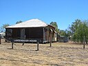
| Lands Administration Building (Q6484993)
|
listed on the Queensland Heritage Register
|
|
|
27°28′21″S 153°01′30″E / 27.4726°S 153.025°E / -27.4726; 153.025
|
600123
|

|
| Landsborough Air Raid Shelter (Q24089985)
|
listed on the Queensland Heritage Register
|
|
|
26°48′32″S 152°57′59″E / 26.8088°S 152.9663°E / -26.8088; 152.9663
|
602709
|

|
| Landsborough Shire Council Chambers (Q24089984)
|
listed on the Queensland Heritage Register
|
|
|
26°48′35″S 152°57′53″E / 26.8097°S 152.9647°E / -26.8097; 152.9647
|
601915
|

|
| Landsborough Tree (Q28183544)
|
listed on the Queensland Heritage Register
|
|
|
17°44′21″S 139°33′53″E / 17.7391°S 139.5648°E / -17.7391; 139.5648
|
600374
|

|
| Landsborough's Blazed Tree (Q28184248)
|
listed on the Queensland Heritage Register
|
|
|
26°40′34″S 146°09′29″E / 26.6761°S 146.158°E / -26.6761; 146.158
|
602715
|

|
| Landsborough's Blazed Tree (Camp 67) (Q26794842)
|
listed on the Queensland Heritage Register
|
|
|
26°29′25″S 146°11′41″E / 26.4904°S 146.1947°E / -26.4904; 146.1947
|
602716
|

|
| Langenbaker House (Q28184195)
|
listed on the Queensland Heritage Register
|
|
|
23°29′30″S 144°30′31″E / 23.4918°S 144.5087°E / -23.4918; 144.5087
|
601088
|
|
| Langer House (Q18754831)
|
listed on the Queensland Heritage Register
|
|
|
27°30′06″S 152°59′42″E / 27.5017°S 152.995°E / -27.5017; 152.995
|
600317
|

|
| Langham Hotel, Warwick (Q20085690)
|
listed on the Queensland Heritage Register
|
|
|
28°13′01″S 152°01′55″E / 28.2169°S 152.032°E / -28.2169; 152.032
|
600957
|
|
| Langmorn Homestead (Q24090281)
|
listed on the Queensland Heritage Register
|
|
|
23°50′07″S 150°45′16″E / 23.8352°S 150.7544°E / -23.8352; 150.7544
|
600387
|

|
| Langshaw Marble Lime Works (Q19875102)
|
listed on the Queensland Heritage Register
|
|
|
27°28′06″S 153°02′24″E / 27.4684°S 153.04°E / -27.4684; 153.04
|
601885
|

|
| Laura to Maytown Coach Road (Q24997974)
|
listed on the Queensland Heritage Register
|
|
|
15°59′29″S 144°18′23″E / 15.9913°S 144.3065°E / -15.9913; 144.3065
|
600427
|
|
| Laurel Bank Park (Q68915891)
|
listed on the Queensland Heritage Register
|
|
|
27°33′45″S 151°56′39″E / 27.5624082°S 151.9442567°E / -27.5624082; 151.9442567
|
650083
|

|
| Laurel Hill Farmhouse (Q16930629)
|
listed on the Queensland Heritage Register
|
|
|
27°50′39″S 153°16′16″E / 27.8442°S 153.271°E / -27.8442; 153.271
|
601936
|
|
| Leckhampton, Kangaroo Point (Q19817761)
|
listed on the Queensland Heritage Register
|
|
|
27°28′32″S 153°02′13″E / 27.4756°S 153.037°E / -27.4756; 153.037
|
600246
|

|
| Leichhardt Tree, Taroom (Q28184130)
|
listed on the Queensland Heritage Register
|
|
|
25°38′29″S 149°47′44″E / 25.6413°S 149.7956°E / -25.6413; 149.7956
|
600835
|

|
| Leyburn State School (Q22906340)
|
listed on the Queensland Heritage Register
|
|
|
28°00′48″S 151°34′44″E / 28.0132°S 151.5788°E / -28.0132; 151.5788
|
600827
|

|
| Liberty Hall, Ipswich (Q24089907)
|
listed on the Queensland Heritage Register
|
|
|
27°36′55″S 152°45′33″E / 27.6154°S 152.7592°E / -27.6154; 152.7592
|
600583
|

|
| Lilyvale Stand Monument (Q26794925)
|
listed on the Queensland Heritage Register
|
|
|
23°12′42″S 148°20′54″E / 23.2118°S 148.3483°E / -23.2118; 148.3483
|
602167
|

|
| Lime Kiln Remains, Ipswich (Q24089873)
|
listed on the Queensland Heritage Register
|
|
|
27°36′51″S 152°46′12″E / 27.6141°S 152.7699°E / -27.6141; 152.7699
|
600562
|

|
| Linville War Memorial (Q20644085)
|
listed on the Queensland Heritage Register
|
|
|
26°50′37″S 152°16′35″E / 26.8436°S 152.2765°E / -26.8436; 152.2765
|
602701
|

|
| Lion Brewery, Townsville (Q24190026)
|
listed on the Queensland Heritage Register
|
|
|
19°16′00″S 146°48′33″E / 19.2668°S 146.8092°E / -19.2668; 146.8092
|
602160
|

|
| Lister House (Q19875283)
|
listed on the Queensland Heritage Register
|
|
|
27°27′51″S 153°01′37″E / 27.4643°S 153.027°E / -27.4643; 153.027
|
600171
|

|
| Little Crystal Creek Bridge (Q6649697)
|
listed on the Queensland Heritage Register
|
Paluma
|
|
19°00′01″S 146°15′36″E / 19.0004°S 146.26°E / -19.0004; 146.26
|
602652
|

|
| Lloyd's Barber Shop (Q24090238)
|
listed on the Queensland Heritage Register
|
|
|
25°14′12″S 152°16′42″E / 25.2367°S 152.2783°E / -25.2367; 152.2783
|
600625
|

|
| Lochiel, Hamilton (Q19875295)
|
listed on the Queensland Heritage Register
|
|
|
27°26′19″S 153°03′04″E / 27.4387°S 153.051°E / -27.4387; 153.051
|
601965
|

|
| Lockyer Creek Railway Bridge (Q18618969)
|
listed on the Queensland Heritage Register
|
|
|
27°31′05″S 152°05′20″E / 27.518°S 152.089°E / -27.518; 152.089
|
600513
|

|
| Lockyer Creek Railway Bridge (Q18618970)
|
listed on the Queensland Heritage Register
|
|
|
27°29′35″S 152°04′55″E / 27.493°S 152.082°E / -27.493; 152.082
|
600515
|

|
| Lockyer Creek Railway Bridge (Q24286777)
|
listed on the Queensland Heritage Register
|
|
|
27°25′12″S 152°31′50″E / 27.4199°S 152.5305°E / -27.4199; 152.5305
|
600495
|

|
| Lockyer Hotel (Q19875299)
|
listed on the Queensland Heritage Register
|
|
|
27°35′21″S 152°21′25″E / 27.5893°S 152.357°E / -27.5893; 152.357
|
600650
|

|
| Lolworth Creek Battery (Q24884925)
|
listed on the Queensland Heritage Register
|
|
|
20°07′01″S 145°19′00″E / 20.1169°S 145.3168°E / -20.1169; 145.3168
|
601849
|
|
| London North Mine (Q24885870)
|
listed on the Queensland Heritage Register
|
|
|
20°05′54″S 146°53′13″E / 20.0982°S 146.8869°E / -20.0982; 146.8869
|
601207
|

|
| Longreach Ambulance Centre (Q28184218)
|
listed on the Queensland Heritage Register
|
|
|
23°26′24″S 144°14′46″E / 23.4401°S 144.2461°E / -23.4401; 144.2461
|
600663
|

|
| Longreach Powerhouse (Q28184223)
|
listed on the Queensland Heritage Register
|
|
|
23°26′25″S 144°14′44″E / 23.4404°S 144.2455°E / -23.4404; 144.2455
|
601541
|
|
| Longreach railway station (Q20718048)
|
listed on the Queensland Heritage Register
|
|
|
23°26′24″S 144°15′08″E / 23.4401°S 144.2523°E / -23.4401; 144.2523
|
601970
|

|
| Lonsdale House (Q19875312)
|
listed on the Queensland Heritage Register
|
|
|
27°27′40″S 153°01′37″E / 27.461°S 153.027°E / -27.461; 153.027
|
601159
|

|
| Lota House (Q19875316)
|
listed on the Queensland Heritage Register
|
|
|
27°27′46″S 153°11′20″E / 27.4629°S 153.189°E / -27.4629; 153.189
|
600247
|

|
| Loudoun House, Irvinebank (Q24882983)
|
listed on the Queensland Heritage Register
|
|
|
17°25′44″S 145°12′16″E / 17.4289°S 145.2045°E / -17.4289; 145.2045
|
600680
|

|
| Lt Thomas Armstrong Memorial (Q23002997)
|
listed on the Queensland Heritage Register
|
|
|
21°09′36″S 148°51′51″E / 21.1601°S 148.8641°E / -21.1601; 148.8641
|
600724
|

|
| Lucerne on Fernberg (Q6696506)
|
listed on the Queensland Heritage Register
|
|
|
27°27′55″S 153°00′04″E / 27.4653°S 153.001°E / -27.4653; 153.001
|
600251
|

|
| Lyall's Jewellery Shop (Q24901167)
|
listed on the Queensland Heritage Register
|
|
|
20°04′35″S 146°15′23″E / 20.0764°S 146.2565°E / -20.0764; 146.2565
|
600408
|

|
| Lyndhurst, Clayfield (Q19875331)
|
listed on the Queensland Heritage Register
|
|
|
27°25′15″S 153°03′14″E / 27.4209°S 153.054°E / -27.4209; 153.054
|
601841
|

|
| Lytton Hill (Q19875333)
|
listed on the Queensland Heritage Register
|
|
|
27°24′51″S 153°09′43″E / 27.4141°S 153.162°E / -27.4141; 153.162
|
601366
|

|
| Lytton Quarantine Station (Q19875334)
|
listed on the Queensland Heritage Register
|
|
|
27°24′52″S 153°09′00″E / 27.4144°S 153.15°E / -27.4144; 153.15
|
601347
|

|
| Ma Ma Creek War Memorial (Q19875337)
|
listed on the Queensland Heritage Register
|
|
|
27°37′47″S 152°11′24″E / 27.6298°S 152.19°E / -27.6298; 152.19
|
600514
|

|
| Mabel Mill (Q24885801)
|
listed on the Queensland Heritage Register
|
|
|
20°05′59″S 146°53′10″E / 20.0996°S 146.8861°E / -20.0996; 146.8861
|
601206
|

|
| MacArthur Chambers (Q28183396)
|
listed on the Queensland Heritage Register
|
|
|
27°28′06″S 153°01′38″E / 27.4684°S 153.0273°E / -27.4684; 153.0273
|
600147
|

|
| Mackay Central State School (Q22906634)
|
listed on the Queensland Heritage Register
|
|
|
21°08′46″S 149°10′55″E / 21.146°S 149.182°E / -21.146; 149.182
|
601911
|

|
| Mackay Court House and Police Station (Q24189366)
|
listed on the Queensland Heritage Register
|
|
|
21°08′32″S 149°11′16″E / 21.1421°S 149.1877°E / -21.1421; 149.1877
|
600673
|

|
| Mackay Customs House (Q24189368)
|
listed on the Queensland Heritage Register
|
|
|
21°08′23″S 149°11′14″E / 21.1397°S 149.1871°E / -21.1397; 149.1871
|
600669
|

|
| Mackay General Cemetery (Q22919899)
|
listed on the Queensland Heritage Register
|
|
|
21°08′42″S 149°09′51″E / 21.145°S 149.1642°E / -21.145; 149.1642
|
602766
|

|
| Mackay Masonic Temple (Q24041140)
|
listed on the Queensland Heritage Register
|
|
|
21°08′34″S 149°11′09″E / 21.1427°S 149.1859°E / -21.1427; 149.1859
|
602731
|

|
| Mackay Technical College (Q24189379)
|
listed on the Queensland Heritage Register
|
|
|
21°08′44″S 149°11′08″E / 21.1456°S 149.1856°E / -21.1456; 149.1856
|
602056
|

|
| Mackay Town Hall (Q16894449)
|
listed on the Queensland Heritage Register
|
|
|
21°08′32″S 149°11′13″E / 21.1423°S 149.187°E / -21.1423; 149.187
|
601107
|
|
| Mactaggarts Woolstore (Q18754808)
|
listed on the Queensland Heritage Register
|
|
|
27°27′12″S 153°02′56″E / 27.4532°S 153.049°E / -27.4532; 153.049
|
600319
|

|
| Magnetic House (Q24189983)
|
listed on the Queensland Heritage Register
|
|
|
19°15′26″S 146°49′14″E / 19.2571°S 146.8205°E / -19.2571; 146.8205
|
600892
|

|
| Main Beach Pavilion and Southport Surf Lifesaving Club (Q18754793)
|
listed on the Queensland Heritage Register
|
|
|
27°58′31″S 153°25′44″E / 27.9753°S 153.429°E / -27.9753; 153.429
|
601265
|

|
| Main Range Railway (Q18619258)
|
listed on the Queensland Heritage Register
|
|
|
27°29′21″S 152°00′22″E / 27.4892°S 152.006°E / -27.4892; 152.006
|
601480
|

|
| Main Roads Building (Q19817762)
|
listed on the Queensland Heritage Register
|
|
|
27°27′36″S 153°01′23″E / 27.4601°S 153.023°E / -27.4601; 153.023
|
602830
|

|
| Majestic Picture Theatre (Q24887243)
|
listed on the Queensland Heritage Register
|
|
|
17°21′13″S 145°35′34″E / 17.35351°S 145.59287°E / -17.35351; 145.59287
|
601743
|

|
| Majestic Theatre, Pomona (Q24090148)
|
listed on the Queensland Heritage Register
|
|
|
26°21′56″S 152°51′27″E / 26.3655°S 152.8576°E / -26.3655; 152.8576
|
602696
|

|
| Malanda Falls Swimming Pool (Q24887248)
|
listed on the Queensland Heritage Register
|
|
|
17°21′17″S 145°35′10″E / 17.3546°S 145.5862°E / -17.3546; 145.5862
|
602733
|
|


.jpg)
.jpg)


.jpg)
.jpg)

,_Quay_Street,_Rockhampton_(2002).jpg)
.jpg)


.jpg)

.jpg)


.jpg)
.jpg)


.jpg)
.jpg)


.jpg)


_(2011).jpg)


.jpg)
.jpg)

.jpg)
_(2009).jpg)

_(2016).jpg)


_-_Gympie_Stock_Exchange_(fmr)_(2008).jpg)


_on_Colliston_(2008).jpg)


.jpg)

_(2000).jpg)


,_looking_southwest.jpg)


.jpg)
.jpg)

_Australian_Anti-Aircraft_Battery_(2006).jpg)
.jpg)

.jpg)
.jpg)

,_from_N_(2009).jpg)
,_Cairns_(2015).jpg)

.jpg)

.jpg)

.jpg)
.jpg)


.jpg)

.jpg)


.jpg)
.jpg)
.jpg)

.jpg)
.jpg)


.jpg)

.jpg)
,_Gayndah_(2002).jpg)
_(2010).jpg)
.jpg)


,_from_N_bank.jpg)
.jpg)
.jpg)


.jpg)
.jpg)


.jpg)


.jpg)


.jpg)
.jpg)
.jpg)


.jpg)
,_from_W_(2015).jpg)
.jpg)
_(1992).jpg)


_(1992).jpg)


.jpg)
.jpg)
.jpg)


.jpg)
_(2007).jpg)
_(2008).jpg)


_Steam_Plant_(2009).jpg)
.jpg)
.jpg)


.jpg)
.jpg)
.jpg)

.jpg)


.jpg)
.jpg)
.jpg)

.jpg)
.jpg)
.jpg)
.jpg)


.jpg)
.jpg)


.jpg)

_(2008).jpg)
.jpg)
.jpg)


_with_graffiti.jpg)
.jpg)


.jpg)

.jpg)

,_with_posters_for_%22Cosi%22.jpg)


.jpg)
_at_Lahey%27s_Canungra_Sawmill.jpg)

.jpg)
.jpg)
.jpg)

.jpg)
.jpg)


.jpg)
.jpg)


.jpg)
.jpg)
.jpg)


.jpg)
.jpg)

.jpg)
.jpg)

,_Townsville.jpg)


_(2000).jpg)

.jpg)
,_from_SW_(2009).jpg)
_(2008)_01.jpg)

.jpg)
_(1998),_Longreach.jpg)
_(1998).jpg)

.jpg)

.jpg)
.jpg)
.jpg)
.jpg)

.jpg)
_-_site_view.jpg)

.jpg)


.jpg)
_(2014).jpg)

.jpg)
