Commons:Wiki4Alps/Val-de-Charmey
Jump to navigation
Jump to search
| KGS-Nr | Upload | Foto | Object | Other | Cov. | Cat. | Type | Address | Town | Coordinates | |||
|---|---|---|---|---|---|---|---|---|---|---|---|---|---|
| 1980 | 
|
Alphütte La Monse | A | G | Pra de La Monse 249, Charmey | [[:Category:Pra de La Monse 249, Charmey|{{{Town}}}]] |
| ||||||
| 1981 | 
|
Alphütte Le Lapé | A | G | Le Lapé 320, Charmey | [[:Category:|]] |
| ||||||
| 1973 | 
|
Kartause La Valsainte | A | G | La Valsainte 196–199, Cerniat | [[:Category:La Valsainte 196–199, Cerniat|{{{Town}}}]] |
| ||||||
| ? | Alphütte | B | G | Grosse Vère 162, Charmey | [[:Category:|]] |
| |||||||
| ? | Alphütte | B | G | Jeu de Quilles 307, Charmey | [[:Category:|]] |
| |||||||
| ? | Alphütte | B | G | Poutè Palu Dessus 280, Charmey | [[:Category:|]] |
| |||||||
| ? | Alphütte | B | G | Le Praz 266, Charmey | [[:Category:|]] |
| |||||||
| ? | Alphütte | B | G | Vi Tsalet d’Amont 256, Charmey | [[:Category:|]] |
| |||||||
| 1976 | Auberge de l’Étoile | B | G | Route du Centre 21, Charmey | [[:Category:|]] |
| |||||||
| ? | Bauernhaus | B | G | Les Pelley d’Amont 52, Cerniat | [[:Category:|]] |
| |||||||
| 1979 | Bauernhaus 44 | B | G | La Delèze, Charmey | [[:Category:|]] |
| |||||||
| 12404 | Bauernhaus | B | G | Le Liderrey 1, Charmey | [[:Category:|]] |
| |||||||
| 12405 | Bauernhaus | B | G | Le Liderrey 71, Charmey | [[:Category:|]] |
| |||||||
| 12402 | Bauernhaus | B | G | Les Ciernes 7, Charmey | [[:Category:|]] |
| |||||||
| 12403 | Bauernhaus | B | G | Route Derrière-la-Roche 57, Charmey | [[:Category:|]] |
| |||||||
| 12401 | Bauernhaus | B | G | Route du Centre 36, Charmey | [[:Category:|]] |
| |||||||
| 10715 | Bauernhaus | B | G | Village-d’En-Haut 37, Charmey | [[:Category:|]] |
| |||||||
| ? | Bildstock | B | G | Route du Centre 18B, Charmey | [[:Category:|]] |
| |||||||
| 9947 | Brücke über den Javro | B | G | Route du Pont-du-Javro, Charmey | [[:Category:|]] |
| |||||||
| ? | Haus der Begegnung (Centre protestant) | B | G | Riau de la Maula 28–30, Charmey | [[:Category:|]] |
| |||||||
| 10716 | Haus Mossu | B | G | Route du Centre 19, Charmey | [[:Category:|]] |
| |||||||
| ? | 
|
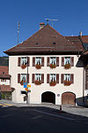
Hôtel de la Berra | B | G | Au Village 20, Cerniat | [[:Category:|]] |
| ||||||
| 12326 | 
|
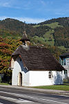
Kapelle Saint-Garin | B | G | Pré de l’Essert 505, Charmey | [[:Category:|]] |
| ||||||
| 12327 | 
|
Kapelle Saint-Jean-Baptiste | B | G | Route du Pra 33, Charmey | [[:Category:|]] |
| ||||||
| 12328 | 
|
Kapelle Saint-Pierre à La Corbettaz | B | G | Route du Pont-du-Javro 7, Charmey | [[:Category:|]] |
| ||||||
| 12325 | 
|
Kapelle Sainte-Anne au Liderrey | B | G | Route Derrière-la-Roche 101, Charmey | [[:Category:|]] |
| ||||||
| 12387 | 
|
Kapelle Sainte-Trinité | B | G | Les Pelley d’Amont 53, Cerniat | [[:Category:|]] |
| ||||||
| 1977 | 
|
Kirche Saint-Laurent | B | G | Route du Centre 18, Charmey | [[:Category:|]] |
| ||||||
| 12388 | 
|
Kirche Saints-Jean-et-Paul | B | G | Vers l’Église 1, Cerniat | [[:Category:|]] |
| ||||||
| 12330 | 
|
Pfarrhaus | B | G | Route du Centre 17, Charmey | [[:Category:|]] |
| ||||||
| 12406 | Scheune von Haus n° 11 | B | G | Le Clos 9, Charmey | [[:Category:|]] |
| |||||||
| 12329 | Schloss La Corbetta | B | G | Chemin du Lac 4, Charmey | [[:Category:|]] |
|