Commons:Wiki4Alps/Stein

From Wikimedia Commons, the free media repository
Jump to navigation Jump to search
KGS-Nr Upload Foto   Object Other Cov. Cat. Type Address Town Coordinates
8572 Upload a file Appenzeller Volkskunde-Museum Appenzeller Volkskunde-Museum No images A S Dorf 821 [[:Category:|]]
47° 22′ 22.51″ N, 9° 20′ 40.6″ E Kartographer map based on OpenStreetMap.View all coordinates using: OpenStreetMapinfo


10495 Upload a file Eisensteg Zweibruggen Eisensteg Zweibruggen No images A G Blatten [[:Category:|]]
47° 23′ 59.35″ N, 9° 20′ 21.7″ E Kartographer map based on OpenStreetMap.View all coordinates using: OpenStreetMapinfo


9074 Upload a file Gmündertobelbrücke Gmündertobelbrücke No images A G Steinerstrasse [[:Category:|]]
47° 23′ 16″ N, 9° 20′ 53″ E Kartographer map based on OpenStreetMap.View all coordinates using: OpenStreetMapinfo


10513 Upload a file Urnäschbrücke im Kubel Urnäschbrücke im Kubel No images A G Sturzenegg/Weitenau [[:Category:|]]
47° 23′ 59.71″ N, 9° 19′ 35.4″ E Kartographer map based on OpenStreetMap.View all coordinates using: OpenStreetMapinfo


11451 Upload a file Bauernhaus No images B G Oberhaus 1 [[:Category:|]]
47° 22′ 28.7″ N, 9° 20′ 30.48″ E Kartographer map based on OpenStreetMap.View all coordinates using: OpenStreetMapinfo


11452 Upload a file Bauernhaus No images B G Horgenbühl 121 [[:Category:|]]
47° 22′ 06.38″ N, 9° 20′ 58.96″ E Kartographer map based on OpenStreetMap.View all coordinates using: OpenStreetMapinfo


11453 Upload a file Bauernhaus No images B G Schmitten 480 [[:Category:|]]
47° 23′ 30.52″ N, 9° 20′ 19.97″ E Kartographer map based on OpenStreetMap.View all coordinates using: OpenStreetMapinfo


500 Upload a file Bauernhaus No images B G Sonder 238 [[:Category:|]]
47° 21′ 46.73″ N, 9° 20′ 15.76″ E Kartographer map based on OpenStreetMap.View all coordinates using: OpenStreetMapinfo


10497 Upload a file Gedeckte Sitterbrücke No images B G Zweibruggen [[:Category:|]]
47° 23′ 58.09″ N, 9° 20′ 23.14″ E Kartographer map based on OpenStreetMap.View all coordinates using: OpenStreetMapinfo


11454 Upload a file Heidenhaus No images B G Horgenbühl 121 [[:Category:|]]
47° 22′ 00.26″ N, 9° 20′ 52.12″ E Kartographer map based on OpenStreetMap.View all coordinates using: OpenStreetMapinfo


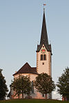
11446 Upload a file Reformierte Kirche Reformierte Kirche No images B G Dorf 14 [[:Category:|]]
47° 22′ 30.04″ N, 9° 20′ 37.86″ E Kartographer map based on OpenStreetMap.View all coordinates using: OpenStreetMapinfo


11457 Upload a file Wirtshaus Sonder No images B G Sonder 249 [[:Category:|]]
47° 21′ 47.88″ N, 9° 20′ 29.58″ E Kartographer map based on OpenStreetMap.View all coordinates using: OpenStreetMapinfo


Upload a file Altes Schulhaus No images G Dorf 37 [[:Category:|]]
47° 22′ 23.92″ N, 9° 20′ 37.5″ E Kartographer map based on OpenStreetMap.View all coordinates using: OpenStreetMapinfo


Upload a file Haus No images G Dorf 6 [[:Category:|]]
47° 22′ 29.75″ N, 9° 20′ 35.16″ E Kartographer map based on OpenStreetMap.View all coordinates using: OpenStreetMapinfo


Upload a file Haus No images G Dorf 7 [[:Category:|]]
47° 22′ 30″ N, 9° 20′ 35.63″ E Kartographer map based on OpenStreetMap.View all coordinates using: OpenStreetMapinfo


Upload a file Haus No images G Dorf 8 [[:Category:|]]
47° 22′ 30.18″ N, 9° 20′ 36.13″ E Kartographer map based on OpenStreetMap.View all coordinates using: OpenStreetMapinfo


Upload a file Haus No images G Dorf 10 [[:Category:|]]
47° 22′ 30.47″ N, 9° 20′ 36.82″ E Kartographer map based on OpenStreetMap.View all coordinates using: OpenStreetMapinfo


Upload a file Haus No images G Dorf 16 [[:Category:|]]
47° 22′ 29.28″ N, 9° 20′ 38.72″ E Kartographer map based on OpenStreetMap.View all coordinates using: OpenStreetMapinfo