Commons:Wiki4Alps/Schwende

From Wikimedia Commons, the free media repository
Jump to navigation Jump to search
KGS-Nr Upload Foto   Object Other Cov. Cat. Type Address Town Coordinates
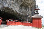
386 Upload a file Wildkirchli mit Kapelle St. Michael, Wohnhöhle, Einsiedelei Wildkirchli mit Kapelle St. Michael, Wohnhöhle, Einsiedelei No images A F/G unterhalb der Ebenalp [[:Category:|]]
47° 17′ 04.52″ N, 9° 24′ 54.15″ E Kartographer map based on OpenStreetMap.View all coordinates using: OpenStreetMapinfo


396 Upload a file Bauernhaus Dörig Lehnerlis, Triebern No images B G Triebernstrasse 26 [[:Category:|]]
47° 18′ 20.49″ N, 9° 25′ 40.01″ E Kartographer map based on OpenStreetMap.View all coordinates using: OpenStreetMapinfo


391 Upload a file Heidenhaus, Grubenmann, früher Baumanns Heimat No images B G Weissbadstrasse 41 [[:Category:|]]
47° 19′ 42″ N, 9° 24′ 50.17″ E Kartographer map based on OpenStreetMap.View all coordinates using: OpenStreetMapinfo


388 Upload a file Kapelle Jesus, Maria und Josef, Bild No images B G Schwendetalstrasse [[:Category:|]]
47° 17′ 35.13″ N, 9° 25′ 59.74″ E Kartographer map based on OpenStreetMap.View all coordinates using: OpenStreetMapinfo


392 Upload a file Kapelle Maria zum Schnee Kapelle Maria zum Schnee No images B G Meglisalp [[:Category:|]]
47° 15′ 22.13″ N, 9° 23′ 05.93″ E Kartographer map based on OpenStreetMap.View all coordinates using: OpenStreetMapinfo


390 Upload a file Kapelle St. Anna, Haggen No images B G St. Annastrasse [[:Category:|]]
47° 19′ 25.26″ N, 9° 25′ 21.94″ E Kartographer map based on OpenStreetMap.View all coordinates using: OpenStreetMapinfo


393 Upload a file Kapelle St. Franziska Romana, Rechböhl No images B G Sonnenhalbstrasse [[:Category:|]]
47° 18′ 41.63″ N, 9° 25′ 35.08″ E Kartographer map based on OpenStreetMap.View all coordinates using: OpenStreetMapinfo


395 Upload a file Kapelle zur Schmerzhaften Muttergottes, Sonnenhalb No images B G Tüllenstrasse [[:Category:|]]
47° 18′ 22.73″ N, 9° 25′ 04.38″ E Kartographer map based on OpenStreetMap.View all coordinates using: OpenStreetMapinfo


10606 Upload a file Museum Liner, Gebäude No images B G Unterrainstrasse 5 [[:Category:|]]
47° 19′ 41.67″ N, 9° 24′ 41.34″ E Kartographer map based on OpenStreetMap.View all coordinates using: OpenStreetMapinfo


8556 Upload a file Museum Liner, Sammlung No images B S Unterrainstrasse 5 [[:Category:|]]
47° 19′ 41.67″ N, 9° 24′ 41.34″ E Kartographer map based on OpenStreetMap.View all coordinates using: OpenStreetMapinfo


394 Upload a file Sammlung Hermann Fässler (Appenzeller Malerei) No images B S Blaues Haus, Weissbadstrasse 33 [[:Category:|]]
47° 19′ 43.01″ N, 9° 24′ 48.3″ E Kartographer map based on OpenStreetMap.View all coordinates using: OpenStreetMapinfo


387 Upload a file Wallfahrtskapelle Maria Hilf, Ahorn No images B G Ahorn 2 [[:Category:|]]
47° 17′ 34.88″ N, 9° 22′ 34.26″ E Kartographer map based on OpenStreetMap.View all coordinates using: OpenStreetMapinfo