Commons:Wiki4Alps/Sattel

From Wikimedia Commons, the free media repository
Jump to navigation Jump to search
KGS-Nr Upload Foto   Object Other Cov. Cat. Type Address Town Coordinates
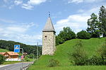
10210 Upload a file Letziturm sowie mittelalterliche Letzinen Letziturm sowie mittelalterliche Letzinen No images A G Ägeristrasse [[:Category:|]]
47° 05′ 29″ N, 8° 38′ 04.42″ E Kartographer map based on OpenStreetMap.View all coordinates using: OpenStreetMapinfo


4842 Upload a file Morgarten, Gedenkstätte mit Schlachtkapelle Morgarten, Gedenkstätte mit Schlachtkapelle No images A G {{{Town}}}
47° 05′ 24.53″ N, 8° 38′ 00.86″ E Kartographer map based on OpenStreetMap.View all coordinates using: OpenStreetMapinfo


12904 Upload a file Altes Schulhaus (Districthaus) No images B G Dorfstrasse 36 [[:Category:|]]
47° 05′ 01.1″ N, 8° 38′ 17.27″ E Kartographer map based on OpenStreetMap.View all coordinates using: OpenStreetMapinfo


12905 Upload a file Haus No images B G Magrainweg 17 [[:Category:|]]
47° 05′ 22.96″ N, 8° 37′ 44.15″ E Kartographer map based on OpenStreetMap.View all coordinates using: OpenStreetMapinfo


12906 Upload a file Haus Gütschli No images B G Schornenrainstrasse 15 [[:Category:|]]
47° 05′ 16.58″ N, 8° 37′ 34.46″ E Kartographer map based on OpenStreetMap.View all coordinates using: OpenStreetMapinfo


12907 Upload a file Haus Sagemattli, ehem. Wagnerei No images B G Aegeristrasse 85 [[:Category:|]]
47° 05′ 24.68″ N, 8° 37′ 58.48″ E Kartographer map based on OpenStreetMap.View all coordinates using: OpenStreetMapinfo


12908 Upload a file Haus Weiermattli, Schornen No images B G Aegeristrasse 81 [[:Category:|]]
47° 05′ 24.18″ N, 8° 37′ 59.56″ E Kartographer map based on OpenStreetMap.View all coordinates using: OpenStreetMapinfo


12909 Upload a file Haus Zanggern No images B G Jansernstrasse 62 [[:Category:|]]
47° 04′ 49.58″ N, 8° 38′ 27.71″ E Kartographer map based on OpenStreetMap.View all coordinates using: OpenStreetMapinfo


12912 Upload a file Haus, Ecce Homo No images B G Steinerbergstrasse 18 [[:Category:|]]
47° 04′ 41.27″ N, 8° 37′ 39.65″ E Kartographer map based on OpenStreetMap.View all coordinates using: OpenStreetMapinfo


12910 Upload a file Haus, Ecce Homo No images B G Steinerbergstrasse 85 [[:Category:|]]
47° 04′ 15.02″ N, 8° 37′ 07.14″ E Kartographer map based on OpenStreetMap.View all coordinates using: OpenStreetMapinfo


12911 Upload a file Haus, Ecce Homo No images B G Steinerbergstrasse 102 [[:Category:|]]
47° 04′ 07.43″ N, 8° 36′ 58.03″ E Kartographer map based on OpenStreetMap.View all coordinates using: OpenStreetMapinfo


12913 Upload a file Haus, Schornen No images B G Aegeristrasse 87 [[:Category:|]]
47° 05′ 25.62″ N, 8° 37′ 58.37″ E Kartographer map based on OpenStreetMap.View all coordinates using: OpenStreetMapinfo


12914 Upload a file Haus, Schornen No images B G Neumattstrasse 15 [[:Category:|]]
47° 05′ 35.88″ N, 8° 37′ 57.94″ E Kartographer map based on OpenStreetMap.View all coordinates using: OpenStreetMapinfo


12915 Upload a file Haus, Schornen No images B G Neumattstrasse 16 [[:Category:|]]
47° 05′ 36.17″ N, 8° 37′ 58.91″ E Kartographer map based on OpenStreetMap.View all coordinates using: OpenStreetMapinfo


12916 Upload a file Kapelle Ecce Homo Kapelle Ecce Homo No images B G Steinbergstrasse [[:Category:|]]
47° 04′ 09.23″ N, 8° 37′ 00.55″ E Kartographer map based on OpenStreetMap.View all coordinates using: OpenStreetMapinfo


12917 Upload a file Pfarrhaus No images B G Dorfstrasse 35 [[:Category:|]]
47° 05′ 01.03″ N, 8° 38′ 13.7″ E Kartographer map based on OpenStreetMap.View all coordinates using: OpenStreetMapinfo


12918 Upload a file Pfarrkirche St. Peter und Paul No images B G Dorfstrasse [[:Category:|]]
47° 05′ 01.03″ N, 8° 38′ 14.71″ E Kartographer map based on OpenStreetMap.View all coordinates using: OpenStreetMapinfo


Übrige Baudenkmäler
KGS-Nr Upload Foto   Object Other Cov. Cat. Type Address Town Coordinates
Upload a file Gasthaus Krone No images G Schlagstrasse 69 [[:Category:|]]
47° 04′ 53.62″ N, 8° 38′ 04.49″ E Kartographer map based on OpenStreetMap.View all coordinates using: OpenStreetMapinfo


Upload a file Haus No images G Dorfstrasse 37 [[:Category:|]]
47° 05′ 02.18″ N, 8° 38′ 16.87″ E Kartographer map based on OpenStreetMap.View all coordinates using: OpenStreetMapinfo


Upload a file Haus No images G Lustnaustrasse 51 [[:Category:|]]
47° 05′ 19.9″ N, 8° 39′ 10.62″ E Kartographer map based on OpenStreetMap.View all coordinates using: OpenStreetMapinfo


Upload a file Haus No images G Jansernstrasse 26, Eumatt [[:Category:|]]
47° 04′ 56.96″ N, 8° 38′ 18.06″ E Kartographer map based on OpenStreetMap.View all coordinates using: OpenStreetMapinfo


Upload a file Haus No images G Steinerbergstrasse 12 (Lehmatt) [[:Category:|]]
47° 04′ 42.1″ N, 8° 37′ 42.89″ E Kartographer map based on OpenStreetMap.View all coordinates using: OpenStreetMapinfo


Upload a file Haus No images G Esch 12 (Schnüerlen) [[:Category:|]]
47° 04′ 57.18″ N, 8° 37′ 37.45″ E Kartographer map based on OpenStreetMap.View all coordinates using: OpenStreetMapinfo


Upload a file Haus No images G Nideristmatt [[:Category:|]]
47° 05′ 20.87″ N, 8° 37′ 52.43″ E Kartographer map based on OpenStreetMap.View all coordinates using: OpenStreetMapinfo


Upload a file Haus No images G Hof 4 [[:Category:|]]
47° 04′ 33.02″ N, 8° 36′ 55.37″ E Kartographer map based on OpenStreetMap.View all coordinates using: OpenStreetMapinfo


Upload a file Haus No images G Erli 25 [[:Category:|]]
47° 04′ 17″ N, 8° 37′ 20.64″ E Kartographer map based on OpenStreetMap.View all coordinates using: OpenStreetMapinfo


Upload a file Haus No images G Erli 15 [[:Category:|]]
47° 04′ 24.17″ N, 8° 37′ 31.22″ E Kartographer map based on OpenStreetMap.View all coordinates using: OpenStreetMapinfo


Upload a file Haus Änderen No images G Brunnernstrasse 26 [[:Category:|]]
47° 05′ 05.42″ N, 8° 37′ 26.44″ E Kartographer map based on OpenStreetMap.View all coordinates using: OpenStreetMapinfo


Upload a file Haus Dietzigen No images G Magrainweg 8 [[:Category:|]]
47° 05′ 19.9″ N, 8° 37′ 40.66″ E Kartographer map based on OpenStreetMap.View all coordinates using: OpenStreetMapinfo


Upload a file Haus Gross Seilegg No images G Gross Seilegg [[:Category:|]]
47° 04′ 23.23″ N, 8° 37′ 08.76″ E Kartographer map based on OpenStreetMap.View all coordinates using: OpenStreetMapinfo


Upload a file Haus Lutzi No images G Lutzistrasse 59 [[:Category:|]]
47° 04′ 24.02″ N, 8° 36′ 16.78″ E Kartographer map based on OpenStreetMap.View all coordinates using: OpenStreetMapinfo


Upload a file Haus Obere Seilegg No images G Herreneggstrasse 41 [[:Category:|]]
47° 04′ 39.97″ N, 8° 37′ 18.05″ E Kartographer map based on OpenStreetMap.View all coordinates using: OpenStreetMapinfo


Upload a file Haus Oberer Schlag No images G Figlenstrasse 11 [[:Category:|]]
47° 05′ 20.18″ N, 8° 38′ 11.8″ E Kartographer map based on OpenStreetMap.View all coordinates using: OpenStreetMapinfo


Upload a file Haus Unterer Schlag No images G Schornenstrasse 40 [[:Category:|]]
47° 05′ 16.73″ N, 8° 38′ 00.13″ E Kartographer map based on OpenStreetMap.View all coordinates using: OpenStreetMapinfo


Upload a file Haus Zizenmatt No images G Aegeristrasse 19 [[:Category:|]]
47° 04′ 55.74″ N, 8° 37′ 39.79″ E Kartographer map based on OpenStreetMap.View all coordinates using: OpenStreetMapinfo