Commons:Wiki4Alps/Rothenthurm

From Wikimedia Commons, the free media repository
Jump to navigation Jump to search


KGS-Nr Upload Foto   Object Other Cov. Cat. Type Address Town Coordinates
9672 Upload a file Mittelalterliche Letzinen, Wehrturm No images A G Höhenweg [[:Category:|]]
47° 06′ 16.56″ N, 8° 40′ 11.65″ E Kartographer map based on OpenStreetMap.View all coordinates using: OpenStreetMapinfo


11652 Upload a file Roter Turm und Tor Roter Turm und Tor No images A G Altmattstrasse [[:Category:|]]
47° 06′ 21.82″ N, 8° 40′ 34.16″ E Kartographer map based on OpenStreetMap.View all coordinates using: OpenStreetMapinfo


12898 Upload a file Haus No images B G Biberegg 11 [[:Category:|]]
47° 05′ 29.58″ N, 8° 40′ 13.66″ E Kartographer map based on OpenStreetMap.View all coordinates using: OpenStreetMapinfo


12900 Upload a file Haus No images B G Biberegg 13 [[:Category:|]]
47° 05′ 28.57″ N, 8° 40′ 15.78″ E Kartographer map based on OpenStreetMap.View all coordinates using: OpenStreetMapinfo


12899 Upload a file Haus No images B G Hauptstrasse 22 [[:Category:|]]
47° 06′ 13″ N, 8° 40′ 30.54″ E Kartographer map based on OpenStreetMap.View all coordinates using: OpenStreetMapinfo


12901 Upload a file Haus Chilleren No images B G Killernweg 3 [[:Category:|]]
47° 06′ 03.92″ N, 8° 40′ 33.89″ E Kartographer map based on OpenStreetMap.View all coordinates using: OpenStreetMapinfo


12902 Upload a file Kaplanei No images B G Biberegg 15 [[:Category:|]]
47° 05′ 29.76″ N, 8° 40′ 16″ E Kartographer map based on OpenStreetMap.View all coordinates using: OpenStreetMapinfo


12903 Upload a file Loreto-Kapelle No images B G Biberegg [[:Category:|]]
47° 05′ 29.08″ N, 8° 40′ 14.84″ E Kartographer map based on OpenStreetMap.View all coordinates using: OpenStreetMapinfo


4841 Upload a file Pfarrhaus Pfarrhaus No images B G Hauptstrasse 9 [[:Category:|]]
47° 06′ 17.46″ N, 8° 40′ 34.21″ E Kartographer map based on OpenStreetMap.View all coordinates using: OpenStreetMapinfo


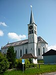
4839 Upload a file Pfarrkirche St. Antonius Pfarrkirche St. Antonius No images B G Hauptstrasse [[:Category:|]]
47° 06′ 17.82″ N, 8° 40′ 31.37″ E Kartographer map based on OpenStreetMap.View all coordinates using: OpenStreetMapinfo


Übrige Baudenkmäler
KGS-Nr Upload Foto   Object Other Cov. Cat. Type Address Town Coordinates
Upload a file Gasthaus zum Ochsen No images G Hauptstrasse 11 [[:Category:|]]
47° 06′ 15.52″ N, 8° 40′ 33.67″ E Kartographer map based on OpenStreetMap.View all coordinates using: OpenStreetMapinfo


Upload a file Haus No images G Äussere Altmatt [[:Category:|]]
47° 07′ 48.43″ N, 8° 41′ 39.8″ E Kartographer map based on OpenStreetMap.View all coordinates using: OpenStreetMapinfo


Upload a file Haus No images G Clauseren 1 [[:Category:|]]
47° 05′ 30.08″ N, 8° 39′ 53.28″ E Kartographer map based on OpenStreetMap.View all coordinates using: OpenStreetMapinfo


Upload a file Haus Churzeren No images G Alte Strasse 20 [[:Category:|]]
47° 05′ 30.01″ N, 8° 39′ 50.8″ E Kartographer map based on OpenStreetMap.View all coordinates using: OpenStreetMapinfo


Upload a file Haus Unterdorf No images G Müllernstrasse 3 [[:Category:|]]
47° 06′ 15.73″ N, 8° 40′ 29.57″ E Kartographer map based on OpenStreetMap.View all coordinates using: OpenStreetMapinfo


Upload a file Haus Unterdorf No images G Müllernstrasse 4 [[:Category:|]]
47° 06′ 16.6″ N, 8° 40′ 31.01″ E Kartographer map based on OpenStreetMap.View all coordinates using: OpenStreetMapinfo


Upload a file Kapelle Heilige Dreifaltigkeit No images G Alte Strasse [[:Category:|]]
47° 05′ 29.11″ N, 8° 39′ 48.74″ E Kartographer map based on OpenStreetMap.View all coordinates using: OpenStreetMapinfo