Commons:Wiki4Alps/Martigny

From Wikimedia Commons, the free media repository
Jump to navigation Jump to search

<< Wiki4Alps << Valais

List of the cultural heritage of the district of Martigny in the Canton Valais

[edit]
Map of Martigny
Map of Martigny

List of Monuments in the district of Martigny in the Canton Valais.

Update: 15 April 2014

List

[edit]
KGS-Nr Upload Foto   Object Other Cov. Cat. Type Address Town Coordinates
6747 Upload a file Usine électrique (ancienne usine d'emboutissage) No images B G Chemin de l’Usine 21 Fully
46° 08′ 34.19″ N, 7° 07′ 01.63″ E Kartographer map based on OpenStreetMap.View all coordinates using: OpenStreetMapinfo


6748 Upload a file Église Saint-Symphorien (1934, peintures et vitraux d'Edmond Bille) No images B G Ruelle du Mont Fully
46° 08′ 17.56″ N, 7° 06′ 50.22″ E Kartographer map based on OpenStreetMap.View all coordinates using: OpenStreetMapinfo


6786 Upload a file Combe de Teur, groupe de raccards No images B G Route de Thur Isérables
46° 09′ 59.08″ N, 7° 14′ 30.62″ E Kartographer map based on OpenStreetMap.View all coordinates using: OpenStreetMapinfo


6787 Upload a file Scierie du Vallon de la Fare No images B G Route de Plantorny Isérables
46° 08′ 54.1″ N, 7° 15′ 43.56″ E Kartographer map based on OpenStreetMap.View all coordinates using: OpenStreetMapinfo


6823 Upload a file Anciennes maisons (avec cheminées "savoyardes") No images B G Dugny et Montagnon Leytron
46° 11′ 19.9″ N, 7° 10′ 55.81″ E Kartographer map based on OpenStreetMap.View all coordinates using: OpenStreetMapinfo


6822 Upload a file Ancienne église et clocher No images B G Route de Saillon Leytron
46° 11′ 09.38″ N, 7° 12′ 30.56″ E Kartographer map based on OpenStreetMap.View all coordinates using: OpenStreetMapinfo


6824 Upload a file Maison Rossier No images B G Route de Chamoson 11 Leytron
46° 11′ 13.67″ N, 7° 12′ 32.4″ E Kartographer map based on OpenStreetMap.View all coordinates using: OpenStreetMapinfo


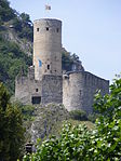
6832 Upload a file Burg La Bâtiaz Burg La Bâtiaz No images A G Chemin du Château Martigny
46° 06′ 18″ N, 7° 04′ 09.3″ E Kartographer map based on OpenStreetMap.View all coordinates using: OpenStreetMapinfo


9384 Upload a file Fondation Pierre Gianadda, Musée gallo-romain, Musée des voitures Fondation Pierre Gianadda, Musée gallo-romain, Musée des voitures No images A F/S Rue du Forum 59 Martigny
46° 05′ 42.47″ N, 7° 04′ 14.88″ E Kartographer map based on OpenStreetMap.View all coordinates using: OpenStreetMapinfo


6831 Upload a file Centre valaisan du film (integré à la Mediathèque du Valais) No images A S Avenue du Grand-Saint-Bernard 4 Martigny
46° 06′ 01.84″ N, 7° 04′ 17.83″ E Kartographer map based on OpenStreetMap.View all coordinates using: OpenStreetMapinfo


9700 Upload a file Ville romaine et moderne Ville romaine et moderne No images A F Martigny
46° 05′ 55.03″ N, 7° 04′ 26.33″ E Kartographer map based on OpenStreetMap.View all coordinates using: OpenStreetMapinfo


8745 Upload a file Fondation B. et S.Tissières No images B S Avenue de la Gare 6 Martigny
46° 06′ 07.02″ N, 7° 04′ 26.47″ E Kartographer map based on OpenStreetMap.View all coordinates using: OpenStreetMapinfo


6837 Upload a file Fondation Claude Bellanger No images B G Rue du Castel Martigny
46° 05′ 39.52″ N, 7° 03′ 55.44″ E Kartographer map based on OpenStreetMap.View all coordinates using: OpenStreetMapinfo


6840 Upload a file Pont couvert sur la Drance Pont couvert sur la Drance No images B G Rue de la Bâtiaz Martigny
46° 06′ 17.71″ N, 7° 04′ 15.56″ E Kartographer map based on OpenStreetMap.View all coordinates using: OpenStreetMapinfo


10575 Upload a file Hôtel Clerc Hôtel Clerc No images B G Rue Marc-Morand 13 Martigny
46° 06′ 12.13″ N, 7° 04′ 19.16″ E Kartographer map based on OpenStreetMap.View all coordinates using: OpenStreetMapinfo


6839 Upload a file Chapelle Notre-Dame des 7 douleurs (ex voto) Chapelle Notre-Dame des 7 douleurs (ex voto) No images B G Chemin de la Chapelle Martigny
46° 06′ 16.78″ N, 7° 04′ 11.53″ E Kartographer map based on OpenStreetMap.View all coordinates using: OpenStreetMapinfo


6836 Upload a file Église Notre-Dame des Champs No images B G Rue de l’Église Martigny
46° 06′ 02.27″ N, 7° 04′ 25.82″ E Kartographer map based on OpenStreetMap.View all coordinates using: OpenStreetMapinfo


6841 Upload a file Le Manoir (Maison Ganioz) No images B G Rue de la Dranse 3 Martigny
46° 06′ 08.64″ N, 7° 04′ 19.63″ E Kartographer map based on OpenStreetMap.View all coordinates using: OpenStreetMapinfo


6842 Upload a file Maison du Saint-Bernard (Prévôté) No images B G Rue de l’Hôtel de Ville 18 Martigny
46° 06′ 00.5″ N, 7° 04′ 24.42″ E Kartographer map based on OpenStreetMap.View all coordinates using: OpenStreetMapinfo


6843 Upload a file Maison Supersaxo No images B G Rue des Alpes 1 Martigny
46° 06′ 00.83″ N, 7° 04′ 29.14″ E Kartographer map based on OpenStreetMap.View all coordinates using: OpenStreetMapinfo


6838 Upload a file Hôtel de Ville avec Archives No images B G/S Rue de l’Hôtel de Ville 1 Martigny
46° 06′ 02.84″ N, 7° 04′ 22.76″ E Kartographer map based on OpenStreetMap.View all coordinates using: OpenStreetMapinfo


6845 Upload a file Chapelle Saint-Jean et site archéologique (ancien château) No images B G Route du Château Martigny-Combe
46° 04′ 44.33″ N, 7° 02′ 50.32″ E Kartographer map based on OpenStreetMap.View all coordinates using: OpenStreetMapinfo


6955 Upload a file Ancienne église Saint-Laurent No images B G Rue des Pommerets Riddes
46° 10′ 06.96″ N, 7° 13′ 12.94″ E Kartographer map based on OpenStreetMap.View all coordinates using: OpenStreetMapinfo


6956 Upload a file La Vidondée No images B G Rue de la Vidondée 4 Riddes
46° 10′ 17.08″ N, 7° 13′ 31.12″ E Kartographer map based on OpenStreetMap.View all coordinates using: OpenStreetMapinfo


10448 Upload a file Fortifications (Enceinte avec 5 tourelles, Porte du Scex, Porte de Fully, Porte de Leytron) Fortifications (Enceinte avec 5 tourelles, Porte du Scex, Porte de Fully, Porte de Leytron) No images A G Saillon
46° 10′ 16.54″ N, 7° 11′ 05.24″ E Kartographer map based on OpenStreetMap.View all coordinates using: OpenStreetMapinfo


6975 Upload a file Tour Bayard Tour Bayard No images A G Saillon
46° 10′ 13.8″ N, 7° 10′ 57.47″ E Kartographer map based on OpenStreetMap.View all coordinates using: OpenStreetMapinfo


10578 Upload a file Maison d'habitation No images B G Route de la Salentze 45 Saillon
46° 10′ 44.08″ N, 7° 11′ 37.97″ E Kartographer map based on OpenStreetMap.View all coordinates using: OpenStreetMapinfo


6987 Upload a file Ancien Casino des Bains Ancien Casino des Bains No images B G Rue du Casino 4 Saxon
46° 08′ 47.04″ N, 7° 10′ 15.2″ E Kartographer map based on OpenStreetMap.View all coordinates using: OpenStreetMapinfo


6990 Upload a file Tour ronde médiévale Tour ronde médiévale No images B G Chemin de la Tour Saxon
46° 08′ 32.14″ N, 7° 10′ 40.33″ E Kartographer map based on OpenStreetMap.View all coordinates using: OpenStreetMapinfo


6989 Upload a file Ruine de l'ancienne église Ruine de l'ancienne église No images B G Chemin de la Tour Saxon
46° 08′ 34.66″ N, 7° 10′ 39.32″ E Kartographer map based on OpenStreetMap.View all coordinates using: OpenStreetMapinfo


10580 Upload a file Villa de la famille Fama Villa de la famille Fama No images B G Route du Léman 3 Saxon
46° 08′ 51.58″ N, 7° 10′ 18.8″ E Kartographer map based on OpenStreetMap.View all coordinates using: OpenStreetMapinfo


13924 Upload a file Alpage des Herbagères No images B G Trient
46° 01′ 46.96″ N, 6° 58′ 37.42″ E Kartographer map based on OpenStreetMap.View all coordinates using: OpenStreetMapinfo


7137 Upload a file Église de Saint-Bernard et environs No images B G Au Village Trient
46° 03′ 21.85″ N, 6° 59′ 41.03″ E Kartographer map based on OpenStreetMap.View all coordinates using: OpenStreetMapinfo