Commons:Wiki4Alps/Leuk

From Wikimedia Commons, the free media repository
Jump to navigation Jump to search

<< Wiki4Alps << Valais

List of the cultural heritage of the district of Leuk in the Canton Valais

[edit]
Map of Leuk
Map of Leuk

List of Monuments in the district of Leuk in the Canton Valais.

Update: 15 April 2014

List

[edit]
KGS-Nr Upload Foto   Object Other Cov. Cat. Type Address Town Coordinates
6590 Upload a file Haus Beney-Zumofen (Wandmalereien) No images B G Albinen
46° 20′ 40.63″ N, 7° 38′ 00.53″ E Kartographer map based on OpenStreetMap.View all coordinates using: OpenStreetMapinfo


6785 Upload a file Bogenbrücke über die Dala (1539, Ruffiner) No images B G Rumeling Inden
46° 20′ 05.03″ N, 7° 37′ 28.6″ E Kartographer map based on OpenStreetMap.View all coordinates using: OpenStreetMapinfo


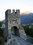
6808 Upload a file Dalaturm Dalaturm No images A G Varenstrasse Leuk
46° 19′ 00.16″ N, 7° 37′ 21.5″ E Kartographer map based on OpenStreetMap.View all coordinates using: OpenStreetMapinfo


6801 Upload a file Kirche St.Stephan Kirche St.Stephan No images A G Hauptplatz 16 Leuk
46° 19′ 03.07″ N, 7° 38′ 05.68″ E Kartographer map based on OpenStreetMap.View all coordinates using: OpenStreetMapinfo


6802 Upload a file Rathaus Rathaus No images A G Rathausplatz 1 Leuk
46° 18′ 58.21″ N, 7° 38′ 05.53″ E Kartographer map based on OpenStreetMap.View all coordinates using: OpenStreetMapinfo


6803 Upload a file Ringackerkapelle Mariä Empfängnis mit Einsiedelei Ringackerkapelle Mariä Empfängnis mit Einsiedelei No images A G Ringacker 3 Leuk
46° 18′ 50.15″ N, 7° 38′ 07.12″ E Kartographer map based on OpenStreetMap.View all coordinates using: OpenStreetMapinfo


6804 Upload a file Schloss Zen-Ruffinen/Loretan (ehemals de Werra) Schloss Zen-Ruffinen/Loretan (ehemals de Werra) No images A G Geisstall Leuk
46° 18′ 58.28″ N, 7° 38′ 01.9″ E Kartographer map based on OpenStreetMap.View all coordinates using: OpenStreetMapinfo


6806 Upload a file Alte Kür No images B G Kreuzgasse Leuk
46° 19′ 02.46″ N, 7° 38′ 07.4″ E Kartographer map based on OpenStreetMap.View all coordinates using: OpenStreetMapinfo


6807 Upload a file Bischofsschloss (mit Heimatmuseum) Bischofsschloss (mit Heimatmuseum) No images B G Rathausplatz 5 Leuk
46° 19′ 00.59″ N, 7° 38′ 07.87″ E Kartographer map based on OpenStreetMap.View all coordinates using: OpenStreetMapinfo


6718 Upload a file Hohe Brücke über den Feschelbach mit Kapelle No images B G Unter Rotafen, Erschmatt Leuk
46° 18′ 48.28″ N, 7° 40′ 29.17″ E Kartographer map based on OpenStreetMap.View all coordinates using: OpenStreetMapinfo


6810 Upload a file Juon-Haus No images B G Friedhofgasse 2 Leuk
46° 19′ 04.48″ N, 7° 38′ 05.17″ E Kartographer map based on OpenStreetMap.View all coordinates using: OpenStreetMapinfo


6817 Upload a file Kapelle Heilige Familie (Ex voto) No images B G Thiel 44 Leuk
46° 19′ 26.69″ N, 7° 39′ 08.46″ E Kartographer map based on OpenStreetMap.View all coordinates using: OpenStreetMapinfo


6719 Upload a file Kirche St.Michael (Altäre) No images B G Dorfplatz, Erschmatt Leuk
46° 19′ 17.4″ N, 7° 41′ 33.22″ E Kartographer map based on OpenStreetMap.View all coordinates using: OpenStreetMapinfo


6812 Upload a file Mageranhaus No images B G Kreuzgasse 4 Leuk
46° 19′ 00.55″ N, 7° 38′ 05.75″ E Kartographer map based on OpenStreetMap.View all coordinates using: OpenStreetMapinfo


6813 Upload a file Majorshof von Werra Galdinen No images B G Galdinen 1 Leuk
46° 19′ 03.54″ N, 7° 37′ 55.74″ E Kartographer map based on OpenStreetMap.View all coordinates using: OpenStreetMapinfo


6814 Upload a file Pfarr- und Zendenarchiv im Pfarrhaus No images B S Kreuzgasse 37 Leuk
46° 19′ 02.82″ N, 7° 38′ 07.15″ E Kartographer map based on OpenStreetMap.View all coordinates using: OpenStreetMapinfo


10603 Upload a file Pont sur le Rhône No images B G Über den Rotten Leuk
46° 18′ 43.92″ N, 7° 38′ 18.1″ E Kartographer map based on OpenStreetMap.View all coordinates using: OpenStreetMapinfo


6815 Upload a file Schützenlaube No images B G Schützenlaube 10 Leuk
46° 18′ 57.92″ N, 7° 38′ 13.13″ E Kartographer map based on OpenStreetMap.View all coordinates using: OpenStreetMapinfo


6816 Upload a file Schloss Mageran / de Werra (Altersheim St.Josef) Schloss Mageran / de Werra (Altersheim St.Josef) No images B G Kantonsstrasse 80 Leuk
46° 18′ 21.17″ N, 7° 39′ 01.26″ E Kartographer map based on OpenStreetMap.View all coordinates using: OpenStreetMapinfo


6820 Upload a file Gemmi Daubenwand No images A F Leukerbad
46° 23′ 36.92″ N, 7° 36′ 59.36″ E Kartographer map based on OpenStreetMap.View all coordinates using: OpenStreetMapinfo


6819 Upload a file Eisenzeitliches Gräberfeld No images B F Leukerbad


6821 Upload a file Kirche Maria Hilf Kirche Maria Hilf No images B G Kirchstrasse Leukerbad
46° 22′ 45.84″ N, 7° 37′ 45.12″ E Kartographer map based on OpenStreetMap.View all coordinates using: OpenStreetMapinfo


6911 Upload a file Alte Kapelle No images B G Dorf Oberems
46° 16′ 53.15″ N, 7° 41′ 41.68″ E Kartographer map based on OpenStreetMap.View all coordinates using: OpenStreetMapinfo


6977 Upload a file Kapelle Sieben Schmerzen Mariä No images B G auf dem Hubel Salgesch
46° 18′ 27.4″ N, 7° 34′ 17.44″ E Kartographer map based on OpenStreetMap.View all coordinates using: OpenStreetMapinfo


6978 Upload a file Kirche St. Johann Baptist No images B G Kirchplatz Salgesch
46° 18′ 42.3″ N, 7° 34′ 15.02″ E Kartographer map based on OpenStreetMap.View all coordinates using: OpenStreetMapinfo


7144 Upload a file Fünf Steinhäuser mit Treppenhaus-Vorbauten No images B G Grabengasse Turtmann-Unterems
46° 18′ 01.4″ N, 7° 42′ 12.24″ E Kartographer map based on OpenStreetMap.View all coordinates using: OpenStreetMapinfo


7146 Upload a file Kapelle Heilige Familie No images B G Meiden Turtmann-Unterems
46° 12′ 38.52″ N, 7° 42′ 19.12″ E Kartographer map based on OpenStreetMap.View all coordinates using: OpenStreetMapinfo


7145 Upload a file Kirche St.Josef No images B G Kirchgasse Turtmann-Unterems
46° 18′ 04.61″ N, 7° 42′ 09.68″ E Kartographer map based on OpenStreetMap.View all coordinates using: OpenStreetMapinfo


7147 Upload a file Ruinen der Sust von Stockalper No images B F/G Dorfstrasse Turtmann-Unterems
46° 18′ 01.37″ N, 7° 42′ 05.69″ E Kartographer map based on OpenStreetMap.View all coordinates using: OpenStreetMapinfo


7148 Upload a file Wäbihüs No images B G Enetbrückenstrasse 9 Turtmann-Unterems
46° 18′ 00.4″ N, 7° 42′ 00.18″ E Kartographer map based on OpenStreetMap.View all coordinates using: OpenStreetMapinfo