Commons:Wiki4Alps/Jaun
Jump to navigation
Jump to search
| KGS-Nr | Upload | Foto | Object | Other | Cov. | Cat. | Type | Address | Town | Coordinates | |||
|---|---|---|---|---|---|---|---|---|---|---|---|---|---|
| 9980 | 
|
Bauernhaus | A | G | Jaunpassstrasse 5 | [[:Category:|]] |
| ||||||
| 2212 | 
|
Statthalterhaus | A | G | Dorfstrasse 15–17 | [[:Category:|]] |
| ||||||
| ? | Alphütte | B | G | Büelsweid 188 | [[:Category:|]] |
| |||||||
| ? | Alphütte | B | G | Hinter Thurm 394 | [[:Category:|]] |
| |||||||
| ? | Alphütte | B | G | Roter Sattel 323 | [[:Category:|]] |
| |||||||
| 2208 | Altes Pfarrhaus und ehemalige Kaplanei | B | G | Alte Kirchgasse | [[:Category:|]] |
| |||||||
| 13225 | Bauernhaus | B | G | Abländschenstrasse 53 | [[:Category:|]] |
| |||||||
| 13226 | Bauernhaus | B | G | Abländschenstrasse 69 | [[:Category:|]] |
| |||||||
| 13227 | Bauernhaus | B | G | Dechlemattaweg 1 | [[:Category:|]] |
| |||||||
| 9979 | Bauernhaus | B | G | Dorfbachweg 2 | [[:Category:|]] |
| |||||||
| 13228 | Bauernhaus | B | G | Dorfstrasse 25 | [[:Category:|]] |
| |||||||
| ? | Bauernhaus | B | G | In der Goheit 9 | [[:Category:|]] |
| |||||||
| ? | Bauernhaus | B | G | Höflistrasse 1A | [[:Category:|]] |
| |||||||
| 13224 | 
|
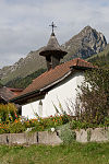
Kapelle | B | G | Kappelboden 531A | [[:Category:|]] |
| ||||||
| 2210 | 
|
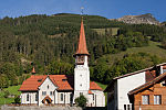
Katholische Kirche St. Stephan | B | G | Dorfstrasse | [[:Category:|]] |
| ||||||
| ? | Speicher | B | G | Dorfbachweg 2A | [[:Category:|]] |
| |||||||
| ? | Vorsass | B | G | Uf der Matta 284 | [[:Category:|]] |
|