Commons:Wiki4Alps/Arth

From Wikimedia Commons, the free media repository
Jump to navigation Jump to search


KGS-Nr Upload Foto   Object Other Cov. Cat. Type Address Town Coordinates
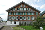
11625 Upload a file Haus (Alte Post) Haus (Alte Post) No images A G Gotthardstrasse 29 [[:Category:|]]
47° 03′ 21.36″ N, 8° 32′ 05.22″ E Kartographer map based on OpenStreetMap.View all coordinates using: OpenStreetMapinfo


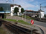
10175 Upload a file Hochperron der Rigibahn Hochperron der Rigibahn No images A G Bahnhofstrasse [[:Category:|]]
47° 02′ 56.97″ N, 8° 32′ 52.01″ E Kartographer map based on OpenStreetMap.View all coordinates using: OpenStreetMapinfo


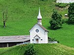
11626 Upload a file Kapelle Reding Kapelle Reding No images A G Gotthardstrasse 25 [[:Category:|]]
47° 03′ 23.81″ N, 8° 32′ 02.62″ E Kartographer map based on OpenStreetMap.View all coordinates using: OpenStreetMapinfo


9673 Upload a file Mittelalterliche Letzinen Mittelalterliche Letzinen No images A G Gotthardstrasse [[:Category:|]]
47° 03′ 22.72″ N, 8° 32′ 04.3″ E Kartographer map based on OpenStreetMap.View all coordinates using: OpenStreetMapinfo


4766 Upload a file Pfarrkirche St. Georg und Zeno Pfarrkirche St. Georg und Zeno No images A G Kirchweg [[:Category:|]]
47° 03′ 49.02″ N, 8° 31′ 23.13″ E Kartographer map based on OpenStreetMap.View all coordinates using: OpenStreetMapinfo


12773 Upload a file Altersheim Hofmatt No images B G Hofmatt 3 [[:Category:|]]
47° 03′ 45.72″ N, 8° 31′ 29.24″ E Kartographer map based on OpenStreetMap.View all coordinates using: OpenStreetMapinfo


12774 Upload a file Brücke Unterstetten No images B G Scheideggstrasse, Rigi [[:Category:|]]
47° 01′ 55.2″ N, 8° 29′ 27.38″ E Kartographer map based on OpenStreetMap.View all coordinates using: OpenStreetMapinfo


4768 Upload a file Bahnhof Arth-Goldau Bahnhof Arth-Goldau No images B G Bahnhofstrasse 1 [[:Category:|]]
47° 02′ 56.94″ N, 8° 32′ 57.8″ E Kartographer map based on OpenStreetMap.View all coordinates using: OpenStreetMapinfo


4769 Upload a file Bergsturzmuseum No images B S Parkstrasse 46 [[:Category:|]]
47° 03′ 05.22″ N, 8° 33′ 12.64″ E Kartographer map based on OpenStreetMap.View all coordinates using: OpenStreetMapinfo


12779 Upload a file Haus No images B G Zwygarten 5 [[:Category:|]]
47° 03′ 48.67″ N, 8° 31′ 27.62″ E Kartographer map based on OpenStreetMap.View all coordinates using: OpenStreetMapinfo


12776 Upload a file Haus No images B G Gotthardstrasse 16 [[:Category:|]]
47° 03′ 45.83″ N, 8° 31′ 20.46″ E Kartographer map based on OpenStreetMap.View all coordinates using: OpenStreetMapinfo


12775 Upload a file Haus No images B G Gotthardstrasse 26 [[:Category:|]]
47° 03′ 43.67″ N, 8° 31′ 22.8″ E Kartographer map based on OpenStreetMap.View all coordinates using: OpenStreetMapinfo


12777 Upload a file Haus No images B G Gotthardstrasse 68 [[:Category:|]]
47° 03′ 35.93″ N, 8° 31′ 38.75″ E Kartographer map based on OpenStreetMap.View all coordinates using: OpenStreetMapinfo


12778 Upload a file Haus No images B G St. Georgsweg 8 [[:Category:|]]
47° 03′ 42.26″ N, 8° 31′ 21.43″ E Kartographer map based on OpenStreetMap.View all coordinates using: OpenStreetMapinfo


12780 Upload a file Haus (alter Rossstall) No images B G Gotthardstrasse 62 [[:Category:|]]
47° 03′ 38.16″ N, 8° 31′ 34.97″ E Kartographer map based on OpenStreetMap.View all coordinates using: OpenStreetMapinfo


12781 Upload a file Haus (Fischlin) No images B G Gotthardstrasse 52 [[:Category:|]]
47° 03′ 39.85″ N, 8° 31′ 33.56″ E Kartographer map based on OpenStreetMap.View all coordinates using: OpenStreetMapinfo


12782 Upload a file Haus (Schulweg) No images B G Kirchfeldweg 1 [[:Category:|]]
47° 03′ 44.1″ N, 8° 31′ 30.61″ E Kartographer map based on OpenStreetMap.View all coordinates using: OpenStreetMapinfo


12783 Upload a file Haus (St. Georg, altes Armenhaus) No images B G Rigiweg 26 [[:Category:|]]
47° 03′ 36.79″ N, 8° 31′ 13.66″ E Kartographer map based on OpenStreetMap.View all coordinates using: OpenStreetMapinfo


12784 Upload a file Haus (St. Georgshof) No images B G St. Georgsweg 15 [[:Category:|]]
47° 03′ 37.58″ N, 8° 31′ 16.97″ E Kartographer map based on OpenStreetMap.View all coordinates using: OpenStreetMapinfo


12785 Upload a file Haus (Zay-Reding) No images B G Klosterstrasse 4 [[:Category:|]]
47° 03′ 53.53″ N, 8° 31′ 27.73″ E Kartographer map based on OpenStreetMap.View all coordinates using: OpenStreetMapinfo


12786 Upload a file Haus alter Pilgerweg (Reding) No images B G Alter Pilgerweg 2 [[:Category:|]]
47° 03′ 31″ N, 8° 31′ 30.58″ E Kartographer map based on OpenStreetMap.View all coordinates using: OpenStreetMapinfo


12787 Upload a file Haus Baltisberg No images B G Sonnenbergstrasse 6 [[:Category:|]]
47° 04′ 11.89″ N, 8° 32′ 12.7″ E Kartographer map based on OpenStreetMap.View all coordinates using: OpenStreetMapinfo


12788 Upload a file Haus Gengigen No images B G Zugerstrasse 112 [[:Category:|]]
47° 04′ 41.88″ N, 8° 31′ 31.55″ E Kartographer map based on OpenStreetMap.View all coordinates using: OpenStreetMapinfo


12789 Upload a file Haus Rindelstrasse (Ehrli) No images B G Rindelstrasse 25 [[:Category:|]]
47° 03′ 25.88″ N, 8° 31′ 29.42″ E Kartographer map based on OpenStreetMap.View all coordinates using: OpenStreetMapinfo


12790 Upload a file Haus St. Adrian No images B G Zugerstrasse 114 [[:Category:|]]
47° 04′ 53.22″ N, 8° 31′ 26.47″ E Kartographer map based on OpenStreetMap.View all coordinates using: OpenStreetMapinfo


12791 Upload a file Haus Vorgasse No images B G Rufibergstrasse 25 [[:Category:|]]
47° 04′ 19.16″ N, 8° 31′ 54.8″ E Kartographer map based on OpenStreetMap.View all coordinates using: OpenStreetMapinfo


12792 Upload a file Haus, Goldau (Altes Pfrundhaus) No images B G Gotthardstrasse 31 [[:Category:|]]
47° 02′ 48.8″ N, 8° 32′ 45.53″ E Kartographer map based on OpenStreetMap.View all coordinates using: OpenStreetMapinfo


4773 Upload a file Kapelle Maria zum Schnee No images B G Klösterliweg, Rigi-Klösterli [[:Category:|]]
47° 02′ 36.38″ N, 8° 29′ 08.16″ E Kartographer map based on OpenStreetMap.View all coordinates using: OpenStreetMapinfo


4770 Upload a file Kapelle St. Georg No images B G Rigiweg [[:Category:|]]
47° 03′ 36.47″ N, 8° 31′ 15.31″ E Kartographer map based on OpenStreetMap.View all coordinates using: OpenStreetMapinfo


12793 Upload a file Kapelle Wegscheide No images B G Wegscheide [[:Category:|]]
47° 03′ 36″ N, 8° 31′ 53.62″ E Kartographer map based on OpenStreetMap.View all coordinates using: OpenStreetMapinfo


4771 Upload a file Kloster/Klosterkirche St. Avgin (ehem. Zeno) No images B G Klosterstrasse 10 [[:Category:|]]
47° 03′ 55.73″ N, 8° 31′ 28.16″ E Kartographer map based on OpenStreetMap.View all coordinates using: OpenStreetMapinfo


12794 Upload a file Pfarrkirche Herz-Jesu No images B G Gotthardstrasse 36 [[:Category:|]]
47° 02′ 47.54″ N, 8° 32′ 41.71″ E Kartographer map based on OpenStreetMap.View all coordinates using: OpenStreetMapinfo


4772 Upload a file Rathaus No images B G Rathausplatz 6 [[:Category:|]]
47° 03′ 45.79″ N, 8° 31′ 23.05″ E Kartographer map based on OpenStreetMap.View all coordinates using: OpenStreetMapinfo


12795 Upload a file Reformierte Kirche Oberarth No images B G Gotthardstrasse [[:Category:|]]
47° 03′ 21.64″ N, 8° 32′ 00.82″ E Kartographer map based on OpenStreetMap.View all coordinates using: OpenStreetMapinfo


Übrige Baudenkmäler
KGS-Nr Upload Foto   Object Other Cov. Cat. Type Address Town Coordinates
Upload a file Friedhofkapelle No images G Schulweg [[:Category:|]]
47° 03′ 49.36″ N, 8° 31′ 24.1″ E Kartographer map based on OpenStreetMap.View all coordinates using: OpenStreetMapinfo


Upload a file Kapelle Heilig Kreuz No images G Rathausplatz [[:Category:|]]
47° 03′ 47.23″ N, 8° 31′ 23.81″ E Kartographer map based on OpenStreetMap.View all coordinates using: OpenStreetMapinfo


Upload a file Kapelle Kreuz No images G Bergstrasse [[:Category:|]]
47° 03′ 13.28″ N, 8° 32′ 56.47″ E Kartographer map based on OpenStreetMap.View all coordinates using: OpenStreetMapinfo


Upload a file Kapelle Malchus No images G Rigi-Klösterli [[:Category:|]]
47° 02′ 17.38″ N, 8° 29′ 56.87″ E Kartographer map based on OpenStreetMap.View all coordinates using: OpenStreetMapinfo


Upload a file Kapelle St. Adrian Kapelle St. Adrian No images G Zugerstrasse [[:Category:|]]
47° 04′ 54.12″ N, 8° 31′ 25.43″ E Kartographer map based on OpenStreetMap.View all coordinates using: OpenStreetMapinfo


Upload a file Kaplaneihaus No images G Herrengasse 4 [[:Category:|]]
47° 03′ 50.65″ N, 8° 31′ 22.69″ E Kartographer map based on OpenStreetMap.View all coordinates using: OpenStreetMapinfo


Upload a file Pfarrhaus No images G Gotthardstrasse 34 [[:Category:|]]
47° 02′ 48.7″ N, 8° 32′ 42″ E Kartographer map based on OpenStreetMap.View all coordinates using: OpenStreetMapinfo


Upload a file Sigristenhaus No images G Zugerstrasse 4 [[:Category:|]]
47° 03′ 48.89″ N, 8° 31′ 21.72″ E Kartographer map based on OpenStreetMap.View all coordinates using: OpenStreetMapinfo


Upload a file Haus No images G Gotthardstrasse 4 [[:Category:|]]
47° 03′ 46.87″ N, 8° 31′ 19.63″ E Kartographer map based on OpenStreetMap.View all coordinates using: OpenStreetMapinfo


Upload a file Haus No images G Gotthardstrasse 10 [[:Category:|]]
47° 03′ 46.51″ N, 8° 31′ 19.92″ E Kartographer map based on OpenStreetMap.View all coordinates using: OpenStreetMapinfo


Upload a file Haus No images G Gotthardstrasse 12 [[:Category:|]]
47° 03′ 46.33″ N, 8° 31′ 20.1″ E Kartographer map based on OpenStreetMap.View all coordinates using: OpenStreetMapinfo


Upload a file Haus No images G Gotthardstrasse 13 [[:Category:|]]
47° 03′ 46.55″ N, 8° 31′ 21″ E Kartographer map based on OpenStreetMap.View all coordinates using: OpenStreetMapinfo


Upload a file Haus No images G Gotthardstrasse 24 [[:Category:|]]
47° 03′ 44.03″ N, 8° 31′ 22.08″ E Kartographer map based on OpenStreetMap.View all coordinates using: OpenStreetMapinfo


Upload a file Haus No images G Gotthardstrasse 32 [[:Category:|]]
47° 03′ 43.02″ N, 8° 31′ 23.74″ E Kartographer map based on OpenStreetMap.View all coordinates using: OpenStreetMapinfo


Upload a file Haus No images G Luzernerstrasse 5 [[:Category:|]]
47° 03′ 46.01″ N, 8° 31′ 18.08″ E Kartographer map based on OpenStreetMap.View all coordinates using: OpenStreetMapinfo


Upload a file Haus No images G Mühlemoosweg 13 [[:Category:|]]
47° 03′ 41.18″ N, 8° 32′ 24.9″ E Kartographer map based on OpenStreetMap.View all coordinates using: OpenStreetMapinfo


Upload a file Haus No images G Rathausplatz 10 [[:Category:|]]
47° 03′ 46.66″ N, 8° 31′ 23.45″ E Kartographer map based on OpenStreetMap.View all coordinates using: OpenStreetMapinfo


Upload a file Haus No images G Schulweg 8 [[:Category:|]]
47° 03′ 45.07″ N, 8° 31′ 25.14″ E Kartographer map based on OpenStreetMap.View all coordinates using: OpenStreetMapinfo


Upload a file Haus No images G Tramweg 23 [[:Category:|]]
47° 03′ 33.55″ N, 8° 31′ 51.24″ E Kartographer map based on OpenStreetMap.View all coordinates using: OpenStreetMapinfo


Upload a file Haus No images G Zugerstrasse 75 [[:Category:|]]
47° 04′ 04.8″ N, 8° 31′ 32.23″ E Kartographer map based on OpenStreetMap.View all coordinates using: OpenStreetMapinfo


Upload a file Haus No images G Zugerstrasse 77 [[:Category:|]]
47° 04′ 06.31″ N, 8° 31′ 33.35″ E Kartographer map based on OpenStreetMap.View all coordinates using: OpenStreetMapinfo


Upload a file Haus (Alte Mühle) No images G Bergstrasse 3 [[:Category:|]]
47° 03′ 14.94″ N, 8° 32′ 12.12″ E Kartographer map based on OpenStreetMap.View all coordinates using: OpenStreetMapinfo


Upload a file Haus (Altes Schulhaus) No images G Bahnhofstrasse 4 [[:Category:|]]
47° 03′ 50.8″ N, 8° 31′ 24.6″ E Kartographer map based on OpenStreetMap.View all coordinates using: OpenStreetMapinfo


Upload a file Haus (Altes Zollhaus) No images G Artherstrasse 65 [[:Category:|]]
47° 05′ 23.6″ N, 8° 31′ 23.16″ E Kartographer map based on OpenStreetMap.View all coordinates using: OpenStreetMapinfo


Upload a file Haus (Feld) No images G Gotthardstrasse 55 [[:Category:|]]
47° 03′ 40.82″ N, 8° 31′ 35.76″ E Kartographer map based on OpenStreetMap.View all coordinates using: OpenStreetMapinfo


Upload a file Haus (Gasthaus Bauernhof) No images G Gotthardstrasse 18 [[:Category:|]]
47° 02′ 58.74″ N, 8° 32′ 39.8″ E Kartographer map based on OpenStreetMap.View all coordinates using: OpenStreetMapinfo


Upload a file Haus (Hotel Rössli) No images G Gotthardstrasse 29, Goldau [[:Category:|]]
47° 02′ 49.63″ N, 8° 32′ 45.1″ E Kartographer map based on OpenStreetMap.View all coordinates using: OpenStreetMapinfo


Upload a file Haus (Kronenhof) No images G Kronenhofweg 15 [[:Category:|]]
47° 03′ 36.18″ N, 8° 31′ 10.31″ E Kartographer map based on OpenStreetMap.View all coordinates using: OpenStreetMapinfo


Upload a file Haus (Restaurant Chilestägli) No images G Rathausplatz 5 [[:Category:|]]
47° 03′ 47.09″ N, 8° 31′ 22.62″ E Kartographer map based on OpenStreetMap.View all coordinates using: OpenStreetMapinfo


Upload a file Haus (Restaurant Engel) No images G Gotthardstrasse 15 [[:Category:|]]
47° 03′ 45.97″ N, 8° 31′ 21.61″ E Kartographer map based on OpenStreetMap.View all coordinates using: OpenStreetMapinfo


Upload a file Haus (Restaurant Krone) No images G Gotthardstrasse 22 [[:Category:|]]
47° 03′ 44.5″ N, 8° 31′ 21.14″ E Kartographer map based on OpenStreetMap.View all coordinates using: OpenStreetMapinfo


Upload a file Haus (Restaurant Turm) No images G Luzernerstrasse 39 [[:Category:|]]
47° 03′ 39.92″ N, 8° 30′ 53.1″ E Kartographer map based on OpenStreetMap.View all coordinates using: OpenStreetMapinfo


Upload a file Haus (Schlüssel) No images G Gotthardstrasse 5 [[:Category:|]]
47° 03′ 47.3″ N, 8° 31′ 20.24″ E Kartographer map based on OpenStreetMap.View all coordinates using: OpenStreetMapinfo


Upload a file Haus im Guggli, Rufihof No images G Zugerstrasse [[:Category:|]]
47° 04′ 33.42″ N, 8° 31′ 38.86″ E Kartographer map based on OpenStreetMap.View all coordinates using: OpenStreetMapinfo


Upload a file Haus Kleinrossbergli No images G Sonnerbergstrasse [[:Category:|]]
47° 04′ 14.05″ N, 8° 32′ 07.87″ E Kartographer map based on OpenStreetMap.View all coordinates using: OpenStreetMapinfo


Upload a file Haus Langacker No images G Schattenberg [[:Category:|]]
47° 04′ 10.99″ N, 8° 30′ 18.18″ E Kartographer map based on OpenStreetMap.View all coordinates using: OpenStreetMapinfo


Upload a file Haus Mettlenhof No images G St. Adrianstrasse [[:Category:|]]
47° 05′ 06.68″ N, 8° 31′ 28.27″ E Kartographer map based on OpenStreetMap.View all coordinates using: OpenStreetMapinfo


Upload a file Haus Oberegg No images G Oberegg [[:Category:|]]
47° 04′ 46.16″ N, 8° 31′ 42.31″ E Kartographer map based on OpenStreetMap.View all coordinates using: OpenStreetMapinfo


Upload a file Haus Riedmatt No images G Riedmatt [[:Category:|]]
47° 04′ 23.52″ N, 8° 31′ 49.62″ E Kartographer map based on OpenStreetMap.View all coordinates using: OpenStreetMapinfo


Upload a file Haus Unteregg No images G Unteregg [[:Category:|]]
47° 04′ 39.86″ N, 8° 31′ 40.04″ E Kartographer map based on OpenStreetMap.View all coordinates using: OpenStreetMapinfo


Upload a file Haus untere Röthen No images G Röthenstrasse [[:Category:|]]
47° 03′ 03.82″ N, 8° 34′ 22.4″ E Kartographer map based on OpenStreetMap.View all coordinates using: OpenStreetMapinfo