Category:Zuestoll
Jump to navigation
Jump to search
| Object location | | View all coordinates using: OpenStreetMap |
|---|
mountain in Switzerland  | |||||
| Upload media | |||||
| Instance of | |||||
|---|---|---|---|---|---|
| Location | canton St. Gallen, Switzerland | ||||
| Mountain range | |||||
| Topographic prominence |
| ||||
| Elevation above sea level |
| ||||
| Parent peak | |||||
 | |||||
Media in category "Zuestoll"
The following 11 files are in this category, out of 11 total.
-
 2011-08-04 12-22-45 Switzerland Alt Sankt Johann.jpg 4,288 × 2,848; 2.54 MB
-
 Blick vom Säntis nach SW mit Fümsel, Brisi & Zustoll (2013).jpg 4,800 × 3,200; 10.49 MB
-
 Churfirsten mit Sommerschnee.JPG 2,592 × 1,944; 1.88 MB
-
 Churfirsten obertoggenburg gesamt.jpg 3,931 × 2,385; 4.73 MB
-
 Churfirsten.JPG 2,592 × 1,239; 1.37 MB
-
 Churfirsten05.jpg 3,015 × 558; 67 KB
-
-
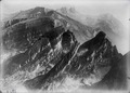
 ETH-BIB-Churfirsten, Frümset-Brisi-Zustoll -Zuestoll- aus der Bahn-Dia 247-10168.tif 3,652 × 2,784; 9.78 MB
-
 Nesslau 2.jpg 2,848 × 2,136; 4.96 MB
-
 Picswiss SG-37-02.jpg 500 × 333; 53 KB
-
 Zuestoll05.jpg 4,000 × 3,000; 5.4 MB

.jpg)


