Category:Zechner-Hube, Ading, Weitensfeld im Gurktal
Jump to navigation
Jump to search
| Object location | | View all coordinates using: OpenStreetMap |
|---|
 | |||||
| Upload media | |||||
| Instance of | |||||
|---|---|---|---|---|---|
| Location | Weitensfeld im Gurktal, Sankt Veit an der Glan District, Carinthia, Austria | ||||
| Street address |
| ||||
| Heritage designation | |||||
 | |||||
Subcategories
This category has only the following subcategory.
S
- Speicher Zechner-Hube, Ading (6 F)
Media in category "Zechner-Hube, Ading, Weitensfeld im Gurktal"
The following 8 files are in this category, out of 8 total.
-
 Ading Nr 1 01.jpg 4,608 × 3,456; 3.24 MB
-
 Ading Nr 1 02.jpg 4,567 × 2,569; 1.2 MB
-
 Ortschaftstafel Ading.jpg 4,608 × 3,456; 2.2 MB
-
 Weitensfeld Ading 1 vulgo Zechner Hausnummer 25102012 081.jpg 2,848 × 4,288; 1.84 MB
-
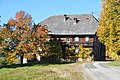 Weitensfeld Ading 1 Zechner-Hube Hofgebaeude 25102012 071.jpg 4,288 × 2,848; 2.66 MB
-
 Weitensfeld Ading 1 Zechner-Hube Hofgebaeude 25102012 072.jpg 4,288 × 2,848; 2.54 MB
-
 Weitensfeld Ading 1 Zechner-Hube Hofstatt 25102012 077.jpg 4,288 × 2,848; 1.44 MB
-
 Weitensfeld Ading 1 Zechner-Hube Hofstatt N-Wand-Ausschnitt 25102012 079.jpg 2,848 × 4,288; 2.18 MB


