Category:Zandwijkse Molen
Jump to navigation
Jump to search
| Object location | | View all coordinates using: OpenStreetMap |
|---|
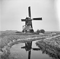
windmill in Almkerk, Netherlands  | |||||
| Upload media | |||||
| Instance of | |||||
|---|---|---|---|---|---|
| Location | Almkerk, Altena, North Brabant, Netherlands | ||||
| Street address |
| ||||
| Has use |
| ||||
| Heritage designation |
| ||||
| Source of energy | |||||
 | |||||
|
This is a category about rijksmonument number 39607
|
| Address |
|
Media in category "Zandwijkse Molen"
The following 127 files are in this category, out of 127 total.
-
 Aanzicht - Almkerk - 20007374 - RCE.jpg 3,110 × 3,061; 1.31 MB
-
 Aanzicht - Almkerk - 20007395 - RCE.jpg 3,130 × 3,024; 2.51 MB
-
 Aanzicht - Almkerk - 20007396 - RCE.jpg 3,366 × 2,226; 1.99 MB
-
 Aanzicht - Almkerk - 20007397 - RCE.jpg 3,366 × 2,229; 1.71 MB
-
 Aanzicht - Almkerk - 20007403 - RCE.jpg 3,130 × 3,034; 1.75 MB
-
 Aanzicht - Almkerk - 20007404 - RCE.jpg 3,112 × 3,064; 1.63 MB
-
 Aanzicht - Almkerk - 20007405 - RCE.jpg 3,106 × 3,052; 1.83 MB
-
 Aanzicht onderzijde - Almkerk - 20007434 - RCE.jpg 1,179 × 1,200; 384 KB
-
 Bedstede - Almkerk - 20007387 - RCE.jpg 1,200 × 1,192; 270 KB
-
 Bedstee, deur en schouw - Almkerk - 20007379 - RCE.jpg 1,200 × 1,174; 183 KB
-
 Beschadiging van het riet op de onderbouw. - Almkerk - 20007444 - RCE.jpg 1,200 × 1,200; 468 KB
-

-

-
 Boezem dichtgeworpen - Almkerk - 20007425 - RCE.jpg 1,200 × 770; 111 KB
-
 Borsteind (behoeft herstel) - Almkerk - 20007376 - RCE.jpg 1,200 × 1,162; 165 KB
-
 Detail bovenhuis met buitenroede - Almkerk - 20428978 - RCE.jpg 798 × 1,200; 178 KB
-
 Detail ondertoren, - Almkerk - 20428982 - RCE.jpg 1,200 × 798; 335 KB
-
 Detail voegburriebalken - Almkerk - 20428952 - RCE.jpg 1,200 × 798; 278 KB
-
 Droog gekomen fundering - Almkerk - 20007381 - RCE.jpg 1,175 × 1,200; 259 KB
-
 Droog gekomen fundering achterzijde - Almkerk - 20007382 - RCE.jpg 1,200 × 1,184; 370 KB
-
 Droogstaand scheprad onder molen polderzijde - Almkerk - 20007383 - RCE.jpg 1,200 × 1,182; 290 KB
-
 Exterieur - Almkerk - 20007372 - RCE.jpg 780 × 1,200; 121 KB
-
 Exterieur - Almkerk - 20007410 - RCE.jpg 1,200 × 1,179; 301 KB
-
 Exterieur - Almkerk - 20007417 - RCE.jpg 1,200 × 793; 168 KB
-
 Exterieur - Almkerk - 20007437 - RCE.jpg 1,200 × 1,184; 229 KB
-
 Exterieur aanzicht - Almkerk - 20007392 - RCE.jpg 1,200 × 1,176; 263 KB
-
 Exterieur VERNIEUWING RIETDEK - Almkerk - 20299541 - RCE.jpg 1,200 × 1,195; 310 KB
-
 In bedrijf - Almkerk - 20007373 - RCE.jpg 1,200 × 775; 133 KB
-
 In bedrijf - Almkerk - 20007398 - RCE.jpg 1,200 × 1,175; 252 KB
-
 Interieur - Almkerk - 20007411 - RCE.jpg 1,200 × 1,195; 240 KB
-
 Interieur ondertoren, detail hoekstijl - Almkerk - 20428968 - RCE.jpg 798 × 1,200; 217 KB
-
 Interieur ondertoren, overzicht begane grond - Almkerk - 20428967 - RCE.jpg 798 × 1,200; 187 KB
-
 Interieur, bovenwiel met schijfloop - Almkerk - 20428972 - RCE.jpg 798 × 1,200; 211 KB
-
 Interieur, detail bovenzetel - Almkerk - 20428969 - RCE.jpg 798 × 1,200; 187 KB
-
 Interieur, onderwiel - Almkerk - 20428965 - RCE.jpg 798 × 1,200; 174 KB
-
 Interieur, overzicht - Almkerk - 20428960 - RCE.jpg 1,200 × 798; 172 KB
-
 Interieur, overzicht - Almkerk - 20428961 - RCE.jpg 1,200 × 798; 173 KB
-
 Interieur, overzicht - Almkerk - 20428962 - RCE.jpg 1,200 × 798; 147 KB
-
 Interieur, overzicht - Almkerk - 20428963 - RCE.jpg 1,200 × 798; 150 KB
-
 Interieur, overzicht bovenhuis - Almkerk - 20428970 - RCE.jpg 1,200 × 798; 192 KB
-
 Interieur, overzicht bovenwiel - Almkerk - 20428971 - RCE.jpg 1,200 × 798; 208 KB
-
 Interieur, overzicht kokerbalken - Almkerk - 20428966 - RCE.jpg 798 × 1,200; 186 KB
-
 Interieur, overzicht weegbanden en vang - Almkerk - 20428973 - RCE.jpg 798 × 1,200; 194 KB
-
 Jonge torenvalken op onderzetel van kaker - Almkerk - 20007380 - RCE.jpg 1,200 × 1,179; 213 KB
-
 Klaarmaken van nieuwe hoekstijl - Almkerk - 20007409 - RCE.jpg 1,200 × 1,181; 383 KB
-
 Kruihaspel - Almkerk - 20007428 - RCE.jpg 1,200 × 1,188; 245 KB
-

-
 Makelaar achter op kap - Almkerk - 20007378 - RCE.jpg 1,200 × 1,170; 161 KB
-
 Molen - Almkerk - 20007426 - RCE.jpg 1,200 × 1,191; 256 KB
-
 Molen in restauratie, aanzicht - Almkerk - 20007423 - RCE.jpg 1,200 × 1,180; 255 KB
-
 Molen met gebroken roe, achtergrond uitwendig - Almkerk - 20007418 - RCE.jpg 1,200 × 772; 124 KB
-
 Molen Zandwijkse molen, bovenhuis, Uppel.jpg 2,448 × 3,264; 1.28 MB
-
 Molen Zandwijkse molen, Uppel.jpg 2,271 × 3,069; 2.07 MB
-
 Molen, restauratie trap - Almkerk - 20007424 - RCE.jpg 1,200 × 1,170; 222 KB
-
 Molenwerf - Almkerk - 20007427 - RCE.jpg 1,200 × 1,191; 429 KB
-
 Na roedebreuk op 28 oktober 1961 - Almkerk - 20007419 - RCE.jpg 1,200 × 777; 105 KB
-
 Na roedebreuk op 28 oktober 1961 - Almkerk - 20007420 - RCE.jpg 781 × 1,200; 181 KB
-
 Na roedebreuk op 28 oktober 1961 - Almkerk - 20007421 - RCE.jpg 1,200 × 777; 133 KB
-
 Na roedebreuk op 28 oktober 1961 - Almkerk - 20007422 - RCE.jpg 1,200 × 785; 124 KB
-
Nationale Molendag Zandwijkse Molen - Altena TV.webm 2 min 45 s, 1,280 × 720; 53.45 MB
-
 Onderbonkelaar - Almkerk - 20428964 - RCE.jpg 798 × 1,200; 212 KB
-
 Ondertoren met ingang - Almkerk - 20428975 - RCE.jpg 798 × 1,200; 339 KB
-
 Ondertoren, detail ingang - Almkerk - 20428983 - RCE.jpg 798 × 1,200; 361 KB
-
 Overzicht - Almkerk - 20007401 - RCE.jpg 1,200 × 1,181; 224 KB
-
 Overzicht - Almkerk - 20007402 - RCE.jpg 1,200 × 1,179; 182 KB
-
 Overzicht - Almkerk - 20361223 - RCE.jpg 1,195 × 1,200; 232 KB
-
 Overzicht - Almkerk - 20363908 - RCE.jpg 1,200 × 1,180; 203 KB
-
 Overzicht bovenhuis met gedeelte van de wieken - Almkerk - 20428979 - RCE.jpg 798 × 1,200; 155 KB
-
 Overzicht boventafelement - Almkerk - 20428974 - RCE.jpg 1,200 × 798; 227 KB
-
 Overzicht met Uitwijkse molen - Almkerk - 20007438 - RCE.jpg 1,200 × 1,178; 257 KB
-
 Overzicht met Zandwijkse molen - Almkerk - 20007279 - RCE.jpg 1,200 × 1,179; 303 KB
-
 Overzicht ondertoren met riet gedekt - Almkerk - 20428949 - RCE.jpg 1,200 × 798; 238 KB
-
 Overzicht ondertoren met riet gedekt - Almkerk - 20428950 - RCE.jpg 1,200 × 798; 322 KB
-
 Overzicht ondertoren met riet gedekt - Almkerk - 20428980 - RCE.jpg 798 × 1,200; 244 KB
-
 Overzicht polder met wipwatermolens, poldermolens - Almkerk - 20347088 - RCE.jpg 1,192 × 1,200; 336 KB
-
 Overzicht scheprad - Almkerk - 20428948 - RCE.jpg 798 × 1,200; 222 KB
-
 Overzicht scheprad - Almkerk - 20428976 - RCE.jpg 798 × 1,200; 247 KB
-
 Overzicht scheprad - Almkerk - 20428977 - RCE.jpg 798 × 1,200; 239 KB
-
 Overzicht van de achterkant - Almkerk - 20421352 - RCE.jpg 803 × 1,200; 126 KB
-
 Overzicht van de achterkant met hek - Almkerk - 20421353 - RCE.jpg 803 × 1,200; 171 KB
-
 Overzicht van de achterzijde met trapbomen - Almkerk - 20428955 - RCE.jpg 798 × 1,200; 232 KB
-
 Overzicht van de achterzijde met trapbomen - Almkerk - 20428956 - RCE.jpg 798 × 1,200; 237 KB
-
 Overzicht van de molen - Almkerk - 20428943 - RCE.jpg 798 × 1,200; 237 KB
-
 Overzicht van de molen - Almkerk - 20428945 - RCE.jpg 798 × 1,200; 170 KB
-
 Overzicht van de molen - Almkerk - 20428984 - RCE.jpg 798 × 1,200; 143 KB
-
 Overzicht van de molen - Almkerk - 20428985 - RCE.jpg 798 × 1,200; 103 KB
-
 Overzicht van de molen - Almkerk - 20428986 - RCE.jpg 798 × 1,200; 84 KB
-
 Overzicht van de romp met riet gedekt - Almkerk - 20428944 - RCE.jpg 1,200 × 798; 222 KB
-
 Overzicht van de trapbomen - Almkerk - 20428959 - RCE.jpg 798 × 1,200; 220 KB
-
 Overzicht van de voorkant - Almkerk - 20421354 - RCE.jpg 803 × 1,200; 59 KB
-
 Overzicht van het bovenhuis - Almkerk - 20428957 - RCE.jpg 798 × 1,200; 193 KB
-
 Overzicht van het bovenhuis - Almkerk - 20428958 - RCE.jpg 798 × 1,200; 136 KB
-
 Overzicht van het waterwiel - Almkerk - 20428946 - RCE.jpg 1,200 × 798; 224 KB
-
 Overzicht wipmolen in polderlandschap - Almkerk - 20007448 - RCE.jpg 1,200 × 1,175; 206 KB
-
 Overzicht wipmolen in polderlandschap - Almkerk - 20007449 - RCE.jpg 788 × 1,200; 186 KB
-
 Overzicht Zandwijkse molen - Almkerk - 20007443 - RCE.jpg 1,200 × 1,200; 205 KB
-
 Restauratie zijkant - Almkerk - 20007408 - RCE.jpg 1,200 × 1,167; 209 KB
-
 Scheprad of roefplanken vernield - Almkerk - 20007385 - RCE.jpg 1,200 × 1,185; 245 KB
-
 Schouw in stookhal - Almkerk - 20007386 - RCE.jpg 1,200 × 1,192; 219 KB
-
 Stookhok - Almkerk - 20007400 - RCE.jpg 1,188 × 1,200; 250 KB
-
 Tijdens restauratie - Almkerk - 20007388 - RCE.jpg 1,200 × 1,181; 171 KB
-
 Tijdens restauratie - Almkerk - 20007389 - RCE.jpg 1,200 × 1,181; 170 KB
-
 Uppel, Zandwijkse Molen.JPG 2,896 × 1,936; 1.16 MB
-
 Vanuit nieuw verkavelde land - Almkerk - 20007432 - RCE.jpg 1,200 × 1,148; 274 KB
-
 Vernield rieten dak - Almkerk - 20007430 - RCE.jpg 1,200 × 1,183; 287 KB
-
 Vernielde roefplanken van binnen uit - Almkerk - 20007384 - RCE.jpg 1,180 × 1,200; 221 KB
-
 Vernieuwen berriebalken - Almkerk - 20007390 - RCE.jpg 1,200 × 1,165; 213 KB
-
 Vernieuwen berriebalken - Almkerk - 20007391 - RCE.jpg 1,200 × 1,174; 220 KB
-
 Vertrek in de wipmolen voor het nachtmalen - Almkerk - 20007436 - RCE.jpg 1,184 × 1,200; 315 KB
-
 Verval rieten dak - Almkerk - 20007375 - RCE.jpg 1,200 × 1,162; 238 KB
-
 Voor- en na de restauratie - Almkerk - 20007433 - RCE.jpg 1,200 × 875; 136 KB
-
 Wipmolen in polderlandschap - Almkerk - 20007450 - RCE.jpg 788 × 1,200; 184 KB
-
 Wipwatermolen - Almkerk - 20007377 - RCE.jpg 1,200 × 942; 163 KB
-
 Wipwatermolen - Almkerk - 20007429 - RCE.jpg 1,200 × 1,182; 204 KB
-
 Zandwijkse molen - Almkerk - 20007440 - RCE.jpg 3,130 × 3,054; 2.21 MB
-
 Zandwijkse Molen - Almkerk - 20007445 - RCE.jpg 3,130 × 3,130; 2.23 MB
-
 Zandwijkse Molen Almkerk 1.JPG 2,736 × 3,150; 2.79 MB
-
 Zandwijkse Molen Almkerk 2.JPG 2,736 × 3,308; 3.25 MB
-
 Zandwijkse molen exterieur - Almkerk - 20007439 - RCE.jpg 3,054 × 2,988; 2.08 MB
-
 Zandwijkse molen, aanzicht - Almkerk - 20007441 - RCE.jpg 3,113 × 3,054; 1.87 MB
-
 Zandwijkse molen, steken van de roede - Almkerk - 20007442 - RCE.jpg 3,130 × 3,052; 1.48 MB
-
 Zandwijkse Molen.jpg 1,444 × 1,167; 670 KB
-
 Zicht op een gedeelte van het bovenhuis en wieken - Almkerk - 20428953 - RCE.jpg 2,832 × 4,256; 2.37 MB
-
 Zicht op het bovenhuis - Almkerk - 20428951 - RCE.jpg 4,256 × 2,832; 2.05 MB
-
 Zicht op het bovenhuis - Almkerk - 20428981 - RCE.jpg 2,832 × 4,256; 2.12 MB
-
 Zicht op het bovenhuis met gedeelte van de wieken - Almkerk - 20428947 - RCE.jpg 4,256 × 2,832; 1.32 MB
-
 Zicht op ondertoren - Almkerk - 20428954 - RCE.jpg 2,832 × 4,256; 3.26 MB


_-_Almkerk_-_20007376_-_RCE.jpg)


