Category:Zandverstuiving Seterse Bergen
Jump to navigation
Jump to search
| Camera location | | View all coordinates using: OpenStreetMap |
|---|
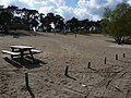
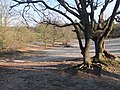
Nederlands: Afbeeldingen van de zandverstuiving bij de Seterse Bergen, Hoevestraat 12, 4903 RR Oosterhout. Behorende tot de Boswachterij Dorst nabij Dorst in de provincie Noord-Brabant in het zuiden van Nederland
Media in category "Zandverstuiving Seterse Bergen"
The following 20 files are in this category, out of 20 total.
-
 Boswachterij Dorst P1020260 copy.jpg 3,264 × 2,448; 5.18 MB
-
 Boswachterij Dorst P1060652.JPG 3,264 × 2,448; 3.93 MB
-
 Detail boom P1480428.jpg 4,000 × 2,672; 5.36 MB
-
 P1020259Seterse bergen.JPG 3,264 × 2,448; 3.99 MB
-
 P1020263copySeterse bergen.jpg 3,264 × 2,448; 6.09 MB
-
 Seterse Bergen DSCF2607.JPG 2,816 × 2,112; 2.86 MB
-
 Seterse Bergen DSCF2608.JPG 2,816 × 2,112; 2.89 MB
-
 Seterse Bergen DSCF2609.JPG 2,816 × 2,112; 2.92 MB
-
 Zandverstuiving P1480388.jpg 4,000 × 2,672; 5.02 MB
-
 Zandverstuiving P1480391.jpg 4,000 × 2,672; 5.19 MB
-
 Zandverstuiving P1480400.jpg 4,000 × 2,672; 5.37 MB
-
 Zandverstuiving P1480408.jpg 4,000 × 2,672; 5.45 MB
-
 Zandverstuiving P1480417.jpg 4,000 × 2,672; 5.09 MB
-
 Zandverstuiving P1480423.jpg 4,000 × 2,672; 5.35 MB
-
 Zandverstuiving P1480425.jpg 4,000 × 2,672; 5.4 MB
-
 Zandverstuiving P1480427.jpg 4,000 × 2,672; 5.23 MB
-
 Zandverstuiving P1480433.jpg 4,000 × 2,672; 5.09 MB
-
 Zandverstuiving P1480439.jpg 4,000 × 2,672; 5.25 MB
-
 Zandverstuiving P1480440.jpg 4,000 × 2,672; 5.59 MB
-
 Zandverstuiving P1480442.jpg 4,000 × 2,672; 5.14 MB


