Category:Yorkshire Wolds
Jump to navigation
Jump to search
Range of hills in the United Kingdom   | |||||
| Upload media | |||||
| Instance of | |||||
|---|---|---|---|---|---|
| Made from material | |||||
| Location | East Riding of Yorkshire, Yorkshire and the Humber, England | ||||
| Elevation above sea level |
| ||||
 | |||||
Subcategories
This category has the following 5 subcategories, out of 5 total.
Media in category "Yorkshire Wolds"
The following 82 files are in this category, out of 82 total.
-
 A Yorkshire Wolds farm - geograph.org.uk - 174362.jpg 640 × 373; 68 KB
-
 Barleyfield - geograph.org.uk - 178530.jpg 640 × 480; 60 KB
-
 Beside the Wolds Way - geograph.org.uk - 23063.jpg 640 × 480; 135 KB
-
 Bridleway near Cottam - geograph.org.uk - 57498.jpg 640 × 480; 126 KB
-
 Bridleway near Cottam - geograph.org.uk - 57503.jpg 640 × 480; 98 KB
-

-
 Deep Dale panorama - geograph.org.uk - 1383599.jpg 640 × 480; 97 KB
-
 East Heslerton Wold.jpg 640 × 480; 111 KB
-
 Fairy Dale - geograph.org.uk - 1414471.jpg 640 × 480; 89 KB
-
 Farmland North of Towthorpe Plantation - geograph.org.uk - 1414484.jpg 640 × 480; 103 KB
-
 Farmland, Wharram Percy Wold - geograph.org.uk - 1414478.jpg 640 × 480; 99 KB
-
 Field near Weaverthorpe - geograph.org.uk - 253051.jpg 640 × 426; 274 KB
-
 Footpath From Field Head towards Carberry Hall Farm - geograph.org.uk - 722997.jpg 1,280 × 960; 1.35 MB
-

-

-
 Head of Swindale, on the Wolds Way - geograph.org.uk - 120099.jpg 640 × 480; 99 KB
-
 Hedgerow and Fields, William Dale - geograph.org.uk - 1414459.jpg 640 × 480; 73 KB
-
 Horse Dale - geograph.org.uk - 121663.jpg 640 × 584; 110 KB
-
 Lambert Dale - geograph.org.uk - 1383384.jpg 640 × 480; 51 KB
-
 Leavening Brow - geograph.org.uk - 76772.jpg 640 × 480; 50 KB
-
 Looking Back^ - geograph.org.uk - 1422427.jpg 640 × 480; 72 KB
-
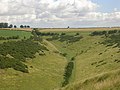
 Looking down Holm Dale - geograph.org.uk - 1398240.jpg 640 × 480; 65 KB
-
 Looking towards Acklam - geograph.org.uk - 189468.jpg 640 × 479; 50 KB
-
 Maize Near Newcote Farm - geograph.org.uk - 236818.jpg 640 × 426; 136 KB
-
 Megdale - geograph.org.uk - 172245.jpg 640 × 480; 146 KB
-
 Millington Dale - geograph.org.uk - 120123.jpg 640 × 480; 176 KB
-
 Millington from the Wolds Way 1.jpg 640 × 393; 71 KB
-
 Millington from the Wolds Way.jpg 640 × 480; 119 KB
-
 Millington Pastures from the Wolds Way - geograph.org.uk - 19505.jpg 640 × 480; 124 KB
-
 New layed hedge and a Yorkshire Wolds view (geograph 3958933).jpg 4,000 × 3,000; 4.2 MB
-
 Newbald Wold - geograph.org.uk - 1123868.jpg 640 × 482; 197 KB
-
 On the Minster Way - geograph.org.uk - 10759.jpg 640 × 480; 123 KB
-

-
 Pasture land near Thixendale - geograph.org.uk - 543669.jpg 640 × 428; 96 KB
-
 Road Junction - geograph.org.uk - 63832.jpg 640 × 480; 91 KB
-
 Road to Fordon - geograph.org.uk - 203482.jpg 640 × 480; 110 KB
-
 Rolling Wolds - geograph.org.uk - 784250.jpg 480 × 640; 88 KB
-
 Rolling Wolds II - geograph.org.uk - 895735.jpg 480 × 640; 85 KB
-
 Rolling Wolds III - geograph.org.uk - 1095181.jpg 480 × 640; 93 KB
-
 Rolling Wolds IV - geograph.org.uk - 1121745.jpg 480 × 640; 41 KB
-
 Sheep farming on the Yorkshire Wolds - geograph.org.uk - 161091.jpg 640 × 427; 64 KB
-
 Sheep On Scrayingham Pasture - geograph.org.uk - 261422.jpg 640 × 480; 99 KB
-
 Shelter on the Wolds near North Dalton - geograph.org.uk - 725572.jpg 640 × 271; 101 KB
-
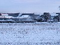
 Snow at Wilberfoss - geograph.org.uk - 737621.jpg 640 × 338; 87 KB
-
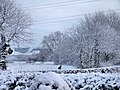
 Snowy Wilberfoss - geograph.org.uk - 1726336.jpg 1,744 × 1,308; 1.03 MB
-
 Snowy Yorkshire Wolds at West Lutton.jpg 2,048 × 1,536; 1.44 MB
-
 Speeton Moor - geograph.org.uk - 835240.jpg 640 × 383; 206 KB
-
 Swindale on the Wolds Way - geograph.org.uk - 120100.jpg 640 × 480; 124 KB
-
 Sylvan Dale, near Millington - geograph.org.uk - 120121.jpg 640 × 480; 121 KB
-

-
 The Vale of York - geograph.org.uk - 3210790.jpg 4,608 × 3,072; 4.05 MB
-

-
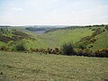
 The view down Pluckham Dale - geograph.org.uk - 536497.jpg 640 × 480; 118 KB
-
 The view down Upper Pluckham Dale - geograph.org.uk - 536502.jpg 640 × 480; 137 KB
-
 The view from Church Hill - geograph.org.uk - 1325510.jpg 640 × 480; 68 KB
-
 Thixen Dale - geograph.org.uk - 536463.jpg 640 × 480; 106 KB
-
 Thixen Dale - geograph.org.uk - 536473.jpg 640 × 480; 132 KB
-
 Thixen Dale - geograph.org.uk - 536478.jpg 640 × 480; 145 KB
-
 Through The Snowy Hedge - geograph.org.uk - 1726252.jpg 1,744 × 1,308; 975 KB
-

-
 Water And Wolds - geograph.org.uk - 247486.jpg 640 × 480; 114 KB
-
 Wayrham Dale - geograph.org.uk - 16654.jpg 426 × 640; 53 KB
-
 Well Dale.jpg 3,264 × 2,448; 2.03 MB
-
 Wheat Field - geograph.org.uk - 512791.jpg 640 × 480; 102 KB
-
 Wilberfoss to Beacon Road - geograph.org.uk - 737559.jpg 1,280 × 884; 1.29 MB
-
 Wilberfoss to Yorkshire Wolds - geograph.org.uk - 1726246.jpg 1,744 × 1,308; 1.16 MB
-
 Winter On The Yorkshire Wolds - geograph.org.uk - 1625683.jpg 640 × 480; 232 KB
-
 Wold Views - geograph.org.uk - 172252.jpg 640 × 480; 124 KB
-
 Wolds Farmland - geograph.org.uk - 1302341.jpg 640 × 480; 84 KB
-
 Wolds Farmland - geograph.org.uk - 174372.jpg 640 × 480; 119 KB
-
 Wolds from route 66 - geograph.org.uk - 370436.jpg 640 × 480; 119 KB
-
 Wolds location.jpg 1,766 × 1,136; 191 KB
-
 Wolds panorama - geograph.org.uk - 1383350.jpg 640 × 480; 63 KB
-
 Wolds scenery - geograph.org.uk - 1383360.jpg 640 × 480; 78 KB
-
 Wolds scenery from Deep Dale - geograph.org.uk - 1383558.jpg 480 × 640; 93 KB
-
 Wolds view - geograph.org.uk - 1383406.jpg 640 × 480; 87 KB
-
 Wolds view near Wold Newton - geograph.org.uk - 1401252.jpg 640 × 480; 47 KB
-
 Wolds view north of Tibthorpe Lodge (geograph 6837450).jpg 1,024 × 768; 128 KB
-
 Woodleighschoolplayingfields.jpg 5,000 × 2,843; 18.13 MB
-
 Yorkshire Wolds - geograph.org.uk - 147481.jpg 640 × 480; 106 KB
-
 Yorkshire Wolds - geograph.org.uk - 162502.jpg 640 × 480; 66 KB
-
 Yorkshire Wolds village of Millington - geograph.org.uk - 162071.jpg 640 × 480; 69 KB


.jpg)


.jpg)


