Category:Yatton Keynell
Jump to navigation
Jump to search
village and parish in Wiltshire, England, UK  | |||||
| Upload media | |||||
| Instance of | |||||
|---|---|---|---|---|---|
| Location | Wiltshire, South West England, England | ||||
| official website | |||||
 | |||||
Subcategories
This category has only the following subcategory.
Y
Media in category "Yatton Keynell"
The following 127 files are in this category, out of 127 total.
-
 2010 , Barn on West Yatton Down - geograph.org.uk - 2080776.jpg 800 × 502; 139 KB
-

-
 2010 , Lane to Upper Castle Combe - geograph.org.uk - 2081727.jpg 800 × 594; 273 KB
-
 A dangerous tomb - geograph.org.uk - 6145140.jpg 3,296 × 2,472; 3.57 MB
-
 A modern centrepiece - geograph.org.uk - 6145596.jpg 3,296 × 2,472; 3.63 MB
-

-
 A piece of private peace - geograph.org.uk - 6145702.jpg 3,296 × 2,472; 3.53 MB
-
 A potential money-spinner^ - geograph.org.uk - 6145605.jpg 3,296 × 2,472; 3.5 MB
-
 A quiet corner at St Margaret's - geograph.org.uk - 6136515.jpg 2,472 × 3,296; 3.4 MB
-
 A rustic path - geograph.org.uk - 6145711.jpg 3,296 × 2,472; 3.35 MB
-
 A sign^ - geograph.org.uk - 6145612.jpg 3,296 × 2,472; 3.43 MB
-
 A small book exchange - geograph.org.uk - 6145144.jpg 2,472 × 3,296; 3.04 MB
-
 A strange goalmouth^ - geograph.org.uk - 6145706.jpg 3,296 × 2,472; 3.32 MB
-
 A420 heading east for Chippenham - geograph.org.uk - 1250509.jpg 640 × 480; 115 KB
-
 A420 layby near Ivy House - geograph.org.uk - 1270759.jpg 640 × 480; 124 KB
-
 A420 looking east toward Chippenham - geograph.org.uk - 1250491.jpg 640 × 491; 155 KB
-
 A420 near the junction with the B4039 - geograph.org.uk - 1270803.jpg 640 × 482; 133 KB
-
 Across Kent's Bottom - geograph.org.uk - 6145148.jpg 3,296 × 2,472; 3.3 MB
-
 An old post box in an old wall - geograph.org.uk - 6415770.jpg 2,472 × 3,296; 1.82 MB
-
 An old pump - geograph.org.uk - 6145718.jpg 2,472 × 3,296; 3.37 MB
-
 Ancient and fairly modern - geograph.org.uk - 1760341.jpg 640 × 438; 81 KB
-
 Approaching West Barn Farm - geograph.org.uk - 208912.jpg 640 × 480; 160 KB
-

-
 B4039 looking east near Yatton Keynell - geograph.org.uk - 1299124.jpg 640 × 516; 177 KB
-
 B4039 through Yatton Keynell, Wiltshire 2016 - geograph.org.uk - 5806514.jpg 2,828 × 1,795; 1.5 MB
-
 B4039 through Yatton Keynell, Wiltshire 2016 - geograph.org.uk - 5806515.jpg 2,508 × 1,646; 1.22 MB
-
 Benchmark on St Margaret's - geograph.org.uk - 6136521.jpg 3,296 × 2,472; 3.5 MB
-
 Benchmark on The Street - geograph.org.uk - 6136533.jpg 3,296 × 2,472; 3.49 MB
-
 Between Fir Tree Farm and Sparrow Farm - geograph.org.uk - 1801914.jpg 640 × 485; 119 KB
-
 Blocking the By Brook - geograph.org.uk - 6414833.jpg 2,472 × 3,296; 1.84 MB
-
 Boarded house - geograph.org.uk - 6415788.jpg 3,296 × 2,472; 1.83 MB
-
 Castle Combe, Race Track - geograph.org.uk - 5061563.jpg 1,500 × 1,000; 838 KB
-
 Chapel date stone - geograph.org.uk - 6145611.jpg 3,296 × 2,472; 3.52 MB
-

-

-

-
 Converted Barn, Yatton Keynell, Wiltshire 2016 - geograph.org.uk - 5806572.jpg 2,896 × 1,375; 1.19 MB
-
 Cottages at Yatton Keynell - geograph.org.uk - 318730.jpg 565 × 418; 97 KB
-
 Cottages, Biddestone Rd, Yatton Keynell, Wiltshire 2016 - geograph.org.uk - 5984393.jpg 2,694 × 1,810; 1.32 MB
-
 Cromhall Lane looking west - geograph.org.uk - 1394679.jpg 640 × 515; 191 KB
-
 Cromhall Lane, near Yatton Keynell - geograph.org.uk - 1365059.jpg 640 × 488; 182 KB
-
 Crossroads near West Sevington Farm - geograph.org.uk - 1310747.jpg 640 × 496; 189 KB
-
 Crossroads on the way to Yatton Keynell - geograph.org.uk - 1310756.jpg 640 × 511; 216 KB
-

-
 Direction Signs Old ^ New, Yatton Keynell. - panoramio.jpg 1,984 × 1,506; 1.06 MB
-
 Dry valley - geograph.org.uk - 283037.jpg 640 × 480; 136 KB
-
 Ebenezer Chapel, Yatton Keynell - geograph.org.uk - 6145610.jpg 3,296 × 2,472; 3.41 MB
-
 Ebenezer's benchmark - geograph.org.uk - 6136537.jpg 3,296 × 2,472; 3.36 MB
-
 Either way through the village - geograph.org.uk - 6145603.jpg 3,296 × 2,472; 3.5 MB
-

-
 Entrance to Batten's Farm - geograph.org.uk - 1250552.jpg 640 × 467; 185 KB
-
 Field off Cromhall Lane - geograph.org.uk - 1394492.jpg 640 × 479; 141 KB
-

-
 Footpath adjacent to a small stream - geograph.org.uk - 5137005.jpg 3,648 × 2,048; 3.24 MB
-

-
 Former Red Lion Pub, Yatton Keynell, Wiltshire 2016 - geograph.org.uk - 5806508.jpg 2,812 × 1,204; 884 KB
-
 Former Red Lion Pub, Yatton Keynell, Wiltshire 2016 - geograph.org.uk - 5806510.jpg 2,536 × 1,441; 1.78 MB
-
 Former Red Lion Pub, Yatton Keynell, Wiltshire 2016 - geograph.org.uk - 5806530.jpg 2,556 × 1,546; 1.09 MB
-
 Hedgerow and maize - geograph.org.uk - 1394417.jpg 640 × 437; 132 KB
-
 House at Long Dean - geograph.org.uk - 5455046.jpg 640 × 480; 333 KB
-
 Houses at Giddeahall - geograph.org.uk - 5021792.jpg 1,600 × 1,065; 704 KB
-
 Houses at West Yatton - geograph.org.uk - 5021786.jpg 1,600 × 1,065; 794 KB
-
 Keeping the orchard neat - geograph.org.uk - 6145700.jpg 3,296 × 2,472; 3.5 MB
-

-
 Looking north on Biddestone Lane - geograph.org.uk - 1801857.jpg 640 × 430; 106 KB
-
 Maize near the end of June - geograph.org.uk - 1365037.jpg 640 × 500; 169 KB
-
 March of the towers - geograph.org.uk - 1968482.jpg 2,304 × 1,704; 1.38 MB
-
 Market Cross, Yatton Keynell, Wiltshire 2016 - geograph.org.uk - 5806519.jpg 2,774 × 1,829; 1.11 MB
-
 Minor road north to Foscote - geograph.org.uk - 1299195.jpg 640 × 473; 149 KB
-
 Minor road south of Upper Castle Combe - geograph.org.uk - 5021770.jpg 1,600 × 1,099; 738 KB
-
 Minor road to Slaughterford - geograph.org.uk - 5023176.jpg 1,600 × 1,111; 1.1 MB
-
 Minor road to Yatton Keynell - geograph.org.uk - 1310741.jpg 640 × 507; 146 KB
-
 Misleading signpost^ - geograph.org.uk - 1394466.jpg 640 × 489; 109 KB
-
 MX5s at Quarry - geograph.org.uk - 2435829.jpg 4,752 × 3,168; 5.14 MB
-
 North east from Biddestone Lane - geograph.org.uk - 1801850.jpg 640 × 324; 38 KB
-
 North west from Biddestone Lane - geograph.org.uk - 1801854.jpg 640 × 370; 49 KB
-
 Not the most popular of footpaths - geograph.org.uk - 6145715.jpg 2,472 × 3,296; 3.28 MB
-
 Nut Tree Cottages - geograph.org.uk - 6414845.jpg 3,296 × 2,472; 1.92 MB
-
 Oak tree and power lines - geograph.org.uk - 1801839.jpg 640 × 449; 122 KB
-
 Old School Gardens - geograph.org.uk - 6145733.jpg 3,296 × 2,472; 3.63 MB
-
 Old Village Water Pillar, Yatton Keynell, Wiltshire 2016 - geograph.org.uk - 5806527.jpg 2,728 × 1,799; 1.13 MB
-
 Old Water Pillar, Yatton Keynell, Wiltshire 2016 - geograph.org.uk - 5807385.jpg 2,732 × 1,814; 1.03 MB
-
 Pasture north of Yatton Keynell - geograph.org.uk - 1394475.jpg 640 × 494; 153 KB
-
 Ploughed fields near Manor Farm - geograph.org.uk - 1800654.jpg 640 × 427; 58 KB
-
 Post Office and store, Yatton Keynell - geograph.org.uk - 1310498.jpg 640 × 497; 120 KB
-
 Road leading to Long Dean - geograph.org.uk - 5021779.jpg 1,600 × 1,135; 859 KB
-
 Room for more in the graveyard - geograph.org.uk - 6136511.jpg 3,296 × 2,472; 3.42 MB
-
 Shelter and house, Yatton Keynell - geograph.org.uk - 5591294.jpg 640 × 427; 69 KB
-
 Signpost, Yatton Keynell, Wiltshire 2016 - geograph.org.uk - 5806521.jpg 2,487 × 1,590; 950 KB
-
 St Margaret's church - geograph.org.uk - 6145592.jpg 3,296 × 2,472; 3.58 MB
-
 St Margaret's church tower - geograph.org.uk - 6136525.jpg 2,472 × 3,296; 3.42 MB
-
 St Margaret's Church, Yatton Keynell - geograph.org.uk - 5591291.jpg 640 × 427; 75 KB
-
 Stone Bus Shelter, Yatton Keynell, Wiltshire 2016 - geograph.org.uk - 5807380.jpg 2,816 × 1,795; 1.06 MB
-
 Street Farmhouse, Yatton Keynell, Wiltshire 2016 - geograph.org.uk - 5807376.jpg 2,716 × 1,826; 1.1 MB
-
 Stubble field off Biddestone Lane - geograph.org.uk - 208914.jpg 640 × 480; 178 KB
-
 The B4039 in Yatton Keynell - geograph.org.uk - 6136535.jpg 3,296 × 2,472; 3.33 MB
-
 The Bell Inn, Yatton Keynell - geograph.org.uk - 315664.jpg 640 × 480; 48 KB
-
 The Bell Inn, Yatton Keynell - geograph.org.uk - 6145594.jpg 3,296 × 2,472; 2.3 MB
-
 The Bell Inn, Yatton Keynell, Wiltshire 2016 - geograph.org.uk - 5806517.jpg 2,767 × 1,810; 1.28 MB
-
 The Bell Inn, Yatton Keynell, Wiltshire 2016 - geograph.org.uk - 5806574.jpg 2,778 × 1,784; 2.14 MB
-
 The Crown Inn - geograph.org.uk - 2412124.jpg 3,647 × 2,538; 1.41 MB
-
 The Crown Inn Giddeahall - geograph.org.uk - 5023153.jpg 1,600 × 1,065; 642 KB
-
 The Crown Inn Giddeahall - geograph.org.uk - 5023156.jpg 1,405 × 1,600; 471 KB
-
 The Crown Inn, Biddestone - geograph.org.uk - 4845413.jpg 640 × 468; 54 KB
-
 The Crown Inn, Giddea Hall - geograph.org.uk - 2291633.jpg 640 × 480; 72 KB
-
 The Crown Inn, Giddeahall - geograph.org.uk - 5021810.jpg 1,600 × 1,065; 617 KB
-
 The Crown Inn, Giddeahall - geograph.org.uk - 5021813.jpg 1,600 × 1,065; 672 KB
-
 The Ebenezer chapel from Grove Lane - geograph.org.uk - 6136538.jpg 3,296 × 2,472; 3.51 MB
-
 The Grange, Yatton Keynell, Wiltshire 2016 - geograph.org.uk - 5807387.jpg 2,650 × 1,650; 1,019 KB
-
 The Halfpenny Pond on Grove Lane - geograph.org.uk - 6145613.jpg 3,296 × 2,472; 3.43 MB
-
 The Street, Yatton Keynell - geograph.org.uk - 5591296.jpg 640 × 427; 103 KB
-
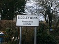 TiddleyWink place name sign - geograph.org.uk - 1138352.jpg 640 × 480; 69 KB
-

-
 Tower and power towers - geograph.org.uk - 5372708.jpg 2,304 × 1,704; 1.29 MB
-
 Tyre wall at Castle Combe Racing Circuit - geograph.org.uk - 5738635.jpg 2,048 × 1,536; 807 KB
-
 Up in the roof timbers - geograph.org.uk - 6145600.jpg 3,296 × 2,472; 3.22 MB
-
 Victorian Postbox at Giddeahall - geograph.org.uk - 5023165.jpg 750 × 1,600; 538 KB
-
 Victorian Postbox at Giddeahall - geograph.org.uk - 5023170.jpg 1,600 × 1,065; 836 KB
-

-
 Village Shop ^ Post Office, Yatton Keynell, Wiltshire 2016 - geograph.org.uk - 5807373.jpg 2,774 × 1,787; 1.15 MB
-
 Yatton Keynell in bloom, 2009 - geograph.org.uk - 1365050.jpg 640 × 507; 165 KB
-
 Yatton Keynell Tower Reservoir. - panoramio - Bob&Anne Powell.jpg 2,816 × 2,112; 2.85 MB
-
 Yatton Keynell Tower Reservoir. - panoramio.jpg 2,565 × 2,109; 929 KB
-
 Yatton Keynell1946.png 1,245 × 1,203; 1.62 MB
-
 Grove farm - geograph.org.uk - 318721.jpg 640 × 480; 101 KB
-
 Water tower - geograph.org.uk - 315662.jpg 480 × 640; 75 KB
-
 West Sevington farm - geograph.org.uk - 315658.jpg 640 × 452; 44 KB


