Category:Yarwell
Jump to navigation
Jump to search
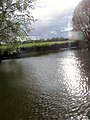
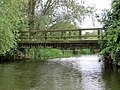
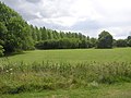
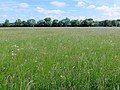
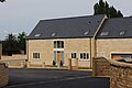
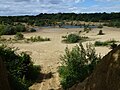
English: Yarwell is a village on the River Nene in the extreme east of the English county of Northamptonshire near the border with Cambridgeshire.
village and civil parish in Northamptonshire, United Kingdom   | |||||
| Upload media | |||||
| Instance of | |||||
|---|---|---|---|---|---|
| Location | North Northamptonshire, Northamptonshire, East Midlands, England | ||||
| Population |
| ||||
 | |||||
Subcategories
This category has the following 4 subcategories, out of 4 total.
Media in category "Yarwell"
The following 200 files are in this category, out of 308 total.
(previous page) (next page)-
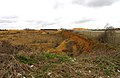
 A duck's view of the caravan park - Yarwell - June 2013 - panoramio.jpg 4,000 × 3,000; 1.9 MB
-
 A lot of water in the Mill Stream - Yarwell - May 2014 - panoramio.jpg 4,000 × 3,000; 2.19 MB
-
 Above the River Nene at Yarwell - June 2011 - panoramio.jpg 2,288 × 1,712; 876 KB
-
 Above the tunnel portal, Yarwell - August 2013 - panoramio.jpg 3,000 × 4,000; 1.9 MB
-
 Across the Lake - Yarwell Mill - June 2011 - panoramio.jpg 2,288 × 1,712; 787 KB
-
 Across the lock - Yarwell - April 2014 - panoramio.jpg 4,000 × 3,000; 2.71 MB
-
 Across the Mill Pond, Yarwell Mill - June 2011 - panoramio.jpg 2,288 × 1,712; 854 KB
-
 After the rain in May - May 2014 - panoramio.jpg 3,000 × 4,000; 2.29 MB
-
 Allotments at Yarwell - August 2013 - panoramio.jpg 4,000 × 3,000; 2.15 MB
-
 Allotments in Yarwell - August 2013 - panoramio.jpg 4,000 × 3,000; 2.56 MB
-
 Approaching Wansford Lock - August 2013 - panoramio.jpg 4,000 × 3,000; 1.78 MB
-
 Approaching Yarwell - River Nene - June 2013 - panoramio.jpg 4,000 × 3,000; 2 MB
-
 Barge Crusader at Yarwell Lock - geograph.org.uk - 6126621.jpg 3,648 × 2,736; 4.43 MB
-
 Barge manoeuvring on the Nene - geograph.org.uk - 4218431.jpg 1,600 × 1,069; 460 KB
-
 Barn and bales, east of Wansford Road - geograph.org.uk - 2743577.jpg 1,024 × 768; 179 KB
-
 Barn near Whiteland's Coppice, Yarwell - geograph.org.uk - 4580636.jpg 4,320 × 3,240; 5.53 MB
-
 Below the Mill - Yarwell - June 2011 - panoramio.jpg 2,288 × 1,712; 850 KB
-
 Beside Millstream No 10 - Yarwell Caravan Park - August 2013 - panoramio.jpg 4,000 × 3,000; 3.92 MB
-
 Beside the Millstream at Yarwell - August 2012 - panoramio.jpg 4,000 × 3,000; 3.4 MB
-
 Between two bits of the River - Yarwell - August 2012 - panoramio.jpg 4,000 × 3,000; 3.85 MB
-
 Between Wansford and Wansford Lock on the River Nene - August 2013 - panoramio.jpg 4,000 × 3,000; 2.28 MB
-
 Between Yarwell ^ Wansford on the River Nene - August 2013 - panoramio.jpg 4,000 × 3,000; 1.92 MB
-
 Big clouds - Yarwell - August 2012 - panoramio.jpg 4,000 × 3,000; 3.13 MB
-
 Boat above us - Wansford Lock - August 2013 - panoramio.jpg 4,000 × 3,000; 2.92 MB
-
 Boat ahead - Yarwell - August 2013 - panoramio.jpg 4,000 × 3,000; 2.9 MB
-
 Bridge - Yarwell - August 2012 - panoramio.jpg 4,000 × 3,000; 4.78 MB
-
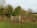
 Bridge and stile - geograph.org.uk - 2364859.jpg 640 × 521; 87 KB
-
 Bridge close to Yarwell - August 2012 - panoramio.jpg 4,000 × 3,000; 3.97 MB
-
 Bridge close to Yarwell - August 2013 - panoramio.jpg 3,011 × 2,439; 1.3 MB
-
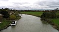
 Bridge over River Nene - geograph.org.uk - 1258662.jpg 640 × 480; 118 KB
-
 Bridleway into Old Sulehay Forest - geograph.org.uk - 2743566.jpg 1,024 × 768; 115 KB
-
 Bridleway off Wansford Road - geograph.org.uk - 4218393.jpg 1,600 × 1,067; 478 KB
-
 Bridleway to Old Sulehay Forest - geograph.org.uk - 2743582.jpg 1,024 × 768; 206 KB
-
 Bridleway to Old Sulehay Forest - geograph.org.uk - 4105854.jpg 1,024 × 683; 188 KB
-
 Bridleway to Old Sulehay Forest - geograph.org.uk - 4218388.jpg 1,600 × 1,067; 590 KB
-
 Bridleway to Old Sulehay Forest - geograph.org.uk - 6227296.jpg 1,024 × 768; 214 KB
-
 Byway between Yarwell and Nassington - May 2014 - panoramio.jpg 3,000 × 4,000; 2.14 MB
-
 Cabbages and brussels at Yarwell - August 2013 - panoramio.jpg 4,000 × 3,000; 2.16 MB
-
 Camp site, Yarwell Mill - geograph.org.uk - 5265023.jpg 1,024 × 576; 189 KB
-
 Caravans beyond the meadow - Yarwell Mill - June 2013 - panoramio.jpg 4,000 × 3,000; 4.46 MB
-
 Chicken run near Sulehay Cottages - geograph.org.uk - 6593817.jpg 1,024 × 768; 190 KB
-
 Chugging down river - Yarwell - August 2012 - panoramio.jpg 4,000 × 3,000; 6.33 MB
-
 Close to Yarwell - August 2012 - panoramio.jpg 3,000 × 4,000; 4.15 MB
-
 Close to Yarwell - River Nene - June 2013 - panoramio.jpg 4,000 × 3,000; 2.22 MB
-
 Close to Yarwell Mill - panoramio.jpg 4,000 × 3,000; 1.73 MB
-
 Close to Yarwell on the River Nene - June 2013 - panoramio.jpg 4,000 × 3,000; 1.63 MB
-
 Coming up to Wansford Lock - August 2013 - panoramio.jpg 4,000 × 3,000; 2.4 MB
-

-
 Copper Beach near the weir at Yarwell - June 2011 - panoramio.jpg 2,288 × 1,712; 844 KB
-
 Copse round the disused pit - geograph.org.uk - 4218378.jpg 1,600 × 1,068; 521 KB
-
 Cottages in Yarwell - geograph.org.uk - 2957328.jpg 4,000 × 3,000; 3.99 MB
-
 Crossroads at Yarwell - geograph.org.uk - 2743584.jpg 640 × 480; 71 KB
-
 Disused Quarry building - geograph.org.uk - 2364855.jpg 640 × 480; 110 KB
-
 Disused Quarry workings - geograph.org.uk - 2364856.jpg 640 × 480; 65 KB
-
 Downstream from Wansford Lock - August 2013 - panoramio.jpg 4,000 × 3,000; 2.02 MB
-
 Dusk across the fields at Yarwell - August 2013 - panoramio.jpg 4,000 × 3,000; 1.87 MB
-
 Dusk in the Nene Valley at Yarwell - August 2013 - panoramio.jpg 4,000 × 3,000; 1.86 MB
-
 Edge of Yarwell Village - August 2013 - panoramio.jpg 4,000 × 3,000; 2.56 MB
-
 Edge of Yarwell village - August 2013 - panoramio.jpg 4,000 × 1,997; 1.28 MB
-
 Edge of Yarwell Village above the caravan park - August 2013 - panoramio.jpg 4,000 × 3,000; 1.81 MB
-
 Elder flower in May - panoramio.jpg 4,000 × 3,000; 2.82 MB
-
 Entrance into Old Sulehay Forest - geograph.org.uk - 2743570.jpg 1,024 × 768; 169 KB
-
 Entrance to field near Wansford - geograph.org.uk - 2957354.jpg 4,000 × 3,000; 4.48 MB
-
 Entrance to Rutland Oil - geograph.org.uk - 2616264.jpg 640 × 445; 64 KB
-
 Entrance to Yarwell Mill - August 2013 - panoramio.jpg 4,000 × 3,000; 1.93 MB
-
 Evening along the Nene Valley - Yarwell - August 2013 - panoramio.jpg 4,000 × 3,000; 1.66 MB
-
 Evening between Elton ^ Yarwell - August 2013 - panoramio.jpg 3,000 × 4,000; 907 KB
-
 Evening stroll close to Yarwell Station - panoramio.jpg 4,000 × 3,000; 2.15 MB
-
 Evening sun - Yarwell - June 2013 - panoramio.jpg 3,000 × 4,000; 1.91 MB
-
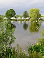
 Evening sun on the lake at Yarwell Mill caravan park - June 2013 - panoramio.jpg 3,000 × 4,000; 2.03 MB
-
 Farm buildings by the Wansford Road - geograph.org.uk - 4218399.jpg 1,600 × 1,067; 482 KB
-
 Farmland east of Wansford Road - geograph.org.uk - 2743576.jpg 1,024 × 768; 218 KB
-
 Field edge trees, Yarwell - August 2013 - panoramio.jpg 4,000 × 3,000; 1.98 MB
-
 Fields close to Yarwell ^ Wansford - evening August 2013 - panoramio.jpg 4,000 × 3,000; 1.43 MB
-
 Fields near Yarwell - August 2013 - panoramio.jpg 4,000 × 3,000; 1.8 MB
-
 Fields near Yarwell Mill - August 2013 - panoramio.jpg 4,000 × 3,000; 1.26 MB
-

-
 Fishing lake below Yarwell - April 2014 - panoramio.jpg 3,000 × 4,000; 4.91 MB
-
 Fishing lake in the meadows below Yarwell - April 2014 - panoramio.jpg 3,000 × 4,000; 3.05 MB
-
 Fishing on the Lake at Yarwell - geograph.org.uk - 917393.jpg 640 × 427; 134 KB
-
 Flooded Mill Stream at Yarwell - May 2014 - panoramio.jpg 4,000 × 3,000; 1.74 MB
-
 Footbridge from the river - Yarwell - June 2013 - panoramio.jpg 4,000 × 3,000; 1.8 MB
-
 Footbridge On Footpath To Thornhaugh - geograph.org.uk - 2543177.jpg 1,122 × 1,496; 986 KB
-
 Footings of old railway viaduct, Yarwell - June 2013 - panoramio.jpg 4,000 × 3,000; 1.6 MB
-
 Footpath into Yarwell - geograph.org.uk - 4218372.jpg 1,600 × 1,067; 424 KB
-
 Footpath off Sulehay Road - geograph.org.uk - 2364849.jpg 640 × 480; 108 KB
-
 Footpath to Mill Road by Prebendel Farm - geograph.org.uk - 4218384.jpg 1,600 × 1,067; 713 KB
-
 Footpath towards Nassington - geograph.org.uk - 2364850.jpg 640 × 480; 71 KB
-
 Ford across Millstream at Yarwell - August 2012 - panoramio.jpg 3,000 × 4,000; 3.76 MB
-
 Ford at Yarwell - geograph.org.uk - 3009720.jpg 3,264 × 2,448; 2.18 MB
-
 Ford is unfordable today - May 2014 - panoramio.jpg 4,000 × 3,000; 3.98 MB
-
 Forge Cottage, Mill Road, Yarwell (geograph 6696338).jpg 2,656 × 1,768; 872 KB
-
 Former quarry near Yarwell - geograph.org.uk - 4583035.jpg 4,320 × 3,240; 5.91 MB
-
 Former stone quarry near Yarwell - geograph.org.uk - 4583225.jpg 4,320 × 3,240; 5.63 MB
-
 Garden shed on the river bank - Yarwell - August 2012 - panoramio.jpg 3,000 × 4,000; 4.95 MB
-
 Gate opening at Wansford Lock - August 2013 - panoramio.jpg 4,000 × 3,000; 3.1 MB
-
 Gated footbridge - geograph.org.uk - 4778402.jpg 1,280 × 960; 297 KB
-
 Gates - geograph.org.uk - 2364851.jpg 640 × 480; 102 KB
-
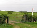 Gateway and gas pipeline marker - geograph.org.uk - 2364860.jpg 640 × 490; 69 KB
-
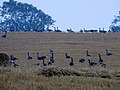 Geese at dusk - near Yarwell Junction - August 2013 - panoramio.jpg 4,000 × 3,000; 1.76 MB
-
 Geese close to Wansford Lock - August 2013 - panoramio.jpg 4,000 × 3,000; 2.9 MB
-
 Glimpses of fishing lake by Yarwell Station - August 2013 - panoramio.jpg 4,000 × 3,000; 2.17 MB
-
 Grand Design, Wansford Road - geograph.org.uk - 2743558.jpg 1,024 × 768; 244 KB
-
 Grass fields near the Old Pump House, Wansford - geograph.org.uk - 6593814.jpg 1,024 × 768; 259 KB
-
 Green lane between Yarwell ^ Nassington - May 2014 - panoramio.jpg 4,000 × 3,000; 2.29 MB
-
 Green lane near Yarwell - May 2014 - panoramio (1).jpg 4,000 × 3,000; 1.88 MB
-
 Green lane near Yarwell - May 2014 - panoramio.jpg 3,000 × 4,000; 2.08 MB
-
 Harvest - Nene Valley - Yarwell - August 2013 - panoramio.jpg 4,000 × 3,000; 2.23 MB
-
 Help yourself - within reason - geograph.org.uk - 2743574.jpg 1,024 × 768; 169 KB
-
 Horses at Yarwell - August 2013 - panoramio.jpg 4,000 × 3,000; 5.26 MB
-
 Horses in the meadow between Wansford Lock and Yarwell Mill - August 2013 - panoramio.jpg 4,000 × 3,000; 2.38 MB
-
 Horses meadow close to Yarwell - August 2013 - panoramio.jpg 4,000 × 3,000; 1.8 MB
-
 Houses near Yarwell Mill - AUgust 2013 - panoramio.jpg 4,000 × 1,997; 1.02 MB
-
 In Yarwell Village - August 2013 - panoramio.jpg 4,000 × 3,000; 2.1 MB
-

-
 Inquisitive sheep on Wansford Road near Yarwell - geograph.org.uk - 4579309.jpg 4,320 × 3,240; 6.07 MB
-
 Into Yarwell - geograph.org.uk - 2364861.jpg 640 × 562; 67 KB
-

-
 Lake at Yarwell - August 2012 - panoramio.jpg 4,000 × 3,000; 4.68 MB
-
 Lake at Yarwell Mill - August 2012 - panoramio.jpg 4,000 × 3,000; 3.62 MB
-
 Lakeside camping at Yarwell - August 2012 - panoramio.jpg 4,000 × 3,000; 3.02 MB
-
 Late summer at Yarwell - August 2013 - panoramio.jpg 4,000 × 3,000; 2.62 MB
-
 Line of old railway - Yarwell - panoramio.jpg 4,000 × 3,000; 1.39 MB
-
 Linley Cottage, Wansford Road - geograph.org.uk - 2743578.jpg 1,024 × 768; 164 KB
-
 Lone tree at head of the recreation area at Yarwell - August 2013 - panoramio.jpg 4,000 × 3,000; 2.46 MB
-
 Looking back upstream towards Yarwell - August 2013 - panoramio.jpg 4,000 × 3,000; 1.72 MB
-
 Looking towards Yarwell from the Nene - August 2012 - panoramio.jpg 4,000 × 3,000; 4.1 MB
-
 Lots of water - Yarwell - May 2014 - panoramio.jpg 4,000 × 3,000; 4.47 MB
-
 Main Street, Yarwell - geograph.org.uk - 2743619.jpg 1,024 × 768; 116 KB
-
 Main Street, Yarwell - geograph.org.uk - 5265026.jpg 1,024 × 683; 322 KB
-
 Meadow at Yarwell - August 2012 - panoramio.jpg 4,000 × 3,000; 3.61 MB
-
 Meadow at Yarwell from the river - June 2013 - panoramio.jpg 3,990 × 2,986; 974 KB
-
 Meadow beside the recreation ground at Yarwell - AUgust 2013 - panoramio.jpg 4,000 × 3,000; 2.51 MB
-
 Meadow beside Yarwell Lock - June 2011 - panoramio.jpg 2,288 × 1,712; 822 KB
-
 Meadow between Yarwell and Wansford Lock - August 2013 - panoramio.jpg 4,000 × 3,000; 2.23 MB
-
 Meadow beyond the tent field - Yarwell Mill - June 2013 - panoramio.jpg 3,996 × 2,994; 2.17 MB
-
 Meadow near Yarwell - August 2013 - panoramio.jpg 4,000 × 3,000; 1.62 MB
-
 Meadowland beside the Millstream - Yarwell - August 2012 - panoramio.jpg 4,000 × 3,000; 3.51 MB
-
 Meadows alongside the River Nene, Yarwell - Niassington area - panoramio.jpg 4,000 × 3,000; 2.16 MB
-
 Meadows and caravans at Yarwell - August 2013 - panoramio.jpg 4,000 × 3,000; 1.92 MB
-
 Meadows and Poplars - Yarwell - August 2012 - panoramio.jpg 4,000 × 3,000; 5.03 MB
-
 Meadows at Wansford Lock - August 2013 - panoramio.jpg 4,000 × 3,000; 2.17 MB
-
 Meadows at Yarwell - August 2013 - panoramio (1).jpg 4,000 × 3,000; 2.09 MB
-
 Meadows at Yarwell - August 2013 - panoramio.jpg 4,000 × 1,996; 1.56 MB
-
 Meadows at Yarwell Mill - August 2013 - panoramio.jpg 4,000 × 3,000; 1.62 MB
-
 Meadows beside the lock - Yarwell - August 2013 - panoramio.jpg 4,000 × 3,000; 2.88 MB
-
 Meadows near Yarwell - April 2014 - panoramio.jpg 4,000 × 3,000; 1.68 MB
-
 Meadows near Yarwell - August 2012 - panoramio.jpg 4,000 × 3,000; 4.39 MB
-
 Meadows near Yarwell - Evening - August 2012 - panoramio.jpg 4,000 × 3,000; 4.18 MB
-
 Meadows near Yarwell Village - August 2013 - panoramio.jpg 4,000 × 3,000; 2.27 MB
-
 Mill Stream at Yarwell - April 2014 - panoramio.jpg 3,000 × 4,000; 1.47 MB
-
 Mill Stream at Yarwell Mill - August 2013 - panoramio.jpg 4,000 × 3,000; 2.65 MB
-
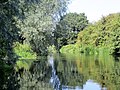
 Millpond, Yarwell Mill - geograph.org.uk - 4962742.jpg 1,024 × 768; 465 KB
-
 Millstream at Yarwell - August 2012 - panoramio.jpg 3,000 × 4,000; 5.68 MB
-
 Millstream at Yarwell - August 2013 - panoramio.jpg 4,000 × 3,000; 3.06 MB
-
 Millstream at Yarwell Mill - August 2013 - panoramio.jpg 4,000 × 3,000; 3.39 MB
-
 Mock farm building conversions - geograph.org.uk - 6370274.jpg 800 × 533; 106 KB
-
 Moored at Wansford Lock - August 2013 - panoramio.jpg 4,000 × 3,000; 1.88 MB
-
 Moored at Yarwell - August 2013 - panoramio.jpg 4,000 × 3,000; 2.34 MB
-
 Moored boats - close to Yarwell Mill - June 2013 - panoramio.jpg 4,000 × 3,000; 1.68 MB
-
 Moored boats close to Yarwell - June 2013 - panoramio.jpg 4,000 × 3,000; 1.57 MB
-
 Moored opposite the weir - Yarwell - August 2012 - panoramio.jpg 4,000 × 3,000; 5.32 MB
-
 Mooring at Yarwell Mill - August 2013 - panoramio.jpg 4,000 × 3,000; 3.83 MB
-
 Moorings at Yarwell - August 2013 - panoramio.jpg 4,000 × 3,000; 1.97 MB
-
 Moorings at Yarwell - June 2011 - panoramio.jpg 2,288 × 1,712; 792 KB
-
 Moorings at Yarwell - River Nene - August 2013 - panoramio.jpg 4,000 × 3,000; 1.68 MB
-
 Narrow boat, Yarwell - geograph.org.uk - 4962731.jpg 1,024 × 683; 376 KB
-
 Narrow boats moored at Yarwell - June 2013 - panoramio.jpg 4,000 × 3,000; 1.74 MB
-
 Nassington Road, Yarwell - geograph.org.uk - 2743608.jpg 1,024 × 768; 140 KB
-
 Nassington Spire aboove the meadows, close to Yarwell - panoramio.jpg 3,980 × 2,972; 1.8 MB
-
 Near Wansford Lock - August 2013 - panoramio.jpg 4,000 × 3,000; 1.85 MB
-
 Nene Way at Yarwell - geograph.org.uk - 1319557.jpg 640 × 480; 106 KB
-
 New house under construction - geograph.org.uk - 4218405.jpg 1,600 × 1,067; 563 KB
-
 New housing at Yarwell - April 2014 - panoramio.jpg 3,996 × 2,994; 2.16 MB
-
 Old farm buildings at Yarwell Mill - April 2014 - panoramio.jpg 4,000 × 3,000; 2.87 MB
-
 Old Leicester Road - geograph.org.uk - 1228150.jpg 640 × 457; 138 KB
-
 Old stone quarry near Yarwell - geograph.org.uk - 4583017.jpg 4,320 × 3,240; 5.68 MB
-
 Old Sulehay Forest - geograph.org.uk - 2617736.jpg 640 × 481; 70 KB
-
 Old Sulehay Forest - geograph.org.uk - 2743580.jpg 777 × 583; 243 KB
-
 Old Sulehay nature reserve - geograph.org.uk - 4582940.jpg 4,320 × 3,240; 5.61 MB
-
 On the edge of a former stone quarry near Yarwell - geograph.org.uk - 4583004.jpg 4,320 × 3,240; 5.85 MB
-
 Orchard - Yarwell - August 2013 - panoramio.jpg 4,000 × 3,000; 2.45 MB
-
 Parachutists always seen above Yarwell - August 2012 - panoramio.jpg 2,003 × 2,664; 2.17 MB
-
 Path into the woods - geograph.org.uk - 2364857.jpg 640 × 480; 163 KB
-
 Pathway between the houses in Yarwell - August 2013 - panoramio.jpg 4,000 × 3,000; 1.82 MB
-
 Ploughed fields close to Yarwell - August 2012 - panoramio.jpg 4,000 × 3,000; 5.85 MB
-
 Poplar Plantation at Yarwell - June 2011 - panoramio.jpg 1,712 × 2,288; 1.88 MB
-
 Prebendal Green, Yarwell - geograph.org.uk - 2743604.jpg 1,024 × 768; 109 KB
-
 Quarry - geograph.org.uk - 2616260.jpg 640 × 525; 156 KB
-
 Quarry - geograph.org.uk - 2616265.jpg 640 × 417; 78 KB
-
 Quarry notice - geograph.org.uk - 2616261.jpg 419 × 640; 85 KB
-
 Railside building - Yarwell - August 2012 - panoramio.jpg 4,000 × 3,000; 9.2 MB
-
 Railway embankment close to Yarwell - June 2013 - panoramio.jpg 4,000 × 3,000; 1.63 MB
-
 Raining near Nassington - May 2014 - panoramio.jpg 4,000 × 3,000; 2.22 MB
-
 Reflection in the Mill Stream - Yarwell - April 2014 - panoramio.jpg 4,000 × 3,000; 1.81 MB
-
 Reflections - Yarwell Mill Caravan Park - June 2013 - panoramio.jpg 3,000 × 4,000; 1.77 MB
-
 Reflections at the ford - Yarwell - May 2014 - panoramio.jpg 3,000 × 4,000; 1.87 MB
-
 Reflections in the Nene at Yarwell - August 2013 - panoramio.jpg 4,000 × 3,000; 2.76 MB
-
 Reflections in the River Nene at Yarwell - April 2014 - panoramio.jpg 4,000 × 3,000; 4.7 MB
-
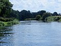
 River Nene - geograph.org.uk - 2616270.jpg 640 × 354; 51 KB


.jpg)


.jpg)


.jpg)


