Category:Yakima Valley
Jump to navigation
Jump to search
Yakima Valley, southeast en:Washington (U.S. state)
Subcategories
This category has the following 3 subcategories, out of 3 total.
T
Y
Media in category "Yakima Valley"
The following 29 files are in this category, out of 29 total.
-
 Helix, v.2, no.1, Sep. 15, 1967 - DPLA - 368a7b2df301973ab9ee094219a3df65 (page 1).jpg 7,071 × 4,556; 4.39 MB
-
 Helix, v.2, no.1, Sep. 15, 1967 - DPLA - 368a7b2df301973ab9ee094219a3df65 (page 6).jpg 9,027 × 7,060; 8.87 MB
-
 Hop pickers in the Yakima Valley, 1906 (CURTIS 244).jpeg 768 × 660; 99 KB
-
 Irrigation Canal along old Naches road west of Yakima (3935892669).jpg 1,632 × 1,224; 1.88 MB
-

-
 Penstock along Old Naches Road (9575601588).jpg 2,304 × 1,728; 891 KB
-
 Power plant along Old Naches Road west of Yakima (9572830467).jpg 2,304 × 1,728; 1.23 MB
-
 Rattlesnake-Hills-AVA.jpg 1,984 × 1,488; 718 KB
-
 Red Mountain from East.JPG 1,984 × 1,488; 690 KB
-
 Red Mountain toward Rattlesnake Mountain.JPG 1,984 × 967; 373 KB
-
 Red Mountains right Rattlesnake Left.JPG 1,984 × 1,025; 457 KB
-
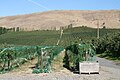
 Sagelands Vineyard.jpg 3,888 × 2,592; 5.03 MB
-

-
 The Beauties of the state of Washington - a book for tourists (1915) (14796216963).jpg 4,448 × 2,842; 1.86 MB
-
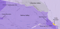
 TTB Yakima Valley AVA map.png 1,131 × 443; 533 KB
-
 Upper Yakima River from Highway 10, between Cle Elum and Thorp, Washington.jpg 3,264 × 2,448; 3.22 MB
-
 View from Sagelands Vineyard.jpg 3,888 × 2,592; 4.55 MB
-
 WASR10 YakimaRiver.jpg 1,638 × 1,200; 405 KB
-
 Windy Point Vineyards.jpg 3,888 × 2,592; 5.2 MB
-
 Yakama Indian Reservation in Washington state (Openstreetmap).png 1,778 × 1,212; 993 KB
-
 Yakima Canyon top view.jpg 240 × 320; 17 KB
-
 Yakima Indian Reservation map.png 1,486 × 1,038; 335 KB
-
 Yakima Valley Candy Mtn AVA.png 1,145 × 562; 568 KB
-
 Yakima Valley from Red Mountain.JPG 2,592 × 1,936; 1.83 MB
-

-
 Yakima Valley Panorama.jpg 1,599 × 363; 66 KB
-
 Yakima Valley.jpg 1,024 × 681; 143 KB
-
 Yakima-Valley-Hop-Yard.jpg 1,984 × 1,488; 711 KB
-
 Zillah-rhythmites.JPG 1,236 × 1,716; 535 KB
.jpg)
.jpg)
.jpeg)
.jpg)

.jpg)
.jpg)


.jpg)
_(14796216963).jpg)


.png)


.jpg)


