Category:Y Garn, Ceredigion
Jump to navigation
Jump to search

Media in category "Y Garn, Ceredigion"
The following 20 files are in this category, out of 20 total.
-
 Dyll Faen - geograph.org.uk - 34857.jpg 640 × 411; 55 KB
-
 Farmland west of Devil's Bridge - geograph.org.uk - 836983.jpg 640 × 428; 96 KB
-
 High seas on Nant y Moch reservoir - geograph.org.uk - 1133063.jpg 640 × 480; 173 KB
-
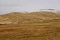
 North west slopes of Y Garn - geograph.org.uk - 648439.jpg 640 × 427; 80 KB
-
 Old road heading east - geograph.org.uk - 1130155.jpg 640 × 428; 113 KB
-
 Rocky strata on Drybedd - geograph.org.uk - 389581.jpg 478 × 640; 97 KB
-
 Slopes east of Nant-y-moch reservoir - geograph.org.uk - 734868.jpg 640 × 428; 78 KB
-
 The summit of Y Garn - geograph.org.uk - 709088.jpg 1,000 × 659; 272 KB
-
 View from Bryn Glas - geograph.org.uk - 389626.jpg 640 × 479; 80 KB
-
 View from Drybedd towards y Garn - geograph.org.uk - 389565.jpg 640 × 479; 68 KB
-
 View north east from Y Garn - geograph.org.uk - 648460.jpg 640 × 397; 60 KB
-
 View northwest from Y Garn - geograph.org.uk - 709083.jpg 1,000 × 660; 202 KB
-
 View towards Nant-y-moch reservoir - geograph.org.uk - 1495601.jpg 640 × 480; 88 KB
-
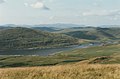
 View towards Y Garn - geograph.org.uk - 1495605.jpg 640 × 480; 92 KB
-
 Cwm of the Nant-y-moch - geograph.org.uk - 559394.jpg 640 × 480; 91 KB
-
 Drum Peithnant - geograph.org.uk - 274744.jpg 640 × 475; 87 KB
-
 Drum Peithnant - geograph.org.uk - 709077.jpg 1,000 × 666; 227 KB
-
 Nant-y-moch reservoir - geograph.org.uk - 655514.jpg 640 × 428; 67 KB
-
 Sunrise over Plynlimon, from Pisgah - geograph.org.uk - 655539.jpg 640 × 432; 38 KB
-
 Wild camp - geograph.org.uk - 274738.jpg 640 × 475; 72 KB


