Category:Wythenshawe and Sale East (UK Parliament constituency)
Jump to navigation
Jump to search
Parliamentary constituency in the United Kingdom, 1997 onwards | |||||
| Upload media | |||||
| Instance of | |||||
|---|---|---|---|---|---|
| Location | North West England, England | ||||
| Inception |
| ||||
| Population |
| ||||
| Area |
| ||||
| Electorate |
| ||||
 | |||||
Subcategories
This category has only the following subcategory.
Media in category "Wythenshawe and Sale East (UK Parliament constituency)"
The following 66 files are in this category, out of 66 total.
-
Bean ^ Brush - geograph.org.uk - 6825339.jpg 1,280 × 886; 755 KB
-
Bee Carving on Northenden Road - geograph.org.uk - 6144039.jpg 1,280 × 1,767; 2 MB
-
Bridgewater Canal - geograph.org.uk - 6506145.jpg 4,032 × 2,826; 1.68 MB
-
Bridgewater Canal in Sale - geograph.org.uk - 5966635.jpg 1,024 × 766; 102 KB
-
Brooklands tram stop - geograph.org.uk - 5921004.jpg 1,024 × 768; 278 KB
-
Building - geograph.org.uk - 6506171.jpg 4,032 × 2,822; 1.65 MB
-
Bulls Head Hotel, Sale - geograph.org.uk - 6824193.jpg 1,280 × 1,280; 1.04 MB
-
Canal towpath users, Timperley - geograph.org.uk - 6876239.jpg 1,557 × 1,168; 476 KB
-
Canal users in Sale - geograph.org.uk - 6876234.jpg 1,778 × 1,333; 624 KB
-
Canal users near Walton Park - geograph.org.uk - 6876155.jpg 1,863 × 1,398; 867 KB
-
Canalside flats, Sale - geograph.org.uk - 6876226.jpg 1,600 × 1,200; 266 KB
-
Canalside houses on Britannia Road, Sale - geograph.org.uk - 6876230.jpg 1,600 × 1,200; 319 KB
-
Canoes for hire by the Kings Ransom - geograph.org.uk - 6876218.jpg 1,600 × 1,200; 440 KB
-
Carved seating - geograph.org.uk - 5927106.jpg 1,280 × 1,064; 1.64 MB
-
Fairy Lane Electricity Substation, Wythenshawe - geograph.org.uk - 6795585.jpg 4,160 × 3,120; 624 KB
-
Housing in the Waterside development, Sale - geograph.org.uk - 6876232.jpg 1,600 × 900; 295 KB
-
Little Gem bus on Simpson Street - geograph.org.uk - 6811424.jpg 1,280 × 960; 1 MB
-
Lowering the Bell Tower - geograph.org.uk - 5925555.jpg 1,280 × 960; 1,007 KB
-
Lowering the Bell Tower - geograph.org.uk - 5926838.jpg 1,280 × 1,280; 1.4 MB
-
Lowering the Bell Tower - geograph.org.uk - 5927067.jpg 1,280 × 1,707; 1.57 MB
-
M60 - geograph.org.uk - 6506142.jpg 3,877 × 2,679; 1.72 MB
-
M60 Motorway - geograph.org.uk - 6506144.jpg 3,834 × 2,505; 1.86 MB
-
Manchester Metrolink Bridge Over River Mersey - geograph.org.uk - 6144302.jpg 3,264 × 2,448; 1.76 MB
-
Metrolink - geograph.org.uk - 6506143.jpg 3,806 × 2,362; 1.77 MB
-
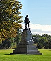
Oliver Cromwell in Wythenshawe Park - geograph.org.uk - 5927073.jpg 1,280 × 1,524; 1.61 MB
-
River Mersey - geograph.org.uk - 6503030.jpg 3,833 × 2,762; 1.75 MB
-
River Mersey near Stretford - geograph.org.uk - 6019047.jpg 800 × 600; 893 KB
-
Rowers approaching Whites Bridge (no 36) - geograph.org.uk - 6876235.jpg 1,060 × 795; 309 KB
-
Rowers on the Bridgewater Canal - geograph.org.uk - 6144162.jpg 1,280 × 1,280; 1.06 MB
-
Rowers on the Bridgewater Canal - geograph.org.uk - 6144176.jpg 1,280 × 960; 937 KB
-
Rowing Together For Healthy Minds - geograph.org.uk - 6144189.jpg 1,280 × 960; 999 KB
-
Sale Marina - geograph.org.uk - 6456821.jpg 1,024 × 745; 220 KB
-
Sale Marina Landing - geograph.org.uk - 6486037.jpg 1,024 × 779; 309 KB
-
Sale tram stop - geograph.org.uk - 5966643.jpg 1,024 × 768; 151 KB
-
School Road - geograph.org.uk - 6825185.jpg 1,280 × 960; 968 KB
-
Service Bridge Over River Mersey - geograph.org.uk - 6144306.jpg 3,264 × 2,448; 2.61 MB
-
Sibson Road - geograph.org.uk - 6808782.jpg 1,280 × 1,013; 1.13 MB
-
Sibson Road - geograph.org.uk - 6811415.jpg 1,280 × 960; 966 KB
-
Sign of the Bulls Head - geograph.org.uk - 6824342.jpg 1,280 × 1,576; 1.38 MB
-
Springfield Road - geograph.org.uk - 6811494.jpg 1,280 × 960; 1.07 MB
-
St Anne's Church - geograph.org.uk - 6163877.jpg 1,280 × 1,058; 1.05 MB
-
St Anne's Church - geograph.org.uk - 6163880.jpg 1,280 × 1,168; 1 MB
-
St Anne's Church Hall - geograph.org.uk - 6163815.jpg 1,280 × 960; 803 KB
-
St Anne's War Memorial - geograph.org.uk - 6163886.jpg 1,280 × 1,707; 1.77 MB
-
Stamford Place - geograph.org.uk - 5966626.jpg 1,024 × 768; 326 KB
-
Statue of Oliver Cromwell - geograph.org.uk - 5925740.jpg 1,280 × 1,280; 1.57 MB
-
Superdrug and Greggs - geograph.org.uk - 6824489.jpg 1,280 × 1,240; 1.1 MB
-
Tesco Extra, Wythenshawe - geograph.org.uk - 5910486.jpg 4,000 × 3,000; 2.2 MB
-
Tree stump in Wythenshawe Park - geograph.org.uk - 5925532.jpg 1,280 × 960; 1.27 MB
-
Trinity Chapel - geograph.org.uk - 6143191.jpg 1,280 × 886; 977 KB
-
Trinity Methodist Church - geograph.org.uk - 6143917.jpg 1,280 × 887; 1.11 MB
-
Welcome to Trafford, Altrincham - geograph.org.uk - 5656467.jpg 1,280 × 982; 1.13 MB
-
White waterlilies on the Bridgewater canal - geograph.org.uk - 6876237.jpg 1,600 × 1,200; 483 KB
-
Wythenshawe Hall - geograph.org.uk - 5927060.jpg 1,280 × 1,184; 1.48 MB
-
Wythenshawe Hall Bell Tower - geograph.org.uk - 5925562.jpg 1,280 × 1,707; 1.48 MB
-
Wythenshawe Hall c.1952 - geograph.org.uk - 6735120.jpg 1,024 × 679; 449 KB
-
Wythenshawe Hall restoration information - geograph.org.uk - 5926087.jpg 2,560 × 1,920; 3.7 MB
-
Wythenshawe Hall Weather Vane - geograph.org.uk - 5926852.jpg 1,280 × 960; 698 KB
-
Wythenshawe Park - geograph.org.uk - 5925380.jpg 1,280 × 960; 980 KB
-
Wythenshawe Park - geograph.org.uk - 5925385.jpg 1,280 × 960; 1.14 MB
-
Wythenshawe Park - geograph.org.uk - 5927102.jpg 1,280 × 960; 1.26 MB
-
WythenshaweSaleEast2007Constituency.svg 322 × 242; 305 KB
-
^261 bus on Hayfield Street - geograph.org.uk - 6823445.jpg 1,280 × 973; 827 KB


