Category:Wymondham, Leicestershire
Jump to navigation
Jump to search
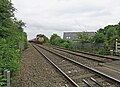
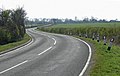
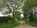
English: Wymondham is a village in the district of Melton in Leicestershire, England. It is part of a civil parish which also covers the nearby hamlet of Edmondthorpe. The parish has a population of about 600. It is close to the county borders with Lincolnshire and Rutland, nearby places being Garthorpe, Teigh (in Rutland) and South Witham (in Lincolnshire). The village is the site of a windmill. A disused railway line runs through the village—the Edmondthorpe and Wymondham railway station, closed to passengers in 1959. [1]

village in Leicestershire, England, UK  | |||||
| Upload media | |||||
| Instance of | |||||
|---|---|---|---|---|---|
| Location | Wymondham, Melton, Leicestershire, East Midlands, England | ||||
 | |||||
Subcategories
This category has the following 5 subcategories, out of 5 total.
B
- Berkeley Arms, Wymondham (6 F)
E
P
- St Peter's Church, Wymondham (7 F)
W
- Wymondham Windmill (33 F)
Media in category "Wymondham, Leicestershire"
The following 200 files are in this category, out of 475 total.
(previous page) (next page)-
 'The Mere' leading off Wymondham Road - geograph.org.uk - 5514446.jpg 3,776 × 2,520; 4.01 MB
-
 2 tractors at Glebe Road level crossing - geograph.org.uk - 6800068.jpg 1,600 × 1,264; 237 KB
-
 A corner of Edmondthorpe Cemetery - geograph.org.uk - 3350193.jpg 640 × 487; 78 KB
-
 A gap in the old line at Cribb's Meadow - geograph.org.uk - 3515651.jpg 1,024 × 768; 224 KB
-
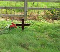 A grave at Edmondthorpe Cemetery - geograph.org.uk - 3350194.jpg 640 × 551; 102 KB
-
 A load of grain - geograph.org.uk - 3350227.jpg 640 × 460; 46 KB
-
 A railway ran here until 1959 - geograph.org.uk - 5522639.jpg 4,000 × 3,000; 4.44 MB
-
 A rather uninteresting track - geograph.org.uk - 5785607.jpg 1,024 × 768; 179 KB
-
 A road to Wymondham - geograph.org.uk - 2318768.jpg 1,024 × 768; 135 KB
-
 Abutments of railway bridge, Fosse Lane - geograph.org.uk - 3515604.jpg 1,024 × 768; 173 KB
-
 Agricultural waste near Wymondham - geograph.org.uk - 6382997.jpg 1,024 × 768; 206 KB
-
 Almost ready for the harvest - geograph.org.uk - 5514433.jpg 3,776 × 2,520; 3.24 MB
-
 An inquisitive sheep - geograph.org.uk - 5520412.jpg 4,000 × 3,000; 4.97 MB
-
 Approaching Edmondthorpe - geograph.org.uk - 3350209.jpg 640 × 473; 77 KB
-

-
 Approaching Wymondham from Edmonthorpe - geograph.org.uk - 2596694.jpg 640 × 511; 117 KB
-

-

-
 Bare field, north-west of the windmill - geograph.org.uk - 2318785.jpg 1,024 × 768; 166 KB
-
 Barn at Cribb's Lodge Farm - geograph.org.uk - 6786111.jpg 1,600 × 1,158; 213 KB
-
 Barn with Cows - geograph.org.uk - 3566112.jpg 2,256 × 1,504; 2.19 MB
-
 Barns near the road - geograph.org.uk - 6786471.jpg 1,600 × 1,192; 199 KB
-
 Benchmark on the tower of St Peter's Church - geograph.org.uk - 6489538.jpg 654 × 1,024; 297 KB
-
 Bend in Edmondthorpe Road towards Teigh - geograph.org.uk - 4931172.jpg 640 × 470; 133 KB
-
 Bend in the path - geograph.org.uk - 5778068.jpg 1,024 × 768; 189 KB
-
 Berkeley Arms - geograph.org.uk - 4313338.jpg 2,000 × 1,500; 471 KB
-
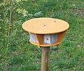 Bird house - geograph.org.uk - 2596696.jpg 640 × 542; 135 KB
-
 Bird house - geograph.org.uk - 2596697.jpg 480 × 640; 135 KB
-
 Bird houses - geograph.org.uk - 2596698.jpg 640 × 595; 160 KB
-
 Brick cattle manger - geograph.org.uk - 3715171.jpg 3,776 × 2,520; 3.9 MB
-
 Bridge over an old railway line - geograph.org.uk - 5522634.jpg 4,000 × 3,000; 4.63 MB
-
 Bridge over dismantled railway - geograph.org.uk - 783393.jpg 640 × 460; 108 KB
-
 Bridge over the stream west of Bryans Lodge - geograph.org.uk - 5915609.jpg 1,600 × 1,200; 1,018 KB
-
 Bridleway alongside a drain - geograph.org.uk - 5785760.jpg 1,024 × 768; 186 KB
-
 Bridleway at Wymondham - geograph.org.uk - 5770507.jpg 1,024 × 768; 261 KB
-
 Bridleway between 'The Drift' and Sewstern Road - geograph.org.uk - 5541764.jpg 3,776 × 2,520; 3.53 MB
-
 Bridleway east of Edmondthorpe - geograph.org.uk - 5770537.jpg 1,024 × 768; 195 KB
-
 Bridleway east of Edmondthorpe - geograph.org.uk - 5785601.jpg 1,024 × 768; 239 KB
-
 Bridleway in Cribb's Meadow - geograph.org.uk - 3515622.jpg 1,024 × 768; 161 KB
-
 Bridleway linking to the Rutland Round - geograph.org.uk - 5785762.jpg 1,024 × 768; 339 KB
-
 Bridleway near Catmose Lodge - geograph.org.uk - 4809961.jpg 1,280 × 960; 375 KB
-
 Bridleway near Crown Point Farm - geograph.org.uk - 6359740.jpg 1,024 × 768; 202 KB
-
 Bridleway on Cord Hill - geograph.org.uk - 5777558.jpg 1,024 × 768; 192 KB
-
 Bridleway on Cord Hill - geograph.org.uk - 5777565.jpg 1,024 × 768; 157 KB
-
 Bridleway on Cord Hill - geograph.org.uk - 5777573.jpg 1,024 × 768; 225 KB
-
 Bridleway signpost, west side of Fosse Lane - geograph.org.uk - 3515601.jpg 1,024 × 768; 226 KB
-
 Bridleway to Edmondthorpe - geograph.org.uk - 5776193.jpg 1,024 × 768; 196 KB
-
 Bridleway to Market Overton - geograph.org.uk - 5770190.jpg 1,024 × 768; 180 KB
-
 Bridleway to Wymondham - geograph.org.uk - 5776396.jpg 1,024 × 768; 367 KB
-
 Brook east of Station Road - geograph.org.uk - 3404641.jpg 640 × 478; 91 KB
-
 Bryans Lodge - geograph.org.uk - 6381050.jpg 1,024 × 768; 297 KB
-
 Buildings at Crown Point Farm - geograph.org.uk - 3515589.jpg 1,024 × 768; 142 KB
-
 Bus shelter Edmondthorpe - geograph.org.uk - 5777531.jpg 1,024 × 768; 263 KB
-
 Butt Lane into Wymondham - geograph.org.uk - 6800081.jpg 1,600 × 1,169; 137 KB
-
 Butt Lane towards Garthorpe - geograph.org.uk - 2596699.jpg 640 × 548; 128 KB
-
 Byway near Crown Point Farm - geograph.org.uk - 6362655.jpg 1,024 × 768; 210 KB
-
 Byway off Drift Road - geograph.org.uk - 3503706.jpg 2,256 × 1,504; 2.37 MB
-
 Byway off The Drift - geograph.org.uk - 6359737.jpg 1,024 × 768; 170 KB
-
 Byway to The Drift - geograph.org.uk - 6362665.jpg 1,024 × 768; 194 KB
-
 Cathodic Protection marker - geograph.org.uk - 6786462.jpg 1,529 × 1,600; 611 KB
-
 Cattle grid on Cordhill Lane - geograph.org.uk - 2650963.jpg 640 × 506; 119 KB
-
 Cattle grid on Cordhill Lane - geograph.org.uk - 2650964.jpg 640 × 489; 85 KB
-
 Cattle grid on Cordhill Lane - geograph.org.uk - 5777550.jpg 1,024 × 768; 162 KB
-
 Cereal field, west of The Drift - geograph.org.uk - 3515593.jpg 1,024 × 768; 186 KB
-
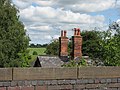 Chimney stacks on the station building - geograph.org.uk - 1923082.jpg 1,024 × 768; 847 KB
-
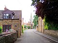 Church Lane, Wymondham, Leicestershire (15-08-2006).jpg 800 × 600; 171 KB
-

-

-
-

-

-
 Combine harvester at work - geograph.org.uk - 3350228.jpg 640 × 474; 44 KB
-
 Combine harvester at work - geograph.org.uk - 3350229.jpg 640 × 455; 51 KB
-

-
 Cordhill Lane - geograph.org.uk - 2650965.jpg 640 × 502; 99 KB
-
 Cordhill Lane - geograph.org.uk - 2650966.jpg 640 × 469; 89 KB
-
 Cordhill Lane approaches The Lodge - geograph.org.uk - 3591480.jpg 640 × 480; 33 KB
-
 Cordhill Lane near Edmondthorpe - geograph.org.uk - 785092.jpg 640 × 423; 111 KB
-
 Cordhill Lane sign - geograph.org.uk - 4931173.jpg 640 × 508; 157 KB
-
 Cordhill Lane towards Edmondthorpe - geograph.org.uk - 3591481.jpg 640 × 474; 48 KB
-
 Cordhill Lane towards Edmondthorpe - geograph.org.uk - 3591495.jpg 640 × 469; 49 KB
-
 Cordhill Lane towards The Lodge - geograph.org.uk - 785102.jpg 640 × 433; 62 KB
-
 Cordhill Lane towards Whissendine - geograph.org.uk - 3591482.jpg 640 × 493; 44 KB
-
 Cordhill Lane towards Whissendine - geograph.org.uk - 3591496.jpg 640 × 473; 50 KB
-

-
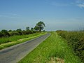 Country lane north of Wymondham - geograph.org.uk - 840178.jpg 640 × 480; 75 KB
-

-
 Country road in east Leicestershire - geograph.org.uk - 783173.jpg 640 × 470; 95 KB
-
 Country road in east Leicestershire - geograph.org.uk - 783174.jpg 640 × 404; 66 KB
-
 Country road in east Leicestershire - geograph.org.uk - 783179.jpg 640 × 502; 78 KB
-
 Country road towards Wymondham - geograph.org.uk - 1853226.jpg 3,041 × 1,962; 2.61 MB
-

-

-
 Cribb's Lodge Farm - geograph.org.uk - 6786112.jpg 1,600 × 1,054; 123 KB
-
 Cribb's Lodge Farm from the west - geograph.org.uk - 6786113.jpg 1,600 × 1,089; 124 KB
-
 Cribb's Meadow - geograph.org.uk - 5770165.jpg 1,024 × 768; 329 KB
-
 Cribb's Meadow - geograph.org.uk - 5787083.jpg 1,024 × 768; 282 KB
-
 Crooked crossroads - geograph.org.uk - 5514904.jpg 3,776 × 2,520; 4.11 MB
-

-

-
 Crossroads on Butt Lane - geograph.org.uk - 5100068.jpg 640 × 380; 55 KB
-
 Dairy Lane, Edmondthorpe - geograph.org.uk - 5777159.jpg 1,024 × 768; 340 KB
-
 Dead End Bridleway - geograph.org.uk - 6786472.jpg 1,600 × 1,286; 238 KB
-
 Dead End Bridleway sign, Fosse Lane - geograph.org.uk - 3515607.jpg 1,024 × 768; 205 KB
-
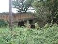
 Disused railway bridge - geograph.org.uk - 3505470.jpg 2,256 × 1,504; 2.91 MB
-
 Disused railway bridge near Wymondham - geograph.org.uk - 784362.jpg 640 × 520; 112 KB
-
 Double gates between fields - geograph.org.uk - 6786114.jpg 1,600 × 1,135; 202 KB
-

-
 Driveway from Pasture Farm across the disused railway line - geograph.org.uk - 3715290.jpg 3,776 × 2,520; 4.27 MB
-
 Driveway to Cribb's Lodge Farm - geograph.org.uk - 3503680.jpg 2,256 × 1,504; 2.69 MB
-
 Driveway to The Grange and Westwell - geograph.org.uk - 6013322.jpg 640 × 446; 65 KB
-
 Dying oak - geograph.org.uk - 3715190.jpg 3,776 × 2,520; 4.18 MB
-
-
 Eastern boundary of Leicestershire cereal field - geograph.org.uk - 3515586.jpg 1,024 × 768; 181 KB
-
 Eastwards along the embankment - geograph.org.uk - 6786116.jpg 1,600 × 1,202; 409 KB
-
 Eastwards alongside former railway embankment - geograph.org.uk - 6786115.jpg 1,600 × 1,200; 164 KB
-

-

-
 Edmondthorpe and Wymondham station - geograph.org.uk - 4815942.jpg 1,280 × 862; 443 KB
-
 Edmondthorpe Cemetery exit - geograph.org.uk - 3350196.jpg 640 × 557; 83 KB
-
 Edmondthorpe Drift - geograph.org.uk - 2916260.jpg 1,024 × 768; 222 KB
-
 Edmondthorpe Drift - geograph.org.uk - 2916270.jpg 1,024 × 768; 213 KB
-
 Edmondthorpe Drift - geograph.org.uk - 3350210.jpg 640 × 482; 53 KB
-
 Edmondthorpe Drift - geograph.org.uk - 3350211.jpg 640 × 541; 48 KB
-
 Edmondthorpe Drift - geograph.org.uk - 5785381.jpg 1,024 × 768; 171 KB
-
 Edmondthorpe Drift eastwards - geograph.org.uk - 3350231.jpg 640 × 472; 51 KB
-
 Edmondthorpe Drift Gates - geograph.org.uk - 2916285.jpg 4,277 × 3,208; 2.11 MB
-
 Edmondthorpe Drift westwards - geograph.org.uk - 3350236.jpg 640 × 475; 60 KB
-
 Edmondthorpe Park - geograph.org.uk - 5778296.jpg 1,024 × 768; 101 KB
-
 Edmondthorpe Road - geograph.org.uk - 2351451.jpg 640 × 508; 83 KB
-
 Edmondthorpe Road towards Teigh - geograph.org.uk - 4931175.jpg 640 × 485; 165 KB
-
 Edmondthorpe Social Club - geograph.org.uk - 2916210.jpg 1,024 × 768; 184 KB
-
 Edmondthorpe village pump - geograph.org.uk - 3350212.jpg 640 × 518; 62 KB
-

-
 Edmondthorpe,1994 - geograph.org.uk - 4133778.jpg 2,389 × 1,471; 3.49 MB
-
 Edmonthorpe Road - geograph.org.uk - 2596695.jpg 640 × 479; 102 KB
-
 Electricity cables across a field - geograph.org.uk - 6786117.jpg 1,600 × 1,348; 103 KB
-
 End of the line^ - geograph.org.uk - 6381042.jpg 1,024 × 768; 242 KB
-
 Entrance to a field - geograph.org.uk - 5015814.jpg 640 × 447; 66 KB
-
 Entrance to byway off Edmondthorpe Drift - geograph.org.uk - 3715149.jpg 3,776 × 2,520; 4.32 MB
-
 Entrance to Canal Farm - geograph.org.uk - 2351448.jpg 640 × 468; 89 KB
-
 Entrance to electricity substation on Fosse Lane - geograph.org.uk - 6786473.jpg 1,600 × 1,241; 169 KB
-
 Entrance to field and barns - geograph.org.uk - 5119691.jpg 640 × 440; 98 KB
-
 Entrance to the Cribbs Meadow National Nature Reserve - geograph.org.uk - 3715383.jpg 3,776 × 2,520; 4.27 MB
-
 Entrance to the sewage works, Wymondham - geograph.org.uk - 5778062.jpg 1,024 × 768; 207 KB
-
 Entrance to Wymondham - geograph.org.uk - 3575091.jpg 640 × 480; 60 KB
-
 Ex-Railway ex-Bridge - geograph.org.uk - 2596701.jpg 640 × 463; 88 KB
-
 Exercising horses, Cordhill Lane - geograph.org.uk - 5770484.jpg 1,024 × 768; 166 KB
-
 Farm track below Cord Hill - geograph.org.uk - 5778095.jpg 1,024 × 768; 152 KB
-

-
 Farm yard - geograph.org.uk - 3445688.jpg 640 × 480; 64 KB
-
 Farmland in east Leicestershire - geograph.org.uk - 783096.jpg 640 × 495; 94 KB
-
 Farmland in east Leicestershire - geograph.org.uk - 783177.jpg 640 × 422; 56 KB
-
 Farmland in the Eye Valley - geograph.org.uk - 4411807.jpg 640 × 368; 43 KB
-
 Farmland with bridleway - geograph.org.uk - 3515640.jpg 1,024 × 768; 171 KB
-
 Field alongside Edmondthorpe Mere - geograph.org.uk - 3349698.jpg 640 × 478; 51 KB
-
 Field alongside embankment of former railway - geograph.org.uk - 6786132.jpg 1,600 × 1,167; 192 KB
-

-
 Field barn near Edmondthorpe - geograph.org.uk - 5785544.jpg 1,024 × 768; 98 KB
-
 Field beyond the barn, near Wyndmondham - geograph.org.uk - 3566076.jpg 2,256 × 1,504; 2.2 MB
-
 Field by the railway - geograph.org.uk - 2000491.jpg 640 × 464; 69 KB
-
 Field corner - geograph.org.uk - 5119692.jpg 640 × 466; 88 KB
-
 Field edge and cottages, Edmondthorpe - geograph.org.uk - 5776430.jpg 1,024 × 768; 157 KB
-
 Field edge north-east - geograph.org.uk - 6787944.jpg 1,600 × 1,200; 229 KB
-
 Field edge south-east - geograph.org.uk - 6787947.jpg 1,600 × 1,099; 151 KB
-
 Field edge south-west - geograph.org.uk - 6787945.jpg 1,600 × 1,167; 196 KB
-
 Field entrance off Cordhill Lane - geograph.org.uk - 5777539.jpg 1,024 × 768; 182 KB
-
 Field of red campion - geograph.org.uk - 5058658.jpg 3,776 × 2,520; 4.22 MB
-
 Field of wheat - geograph.org.uk - 5119697.jpg 640 × 468; 110 KB
-
 Field towards old railway track - geograph.org.uk - 3503164.jpg 2,256 × 1,504; 2.1 MB
-
 Field with Cathodic Protection marker - geograph.org.uk - 6786463.jpg 1,600 × 1,197; 149 KB
-
 Fields - geograph.org.uk - 1294737.jpg 640 × 520; 103 KB
-

-
 Fields by Glebe Road - geograph.org.uk - 4434220.jpg 640 × 538; 78 KB
-
 Fields by Teigh Road - geograph.org.uk - 2351445.jpg 640 × 424; 58 KB
-
 Fields near to Edmondthorpe - geograph.org.uk - 2351446.jpg 640 × 480; 81 KB
-
 Fields north of Edmondthorpe Drift - geograph.org.uk - 3350213.jpg 640 × 491; 47 KB
-
 Fields south of Cordhill Lane - geograph.org.uk - 3591497.jpg 640 × 415; 40 KB
-
 First footbridge across the River Witham - geograph.org.uk - 3715274.jpg 3,776 × 2,520; 4.03 MB
-
 Flooded Road junction - geograph.org.uk - 1054476.jpg 640 × 480; 91 KB
-
 Floods near to Whissendine - geograph.org.uk - 6458698.jpg 640 × 426; 86 KB
-
 Foot bridge and stile - geograph.org.uk - 5100057.jpg 640 × 444; 125 KB
-
 Footbridge over a drain, Edmondthorpe - geograph.org.uk - 5770473.jpg 1,024 × 768; 323 KB
-
 Footbridge over a drain, Edmondthorpe - geograph.org.uk - 5776404.jpg 1,024 × 768; 343 KB
-
 Footpath crosses a ditch to a gate - geograph.org.uk - 6786118.jpg 1,600 × 1,265; 337 KB
-
 Footpath crossing 'The Mere' - geograph.org.uk - 5514465.jpg 3,776 × 2,520; 4.15 MB
-
 Footpath crossing Wymondham Road - geograph.org.uk - 5514437.jpg 3,776 × 2,520; 3.88 MB
-
 Footpath eastward through gateway - geograph.org.uk - 6786119.jpg 1,600 × 1,076; 139 KB
-
 Footpath eastwards away from Market Overton - geograph.org.uk - 6786106.jpg 1,600 × 1,277; 143 KB
-
 Footpath gateway through hedge - geograph.org.uk - 6786121.jpg 1,600 × 1,279; 312 KB
-
 Footpath on edge of field - geograph.org.uk - 6786122.jpg 1,600 × 1,170; 148 KB
-
 Footpath reaches another hedge - geograph.org.uk - 6786123.jpg 1,600 × 1,180; 124 KB
-
 Footpath sign - geograph.org.uk - 5100058.jpg 640 × 564; 109 KB
-
 Footpath south of Wymondham - geograph.org.uk - 5778065.jpg 1,024 × 768; 201 KB
-
 Footpath through a field of wheat - geograph.org.uk - 5777591.jpg 1,024 × 768; 159 KB
-
 Footpath through hedge from north - geograph.org.uk - 6786108.jpg 1,600 × 1,191; 236 KB
-
 Footpath through hedge from south - geograph.org.uk - 6786107.jpg 1,600 × 1,370; 408 KB
-
 Footpath to Edmondthorpe - geograph.org.uk - 5786862.jpg 1,024 × 768; 157 KB
-
 Footpath to Edmondthorpe - geograph.org.uk - 5786899.jpg 1,024 × 768; 203 KB
-
 Footpath to Edmondthorpe Drift - geograph.org.uk - 5776400.jpg 1,024 × 768; 373 KB


.jpg)


