Category:Wycliffe with Thorpe
Jump to navigation
Jump to search
civil parish in County Durham, England  | |||||
| Upload media | |||||
| Instance of | |||||
|---|---|---|---|---|---|
| Location | County Durham, North East England, England | ||||
 | |||||
Subcategories
This category has the following 3 subcategories, out of 3 total.
W
- Whorlton Bridge (11 F)
- Wycliffe Hall, County Durham (4 F)
Media in category "Wycliffe with Thorpe"
The following 155 files are in this category, out of 155 total.
-
 "You are being watched" at Wycliffe Grange - geograph.org.uk - 6405457.jpg 1,730 × 1,298; 806 KB
-
 A row of trees, Thorpe - geograph.org.uk - 6404913.jpg 1,852 × 1,389; 1.01 MB
-
 A66 approaching right turn for Thorpe Farm Centre - geograph.org.uk - 5742257.jpg 4,291 × 3,220; 5.06 MB
-
 A66 turn for Thorpe and Thorpe Farm Centre - geograph.org.uk - 5742267.jpg 4,175 × 3,119; 5.07 MB
-
 A66, Thorpe Grange - geograph.org.uk - 3114546.jpg 640 × 430; 34 KB
-
 Access lane to West Middleton - geograph.org.uk - 2389740.jpg 1,824 × 1,368; 1.11 MB
-
 Anglo-Scandinavian hogback, St. Mary's Wycliffe - geograph.org.uk - 5767232.jpg 1,024 × 768; 156 KB
-
 Animal pens at Thorpe - geograph.org.uk - 6404906.jpg 1,600 × 1,200; 549 KB
-
 Arable farmland, near Girlington Bank - geograph.org.uk - 5311087.jpg 1,024 × 615; 173 KB
-
 Arable field, east of Bartle Gate - geograph.org.uk - 5311081.jpg 1,024 × 768; 154 KB
-

-
 Arch over the path to the church, Wycliffe - geograph.org.uk - 5762335.jpg 1,024 × 768; 235 KB
-
 Bartle Gate junction - geograph.org.uk - 2389644.jpg 1,515 × 1,215; 717 KB
-
 Bridleway north from Lanehead Lane to Wycliffe - geograph.org.uk - 2860577.jpg 3,648 × 2,736; 2.67 MB
-
 Bridleway south from Wycliffe to Lanehead Lane - geograph.org.uk - 2859541.jpg 3,648 × 2,736; 3 MB
-
 Bridleway to Lanehead Lane - geograph.org.uk - 5762329.jpg 1,024 × 768; 263 KB
-
 Bridleway to Wycliffe - geograph.org.uk - 5767098.jpg 1,024 × 768; 163 KB
-
 Church of St Mary, Wycliffe - geograph.org.uk - 5615975.jpg 4,320 × 2,802; 2.23 MB
-
 Churchyard and woodland at Wycliffe - geograph.org.uk - 5767192.jpg 1,024 × 757; 209 KB
-
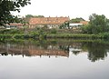
 Cottages on the south bank of the Tees - geograph.org.uk - 5616169.jpg 4,320 × 2,681; 1.98 MB
-
 County Durham south of the River Tees - geograph.org.uk - 2389670.jpg 1,436 × 1,120; 527 KB
-
 Derelict Farm Barn, Thorpe Farm Centre - geograph.org.uk - 2484854.jpg 1,024 × 768; 363 KB
-
 Detail of south wall, St Mary's church - geograph.org.uk - 5615980.jpg 4,320 × 3,240; 4.52 MB
-
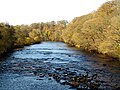
 Downstream from Whorlton Bridge - geograph.org.uk - 5604194.jpg 4,320 × 3,240; 5.02 MB
-
 Downstream River Tees, Whorlton Bridge (1971) - geograph.org.uk - 5906904.jpg 4,319 × 2,723; 1.89 MB
-
 Drunken barn - geograph.org.uk - 1702237.jpg 640 × 550; 119 KB
-
 Entrance for footpath to Wycliffe - geograph.org.uk - 2859534.jpg 3,648 × 2,736; 3.62 MB
-
 Fallen tree stump on edge of Green Lane - geograph.org.uk - 2270591.jpg 3,200 × 3,000; 1.84 MB
-
 Farm track off the A66 - geograph.org.uk - 3114542.jpg 640 × 430; 38 KB
-
 Farmland above Peg Beck - geograph.org.uk - 6405497.jpg 1,932 × 1,449; 1.03 MB
-
 Farmland at Thorpe - geograph.org.uk - 6404902.jpg 1,600 × 1,200; 523 KB
-
 Farmland by the A66 - geograph.org.uk - 3114537.jpg 640 × 430; 28 KB
-
 Farmland north-east of Little Hutton - geograph.org.uk - 5311103.jpg 1,024 × 768; 171 KB
-
 Farmland on the south side of Little Hutton Lane - geograph.org.uk - 5311104.jpg 1,024 × 768; 156 KB
-
 Farmland south of Girlington Hall - geograph.org.uk - 5310279.jpg 1,024 × 615; 132 KB
-
 Farmland south of Wycliffe Hall - geograph.org.uk - 2859503.jpg 3,648 × 2,736; 1.66 MB
-
 Farmland, near Greta Bridge - geograph.org.uk - 91053.jpg 640 × 480; 117 KB
-
 Field and hedgerow - geograph.org.uk - 3956004.jpg 640 × 480; 134 KB
-
 Field of oilseed rape alongside Green Lane - geograph.org.uk - 5762332.jpg 1,024 × 768; 277 KB
-

-
 Field west of Southorpe Farm - geograph.org.uk - 6404815.jpg 1,830 × 1,372; 957 KB
-
 Fields north-east of Thorpe Grange - geograph.org.uk - 3272764.jpg 2,592 × 1,944; 1.99 MB
-
 Fish Pond Plantation, from the east - geograph.org.uk - 6405570.jpg 1,600 × 1,200; 634 KB
-
 Footbridge over Main Stell - geograph.org.uk - 2860335.jpg 3,648 × 2,736; 4.59 MB
-
 Freshly ploughed field - geograph.org.uk - 3956002.jpg 640 × 480; 142 KB
-
 Gated driveway to Wycliffe Hall - geograph.org.uk - 1743288.jpg 640 × 480; 63 KB
-

-
 Girlington - geograph.org.uk - 2583392.jpg 3,888 × 2,592; 1.13 MB
-
 Girlington Bank north of Hutton Magna - geograph.org.uk - 2860344.jpg 3,648 × 2,736; 2.28 MB
-
 Graft's Farm - geograph.org.uk - 2583375.jpg 3,564 × 2,364; 1.71 MB
-
 Ha-ha at Wycliffe Hall - geograph.org.uk - 2859525.jpg 3,648 × 2,736; 2.01 MB
-
 Lido swimming pool, River Tees (1971) - geograph.org.uk - 5906894.jpg 4,199 × 2,574; 2.17 MB
-

-

-

-
 Looking westwards to trees at Bartle Gate - geograph.org.uk - 5311092.jpg 1,024 × 768; 187 KB
-
 Miniature Railway at Whorlton Lido (1971) - geograph.org.uk - 5906880.jpg 4,320 × 2,727; 1.94 MB
-
 Mud alert^ - geograph.org.uk - 5631516.jpg 3,240 × 4,320; 2.74 MB
-
 Nave and chancel, St Mary's church - geograph.org.uk - 5615987.jpg 3,153 × 4,203; 2.03 MB
-
 New Plantation, Wycliffe - geograph.org.uk - 5310290.jpg 1,024 × 768; 114 KB
-
 New pond, Thorp Farm - geograph.org.uk - 1566178.jpg 640 × 489; 108 KB
-
 Northern entrance to Hutton Magna - geograph.org.uk - 2389757.jpg 1,617 × 1,168; 636 KB
-
 One mile to Hutton Magna - geograph.org.uk - 6405483.jpg 1,600 × 1,200; 806 KB
-
 Ovington and River Tees, aerial 2018 - geograph.org.uk - 5906705.jpg 800 × 533; 86 KB
-
 Path through Crow Gill - geograph.org.uk - 5631524.jpg 3,240 × 4,320; 5.02 MB
-
 Path to access land - geograph.org.uk - 1566232.jpg 640 × 550; 136 KB
-
 Peg Beck - geograph.org.uk - 2583382.jpg 2,382 × 3,718; 1.87 MB
-
 Pipeline crossing Peg Beck, east of Wycliffe - geograph.org.uk - 6405566.jpg 1,600 × 1,200; 850 KB
-
 Pond in Little Biltons Plantation - geograph.org.uk - 2860569.jpg 3,648 × 2,736; 1.97 MB
-
 Quarry junction, Hutton Magna - geograph.org.uk - 2389725.jpg 1,824 × 1,368; 780 KB
-
 Rhubarb Cottage - geograph.org.uk - 1467876.jpg 640 × 480; 83 KB
-
 Rhubarb Cottage - geograph.org.uk - 1584862.jpg 640 × 374; 64 KB
-
 River Tees at Whorlton (1971) - geograph.org.uk - 5907951.jpg 4,320 × 2,716; 1.81 MB
-
 River Tees at Whorlton, aerial 2018 - geograph.org.uk - 5906612.jpg 800 × 533; 102 KB
-

-
 River Tees near Winston, Aerial 2018 - geograph.org.uk - 5906700.jpg 683 × 1,024; 134 KB
-
 River Tees swimming area at Whorlton Lido in 2001 - geograph.org.uk - 2560986.jpg 1,772 × 1,170; 604 KB
-
 Riverside Cottages at Wycliffe - geograph.org.uk - 3616625.jpg 3,502 × 2,528; 2.13 MB
-
 Road heading east at Wycliffe Grange - geograph.org.uk - 6405463.jpg 1,600 × 1,200; 471 KB
-
 Road heading west to Thorpe - geograph.org.uk - 6405478.jpg 1,520 × 1,140; 783 KB
-
 Roadside tree, Little Hutton Lane - geograph.org.uk - 5310335.jpg 1,024 × 768; 157 KB
-
 Roadside tree, Thorpe - geograph.org.uk - 6404835.jpg 2,116 × 1,587; 1.04 MB
-
 Signpost at Bartle Gate - geograph.org.uk - 3956000.jpg 640 × 480; 153 KB
-
 Small beck near Wycliffe Hall - geograph.org.uk - 5631508.jpg 3,240 × 4,320; 3.16 MB
-

-
 Southorpe Farm, Thorpe - geograph.org.uk - 6404828.jpg 1,600 × 1,200; 645 KB
-
 St Mary's Catholic Church, from the east - geograph.org.uk - 5310308.jpg 1,024 × 768; 147 KB
-

-

-

-
 St. Mary's church, Wycliffe, nave ceiling - geograph.org.uk - 5767723.jpg 1,024 × 768; 152 KB
-
 St.Mary's church, Wycliffe - geograph.org.uk - 5767210.jpg 1,024 × 768; 231 KB
-
 Stile for footpath to Ovington - geograph.org.uk - 2859492.jpg 3,648 × 2,736; 3.94 MB
-
 Teesdale Way at West Thorpe - geograph.org.uk - 1570134.jpg 640 × 480; 92 KB
-
 The end of the road at Wycliffe - geograph.org.uk - 5767183.jpg 1,024 × 768; 325 KB
-
 The north side of St. Mary's church, Wycliffe - geograph.org.uk - 5767730.jpg 1,024 × 768; 190 KB
-
 The rear of the Old Rectory, Wycliffe (geograph 5767726).jpg 1,024 × 768; 197 KB
-
 The River Tees at Whorlton Lido in 2000 - geograph.org.uk - 2316508.jpg 1,744 × 1,144; 413 KB
-
 The River Tees at Wycliffe - geograph.org.uk - 5767234.jpg 1,024 × 768; 303 KB
-
 The River Tees below Whorlton Banks - geograph.org.uk - 5763366.jpg 1,024 × 768; 342 KB
-
 The River Tees below Whorlton Bridge - geograph.org.uk - 5763375.jpg 1,024 × 768; 221 KB
-
 The road from Thorpe and Wycliffe crossing Peg Beck - geograph.org.uk - 6405493.jpg 1,600 × 1,200; 645 KB
-
 The road from Thorpe to Whorlton - geograph.org.uk - 6405435.jpg 1,600 × 1,200; 596 KB
-
 The road from Thorpe to Wycliffe - geograph.org.uk - 6404923.jpg 1,600 × 1,200; 538 KB
-
 The road through Thorpe - geograph.org.uk - 6404826.jpg 1,600 × 1,200; 574 KB
-
 The road to Van Dieman's Land (and Thorpe) - geograph.org.uk - 6404809.jpg 1,600 × 1,200; 291 KB
-
 The Vicarage, Hutton Magna - geograph.org.uk - 2389735.jpg 1,824 × 1,368; 798 KB
-
 Thorpe Farm - geograph.org.uk - 1584864.jpg 640 × 353; 49 KB
-
 Thorpe Farm near Greta Bridge - geograph.org.uk - 2808124.jpg 640 × 423; 38 KB
-
 Thorpe Hall and Gardens - geograph.org.uk - 1413949.jpg 640 × 427; 94 KB
-
 Track north of Thorp Farm - geograph.org.uk - 1566206.jpg 480 × 640; 109 KB
-
 Tree shadows on Thorpe farmland - geograph.org.uk - 6405440.jpg 1,600 × 1,200; 537 KB
-
 Tree sheltering the Glebe, Thorpe - geograph.org.uk - 6404907.jpg 1,503 × 1,127; 607 KB
-
 Trees on a field boundary, north of Hutton Magna - geograph.org.uk - 5310318.jpg 1,024 × 768; 154 KB
-
 Triangle of woodland, south of Bartle Gate - geograph.org.uk - 5311095.jpg 1,024 × 768; 170 KB
-
 Uncultivated land between two fields - geograph.org.uk - 6404818.jpg 1,600 × 1,200; 744 KB
-
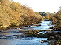
 Upstream from Whorlton Bridge - geograph.org.uk - 5604195.jpg 4,320 × 3,240; 4.97 MB
-
 Van Dieman's Land, UK - geograph.org.uk - 1584863.jpg 640 × 480; 105 KB
-
 View across River Tees, Whorlton Bridge (1971) - geograph.org.uk - 5906859.jpg 4,318 × 2,729; 2.19 MB
-
 West Middleton Farm at Hutton Magna - geograph.org.uk - 2856546.jpg 3,648 × 2,736; 2.27 MB
-
 West Thorpe - geograph.org.uk - 1570126.jpg 640 × 480; 88 KB
-
 West window, St. Mary's Catholic Mission Church - geograph.org.uk - 4890641.jpg 824 × 1,024; 155 KB
-
 Wheat field off Green Lane near Hutton Magna - geograph.org.uk - 5767114.jpg 1,024 × 768; 210 KB
-
 Whorlton Bridge - geograph.org.uk - 2583360.jpg 3,660 × 2,543; 2.06 MB
-
 Whorlton Bridge - geograph.org.uk - 5763390.jpg 1,024 × 768; 211 KB
-
 Whorlton Bridge is closed to vehicles - geograph.org.uk - 6405428.jpg 1,600 × 900; 288 KB
-
 Woodland alongside Main Stell - geograph.org.uk - 6404823.jpg 1,532 × 1,148; 685 KB
-
 Wycliffe - geograph.org.uk - 2583365.jpg 3,718 × 2,065; 1.08 MB
-
 Wycliffe - geograph.org.uk - 2583367.jpg 3,823 × 2,518; 1.74 MB
-
 Wycliffe - geograph.org.uk - 2583378.jpg 2,509 × 3,176; 1.62 MB
-
 Wycliffe Grange, Wycliffe, from the east - geograph.org.uk - 6405468.jpg 1,600 × 1,200; 531 KB
-
 Wycliffe Hall, Wycliffe, Teesdale - geograph.org.uk - 5906820.jpg 4,318 × 2,204; 1.85 MB
-
 Wycliffe, Detached house where the road comes to an end - geograph.org.uk - 6234618.jpg 6,509 × 4,339; 7.39 MB
-

-

-

-

-

-
 Wycliffe, St. Mary's Church, Southern aspect - geograph.org.uk - 6234594.jpg 6,524 × 4,349; 6.72 MB
-
 Wycliffe, St. Mary's Church, Southern aspect - geograph.org.uk - 6234597.jpg 6,428 × 4,285; 7.75 MB
-
 Wycliffe, St. Mary's Church, Stained glass window - geograph.org.uk - 6234671.jpg 5,536 × 3,691; 4.49 MB
-
 Wycliffe, St. Mary's Church, The chancel - geograph.org.uk - 6234634.jpg 6,164 × 4,109; 5.09 MB
-
 Wycliffe, St. Mary's Church, The chancel - geograph.org.uk - 6234654.jpg 6,893 × 4,595; 7.42 MB
-
 Wycliffe, St. Mary's Church, The font (detail) 1 - geograph.org.uk - 6234624.jpg 6,675 × 4,450; 5.7 MB
-
 Wycliffe, St. Mary's Church, The font (detail) 2 - geograph.org.uk - 6234625.jpg 5,958 × 3,972; 4.84 MB
-
 Wycliffe, St. Mary's Church, The font (detail) 3 - geograph.org.uk - 6234631.jpg 7,424 × 4,949; 7.67 MB
-
 Wycliffe, St. Mary's Church, The font (detail) 4 - geograph.org.uk - 6234661.jpg 6,738 × 4,491; 6.98 MB
-
 Wycliffe, St. Mary's Church, The font (detail) 5 - geograph.org.uk - 6234662.jpg 6,871 × 4,581; 6.07 MB
-
 Wycliffe, St. Mary's Church, The font (detail) 6 - geograph.org.uk - 6234666.jpg 6,305 × 4,203; 7.05 MB
-
 Wycliffe, St. Mary's Church, The font - geograph.org.uk - 6234621.jpg 6,648 × 4,432; 6.16 MB
-
 Wycliffe, St. Mary's Church, The font - geograph.org.uk - 6234657.jpg 6,385 × 4,256; 5.49 MB
-
 Wycliffe, St. Mary's Church, The nave - geograph.org.uk - 6234645.jpg 6,443 × 4,294; 7.24 MB
-
 Wycliffe, St. Mary's Church, Wall mounted memorial - geograph.org.uk - 6234669.jpg 6,209 × 4,140; 7.24 MB
-
 Wycliffe, Track to St. Mary's Church 1 - geograph.org.uk - 6234608.jpg 5,551 × 3,700; 6.73 MB
-
 Wycliffe, Track to St. Mary's Church 2 - geograph.org.uk - 6234609.jpg 6,490 × 4,327; 7.49 MB


_-_geograph.org.uk_-_5906904.jpg)


_-_geograph.org.uk_-_5906894.jpg)


_-_geograph.org.uk_-_5906880.jpg)


_-_geograph.org.uk_-_5907951.jpg)


.jpg)


_-_geograph.org.uk_-_6404809.jpg)


_-_geograph.org.uk_-_5906859.jpg)


_brass_of_1606_-_geograph.org.uk_-_6234677.jpg)


_1_-_geograph.org.uk_-_6234624.jpg)
_2_-_geograph.org.uk_-_6234625.jpg)
_3_-_geograph.org.uk_-_6234631.jpg)
_4_-_geograph.org.uk_-_6234661.jpg)
_5_-_geograph.org.uk_-_6234662.jpg)
_6_-_geograph.org.uk_-_6234666.jpg)


