Category:Wraxall and Failand
Jump to navigation
Jump to search
English: Wraxall and Failand is a civil parish in the North Somerset district, in the county of Somerset, England.
civil parish in Somerset, England  | |||||
| Upload media | |||||
| Instance of | |||||
|---|---|---|---|---|---|
| Location | North Somerset, Somerset, South West England, England | ||||
| Population |
| ||||
 | |||||
Subcategories
This category has the following 4 subcategories, out of 4 total.
Media in category "Wraxall and Failand"
The following 200 files are in this category, out of 533 total.
(previous page) (next page)-
 A bathing pond in the middle of a field - geograph.org.uk - 6353461.jpg 3,296 × 2,472; 3.47 MB
-
 A Berntsen benchmark - geograph.org.uk - 2528245.jpg 2,304 × 1,704; 1.73 MB
-
 A damaged stump - geograph.org.uk - 6146553.jpg 3,296 × 2,472; 3.44 MB
-
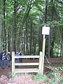
 A footbridge with an unusual gate - geograph.org.uk - 6353442.jpg 2,472 × 3,296; 3.2 MB
-
 A ford on Sandy Lane - geograph.org.uk - 6146574.jpg 3,296 × 2,472; 3.3 MB
-
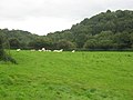 A grassy coombe with grazing cattle - geograph.org.uk - 2086299.jpg 3,072 × 2,304; 2.84 MB
-
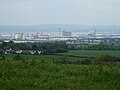 A haze of industry - geograph.org.uk - 6146583.jpg 3,296 × 2,472; 3.25 MB
-
 A late arrival at church - geograph.org.uk - 6146658.jpg 2,472 × 3,296; 3.48 MB
-
 A line of hedge on the earthworks - geograph.org.uk - 6353423.jpg 3,296 × 2,472; 3.64 MB
-
 A little Shetland at the zoo - geograph.org.uk - 6353429.jpg 3,296 × 2,472; 3.59 MB
-
 A short walk up to the church - geograph.org.uk - 6146598.jpg 2,472 × 3,296; 3.21 MB
-
 A stile stumps a gate - geograph.org.uk - 6353464.jpg 3,296 × 2,472; 3.53 MB
-
 A turn-stile^ - geograph.org.uk - 6353446.jpg 2,472 × 3,296; 3.43 MB
-
 A wet approach to Mulberry Farm - geograph.org.uk - 6146577.jpg 3,296 × 2,472; 3.36 MB
-
 A woodland path through Alder Bed Wood - geograph.org.uk - 6146557.jpg 3,296 × 2,472; 3.56 MB
-
 Abandoned farmhouse - geograph.org.uk - 1631700.jpg 640 × 480; 136 KB
-
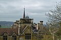
 All Saints Church, Wraxall - geograph.org.uk - 6413740.jpg 1,024 × 768; 166 KB
-
 All Saints, Wraxall, banner (a) - geograph.org.uk - 5476782.jpg 480 × 640; 58 KB
-
 All Saints, Wraxall, banner (b) - geograph.org.uk - 5476783.jpg 480 × 640; 53 KB
-
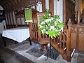
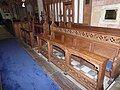 All Saints, Wraxall, choir stalls - geograph.org.uk - 5476850.jpg 640 × 480; 82 KB
-
 All Saints, Wraxall, churchyard (a) - geograph.org.uk - 5476202.jpg 640 × 480; 75 KB
-
 All Saints, Wraxall, churchyard (b) - geograph.org.uk - 5476772.jpg 640 × 480; 78 KB
-
 All Saints, Wraxall, churchyard (c) - geograph.org.uk - 5476773.jpg 640 × 480; 105 KB
-
 All Saints, Wraxall, churchyard (d) - geograph.org.uk - 5476775.jpg 640 × 480; 63 KB
-
 All Saints, Wraxall, churchyard (e) - geograph.org.uk - 5476778.jpg 480 × 640; 60 KB
-
 All Saints, Wraxall, font - geograph.org.uk - 5476781.jpg 480 × 640; 52 KB
-
 All Saints, Wraxall, lectern - geograph.org.uk - 5476846.jpg 480 × 640; 74 KB
-
 All Saints, Wraxall, main altar - geograph.org.uk - 5476848.jpg 640 × 480; 81 KB
-
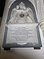 All Saints, Wraxall, memorial (a) - geograph.org.uk - 5476784.jpg 480 × 640; 54 KB
-
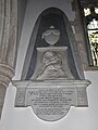
 All Saints, Wraxall, memorial (b) - geograph.org.uk - 5476786.jpg 640 × 480; 62 KB
-
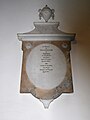
 All Saints, Wraxall, memorial (c) - geograph.org.uk - 5476788.jpg 640 × 480; 84 KB
-
 All Saints, Wraxall, memorial (d) - geograph.org.uk - 5476791.jpg 640 × 480; 50 KB
-
 All Saints, Wraxall, memorial (e) - geograph.org.uk - 5476790.jpg 640 × 480; 47 KB
-
 All Saints, Wraxall, memorial (f) - geograph.org.uk - 5476793.jpg 480 × 640; 56 KB
-
 All Saints, Wraxall, memorial (g) - geograph.org.uk - 5476794.jpg 480 × 640; 31 KB
-
 All Saints, Wraxall, memorial (h) - geograph.org.uk - 5476795.jpg 640 × 480; 55 KB
-
 All Saints, Wraxall, memorial (i) - geograph.org.uk - 5476798.jpg 640 × 480; 54 KB
-
 All Saints, Wraxall, memorial (j) - geograph.org.uk - 5476803.jpg 640 × 480; 47 KB
-
 All Saints, Wraxall, memorial (k) - geograph.org.uk - 5476804.jpg 640 × 480; 39 KB
-
 All Saints, Wraxall, memorial (l) - geograph.org.uk - 5476806.jpg 640 × 480; 65 KB
-
 All Saints, Wraxall, memorial (m) - geograph.org.uk - 5476808.jpg 480 × 640; 37 KB
-
 All Saints, Wraxall, memorial (n) - geograph.org.uk - 5476809.jpg 480 × 640; 49 KB
-
 All Saints, Wraxall, memorial (o) - geograph.org.uk - 5476810.jpg 480 × 640; 63 KB
-
 All Saints, Wraxall, memorial (p) - geograph.org.uk - 5476811.jpg 640 × 480; 82 KB
-
 All Saints, Wraxall, memorial (q) - geograph.org.uk - 5476826.jpg 480 × 640; 61 KB
-
 All Saints, Wraxall, memorial (r) - geograph.org.uk - 5476827.jpg 640 × 557; 59 KB
-
 All Saints, Wraxall, memorial (s) - geograph.org.uk - 5476829.jpg 640 × 480; 51 KB
-
 All Saints, Wraxall, memorial (t) - geograph.org.uk - 5476830.jpg 640 × 518; 53 KB
-
 All Saints, Wraxall, memorial (u) - geograph.org.uk - 5476833.jpg 640 × 526; 74 KB
-
 All Saints, Wraxall, memorial (v) - geograph.org.uk - 5476834.jpg 640 × 480; 52 KB
-
 All Saints, Wraxall, memorial (w) - geograph.org.uk - 5476835.jpg 640 × 585; 64 KB
-
 All Saints, Wraxall, memorial (x) - geograph.org.uk - 5476837.jpg 640 × 480; 52 KB
-
 All Saints, Wraxall, memorial (y) - geograph.org.uk - 5476838.jpg 640 × 480; 43 KB
-
 All Saints, Wraxall, memorial (z) - geograph.org.uk - 5476840.jpg 640 × 480; 58 KB
-

-
 All Saints, Wraxall, pulpit - geograph.org.uk - 5476847.jpg 640 × 480; 91 KB
-
 All Saints, Wraxall, side altar - geograph.org.uk - 5476849.jpg 640 × 637; 104 KB
-
-

-

-

-
-
 All Saints, Wraxall, summer 2017 - geograph.org.uk - 5444542.jpg 640 × 480; 66 KB
-
 An island of trees - geograph.org.uk - 6353408.jpg 3,296 × 2,472; 2.64 MB
-
 An isolated picnic bench - geograph.org.uk - 6352988.jpg 3,296 × 2,472; 3.24 MB
-
 An isolated stretch of dilapidated boundary fence - geograph.org.uk - 6549553.jpg 1,600 × 1,200; 1.24 MB
-
 An issue along Sandy Lane - geograph.org.uk - 6146581.jpg 2,472 × 3,296; 3.13 MB
-
 An old path re-routed - geograph.org.uk - 6353437.jpg 2,472 × 3,296; 3.29 MB
-
 Any which way but straight to the farm - geograph.org.uk - 6353406.jpg 3,296 × 2,472; 3.29 MB
-
 Approach to Tyntesfield House - geograph.org.uk - 4990480.jpg 800 × 600; 195 KB
-
 Approaching the turning to Portbury - geograph.org.uk - 2938609.jpg 1,024 × 769; 219 KB
-
 Approaching Tyntesfield - geograph.org.uk - 6156269.jpg 5,472 × 3,648; 5.85 MB
-
 Are you coming in or will you let us out^ - geograph.org.uk - 6145744.jpg 3,296 × 2,472; 3.37 MB
-
 Avenue heading to old (drained) boating lake, Tyntesfield - geograph.org.uk - 5524031.jpg 5,179 × 3,451; 5.28 MB
-
 B3129 at Belmont Hill - geograph.org.uk - 6407303.jpg 800 × 601; 124 KB
-
 B3129 near Belmont Farm - geograph.org.uk - 2938117.jpg 1,024 × 769; 152 KB
-
 B3129 to Failand - geograph.org.uk - 5520992.jpg 5,179 × 3,451; 5.84 MB
-
 B3130 Bristol Road (or Clevedon Road) - geograph.org.uk - 5065473.jpg 1,600 × 1,201; 782 KB
-
 Baby emu feeling a little hen-pecked^ - geograph.org.uk - 1348637.jpg 480 × 640; 137 KB
-
 Barns at Tyntesfield - geograph.org.uk - 4158841.jpg 5,723 × 3,816; 5.3 MB
-
 Bathing Pond (Disused) - geograph.org.uk - 3073001.jpg 2,000 × 1,496; 362 KB
-
 Battered benchmark on Sandy Lane - geograph.org.uk - 6146623.jpg 3,296 × 2,472; 3.43 MB
-
 Belmont Hill - geograph.org.uk - 1886871.jpg 640 × 480; 95 KB
-
 Belmont Hill - geograph.org.uk - 5065453.jpg 1,600 × 1,200; 840 KB
-
 Benchmark near Tyntesfield walled garden - geograph.org.uk - 5562941.jpg 1,600 × 1,200; 581 KB
-
 Benchmark on lodge - geograph.org.uk - 5562930.jpg 1,600 × 1,219; 1.15 MB
-
 Benchmark on Tyntesfield Lodge - geograph.org.uk - 6293763.jpg 960 × 1,280; 575 KB
-
 Berntsen benchmark in front of the gates - geograph.org.uk - 2528248.jpg 2,304 × 1,704; 1.67 MB
-
 Bluebells in the trees - geograph.org.uk - 2371245.jpg 3,648 × 2,736; 7 MB
-
 Boats in a dried up lake - geograph.org.uk - 4990340.jpg 800 × 531; 136 KB
-

-
 Breach Wood - geograph.org.uk - 2085719.jpg 3,072 × 2,304; 4.26 MB
-
 Bridleway to South Lodge - geograph.org.uk - 6586299.jpg 1,024 × 768; 227 KB
-
 Bridleway to Truckle Wood - geograph.org.uk - 6586290.jpg 1,024 × 768; 208 KB
-
 Bristol and Clifton Golf Club - geograph.org.uk - 2473978.jpg 640 × 480; 74 KB
-
 Broad Walk, pleasure grounds, Tyntesfield - geograph.org.uk - 5524053.jpg 5,179 × 3,451; 5.1 MB
-
 Broadleaf trees in Tyntesfield Park - geograph.org.uk - 2301131.jpg 3,072 × 2,048; 1.09 MB
-
 Bullocks Bottom - geograph.org.uk - 2085744.jpg 3,072 × 2,304; 4.39 MB
-
 Bus stop by Lower Lodge - geograph.org.uk - 2938115.jpg 1,024 × 701; 192 KB
-
 Bus stops on B3128 outside Tyntesfield - geograph.org.uk - 5065415.jpg 1,600 × 1,200; 831 KB
-
 Café seating at Tyntesfield - geograph.org.uk - 4158848.jpg 6,000 × 4,000; 7 MB
-
 Car Park, Tyntesfield - geograph.org.uk - 5050602.jpg 4,896 × 3,672; 6.08 MB
-
 Cedar in front of Tyntesfield House - geograph.org.uk - 5065405.jpg 1,600 × 1,200; 881 KB
-
 Central path, kitchen garden, Tyntesfield - geograph.org.uk - 5523540.jpg 5,179 × 3,451; 5.41 MB
-
 Chaplain's House and Lodge, Tyntesfield - geograph.org.uk - 5065362.jpg 1,600 × 1,200; 939 KB
-
 Chaplain's House, Tyntesfield (geograph 7468883).jpg 4,080 × 3,060; 5.41 MB
-
 Chaplain's house, Tyntesfield - geograph.org.uk - 2423844.jpg 640 × 449; 83 KB
-
 Chaplain's Lodge, Tyntesfield - geograph.org.uk - 6179258.jpg 5,048 × 3,366; 5.12 MB
-
 Charlton Drive-the road to the Downs School - geograph.org.uk - 2085691.jpg 3,072 × 2,304; 4.64 MB
-
 Charlton Farm Children's Hospice - geograph.org.uk - 3073034.jpg 2,000 × 1,497; 308 KB
-
 Church Lodge, All Saints, Wraxall - geograph.org.uk - 6413747.jpg 1,024 × 768; 184 KB
-
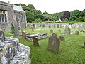
 Churchyard, All Saints, Wraxall - geograph.org.uk - 6413744.jpg 1,024 × 768; 213 KB
-
 Clear cut benchmark - geograph.org.uk - 5562945.jpg 1,600 × 1,200; 1,013 KB
-
 Clevedon Road, looking west - geograph.org.uk - 3429379.jpg 1,142 × 857; 441 KB
-
 Clifton Lodge - geograph.org.uk - 6090471.jpg 2,048 × 1,536; 926 KB
-
 Close to a bow - geograph.org.uk - 6352977.jpg 3,296 × 2,472; 3.6 MB
-
 Copse isolated from surrounding woodland - geograph.org.uk - 6549544.jpg 1,600 × 1,200; 825 KB
-
 Cottages nestling in woodland - geograph.org.uk - 2086322.jpg 3,072 × 2,304; 3.88 MB
-
 Course of gas pipeline - geograph.org.uk - 3072973.jpg 2,000 × 1,489; 443 KB
-
 Cow Barn Café - geograph.org.uk - 4158859.jpg 5,195 × 3,638; 4.64 MB
-
 Cuckoo Lane - geograph.org.uk - 4081824.jpg 800 × 531; 148 KB
-
 Dams at the top of Bullock's Bottom - geograph.org.uk - 6352985.jpg 3,296 × 2,472; 3.39 MB
-

-
 Derelict farmhouse - geograph.org.uk - 3073278.jpg 2,000 × 1,455; 539 KB
-
 Dew Pond - Sheep Dip - geograph.org.uk - 2085789.jpg 3,072 × 2,304; 3.92 MB
-
 Down Whitehouse Lane - geograph.org.uk - 3432940.jpg 1,142 × 857; 374 KB
-
 Downs School cricket pavilion - geograph.org.uk - 6353453.jpg 3,296 × 2,472; 3.49 MB
-
 Downs School grounds - geograph.org.uk - 6353455.jpg 3,296 × 2,472; 3.41 MB
-
 Dried up boating lake, Tyntesfield - geograph.org.uk - 4990795.jpg 800 × 600; 137 KB
-
 Driveway, Court Farm - geograph.org.uk - 6413757.jpg 1,024 × 768; 292 KB
-
 Driveway, Little Wain Wells - geograph.org.uk - 6413531.jpg 1,024 × 768; 160 KB
-
 Earthworks around Moat Cottages - geograph.org.uk - 6353432.jpg 3,296 × 2,472; 3.82 MB
-
 Eastern doorway to kitchen garden, Tyntesfield - geograph.org.uk - 5523316.jpg 5,179 × 3,451; 5.13 MB
-
 Elm Lodge Road - geograph.org.uk - 6414664.jpg 1,024 × 768; 151 KB
-
 Entering Wraxall (geograph 7462135).jpg 4,288 × 2,848; 2.09 MB
-
 Entrance drive - Bristol ^ Clifton Golf Club - geograph.org.uk - 2395592.jpg 3,717 × 2,733; 3.58 MB
-
 Entrance to Mulberry Farm - geograph.org.uk - 6146626.jpg 3,296 × 2,472; 3.26 MB
-
 Entrance to Noah's Ark Farm - geograph.org.uk - 6353427.jpg 3,296 × 2,472; 3.22 MB
-
 Equestrian facilities with donkeys and llamas - geograph.org.uk - 2085709.jpg 3,072 × 2,304; 3.75 MB
-
 Estate greenhouse - geograph.org.uk - 4160632.jpg 5,796 × 3,864; 6.14 MB
-
 Even the path timber is not exempt - geograph.org.uk - 6353392.jpg 3,296 × 2,472; 3.41 MB
-
 Failand Lane - geograph.org.uk - 2479388.jpg 640 × 480; 82 KB
-
 Farmland off Whitehouse Lane - geograph.org.uk - 3429375.jpg 1,142 × 857; 379 KB
-
 Farmland west of Moat House Farm - geograph.org.uk - 3432938.jpg 1,142 × 857; 378 KB
-
 Field edge boundary - geograph.org.uk - 2086291.jpg 3,072 × 2,304; 3.6 MB
-
 Field edge boundary between Priors Wood and Moat Farm - geograph.org.uk - 2085753.jpg 3,072 × 2,304; 3.2 MB
-
 Field edge boundary South of Priors Wood - geograph.org.uk - 2085730.jpg 3,072 × 2,304; 2.69 MB
-
 Field, Tyntesfield - geograph.org.uk - 5659518.jpg 1,024 × 683; 396 KB
-
 First floor turret, Tyntesfield House - geograph.org.uk - 4990332.jpg 531 × 800; 126 KB
-
 Flower bed at Tyntesfield - geograph.org.uk - 5135344.jpg 4,436 × 3,425; 5.05 MB
-
 Flowerbed at Tyntesfield - geograph.org.uk - 4990406.jpg 800 × 531; 200 KB
-
 Footpath and stile at the entrance to Priors Wood - geograph.org.uk - 2086360.jpg 2,304 × 3,072; 3.51 MB
-
 Footpath beside Mogg's Wood - geograph.org.uk - 4081820.jpg 800 × 531; 158 KB
-
 Footpath through Sidelands - geograph.org.uk - 2597669.jpg 1,024 × 680; 327 KB
-
 Footpath to Windmill Hill - geograph.org.uk - 3073270.jpg 2,000 × 1,492; 471 KB
-
 Footpath towards Briery Wood - geograph.org.uk - 3072977.jpg 2,000 × 1,503; 306 KB
-
 Footpath towards Windmill Hill - geograph.org.uk - 3072885.jpg 2,000 × 1,506; 323 KB
-
 Formal garden at Tyntesfield - geograph.org.uk - 5713193.jpg 480 × 640; 94 KB
-
 Former boating lake, Tyntesfield - geograph.org.uk - 6179292.jpg 5,179 × 3,451; 6.03 MB
-
 Former farm building, Tyntesfield - geograph.org.uk - 5050597.jpg 4,896 × 3,672; 5.73 MB
-
 Former pump house at Charlton Farm - geograph.org.uk - 2086373.jpg 2,304 × 3,072; 2.83 MB
-
 Garden Tyntesfield House - geograph.org.uk - 5370242.jpg 4,000 × 3,000; 4.86 MB
-
 Garden Tyntesfield House - geograph.org.uk - 5370244.jpg 4,000 × 3,000; 4.93 MB
-
 Gardens, Tyntesfield House - geograph.org.uk - 5659520.jpg 1,024 × 683; 458 KB
-
 Gibbs family portraits at Tyntesfield - geograph.org.uk - 4744185.jpg 1,824 × 1,368; 674 KB
-
 Gothic skyline - geograph.org.uk - 5660251.jpg 1,024 × 683; 321 KB
-

-

-
 Grazing meadow with old oak tree - geograph.org.uk - 2085544.jpg 3,072 × 2,304; 3.6 MB
-
 Greenhouses, Tyntesfield - geograph.org.uk - 5050046.jpg 4,896 × 3,672; 5.13 MB
-
 Greenhouses, Tyntesfield - geograph.org.uk - 6178119.jpg 5,179 × 3,451; 4.56 MB
-
 Ha-ha between garden and park, Tyntesfield - geograph.org.uk - 5065400.jpg 1,600 × 1,200; 725 KB
-
 Heading towards Wraxall - geograph.org.uk - 2938110.jpg 1,024 × 769; 177 KB
-
 Highfield House - geograph.org.uk - 6413754.jpg 1,024 × 768; 315 KB
-

-
 Home Farm Tyntesfield - geograph.org.uk - 5370198.jpg 3,520 × 2,640; 6.37 MB
-
-
 Home Farm yard Tyntesfield - geograph.org.uk - 5370193.jpg 1,600 × 1,200; 654 KB
-
 Home Farm, Tyntefield - geograph.org.uk - 4990305.jpg 1,024 × 680; 338 KB
-
 Home Farm, Tyntesfield - geograph.org.uk - 4158869.jpg 5,275 × 3,630; 5.78 MB
-
 Home Farm, Tyntesfield - geograph.org.uk - 4990438.jpg 800 × 531; 145 KB
-
 Home Farm, Tyntesfield - geograph.org.uk - 5050594.jpg 4,896 × 3,672; 5.95 MB
-
 Home Farm, Tyntesfield - geograph.org.uk - 5135354.jpg 4,160 × 3,120; 3.47 MB
-
 Hothouse 1 - geograph.org.uk - 4161411.jpg 5,298 × 3,628; 6.54 MB
-
 Hothouse 2 - geograph.org.uk - 4161414.jpg 6,000 × 4,000; 6.1 MB
-
 Hothouse 3 - geograph.org.uk - 4161416.jpg 5,450 × 3,739; 5.8 MB
-
 Hothouse 4 - geograph.org.uk - 4161417.jpg 5,360 × 3,520; 5.51 MB
-
 Hothouse 5 - geograph.org.uk - 4161418.jpg 5,906 × 3,938; 7.18 MB
-
 House at Main Entrance to Tyntesfield - geograph.org.uk - 5050608.jpg 4,896 × 3,672; 6.03 MB
-
 House at the bottom end of Sandy Lane - geograph.org.uk - 2086330.jpg 3,072 × 2,304; 4.16 MB
-
 House in grounds at Tyntesfield - geograph.org.uk - 5050076.jpg 4,896 × 3,672; 5.72 MB
-
 House on edge of Tyntesfield Estate - geograph.org.uk - 6179446.jpg 5,243 × 3,545; 4.39 MB
-
 House on Failand Lane - geograph.org.uk - 2479393.jpg 640 × 480; 88 KB
-
 House, Tyntesfield Park - geograph.org.uk - 5523584.jpg 5,184 × 3,456; 5.64 MB
-
 Houses below Longwood - geograph.org.uk - 6413522.jpg 1,024 × 768; 330 KB
-
 Ice Risk - geograph.org.uk - 6194454.jpg 4,032 × 1,908; 4.47 MB
-
 Inside All Saints, Wraxall (a) - geograph.org.uk - 5476841.jpg 480 × 640; 56 KB
-
 Inside All Saints, Wraxall (b) - geograph.org.uk - 5476842.jpg 640 × 480; 72 KB
-
 Inside All Saints, Wraxall (c) - geograph.org.uk - 5476843.jpg 480 × 640; 73 KB
-
 Inside All Saints, Wraxall (d) - geograph.org.uk - 5476844.jpg 480 × 640; 92 KB


_-_geograph.org.uk_-_5476782.jpg)
_-_geograph.org.uk_-_5476783.jpg)

_-_geograph.org.uk_-_5476202.jpg)
_-_geograph.org.uk_-_5476772.jpg)
_-_geograph.org.uk_-_5476773.jpg)
_-_geograph.org.uk_-_5476775.jpg)
_-_geograph.org.uk_-_5476778.jpg)


_-_geograph.org.uk_-_5476784.jpg)
_-_geograph.org.uk_-_5476786.jpg)
_-_geograph.org.uk_-_5476788.jpg)
_-_geograph.org.uk_-_5476791.jpg)
_-_geograph.org.uk_-_5476790.jpg)
_-_geograph.org.uk_-_5476793.jpg)
_-_geograph.org.uk_-_5476794.jpg)
_-_geograph.org.uk_-_5476795.jpg)
_-_geograph.org.uk_-_5476798.jpg)
_-_geograph.org.uk_-_5476803.jpg)
_-_geograph.org.uk_-_5476804.jpg)
_-_geograph.org.uk_-_5476806.jpg)
_-_geograph.org.uk_-_5476808.jpg)
_-_geograph.org.uk_-_5476809.jpg)
_-_geograph.org.uk_-_5476810.jpg)
_-_geograph.org.uk_-_5476811.jpg)
_-_geograph.org.uk_-_5476826.jpg)
_-_geograph.org.uk_-_5476827.jpg)
_-_geograph.org.uk_-_5476829.jpg)
_-_geograph.org.uk_-_5476830.jpg)
_-_geograph.org.uk_-_5476833.jpg)
_-_geograph.org.uk_-_5476834.jpg)
_-_geograph.org.uk_-_5476835.jpg)
_-_geograph.org.uk_-_5476837.jpg)
_-_geograph.org.uk_-_5476838.jpg)
_-_geograph.org.uk_-_5476840.jpg)


_-_geograph.org.uk_-_5476853.jpg)
_-_geograph.org.uk_-_5476854.jpg)
_-_geograph.org.uk_-_5476855.jpg)
_-_geograph.org.uk_-_5476856.jpg)
_-_geograph.org.uk_-_5476857.jpg)


_boating_lake,_Tyntesfield_-_geograph.org.uk_-_5524031.jpg)


_-_geograph.org.uk_-_5065473.jpg)


_-_geograph.org.uk_-_3073001.jpg)


.jpg)


.jpg)


_-_geograph.org.uk_-_5476841.jpg)
_-_geograph.org.uk_-_5476842.jpg)
_-_geograph.org.uk_-_5476843.jpg)
_-_geograph.org.uk_-_5476844.jpg)