Category:Worlingworth
Jump to navigation
Jump to search
village in the United Kingdom  | |||||
| Upload media | |||||
| Instance of | |||||
|---|---|---|---|---|---|
| Location | Mid Suffolk, Suffolk, East of England, England | ||||
| Population |
| ||||
 | |||||
Subcategories
This category has the following 7 subcategories, out of 7 total.
C
- Cole Street, Worlingworth (8 F)
M
- St Mary's Church, Worlingworth (13 F)
- Moss Farmhouse, Worlingworth (5 F)
S
- Stanway Green, Suffolk (1 F)
- The Swan Inn, Worlingworth (8 F)
- Swan Road, Worlingworth (7 F)
W
- Worlingworth War Memorial (5 F)
Media in category "Worlingworth"
The following 200 files are in this category, out of 313 total.
(previous page) (next page)-

-

-
 2016, a year on Geograph (Day 215) - geograph.org.uk - 5060352.jpg 480 × 640; 54 KB
-
 A range of large buildings at Wood Farm - geograph.org.uk - 4370997.jpg 1,024 × 768; 306 KB
-
 Agricultural Machine Suppliers - geograph.org.uk - 1924156.jpg 1,600 × 1,200; 307 KB
-
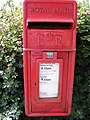
 Almost secret postbox in a hedge - geograph.org.uk - 4370988.jpg 1,024 × 768; 496 KB
-
 Almost secret postbox in a hedge - geograph.org.uk - 4370991.jpg 1,024 × 768; 663 KB
-

-
 Athelington, Entrance to Barton Grange - geograph.org.uk - 6542455.jpg 6,137 × 4,090; 7.59 MB
-
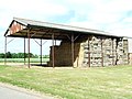 Barn - geograph.org.uk - 1924586.jpg 1,600 × 1,200; 473 KB
-
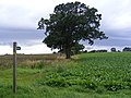
 Becoming The Tree - geograph.org.uk - 3842730.jpg 1,024 × 768; 304 KB
-
 Bedfield Road sign - geograph.org.uk - 2902849.jpg 3,072 × 2,304; 1.67 MB
-
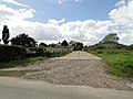
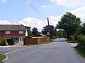
 Bedfield Road, Worlingworth - geograph.org.uk - 2902853.jpg 3,072 × 2,304; 1.45 MB
-
 Bridleway to Charity Lane - geograph.org.uk - 2449823.jpg 3,072 × 2,304; 1.62 MB
-
 Bridleway to Church Street - geograph.org.uk - 2902722.jpg 3,072 × 2,304; 1.5 MB
-
 Bridleway to Worlingworth Hall - geograph.org.uk - 1900766.jpg 2,304 × 3,072; 1.4 MB
-

-
 Carter's Farm at Meadow Corner - geograph.org.uk - 4370859.jpg 1,024 × 768; 320 KB
-
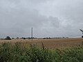
 Cereal crop beside Stanway Green Road - geograph.org.uk - 4370994.jpg 1,024 × 768; 381 KB
-
 Chandos Farm Buildings - geograph.org.uk - 2902831.jpg 3,072 × 2,304; 1.4 MB
-
 Chandos Farm, Worlingworth - geograph.org.uk - 2902827.jpg 3,072 × 2,304; 1.47 MB
-
 Church Road and The Rectory Postbox - geograph.org.uk - 1904764.jpg 3,072 × 2,304; 1.67 MB
-
 Church Road, Worlingworth - geograph.org.uk - 1904769.jpg 3,072 × 2,304; 1.52 MB
-
 Church Street, Worlingworth - geograph.org.uk - 1904797.jpg 3,072 × 2,304; 1.5 MB
-
 Cordy's Meadow sign - geograph.org.uk - 2449776.jpg 3,072 × 2,304; 1.6 MB
-
 Cordy's Meadow Worlingworth, a new developmemt - geograph.org.uk - 4370962.jpg 1,024 × 768; 316 KB
-
 Cordy's Meadow, Worlingworth - geograph.org.uk - 2449770.jpg 3,072 × 2,304; 1.4 MB
-
 Country Lane - geograph.org.uk - 3842982.jpg 1,024 × 768; 282 KB
-
 Crown House sign - geograph.org.uk - 2572759.jpg 3,072 × 2,304; 1.54 MB
-
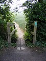
 Curved Footpath - geograph.org.uk - 3842882.jpg 1,024 × 768; 199 KB
-
 Cut Mark Worlingworth Road Loading Bay - geograph.org.uk - 5451691.jpg 1,152 × 1,152; 1.14 MB
-
 Cut Mark Worlingworth St Marys Church - geograph.org.uk - 5046858.jpg 1,920 × 1,920; 545 KB
-
 Entrance driveway to Barton Grange - geograph.org.uk - 4370863.jpg 1,024 × 768; 538 KB
-
-
 Farm Building - geograph.org.uk - 3842721.jpg 1,024 × 768; 216 KB
-
 Farmhouse at Moss Farm - geograph.org.uk - 342451.jpg 640 × 425; 76 KB
-
-
 Fingal Street - geograph.org.uk - 2572640.jpg 3,072 × 2,304; 1.29 MB
-
 Fingal Street - geograph.org.uk - 2572709.jpg 3,072 × 2,304; 1.38 MB
-
 Fingal Street - geograph.org.uk - 2572767.jpg 2,304 × 3,072; 1.4 MB
-
 Fingal Street - geograph.org.uk - 2572770.jpg 2,304 × 3,072; 1.38 MB
-
 Fingal Street junction - geograph.org.uk - 6542530.jpg 7,518 × 5,012; 7.41 MB
-
 Fingal Street Postbox - geograph.org.uk - 2572722.jpg 3,072 × 2,304; 1.39 MB
-
 Fingal Street Postbox - geograph.org.uk - 2572726.jpg 2,304 × 3,072; 1.38 MB
-
 Fingal Street Postbox - geograph.org.uk - 2572729.jpg 2,304 × 3,072; 1.65 MB
-
 Fingal Street Postbox - geograph.org.uk - 2572734.jpg 3,072 × 2,304; 1.68 MB
-
 Fingal Street sign - geograph.org.uk - 2572642.jpg 3,072 × 2,304; 1.63 MB
-
 Fingal Street sign - geograph.org.uk - 2694247.jpg 3,072 × 2,304; 1.55 MB
-
 Fingal Street ^ Fingal Street Postbox - geograph.org.uk - 2572720.jpg 3,072 × 2,304; 1.64 MB
-
 Fingal Street, Cole Street - geograph.org.uk - 6482333.jpg 5,485 × 3,657; 7.46 MB
-
 Fingal Street, Cole Street, Cereal crop - geograph.org.uk - 6482335.jpg 6,834 × 4,556; 7.27 MB
-
 Fingal Street, Cole Street, Cereal crop - geograph.org.uk - 6482337.jpg 5,956 × 3,970; 6.63 MB
-

-
 Fingal Street, Lodge Farm - geograph.org.uk - 6482323.jpg 6,354 × 4,235; 3.96 MB
-
 Fingal Street, Sax Vehicle Services (Worlingworth) Ltd - geograph.org.uk - 6542537.jpg 7,349 × 4,899; 7.05 MB
-
 Fingal Street, Worlingwoth - geograph.org.uk - 2694250.jpg 3,072 × 2,304; 1.67 MB
-
 Fingal Street, Worlingwoth - geograph.org.uk - 2694263.jpg 3,072 × 2,304; 1.67 MB
-
 Fingal Street, Worlingwoth - geograph.org.uk - 2694278.jpg 3,072 × 2,304; 1.43 MB
-
 Fingal Street, Worlingwoth - geograph.org.uk - 2694280.jpg 3,072 × 2,304; 1.45 MB
-
 Footbridge - geograph.org.uk - 3494705.jpg 1,024 × 768; 208 KB
-
 Footbridge - geograph.org.uk - 3842880.jpg 1,024 × 768; 248 KB
-
 Footpath - geograph.org.uk - 3842724.jpg 1,024 × 768; 302 KB
-
 Footpath - geograph.org.uk - 3842950.jpg 1,024 × 768; 153 KB
-
 Footpath along New Road - geograph.org.uk - 2572193.jpg 3,072 × 2,304; 1.38 MB
-
 Footpath along New Road - geograph.org.uk - 2572209.jpg 2,304 × 3,072; 1.43 MB
-
 Footpath along New Road - geograph.org.uk - 2572210.jpg 2,304 × 3,072; 1.45 MB
-
 Footpath And Winter Tree - geograph.org.uk - 3494702.jpg 768 × 1,024; 346 KB
-
 Footpath Crossing - geograph.org.uk - 3842872.jpg 768 × 1,024; 203 KB
-
 Footpath Finger Post - geograph.org.uk - 3842943.jpg 1,024 × 768; 249 KB
-
 Footpath Junction - geograph.org.uk - 3842918.jpg 1,024 × 768; 163 KB
-
 Footpath off Cole Street - geograph.org.uk - 2572514.jpg 3,072 × 2,304; 1.45 MB
-
 Footpath off Water Lane (U5606) - geograph.org.uk - 2694604.jpg 3,072 × 2,304; 1.62 MB
-
 Footpath off Water Lane (U5606) - geograph.org.uk - 2694605.jpg 2,304 × 3,072; 1.67 MB
-
 Footpath off Water Lane (U5606) - geograph.org.uk - 2694610.jpg 3,072 × 2,304; 1.44 MB
-
 Footpath Sign - geograph.org.uk - 1924047.jpg 1,200 × 1,600; 414 KB
-
 Footpath sign and bridge - geograph.org.uk - 1934003.jpg 1,200 × 1,600; 796 KB
-
 Footpath to Church Road - geograph.org.uk - 2902775.jpg 3,072 × 2,304; 1.35 MB
-
 Footpath to Mill Road - geograph.org.uk - 2449870.jpg 3,072 × 2,304; 1.65 MB
-
 Footpath to Mill Road - geograph.org.uk - 2449871.jpg 2,304 × 3,072; 1.47 MB
-
 Footpath to New Road ^ Fingal Street - geograph.org.uk - 2572708.jpg 3,072 × 2,304; 1.49 MB
-
 Footpath to Newtown ^ New Road - geograph.org.uk - 2572499.jpg 3,072 × 2,304; 1.67 MB
-
 Footpath to Poplar Farm - geograph.org.uk - 2449882.jpg 3,072 × 2,304; 1.63 MB
-
 Footpath to Poplar Farm - geograph.org.uk - 2449886.jpg 2,304 × 3,072; 1.48 MB
-
 Footpath to Poplar Farm - geograph.org.uk - 2449888.jpg 2,304 × 3,072; 1.39 MB
-
 Footpath to Poplar Farm - geograph.org.uk - 2449889.jpg 3,072 × 2,304; 1.25 MB
-
 Footpath to Shop Street ^ New Road - geograph.org.uk - 2572203.jpg 3,072 × 2,304; 1.39 MB
-
 Footpath to Southolt Road, Athelington - geograph.org.uk - 2703103.jpg 3,072 × 2,304; 1.45 MB
-
 Footpath to Southolt Road, Athelington ^ Water Lane - geograph.org.uk - 2702818.jpg 3,072 × 2,304; 1.46 MB
-
 Footpath to Stanway Green Farm - geograph.org.uk - 2572214.jpg 2,304 × 3,072; 1.39 MB
-
 Footpath to Stanway Green Farm - geograph.org.uk - 2572215.jpg 3,072 × 2,304; 1.43 MB
-
 Footpath to Stanway Green Farm - geograph.org.uk - 2572227.jpg 3,072 × 2,304; 1.33 MB
-
 Footpath to Stanway Green ^ New Road - geograph.org.uk - 2572557.jpg 3,072 × 2,304; 1.36 MB
-
 Footpath to Stanway Green ^ New Road - geograph.org.uk - 2572559.jpg 3,072 × 2,304; 1.32 MB
-
 Footpath to White Hall Farm - geograph.org.uk - 2694308.jpg 3,072 × 2,304; 1.67 MB
-
 Footpath to Worlingworth Hall ^ New Road - geograph.org.uk - 2572519.jpg 2,304 × 3,072; 1.36 MB
-
 Footpath to Worlingworth Road - geograph.org.uk - 2699513.jpg 3,072 × 2,304; 1.38 MB
-
 Footpath to Worlingworth ^ New Roads - geograph.org.uk - 2572778.jpg 3,072 × 2,304; 1.41 MB
-
 Footpath to Worlingwoth Road - geograph.org.uk - 2699514.jpg 3,072 × 2,304; 1.32 MB
-
 Footpaths crossing Cole Street - geograph.org.uk - 2572516.jpg 3,072 × 2,304; 1.2 MB
-
 Forthcoming Fete - geograph.org.uk - 1924517.jpg 1,600 × 1,200; 514 KB
-
 Green Footpath - geograph.org.uk - 3494692.jpg 768 × 1,024; 253 KB
-
 Horse And Rider - geograph.org.uk - 3842908.jpg 1,024 × 768; 126 KB
-
 Horse Muck For sale - geograph.org.uk - 1924545.jpg 1,600 × 1,200; 539 KB
-
 I Will Collect It Tomorrow 25 Years Ago - geograph.org.uk - 3842728.jpg 768 × 1,024; 410 KB
-
 Inside St. Mary, Worlingworth (I) - geograph.org.uk - 5108046.jpg 480 × 640; 68 KB
-
 Inside St. Mary, Worlingworth (II) - geograph.org.uk - 5108048.jpg 640 × 480; 66 KB
-
 Inside St. Mary, Worlingworth (III) - geograph.org.uk - 5108049.jpg 480 × 640; 80 KB
-
 Inside St. Mary, Worlingworth (IV) - geograph.org.uk - 5108051.jpg 640 × 480; 77 KB
-
 Inside St. Mary, Worlingworth (IX) - geograph.org.uk - 5108057.jpg 640 × 480; 52 KB
-
 Inside St. Mary, Worlingworth (V) - geograph.org.uk - 5108052.jpg 480 × 640; 57 KB
-
 Inside St. Mary, Worlingworth (VI) - geograph.org.uk - 5108053.jpg 480 × 640; 67 KB
-
 Inside St. Mary, Worlingworth (VII) - geograph.org.uk - 5108054.jpg 640 × 480; 54 KB
-
 Inside St. Mary, Worlingworth (VIII) - geograph.org.uk - 5108056.jpg 640 × 480; 70 KB
-
 Inside St. Mary, Worlingworth (X) - geograph.org.uk - 5108059.jpg 480 × 640; 73 KB
-
 Inside St. Mary, Worlingworth (XI) - geograph.org.uk - 5108061.jpg 640 × 480; 89 KB
-
 Inside St. Mary, Worlingworth (XII) - geograph.org.uk - 5108062.jpg 480 × 640; 72 KB
-
 Inside St. Mary, Worlingworth (XIII) - geograph.org.uk - 5108063.jpg 640 × 480; 74 KB
-
 Inside St. Mary, Worlingworth (XIV) - geograph.org.uk - 5108064.jpg 640 × 480; 76 KB
-
 Inside St. Mary, Worlingworth (XIX) - geograph.org.uk - 5108070.jpg 480 × 640; 55 KB
-
 Inside St. Mary, Worlingworth (XV) - geograph.org.uk - 5108065.jpg 480 × 640; 46 KB
-
 Inside St. Mary, Worlingworth (XVI) - geograph.org.uk - 5108082.jpg 640 × 480; 32 KB
-
 Inside St. Mary, Worlingworth (XVII) - geograph.org.uk - 5108066.jpg 640 × 480; 74 KB
-

-
 Inside St. Mary, Worlingworth (XX) - geograph.org.uk - 5108073.jpg 480 × 640; 37 KB
-
 Inside St. Mary, Worlingworth (XXI) - geograph.org.uk - 5108076.jpg 640 × 480; 30 KB
-
 Ivy covered building at Wood Farm - geograph.org.uk - 4371001.jpg 1,024 × 768; 359 KB
-
 Ivy covered building at Wood Farm - geograph.org.uk - 4371002.jpg 1,024 × 768; 501 KB
-
 L.E.Tuckwell Limited - geograph.org.uk - 1904452.jpg 3,072 × 2,304; 1.33 MB
-
 Low Farm - geograph.org.uk - 3842719.jpg 1,024 × 768; 173 KB
-
 Low Farm Buildings - geograph.org.uk - 2902874.jpg 3,072 × 2,304; 1.35 MB
-
 Low Farm, Tannington - geograph.org.uk - 4371004.jpg 1,024 × 768; 328 KB
-
 Mill Road Postbox - geograph.org.uk - 2449830.jpg 3,072 × 2,304; 1.46 MB
-
 Mill Road Postbox - geograph.org.uk - 2449835.jpg 3,072 × 2,304; 1.26 MB
-
 Mill Road Postbox - geograph.org.uk - 2449838.jpg 2,304 × 3,072; 1.67 MB
-
 Mill Road sign - geograph.org.uk - 2449851.jpg 3,072 × 2,304; 1.43 MB
-
 Mill Road ^ Mill Road Postbox - geograph.org.uk - 2449857.jpg 2,489 × 1,652; 950 KB
-
 Mill Road,Worlingworth - geograph.org.uk - 2449827.jpg 3,072 × 2,304; 1.24 MB
-
 Mill Road,Worlingworth - geograph.org.uk - 2694244.jpg 3,072 × 2,304; 1.44 MB
-
 New Road - geograph.org.uk - 3842864.jpg 1,024 × 768; 363 KB
-
 New Road sign - geograph.org.uk - 2572188.jpg 3,072 × 2,304; 1.44 MB
-
 New Road ^ footpath along New Road - geograph.org.uk - 2572204.jpg 3,072 × 2,304; 1.47 MB
-
 New Road, Worlingworth - geograph.org.uk - 1904767.jpg 2,304 × 3,072; 1.5 MB
-
 New Road, Worlingworth - geograph.org.uk - 2572187.jpg 3,072 × 2,304; 1.63 MB
-
 New Road, Worlingworth - geograph.org.uk - 2572195.jpg 3,072 × 2,304; 1.4 MB
-
 New Road, Worlingworth - geograph.org.uk - 2572196.jpg 2,304 × 3,072; 1.63 MB
-
 New Road, Worlingworth - geograph.org.uk - 2572237.jpg 3,072 × 2,304; 1.45 MB
-
 New Road, Worlingworth - geograph.org.uk - 2572241.jpg 3,072 × 2,304; 1.45 MB
-
 New Road, Worlingworth - geograph.org.uk - 2572250.jpg 3,072 × 2,304; 1.32 MB
-
 New Road, Worlingworth - geograph.org.uk - 2572635.jpg 2,640 × 1,801; 1.3 MB
-
 New Road, Worlingworth ^ The Rectory Postbox - geograph.org.uk - 2572794.jpg 3,072 × 2,304; 1.65 MB
-
 Newtown sign - geograph.org.uk - 2694268.jpg 3,072 × 2,304; 1.45 MB
-
 Newtown, Worlingworth - geograph.org.uk - 2694266.jpg 2,304 × 3,072; 1.35 MB
-
 Old disused windmill in Water Lane - geograph.org.uk - 4370865.jpg 1,024 × 768; 382 KB
-

-
 Post Office Shop Street Postbox - geograph.org.uk - 2449757.jpg 3,072 × 2,304; 1.33 MB
-
 Post Office Shop Street Postbox - geograph.org.uk - 2449761.jpg 3,072 × 2,304; 1.41 MB
-
 Post Office Shop Street Postbox - geograph.org.uk - 2449764.jpg 3,072 × 2,304; 1.49 MB
-
 Post Office Shop Street Postbox - geograph.org.uk - 2449771.jpg 2,304 × 3,072; 1.49 MB
-
 Post Office Shop Street Postbox - geograph.org.uk - 2449791.jpg 2,304 × 3,072; 1.39 MB
-
 Postbox in Shop Street, Worlingworth - geograph.org.uk - 4370957.jpg 1,024 × 768; 468 KB
-
 Resurfacing work in Stanway Green Road - geograph.org.uk - 4370990.jpg 1,024 × 768; 546 KB
-
 Road Junction - geograph.org.uk - 3494694.jpg 1,024 × 768; 244 KB
-
 Roadsign at the end of Church Road - geograph.org.uk - 1900773.jpg 2,304 × 3,072; 1.66 MB
-
 Roadsign at the Swan-Church Roads junction - geograph.org.uk - 2572183.jpg 2,304 × 3,072; 1.33 MB
-
 Roadsign on Cole Street - geograph.org.uk - 2572595.jpg 2,304 × 3,072; 1.36 MB
-
 Roadsign on Fingal Street - geograph.org.uk - 2572636.jpg 2,304 × 3,072; 1.28 MB
-
 Roadsign on Fingal Street - geograph.org.uk - 2572788.jpg 2,304 × 3,072; 1.36 MB
-
 Roadsign on New Road - geograph.org.uk - 2572501.jpg 2,304 × 3,072; 1.24 MB
-
 Roadsign on Tannington Road, Worlingworth - geograph.org.uk - 2902845.jpg 2,304 × 3,072; 1.49 MB
-
 Rusting Tanks - geograph.org.uk - 3842720.jpg 1,024 × 768; 212 KB
-
 Sax Vehicle Services, Fingal Street, Worlingworth - geograph.org.uk - 2694294.jpg 3,072 × 2,304; 1.37 MB
-
 Shop Street, Worlingworth - geograph.org.uk - 2449782.jpg 3,072 × 2,304; 1.33 MB
-
 Shop Street, Worlingworth - geograph.org.uk - 2449785.jpg 3,072 × 2,304; 1.39 MB
-
 Small Stream - geograph.org.uk - 3494707.jpg 768 × 1,024; 266 KB
-
 Southolt Road sign - geograph.org.uk - 2702806.jpg 3,072 × 2,304; 1.46 MB
-
 Southolt Road, Southolt - geograph.org.uk - 2703112.jpg 3,072 × 2,304; 1.32 MB
-
 Southolt Road, Worlingworth - geograph.org.uk - 2694671.jpg 3,072 × 2,304; 1.5 MB
-
 Southolt Road, Worlingworth - geograph.org.uk - 2702807.jpg 3,072 × 2,304; 1.34 MB
-
 Southolt Road, Worlingworth - geograph.org.uk - 2702819.jpg 3,072 × 2,304; 1.67 MB
-
 St. Mary, Worlingworth, altar - geograph.org.uk - 5108148.jpg 640 × 480; 52 KB
-
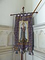 St. Mary, Worlingworth, banner - geograph.org.uk - 5108150.jpg 480 × 640; 54 KB
-

-

-
 St. Mary, Worlingworth, choir stalls - geograph.org.uk - 5108145.jpg 640 × 480; 67 KB
-

-
 St. Mary, Worlingworth, churchyard (II) - geograph.org.uk - 5108023.jpg 640 × 480; 111 KB
-

-

-
 St. Mary, Worlingworth, churchyard (IX) - geograph.org.uk - 5108032.jpg 640 × 480; 102 KB
-
 St. Mary, Worlingworth, churchyard (V) - geograph.org.uk - 5108026.jpg 640 × 480; 132 KB
-
 St. Mary, Worlingworth, churchyard (VI) - geograph.org.uk - 5108028.jpg 640 × 480; 101 KB
-

-

-

-
 St. Mary, Worlingworth, churchyard (XI) - geograph.org.uk - 5108035.jpg 640 × 480; 123 KB
-
 St. Mary, Worlingworth, churchyard (XII) - geograph.org.uk - 5108036.jpg 640 × 480; 115 KB
-

-
 St. Mary, Worlingworth, churchyard (XIV) - geograph.org.uk - 5108038.jpg 640 × 480; 119 KB
-
 St. Mary, Worlingworth, churchyard (XV) - geograph.org.uk - 5108039.jpg 640 × 480; 123 KB
-

.jpg)
.jpg)
_-_geograph.org.uk_-_5060352.jpg)


_Ltd_-_geograph.org.uk_-_6542537.jpg)


_-_geograph.org.uk_-_2694604.jpg)
_-_geograph.org.uk_-_2694605.jpg)
_-_geograph.org.uk_-_2694610.jpg)


_-_geograph.org.uk_-_5108046.jpg)
_-_geograph.org.uk_-_5108048.jpg)
_-_geograph.org.uk_-_5108049.jpg)
_-_geograph.org.uk_-_5108051.jpg)
_-_geograph.org.uk_-_5108057.jpg)
_-_geograph.org.uk_-_5108052.jpg)
_-_geograph.org.uk_-_5108053.jpg)
_-_geograph.org.uk_-_5108054.jpg)
_-_geograph.org.uk_-_5108056.jpg)
_-_geograph.org.uk_-_5108059.jpg)
_-_geograph.org.uk_-_5108061.jpg)
_-_geograph.org.uk_-_5108062.jpg)
_-_geograph.org.uk_-_5108063.jpg)
_-_geograph.org.uk_-_5108064.jpg)
_-_geograph.org.uk_-_5108070.jpg)
_-_geograph.org.uk_-_5108065.jpg)
_-_geograph.org.uk_-_5108082.jpg)
_-_geograph.org.uk_-_5108066.jpg)
_-_geograph.org.uk_-_5108068.jpg)
_-_geograph.org.uk_-_5108073.jpg)
_-_geograph.org.uk_-_5108076.jpg)


_-_geograph.org.uk_-_5108044.jpg)
_-_geograph.org.uk_-_5108045.jpg)

_-_geograph.org.uk_-_5108022.jpg)
_-_geograph.org.uk_-_5108023.jpg)
_-_geograph.org.uk_-_5108024.jpg)
_-_geograph.org.uk_-_5108025.jpg)
_-_geograph.org.uk_-_5108032.jpg)
_-_geograph.org.uk_-_5108026.jpg)
_-_geograph.org.uk_-_5108028.jpg)
_-_geograph.org.uk_-_5108030.jpg)
_-_geograph.org.uk_-_5108031.jpg)
_-_geograph.org.uk_-_5108033.jpg)
_-_geograph.org.uk_-_5108035.jpg)
_-_geograph.org.uk_-_5108036.jpg)
_-_geograph.org.uk_-_5108037.jpg)
_-_geograph.org.uk_-_5108038.jpg)
_-_geograph.org.uk_-_5108039.jpg)
_-_geograph.org.uk_-_5108040.jpg)