Category:Worleston
Jump to navigation
Jump to search
English: Worleston is a village (at ) and civil parish in the unitary authority of Cheshire East and the ceremonial county of Cheshire, England. The village lies 2½ miles north of Nantwich and 3 miles west of Crewe. The civil parish also includes the settlements of Beambridge, Rease Heath, Mile End and Rookery, with a total population of a little over 400.
village and civil parish in Cheshire East, United Kingdom  | |||||
| Upload media | |||||
| Instance of | |||||
|---|---|---|---|---|---|
| Location | Cheshire East, Cheshire, North West England, England | ||||
 | |||||
Subcategories
This category has the following 4 subcategories, out of 4 total.
Media in category "Worleston"
The following 102 files are in this category, out of 102 total.
-

-
 A51 towards Chester - geograph.org.uk - 5225223.jpg 640 × 480; 107 KB
-
 A51, Nantwich - geograph.org.uk - 5226206.jpg 2,848 × 2,136; 1.26 MB
-
 Alvaston Hall - geograph.org.uk - 480712.jpg 640 × 480; 122 KB
-
 Aston Hall showing tennis court - geograph.org.uk - 277165.jpg 640 × 427; 319 KB
-
 B5074 towards Worleston - geograph.org.uk - 5225212.jpg 640 × 480; 83 KB
-
 B5074, near Rookery Hall, Worleston.jpg 1,000 × 714; 414 KB
-
 Boaters on the Canal - geograph.org.uk - 1458566.jpg 521 × 640; 64 KB
-
 Bridge and pylons over the River Weaver - geograph.org.uk - 2130489.jpg 1,512 × 2,016; 767 KB
-
 Carving At Home Farm - geograph.org.uk - 2752999.jpg 3,115 × 2,086; 2.34 MB
-
 Church Road, Worleston - geograph.org.uk - 5829031.jpg 1,024 × 768; 254 KB
-

-
 Cottages in Dairy Lane - geograph.org.uk - 277179.jpg 640 × 427; 339 KB
-
 Cottages, The Green - geograph.org.uk - 5225213.jpg 640 × 480; 79 KB
-
 Crewe - the railway town - geograph.org.uk - 2107499.jpg 2,048 × 1,536; 1.29 MB
-
 Elizabeth II postbox on the A51, Nantwich - geograph.org.uk - 5226204.jpg 1,960 × 2,046; 872 KB
-
 Embankment on the Shropshire Union Canal - geograph.org.uk - 381651.jpg 640 × 374; 117 KB
-

-
 Equestrian Centre, The Green - geograph.org.uk - 5225214.jpg 640 × 480; 66 KB
-
 Field beside the River Weaver - geograph.org.uk - 5197623.jpg 640 × 381; 40 KB
-
 Field entrance off the A51 - geograph.org.uk - 5225220.jpg 640 × 480; 77 KB
-
 Footpath near Reaseheath Equestrian Centre - geograph.org.uk - 4385728.jpg 2,048 × 1,536; 1.82 MB
-
 Footpath off A51 - geograph.org.uk - 4385571.jpg 2,048 × 1,536; 2.06 MB
-
 Footpath off A51 - geograph.org.uk - 4385585.jpg 1,536 × 2,048; 1.9 MB
-
 Footpath past Reaseheath Equestrian Centre - geograph.org.uk - 4385678.jpg 2,048 × 1,536; 1.48 MB
-
 Footpath past Reaseheath Equestrian Centre - geograph.org.uk - 4385699.jpg 2,048 × 1,536; 1.38 MB
-
 Footpath through Reaseheath Equestrian Centre - geograph.org.uk - 4385649.jpg 2,048 × 1,536; 1.41 MB
-
 Former stables, Rookery Hall - geograph.org.uk - 4750824.jpg 640 × 442; 183 KB
-
 Former stables, Rookery Hall - geograph.org.uk - 4750825.jpg 640 × 425; 231 KB
-
 Grazing off the B5074 - geograph.org.uk - 5225211.jpg 640 × 480; 44 KB
-

-
 Nantwich bypass and power lines - geograph.org.uk - 3171338.jpg 640 × 480; 79 KB
-
 Oakfield Cottage, Worleston - geograph.org.uk - 277194.jpg 640 × 427; 328 KB
-
 Old Hall Farm, Reaseheath - geograph.org.uk - 5225219.jpg 640 × 448; 47 KB
-
 Pier at the Venetian Marina - geograph.org.uk - 382116.jpg 640 × 483; 121 KB
-
 Pond, Rookery Hall - geograph.org.uk - 4750826.jpg 640 × 495; 248 KB
-
 Poole Gorse.jpg 1,200 × 800; 545 KB
-
 Pylon and direction sign by A51 near Reaseheath - geograph.org.uk - 6088149.jpg 1,600 × 1,001; 591 KB
-
 Reaseheath Equestrian Centre - geograph.org.uk - 3868920.jpg 4,608 × 2,960; 5.07 MB
-
 Reaseheath Equestrian Centre - geograph.org.uk - 4385539.jpg 2,006 × 1,504; 1,015 KB
-
 Reaseheath Equestrian Centre, horse paddocks - geograph.org.uk - 4385637.jpg 2,048 × 1,536; 1.01 MB
-
 Reaseheath Equestrian Centre, horse walker - geograph.org.uk - 4385665.jpg 2,048 × 1,536; 1.16 MB
-
 Reaseheath Equestrian Centre, large outdoor arena - geograph.org.uk - 4315083.jpg 3,264 × 2,088; 1.98 MB
-
 Reaseheath Equestrian Centre, round pen - geograph.org.uk - 4315123.jpg 3,262 × 2,041; 3.2 MB
-
 Rookery Hall - geograph.org.uk - 4750827.jpg 640 × 425; 188 KB
-
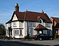 Royal Oak, Worleston, Cheshire.jpg 1,000 × 772; 306 KB
-

-

-
 Shropshire Union east of Brickyard Bridge - geograph.org.uk - 382009.jpg 640 × 430; 104 KB
-
 Spring on the Shropshire Union Canal - geograph.org.uk - 381996.jpg 640 × 432; 162 KB
-
 Stile on Worleston FP3 - geograph.org.uk - 4385753.jpg 2,048 × 1,536; 1.92 MB
-
 Traffic jam on the Shropshire Union^ - geograph.org.uk - 393086.jpg 640 × 427; 70 KB
-
 Trees in pasture by the Shropshire Union - geograph.org.uk - 381922.jpg 640 × 427; 105 KB
-
 Trig point in woodland - geograph.org.uk - 383303.jpg 640 × 435; 187 KB
-
 Weaver trib nr Rookery Hall.jpg 1,200 × 812; 555 KB
-
 Wolvey Cottage, Worleston - geograph.org.uk - 277196.jpg 640 × 427; 328 KB
-
 Wood Farm, off Middlewich Road - geograph.org.uk - 494204.jpg 640 × 480; 83 KB
-
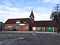
 Worleston School, Cheshire.jpg 640 × 427; 83 KB
-
 Aston Hall - geograph.org.uk - 277164.jpg 640 × 427; 336 KB
-
 Aston Hall Barn - geograph.org.uk - 277169.jpg 640 × 427; 330 KB
-
 Aston Lower Hall - geograph.org.uk - 277208.jpg 640 × 427; 417 KB
-
 Aston Lower Hall Barn - geograph.org.uk - 277209.jpg 640 × 427; 340 KB
-
 Aston Lower Hall sign - geograph.org.uk - 277210.jpg 640 × 427; 431 KB
-
 Barons Road - Aston-juxta-Mondrum - geograph.org.uk - 277205.jpg 640 × 427; 428 KB
-
 Brassey Bank Farm - geograph.org.uk - 619330.jpg 640 × 480; 126 KB
-
 Bullocks in woodland - geograph.org.uk - 386196.jpg 640 × 445; 166 KB
-
 Church Cottage, Worleston - geograph.org.uk - 277204.jpg 640 × 427; 350 KB
-
 Cottages in Station Road - geograph.org.uk - 277180.jpg 640 × 427; 354 KB
-
 Exercising horses in Dairy Lane - geograph.org.uk - 277175.jpg 427 × 640; 405 KB
-
 Farm fields north of Aston Hall - geograph.org.uk - 277192.jpg 640 × 427; 324 KB
-
 Farmyard to rear of Aston Hall - geograph.org.uk - 277186.jpg 640 × 427; 376 KB
-
 Field at Bridge Farm, Cholmondeston - geograph.org.uk - 220943.jpg 640 × 427; 99 KB
-
 Four Oaks Farm - geograph.org.uk - 277176.jpg 640 × 427; 365 KB
-
 Gates Farm, near Aston juxta Mondrum - geograph.org.uk - 385476.jpg 640 × 445; 148 KB
-
 Leighton Grange - geograph.org.uk - 619340.jpg 480 × 640; 132 KB
-
 Lodge and gates, Rookery Hall - geograph.org.uk - 389414.jpg 640 × 427; 171 KB
-
 Mowing machinery in Poole Farm field - geograph.org.uk - 277207.jpg 640 × 427; 380 KB
-

-
 Old and new woodland - geograph.org.uk - 385527.jpg 640 × 448; 125 KB
-
 Pasture by Mile House Farm - geograph.org.uk - 389647.jpg 640 × 427; 179 KB
-
 Pasture by the Shropshire Union Canal - geograph.org.uk - 381607.jpg 640 × 427; 103 KB
-
 Pasture near Cholmondeston - geograph.org.uk - 382091.jpg 640 × 407; 105 KB
-
 Pasture near Rookery Park Stud - geograph.org.uk - 389522.jpg 640 × 423; 145 KB
-
 Pasture south of Park Farm - geograph.org.uk - 389666.jpg 640 × 450; 134 KB
-
 Poole Farm, Poole - geograph.org.uk - 277206.jpg 640 × 427; 376 KB
-
 Poole Old Hall Lane - geograph.org.uk - 259783.jpg 640 × 427; 118 KB
-
 Railway line towards Crewe - geograph.org.uk - 277188.jpg 427 × 640; 358 KB
-
 Rookery Park Stud, near Worleston - geograph.org.uk - 389462.jpg 640 × 411; 141 KB
-
 Royal Oak, Worleston - geograph.org.uk - 389706.jpg 640 × 420; 116 KB
-
-
 Sewage Treatment works - geograph.org.uk - 277193.jpg 640 × 427; 315 KB
-

-
 Signpost - geograph.org.uk - 277171.jpg 427 × 640; 385 KB
-
 Small mere in woodland - geograph.org.uk - 386208.jpg 640 × 432; 185 KB
-
 Station Farm - geograph.org.uk - 277161.jpg 640 × 427; 348 KB
-
 Stoke Hall Farm, near Barbridge - geograph.org.uk - 381645.jpg 640 × 421; 119 KB
-
 Tributary of the Weaver - geograph.org.uk - 389502.jpg 479 × 640; 181 KB
-
 View towards Rookery Hall - geograph.org.uk - 389441.jpg 640 × 427; 153 KB
-
 Wheat field near Aston Lower Hall - geograph.org.uk - 386176.jpg 640 × 442; 125 KB
-
 Woodland by Rookery Hall - geograph.org.uk - 389597.jpg 640 × 463; 198 KB
-
 Worleston House, Worleston - geograph.org.uk - 277197.jpg 427 × 640; 473 KB
-
 Yellow boat by mere - geograph.org.uk - 385490.jpg 640 × 443; 146 KB


