Category:Worgret
Jump to navigation
Jump to search
English: Worgret is a village in the English county of Dorset. It is situated immediately to the west of the town of Wareham.
human settlement in United Kingdom  | |||||
| Upload media | |||||
| Instance of | |||||
|---|---|---|---|---|---|
| Location | Arne, Dorset, South West England, England | ||||
 | |||||
Media in category "Worgret"
The following 20 files are in this category, out of 20 total.
-
 A Weymouth croos country passes Worgret junction. 1990s (49776427726).jpg 1,624 × 1,088; 1.22 MB
-
 A352 at Worgret - geograph.org.uk - 1327752.jpg 640 × 480; 90 KB
-
 Footpath through Worgret Heath - geograph.org.uk - 5929579.jpg 480 × 640; 123 KB
-

-
 Wareham - A352 - geograph.org.uk - 1560002.jpg 640 × 334; 35 KB
-
 Wareham - Worgret Heath - geograph.org.uk - 1574831.jpg 640 × 322; 58 KB
-
 Wareham - Worgret Heath - geograph.org.uk - 1577424.jpg 640 × 480; 69 KB
-
 Worgret Farm Bridge No 2, Swanage Railway - geograph.org.uk - 4894061.jpg 4,850 × 2,728; 7.01 MB
-
 Worgret Heath - geograph.org.uk - 5929577.jpg 640 × 480; 50 KB
-
 Worgret Hill - Wareham - geograph.org.uk - 1607541.jpg 640 × 338; 48 KB
-

-

-
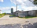 Worgret Manor Farm - geograph.org.uk - 4134943.jpg 1,024 × 768; 161 KB
-
 Worgret, horses - geograph.org.uk - 2059234.jpg 1,024 × 768; 124 KB
-
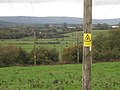
 Worgret, oil well - geograph.org.uk - 2059178.jpg 1,024 × 751; 102 KB
-
 Worgret, Piddle valley - geograph.org.uk - 2059184.jpg 1,024 × 768; 111 KB
-
 Worgret, postbox No. BH20 112 - geograph.org.uk - 1415309.jpg 640 × 480; 116 KB
-
 Worgret, Purbeck Way - geograph.org.uk - 2059199.jpg 1,024 × 768; 236 KB
-
 Oil Well - Worgret - geograph.org.uk - 165844.jpg 640 × 480; 108 KB
-
 Oil Well - Worgret - geograph.org.uk - 165847.jpg 640 × 480; 145 KB
.jpg)


