Category:Woodthorpe, North Yorkshire
Jump to navigation
Jump to search
English: Woodthorpe is a suburb of York, in the unparished area of York, in the York district, in the county of North Yorkshire, England.
area in York, UK .jpg) | |||||
| Upload media | |||||
| Instance of | |||||
|---|---|---|---|---|---|
| Location | York, City of York, North Yorkshire, Yorkshire and the Humber, England | ||||
 | |||||
Media in category "Woodthorpe, North Yorkshire"
The following 34 files are in this category, out of 34 total.
-
 Acomb Moor - geograph.org.uk - 5027838.jpg 1,600 × 1,067; 300 KB
-
 Acomb Wood, Woodthorpe, York - geograph.org.uk - 4834310.jpg 1,200 × 799; 544 KB
-
 Acomb Wood, Woodthorpe, York - geograph.org.uk - 4834316.jpg 1,200 × 799; 670 KB
-
 Acomb Wood, Woodthorpe, York - geograph.org.uk - 4834325.jpg 1,200 × 799; 593 KB
-
 Acomb Wood, Woodthorpe, York - geograph.org.uk - 4834363.jpg 1,200 × 799; 513 KB
-
 Acomb Wood, Woodthorpe, York - geograph.org.uk - 4834374.jpg 1,200 × 799; 570 KB
-
 Acomb Wood, Woodthorpe, York - geograph.org.uk - 4834381.jpg 1,200 × 799; 580 KB
-
 Acomb Wood, Woodthorpe, York - geograph.org.uk - 4834387.jpg 1,200 × 799; 602 KB
-
 Alness Drive, Woodthorpe, York - geograph.org.uk - 4834467.jpg 1,200 × 799; 296 KB
-
 Askham Bryan footpath sign - geograph.org.uk - 2061181.jpg 2,028 × 3,412; 850 KB
-
 Border territory - geograph.org.uk - 2748782.jpg 1,024 × 768; 108 KB
-
 Cairnborrow, Woodthorpe, York - geograph.org.uk - 4834491.jpg 1,200 × 796; 416 KB
-
 Carrfield, Woodthorpe, York - geograph.org.uk - 4834283.jpg 1,200 × 799; 264 KB
-
 Carron Crescent, Woodthorpe, York - geograph.org.uk - 4834474.jpg 1,200 × 799; 234 KB
-
 Deverton Way, Woodthorpe, York - geograph.org.uk - 4834469.jpg 1,200 × 799; 360 KB
-
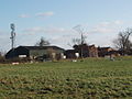 Eastfield Farm, Woodthorpe, York - geograph.org.uk - 324883.jpg 640 × 480; 97 KB
-
 Eden Close - geograph.org.uk - 2061213.jpg 3,488 × 1,960; 407 KB
-
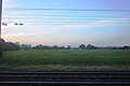
 Field overlooking Woodthorpe - geograph.org.uk - 1609834.jpg 640 × 421; 63 KB
-
 Houses on Ashbourne Way, Woodthorpe, York - geograph.org.uk - 4834305.jpg 1,200 × 799; 275 KB
-
 Houses on Foxton, Woodthorpe, York (geograph 4834294).jpg 1,200 × 849; 296 KB
-
 Houses on Herman Walk, Woodthorne - geograph.org.uk - 4834229.jpg 1,200 × 796; 463 KB
-
 Houses on Teal Drive, Woodthorpe, York - geograph.org.uk - 4834249.jpg 1,200 × 799; 324 KB
-

-
 Nevis Way, Woodthorpe, York - geograph.org.uk - 4834472.jpg 1,200 × 799; 285 KB
-

-
 Not much to harvest here - geograph.org.uk - 3913042.jpg 4,000 × 3,000; 3.03 MB
-
 Over field to Marsh Farm - geograph.org.uk - 3913008.jpg 4,000 × 3,000; 2.25 MB
-
 Path leading to Carrfield, Woodthorpe, York - geograph.org.uk - 4834266.jpg 1,200 × 799; 317 KB
-
 Path leading to Carrfield, Woodthorpe, York - geograph.org.uk - 4834269.jpg 1,200 × 799; 180 KB
-
 Path leading to Foxton, Woodthorpe, York - geograph.org.uk - 4834288.jpg 1,200 × 799; 353 KB
-
 Sim Hills - geograph.org.uk - 5301376.jpg 640 × 426; 34 KB
-
 Tesco Superstore - geograph.org.uk - 2342580.jpg 640 × 430; 38 KB
-
 Tesco Superstore - geograph.org.uk - 2409936.jpg 640 × 487; 35 KB
-
 Trent Way - Wain's Road - geograph.org.uk - 5420076.jpg 640 × 480; 98 KB


