Category:Woodham Mortimer
Jump to navigation
Jump to search
English: Woodham Mortimer is a village on the Dengie peninsula about three miles west-south-west of Maldon in the English county of Essex. The village is part of the Wickham Bishops and Woodham ward of the Maldon district.
village in Essex, United Kingdom  | |||||
| Upload media | |||||
| Instance of | |||||
|---|---|---|---|---|---|
| Location | Maldon, Essex, East of England, England | ||||
 | |||||
Subcategories
This category has the following 4 subcategories, out of 4 total.
Media in category "Woodham Mortimer"
The following 71 files are in this category, out of 71 total.
-

-
 Blue plaque on Woodham Mortimer Hall - geograph.org.uk - 4180808.jpg 4,320 × 3,240; 3.43 MB
-
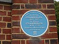
 Blue plaque, Woodham Mortimer Hall - geograph.org.uk - 230499.jpg 572 × 640; 104 KB
-
 Brookhead Farm - geograph.org.uk - 4007347.jpg 640 × 480; 145 KB
-
 Car wash on Maldon Road, Woodham Mortimer - geograph.org.uk - 6070874.jpg 1,920 × 1,280; 887 KB
-
 Chelmsford Road entering Woodham Mortimer - geograph.org.uk - 6071950.jpg 1,892 × 1,236; 1.22 MB
-
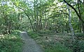
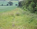
 Clear footpath - geograph.org.uk - 2435062.jpg 2,048 × 1,639; 814 KB
-
 Company of Coopers boundary marker - geograph.org.uk - 2435072.jpg 2,048 × 1,639; 1.82 MB
-
 Conduit Lane - geograph.org.uk - 4762935.jpg 1,600 × 1,064; 414 KB
-
 Coopers Coat of Arms - geograph.org.uk - 4940861.jpg 424 × 640; 106 KB
-
 Fallen Tree in Parsonage Wood - geograph.org.uk - 4941802.jpg 424 × 640; 122 KB
-
 Footbridge on The Path to Rectory Lane - geograph.org.uk - 4940830.jpg 424 × 640; 125 KB
-
 Footbridge, Thrift Wood, Woodham Mortimer - geograph.org.uk - 2420983.jpg 2,903 × 1,794; 1.95 MB
-
 Footpath Across a Hay Meadow - geograph.org.uk - 4941714.jpg 640 × 424; 68 KB
-
 Footpath and boundary markers, Woodham Mortimer - geograph.org.uk - 2435082.jpg 2,048 × 1,266; 1.24 MB
-
 Footpath in Thrift Wood, Woodham Mortimer - geograph.org.uk - 2420952.jpg 3,648 × 2,255; 3.02 MB
-
 Footpath off Marlpit Road - geograph.org.uk - 2468732.jpg 640 × 480; 177 KB
-
 Footpath Past Greno House - geograph.org.uk - 4942026.jpg 424 × 640; 113 KB
-
 Footpath to Old London Road - geograph.org.uk - 4947065.jpg 424 × 640; 84 KB
-
 Footpath to Rectory Lane - geograph.org.uk - 4940826.jpg 640 × 424; 79 KB
-
 Footpaths ^ Greater Stichwort - geograph.org.uk - 4941745.jpg 424 × 640; 115 KB
-
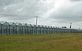 Greenhouses, Woodham Mortimer - geograph.org.uk - 2435095.jpg 2,048 × 1,266; 616 KB
-
 Hyacinthoides x massartiana - geograph.org.uk - 4941820.jpg 424 × 640; 66 KB
-
 Iron Marker - geograph.org.uk - 4947069.jpg 424 × 640; 121 KB
-
 Layby on Maldon Road - geograph.org.uk - 6069414.jpg 1,920 × 1,280; 1.17 MB
-
 Little Grange Farm - geograph.org.uk - 3912190.jpg 640 × 424; 49 KB
-
 Lodge Road - geograph.org.uk - 4007365.jpg 640 × 480; 118 KB
-
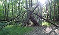 Makeshift Shelter, Thrift Wood, Woodham Mortimer - geograph.org.uk - 2422423.jpg 3,431 × 2,065; 2.7 MB
-
 Maldon Millennium Meander - geograph.org.uk - 4941027.jpg 424 × 640; 66 KB
-
 Maldon Road, A414, Woodham Mortimer - geograph.org.uk - 4007820.jpg 640 × 480; 87 KB
-
 Muddy Path ^ Coopers Limit - geograph.org.uk - 4940855.jpg 424 × 640; 115 KB
-
 Old Maldon Rd - geograph.org.uk - 4941834.jpg 424 × 640; 101 KB
-
 Parsonage Wood boundary - geograph.org.uk - 2435099.jpg 2,048 × 1,639; 1.38 MB
-
 Path ^ Leaning Power Pole - geograph.org.uk - 4941852.jpg 424 × 640; 41 KB
-
 Paths Through Parsonage Wood - geograph.org.uk - 4941774.jpg 424 × 640; 129 KB
-
 Pond in Parsonage Wood - geograph.org.uk - 4940888.jpg 424 × 640; 123 KB
-
 Pond on farmland, Woodham Mortimer - geograph.org.uk - 2434910.jpg 2,048 × 1,266; 1.49 MB
-
 Post Office Road - geograph.org.uk - 760271.jpg 640 × 480; 119 KB
-
 Powerlines over Essex - geograph.org.uk - 2434889.jpg 2,048 × 2,048; 868 KB
-
 Quarry, south of Thrift Wood, Woodham Mortimer - geograph.org.uk - 2420992.jpg 2,900 × 1,792; 987 KB
-
 Redundant Stile ^ Gate - geograph.org.uk - 4940843.jpg 424 × 640; 123 KB
-
 RHS Hyde Hall - April 2010 - Moorhen Out of Water.jpg 3,418 × 2,279; 5.29 MB
-
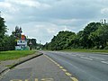
 Roundabout on the A414 - geograph.org.uk - 4762944.jpg 1,600 × 1,153; 298 KB
-
 Scrubland by Maldon Road - geograph.org.uk - 6080962.jpg 1,920 × 1,280; 2.59 MB
-
 Shield of the Company of Coopers - geograph.org.uk - 4940873.jpg 424 × 640; 95 KB
-
 Simple Culvert, Thrift Wood, Woodham Mortimer - geograph.org.uk - 2421000.jpg 3,648 × 2,736; 3.34 MB
-
 Skeletal Tree, Thrift Wood, Woodham Mortimer - geograph.org.uk - 2421021.jpg 3,497 × 1,673; 2.33 MB
-
 Springtime in Thrift Wood - geograph.org.uk - 4941014.jpg 424 × 640; 124 KB
-
 Stellaria holostea - geograph.org.uk - 4941762.jpg 424 × 640; 75 KB
-
 Stile and footpath, Rectory Lane - geograph.org.uk - 2434919.jpg 4,320 × 3,240; 4.76 MB
-
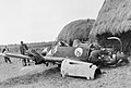 The Battle of Britain HU73560.jpg 2,480 × 1,670; 1,006 KB
-

-

-
 The Path to Brookhead Farm - geograph.org.uk - 4940898.jpg 424 × 640; 79 KB
-
 The Royal Oak, Woodham Mortimer - geograph.org.uk - 230511.jpg 640 × 420; 68 KB
-
 The southern Edge of Thrift Wood in Autumn, Woodham Mortimer - geograph.org.uk - 4722800.jpg 2,736 × 3,420; 6.21 MB
-
 Timber framed building - geograph.org.uk - 2434933.jpg 2,048 × 1,266; 783 KB
-
 Tom Tit Lane - geograph.org.uk - 760284.jpg 640 × 419; 53 KB
-
 Towards Old London Road - geograph.org.uk - 4947074.jpg 640 × 424; 58 KB
-
 Track to Thrift Wood - geograph.org.uk - 2467654.jpg 640 × 480; 173 KB
-
 Woodham Mortimer church - geograph.org.uk - 4007337.jpg 640 × 428; 96 KB
-
 A view of Oak Farm - geograph.org.uk - 760297.jpg 640 × 462; 68 KB
-
 Brookhead Farm - geograph.org.uk - 287538.jpg 640 × 480; 60 KB
-
 Footpath off Slough Road, Bicknacre - geograph.org.uk - 230453.jpg 640 × 478; 144 KB
-
 Footpath to Runsell Green - geograph.org.uk - 688708.jpg 640 × 455; 86 KB
-
 Lane leading to Lodge Farm - geograph.org.uk - 262596.jpg 640 × 446; 78 KB
-
 Loddart's Hill, Lodge Road - geograph.org.uk - 287532.jpg 640 × 401; 57 KB
-
 Lodge Farm - geograph.org.uk - 287170.jpg 640 × 480; 123 KB
-
 Pond, Cock Clarks - geograph.org.uk - 230459.jpg 516 × 640; 156 KB
-
 Thatched cottage, Cock Clarks - geograph.org.uk - 230474.jpg 640 × 378; 71 KB
-
 The Gates of Woodham Mortimer Place - geograph.org.uk - 230745.jpg 640 × 478; 90 KB


