Category:Woodham, Buckinghamshire
Jump to navigation
Jump to search
hamlet and civil parish in Buckinghamshire, United Kingdom  | |||||
| Upload media | |||||
| Instance of | |||||
|---|---|---|---|---|---|
| Location | Aylesbury Vale, Buckinghamshire, South East England, England | ||||
 | |||||
Subcategories
This category has only the following subcategory.
A
Media in category "Woodham, Buckinghamshire"
The following 22 files are in this category, out of 22 total.
-
 A stile by the road - geograph.org.uk - 4365843.jpg 1,500 × 999; 294 KB
-
 A41 at Kingswood village boundary - geograph.org.uk - 2834673.jpg 640 × 481; 50 KB
-
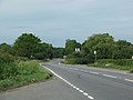
 A41 at Woodham - geograph.org.uk - 2834672.jpg 640 × 481; 50 KB
-
 A41 towards Aylesbury - geograph.org.uk - 5638117.jpg 640 × 428; 96 KB
-
 Akeman Inn - geograph.org.uk - 4354637.jpg 640 × 480; 77 KB
-
 Crooked Billet Kingswood - geograph.org.uk - 2214253.jpg 640 × 460; 62 KB
-
 Drive up to Oving Hill Farm - geograph.org.uk - 1716915.jpg 2,592 × 1,944; 2.45 MB
-

-
 Farmland, Oving Hill Farm near Woodham - geograph.org.uk - 497700.jpg 640 × 480; 118 KB
-
 Lane north-east from Kingswood - geograph.org.uk - 5947991.jpg 1,024 × 684; 306 KB
-
 Path heading to the A41 - geograph.org.uk - 5190505.jpg 640 × 480; 110 KB
-
 Public Footpath, Oving Hill Farm - geograph.org.uk - 4414656.jpg 4,000 × 3,000; 2.38 MB
-
-
 The A41 to Aylesbury - geograph.org.uk - 3970740.jpg 1,500 × 999; 208 KB
-
 The A41 to Aylesbury - geograph.org.uk - 3970745.jpg 1,500 × 999; 169 KB
-
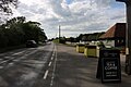 The A41, Kingswood - geograph.org.uk - 6176452.jpg 1,920 × 1,280; 1.18 MB
-
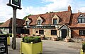 The Akeman Inn, Kingswood - geograph.org.uk - 6176451.jpg 1,872 × 1,202; 1.57 MB
-
 The road to Edgcott and Quainton - geograph.org.uk - 4365841.jpg 1,500 × 999; 199 KB
-
 The road to Kingswood - geograph.org.uk - 4365840.jpg 1,500 × 999; 250 KB
-
 The road to Kingswood and Grendon Underwood - geograph.org.uk - 4365844.jpg 1,500 × 999; 151 KB
-
 The road to Oving Hill Farm - geograph.org.uk - 4365842.jpg 1,500 × 999; 183 KB
-
 Tree Lined Avenue - geograph.org.uk - 1562835.jpg 640 × 480; 132 KB


