Category:Wood End, Kingsbury
Jump to navigation
Jump to search
village in Kingsbury, Warwickshire, United Kingdom  | |||||
| Upload media | |||||
| Instance of | |||||
|---|---|---|---|---|---|
| Location | Kingsbury, North Warwickshire, Warwickshire, West Midlands, England | ||||
| Area |
| ||||
 | |||||
English: Wood End is an old mining village in North Warwickshire. It lies to the south east of Tamworth. It has a church, a primary school, a post office, a co-operative store, a working men's club and a village hall. The population of Wood End is approximately 2000 and many of the residents work in Birmingham.
Media in category "Wood End, Kingsbury"
The following 17 files are in this category, out of 17 total.
-
 103 Tamworth Road, Wood End - geograph.org.uk - 2567417.jpg 640 × 480; 363 KB
-
 Boulters Lane, Wood End CV9 - geograph.org.uk - 2553157.jpg 640 × 480; 336 KB
-
 Chicane, Boulters Lane, Wood End - geograph.org.uk - 2567406.jpg 640 × 480; 402 KB
-
 Fields near Wood End - geograph.org.uk - 5977708.jpg 6,000 × 4,000; 4.93 MB
-

-
 Industrial units, Atherstone.jpg 640 × 397; 82 KB
-
 Modern housing, Wood End - geograph.org.uk - 3168619.jpg 640 × 480; 83 KB
-
 Polars Farm near Wood End - geograph.org.uk - 2727683.jpg 640 × 428; 69 KB
-
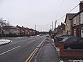
 Tamworth Road, Wood End - geograph.org.uk - 3168628.jpg 640 × 480; 55 KB
-
 Wood End Church.JPG 4,288 × 3,216; 2.4 MB
-
 Wood End Garage - geograph.org.uk - 3168624.jpg 640 × 480; 56 KB
-
 Wood End Main street.jpg 4,288 × 3,216; 4.45 MB
-
 Wood End Main street2.jpg 4,288 × 3,216; 4.4 MB
-
 Wood End Village hall - geograph.org.uk - 2727671.jpg 640 × 428; 61 KB
-
 Wood End Village Hall.JPG 4,288 × 3,216; 2.74 MB
-
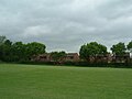 Wood End, Atherstone playing Field.jpg 640 × 480; 109 KB
-
 WoodEndPrimaySchool.JPG 4,288 × 3,216; 2.51 MB


