Category:Wolfslaardreef, Breda
Jump to navigation
Jump to search
| Camera location | | View all coordinates using: OpenStreetMap |
|---|
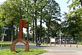
Nederlands: Afbeeldingen van de straat de Wolfslaardreef, Breda. Gelegen in de wijk Overakker in het zuiden van Breda in de provincie Noord-Brabant in het zuiden van Nederland. Nabij de wijken IJpelaar en het Ginneken in het zuiden van Breda. (bron [1])
street in Breda, the Netherlands | |||||
| Upload media | |||||
| Instance of | |||||
|---|---|---|---|---|---|
| Location | Breda, North Brabant, Netherlands | ||||
| Street address |
| ||||
 | |||||
Subcategories
This category has the following 5 subcategories, out of 5 total.
Media in category "Wolfslaardreef, Breda"
The following 2 files are in this category, out of 2 total.
-
 Omgeving Wolfslaar P1100746.jpg 4,000 × 2,672; 5.84 MB
-
 Wolfslaardreef, Breda P1100754.jpg 4,000 × 2,672; 5.76 MB

