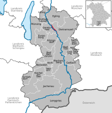
<nowiki>Wolfratshauser Forst; Wolfratshauser Forst; Wolfratshauser Forst; Wolfratshauser Forst; Wolfratshauser Forst; Волфратсхаузер Форст; Wolfratshauser Forst; Wolfratshauser Forst; Wolfratshauser Forst; Wolfratshauser Forst; Wolfratshauser Forst; Wolfratshauser Forst; Wolfratshauser Forst; Wolfratshauser Forst; Wolfratshauser Forst; Wolfratshauser Forst; Wolfratshauser Forst; Wolfratshauser Forst; Wolfratshauser Forst; Wolfratshauser Forst; Wolfratshauser Forst; Wolfratshauser Forst; Wolfratshauser Forst; Wolfratshauser Forst; Wolfratshauser Forst; Wolfratshauser Forst; Wolfratshauser Forst; Wolfratshauser Forst; Wolfratshauser Forst; Wolfratshauser Forst; فولفراتسهاوزر فورست; Wolfratshauser Forst; Wolfratshauser Forst; Wolfratshauser Forst; Wolfratshauser Forst; Wolfratshauser Forst; Wolfratshauser Forst; Wolfratshauser Forst; Wolfratshauser Forst; Wolfratshauser Forst; Wolfratshauser Forst; Wolfratshauser Forst; Wolfratshauser Forst; Wolfratshauser Forst; Wolfratshauser Forst; Wolfratshauser Forst; Wolfratshauser Forst; Wolfratshauser Forst; Wolfratshauser Forst; Wolfratshauser Forst; Wolfratshauser Forst; Wolfratshauser Forst; Wolfratshauser Forst; Wolfratshauser Forst; Wolfratshauser Forst; Wolfratshauser Forst; Wolfratshauser Forst; Wolfratshauser Forst; Wolfratshauser Forst; Wolfratshauser Forst; Wolfratshauser Forst; Wolfratshauser Forst; Wolfratshauser Forst; Wolfratshauser Forst; Wolfratshauser Forst; Wolfratshauser Forst; Wolfratshauser Forst; Wolfratshauser Forst; Wolfratshauser Forst; Wolfratshauser Forst; Wolfratshauser Forst; Wolfratshauser Forst; Wolfratshauser Forst; Wolfratshauser Forst; Wolfratshauser Forst; unincorporated area in Germany; بلدية ألمانية في ولاية بافاريا; Gemeindefreies Gebiet im Landkreis Bad Tölz-Wolfratshausen; Свободен от общини район в окръг Бад Тьолц-Волфратсхаузен</nowiki>


