Category:Wolferlow
Jump to navigation
Jump to search
village and civil parish in Herefordshire, United Kingdom | |||||
| Upload media | |||||
| Instance of | |||||
|---|---|---|---|---|---|
| Location | Herefordshire, West Midlands, England | ||||
| Population |
| ||||
 | |||||
Cymraeg: Pentref yn Swydd Henffordd, Gorllewin Canolbarth Lloegr, Lloegr ydy Wolferlow. (→Wolferlow)

Subcategories
This category has only the following subcategory.
A
Media in category "Wolferlow"
The following 61 files are in this category, out of 61 total.
-
 Access track to Wolferlow House - geograph.org.uk - 3540210.jpg 640 × 480; 250 KB
-
 An old road - geograph.org.uk - 5786853.jpg 1,024 × 576; 454 KB
-
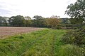
 Arable land to the west of High Lane - geograph.org.uk - 3768670.jpg 1,024 × 680; 301 KB
-
 Arable lane at High Lane - geograph.org.uk - 3767727.jpg 1,024 × 680; 283 KB
-
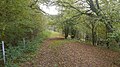
 Climbing through the woods to Wolferlow - geograph.org.uk - 3540196.jpg 640 × 480; 288 KB
-
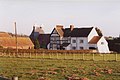
 Court Farm, Wolferlow - geograph.org.uk - 2686196.jpg 1,024 × 680; 139 KB
-
 Court Farm, Wolferlow - geograph.org.uk - 61009.jpg 640 × 427; 58 KB
-
 Cultivated field - geograph.org.uk - 5500758.jpg 1,024 × 683; 369 KB
-
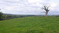
 Dead oak tree - geograph.org.uk - 3764516.jpg 1,024 × 680; 210 KB
-
 Dead tree - geograph.org.uk - 3764515.jpg 1,024 × 680; 179 KB
-
 Dead tree at Underley Farm - geograph.org.uk - 492376 (cropped).jpg 511 × 428; 122 KB
-
 Dead tree at Underley Farm - geograph.org.uk - 492376.jpg 640 × 480; 156 KB
-
 Dead tree, Underley - geograph.org.uk - 5786875.jpg 1,024 × 576; 258 KB
-
 Farmland at Wolferlow - geograph.org.uk - 3768694.jpg 1,024 × 680; 222 KB
-
 Farmland near Stoke Bliss - geograph.org.uk - 6689176.jpg 6,000 × 4,000; 3.44 MB
-
 Fence and tree - geograph.org.uk - 3769481.jpg 1,024 × 680; 266 KB
-
 Field margin - geograph.org.uk - 5786813.jpg 1,024 × 683; 361 KB
-
 Field margin track - geograph.org.uk - 5786807.jpg 1,024 × 683; 366 KB
-
 Field, Poswick - geograph.org.uk - 5786825.jpg 1,024 × 576; 377 KB
-
 Field, Wolferlow - geograph.org.uk - 5499133.jpg 1,024 × 683; 356 KB
-
 Field, Wolferlow - geograph.org.uk - 5499136.jpg 1,024 × 683; 322 KB
-
 Fields, Underley - geograph.org.uk - 5786873.jpg 1,024 × 576; 272 KB
-
 Fields, Underley - geograph.org.uk - 5786877.jpg 1,024 × 576; 269 KB
-
 Footpath to Wolferlow - geograph.org.uk - 3770532.jpg 1,024 × 680; 260 KB
-
 Footpath to Wolferlow church - geograph.org.uk - 3769448.jpg 1,024 × 680; 251 KB
-
 Hilltop pasture, Upper House Farm - geograph.org.uk - 5786850.jpg 1,024 × 576; 241 KB
-
 Last sunlight of the day - geograph.org.uk - 3764532.jpg 1,024 × 680; 207 KB
-
 Low sun on a rolling landscape - geograph.org.uk - 3764529.jpg 1,024 × 680; 211 KB
-
 Mixed farming, Poswick - geograph.org.uk - 5786835.jpg 1,024 × 576; 316 KB
-
 Oak tree and Forty Acre Farm - geograph.org.uk - 3764519.jpg 1,024 × 680; 231 KB
-
 Old tree trunk - geograph.org.uk - 3770528.jpg 1,024 × 680; 256 KB
-
 Path, headwaters of the Kyre Brook - geograph.org.uk - 3928490.jpg 640 × 480; 331 KB
-
 Pond, Park Farm - geograph.org.uk - 5786764.jpg 1,024 × 683; 500 KB
-
 Portaloos in a field - geograph.org.uk - 3540202.jpg 640 × 480; 186 KB
-
 Road to Poswick - geograph.org.uk - 5499137.jpg 1,024 × 683; 349 KB
-
 Road to Poswick - geograph.org.uk - 5786831.jpg 1,024 × 1,024; 572 KB
-
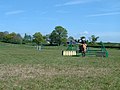
 Sapey Cross Country - geograph.org.uk - 5786842.jpg 1,024 × 576; 247 KB
-
 Scarp, Underley - geograph.org.uk - 5786867.jpg 1,024 × 576; 237 KB
-
 Sheep pasture on Upper House Farm - geograph.org.uk - 492368.jpg 640 × 480; 121 KB
-
 Site of a former medieval village - geograph.org.uk - 3769476.jpg 1,024 × 680; 253 KB
-
 Stubble - geograph.org.uk - 5786819.jpg 1,024 × 683; 330 KB
-
 The Gate Hangs Well - geograph.org.uk - 5500755.jpg 1,024 × 683; 280 KB
-
 Track, Cwmwood - geograph.org.uk - 5786847.jpg 1,024 × 576; 294 KB
-
 Upper House Farm - geograph.org.uk - 2327669.jpg 2,048 × 1,516; 1,011 KB
-
 View north from Wolferlow - geograph.org.uk - 3769456.jpg 1,024 × 680; 240 KB
-
 Wigley Orchard Caravan Park - geograph.org.uk - 6689172.jpg 6,000 × 4,000; 4.42 MB
-
 Winter cereals - geograph.org.uk - 3764524.jpg 1,024 × 680; 311 KB
-
 Wolferlow christmas trees - geograph.org.uk - 492361.jpg 640 × 480; 135 KB
-
 Wolferlow church - geograph.org.uk - 2686192.jpg 1,024 × 680; 175 KB
-
 Wolferlow church - geograph.org.uk - 3770526.jpg 1,024 × 680; 195 KB
-
 Bridleway near Pie Corner - geograph.org.uk - 492413.jpg 640 × 480; 137 KB
-

-
 Entrance road to Underley Farm - geograph.org.uk - 492383.jpg 640 × 480; 129 KB
-
 Entrance road to Underley Farm - geograph.org.uk - 492385.jpg 640 × 480; 149 KB
-
 Entrance to Upper House Farm - geograph.org.uk - 492530.jpg 640 × 480; 131 KB
-
 Farm track at Underley Farm - geograph.org.uk - 492451.jpg 640 × 480; 150 KB
-
 Farm track near Upper House Farm - geograph.org.uk - 492513.jpg 640 × 480; 128 KB
-
 Footpath on Underley Farm - geograph.org.uk - 492395.jpg 640 × 480; 122 KB
-
 Hay field near Upper House Farm - geograph.org.uk - 492366.jpg 626 × 467; 105 KB
-
 Maize field at Lower Barn - geograph.org.uk - 492440.jpg 640 × 480; 132 KB
-
 Sapey Cross Country Course at Wolferlow - geograph.org.uk - 10353.jpg 640 × 480; 107 KB


.jpg)


