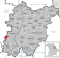
<nowiki>Wolferlohe; Wolferlohe; Wolferlohe; Wolferlohe; Wolferlohe; Wolferlohe; Wolferlohe; Wolferlohe; Wolferlohe; Wolferlohe; Wolferlohe; Wolferlohe; Wolferlohe; Wolferlohe; Wolferlohe; Wolferlohe; Wolferlohe; Wolferlohe; Wolferlohe; Wolferlohe; Wolferlohe; Wolferlohe; Wolferlohe; Wolferlohe; Wolferlohe; Wolferlohe; Wolferlohe; Wolferlohe; Wolferlohe; Wolferlohe; Wolferlohe; Wolferlohe; Wolferlohe; Wolferlohe; Wolferlohe; Wolferlohe; Wolferlohe; Wolferlohe; Wolferlohe; Wolferlohe; Wolferlohe; Wolferlohe; Wolferlohe; Wolferlohe; Wolferlohe; Wolferlohe; Wolferlohe; Wolferlohe; Wolferlohe; Wolferlohe; Wolferlohe; Wolferlohe; Wolferlohe; Wolferlohe; Wolferlohe; Wolferlohe; Wolferlohe; Wolferlohe; Wolferlohe; Wolferlohe; Wolferlohe; Wolferlohe; Wolferlohe; Wolferlohe; Wolferlohe; Wolferlohe; Wolferlohe; Wolferlohe; Wolferlohe; Wolferlohe; Wolferlohe; Wolferlohe; Wolferlohe; Wolferlohe; gemeindefreies Gebiet im Landkreis Schwandorf in Bayern; unincorporated area in Germany; غابة في ألمانيا; hutan di Jerman; bos in Duitsland</nowiki>


 Wolferlohe in SAD.svg 710 × 683; 651 KB