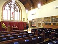
Category:Woking Crematorium Chapel
Jump to navigation
Jump to search
This is a category about listed building number 1236361. |
| Object location | | View all coordinates using: OpenStreetMap |
|---|
chapel in Woking, Surrey, England, UK  | |||||
| Upload media | |||||
| Instance of | |||||
|---|---|---|---|---|---|
| Location | Woking, Surrey, South East England, England | ||||
| Heritage designation |
| ||||
 | |||||
Media in category "Woking Crematorium Chapel"
This category contains only the following file.
-
 Woking Crematorium Chapel 2018.jpg 4,000 × 3,000; 1.31 MB