Category:Wohngebäude (Untere Gasse 19, Unterseen)
Jump to navigation
Jump to search
| Object location | | View all coordinates using: OpenStreetMap |
|---|
| NO WIKIDATA ID FOUND! Search for Wohngebäude (Untere Gasse 19, Unterseen) on Wikidata | |
| Upload media |
Media in category "Wohngebäude (Untere Gasse 19, Unterseen)"
The following 2 files are in this category, out of 2 total.
-
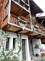 Unterseen Unter den Häusern 18.jpg 3,456 × 4,608; 6.58 MB
-
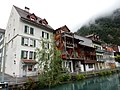 Unterseen Unter den Häusern.jpg 4,608 × 3,456; 6.9 MB

