Category:Witton, North Norfolk
Jump to navigation
Jump to search

village and civil parish in North Norfolk, in the United Kingdom  | |||||
| Upload media | |||||
| Instance of | |||||
|---|---|---|---|---|---|
| Location | North Norfolk, Norfolk, East of England, England | ||||
| Population |
| ||||
| Area |
| ||||
| Different from | |||||
 | |||||
Subcategories
This category has the following 8 subcategories, out of 8 total.
B
M
N
P
R
W
Media in category "Witton, North Norfolk"
The following 200 files are in this category, out of 323 total.
(previous page) (next page)-
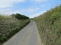 A hollow-way west of Witton - geograph.org.uk - 4602885.jpg 640 × 480; 163 KB
-
 A large irrigator irrigating - geograph.org.uk - 4602909.jpg 640 × 480; 118 KB
-
 A sunny seat - geograph.org.uk - 1051502.jpg 561 × 640; 141 KB
-
 Agricultural view - geograph.org.uk - 6790419.jpg 1,024 × 768; 160 KB
-
 All that remains of an old gate - geograph.org.uk - 6687433.jpg 1,024 × 768; 318 KB
-
 Alternative entrance to Crostwight Plantation - geograph.org.uk - 6725644.jpg 1,024 × 768; 411 KB
-

-
 Arable field - geograph.org.uk - 6701923.jpg 1,024 × 768; 208 KB
-
 Arable field viewed from Happisburgh Road - geograph.org.uk - 6715900.jpg 1,024 × 768; 238 KB
-
 Arable landscape - geograph.org.uk - 6720433.jpg 1,024 × 768; 148 KB
-
 Area of Scrub beside Mill Common Road - geograph.org.uk - 6790490.jpg 1,024 × 768; 293 KB
-
 Area of scrub woodland - geograph.org.uk - 6709417.jpg 1,024 × 768; 392 KB
-
 Autumnal Oak hedge - geograph.org.uk - 6681861.jpg 768 × 1,024; 307 KB
-
 Bachelor's Lane - geograph.org.uk - 6709449.jpg 1,024 × 768; 320 KB
-
 Back up Heath Road - geograph.org.uk - 6720729.jpg 1,024 × 768; 225 KB
-
 Bacton Road - geograph.org.uk - 6275206.jpg 1,600 × 1,067; 413 KB
-
 Bacton Road by Verona Plantation - geograph.org.uk - 5553832.jpg 1,600 × 1,200; 240 KB
-
 Bacton Road near Church Plantation - geograph.org.uk - 4602874.jpg 640 × 480; 128 KB
-
 Bales of silage on hardstanding at Nash's Farm - geograph.org.uk - 5853779.jpg 3,456 × 2,592; 3.47 MB
-
 Barn at Nash's Farm - geograph.org.uk - 6907615.jpg 1,024 × 768; 243 KB
-
 Barn conversion, Church Farm - geograph.org.uk - 6275222.jpg 1,600 × 1,067; 463 KB
-
 Barns by Bacton Road - geograph.org.uk - 6275209.jpg 1,600 × 1,067; 343 KB
-
 Bend in Mill Common Road - geograph.org.uk - 6790362.jpg 1,024 × 768; 273 KB
-
 Bend in the road - geograph.org.uk - 6702730.jpg 1,024 × 768; 248 KB
-
 Bends on Batchelor's lane - geograph.org.uk - 6791150.jpg 1,024 × 768; 248 KB
-
 Bends on Heath Road - geograph.org.uk - 6755680.jpg 1,024 × 768; 244 KB
-
 Blocked Woodland path - geograph.org.uk - 6719372.jpg 1,024 × 768; 308 KB
-
 Boats on North Walsham and Dilham Canal - geograph.org.uk - 5878484.jpg 1,024 × 684; 213 KB
-
 Boats on North Walsham and Dilham Canal - geograph.org.uk - 5878492.jpg 1,024 × 768; 342 KB
-
 Broom Lane - geograph.org.uk - 6027737.jpg 1,600 × 1,200; 415 KB
-
 C 419 Bacton Road - geograph.org.uk - 6701918.jpg 1,024 × 592; 108 KB
-
 C 419 to North Walsham - geograph.org.uk - 6701920.jpg 1,024 × 768; 156 KB
-
 C Road to North Walsham - geograph.org.uk - 6701937.jpg 1,024 × 768; 215 KB
-
 C413 to Happisburgh - geograph.org.uk - 6715991.jpg 1,024 × 768; 175 KB
-
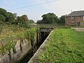
 Canal Basin at Ebridge Mill - geograph.org.uk - 6693598.jpg 1,024 × 768; 157 KB
-
 Caravan site by Witton Heath - geograph.org.uk - 6275197.jpg 1,600 × 1,067; 383 KB
-
 Cattle grazing rough Pasture - geograph.org.uk - 6845357.jpg 1,024 × 768; 218 KB
-
 Chapel Road Ridlington - geograph.org.uk - 6709452.jpg 1,024 × 768; 320 KB
-
 Church Farm House - geograph.org.uk - 6715919.jpg 1,024 × 768; 263 KB
-
 Church Farm, Ridlington - geograph.org.uk - 5978499.jpg 1,600 × 1,064; 609 KB
-
 Churchyard of St. Margaret's Witton - geograph.org.uk - 6727705.jpg 1,024 × 768; 311 KB
-
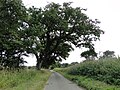
 Copse on Crome's Hill - geograph.org.uk - 1048888.jpg 640 × 457; 73 KB
-
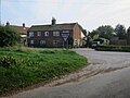
 Cottages at junction - geograph.org.uk - 5878363.jpg 1,024 × 684; 211 KB
-
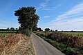
 Country road west of Witton - geograph.org.uk - 4602896.jpg 640 × 480; 201 KB
-
 Countryside walkers - geograph.org.uk - 6720746.jpg 1,024 × 768; 252 KB
-
 Cover crop by Happisburgh Road - geograph.org.uk - 6275225.jpg 1,600 × 1,067; 551 KB
-
 Cover crop on Mill Common - geograph.org.uk - 5553631.jpg 1,600 × 1,200; 412 KB
-
 Crome's Hill - geograph.org.uk - 1048912.jpg 640 × 515; 116 KB
-
 Crome's Hill - geograph.org.uk - 6027725.jpg 1,600 × 1,148; 383 KB
-
 Crossroads on Bacton Road - geograph.org.uk - 5976543.jpg 1,600 × 1,057; 566 KB
-
 Cultivated Field - geograph.org.uk - 6791108.jpg 1,024 × 768; 281 KB
-
 Disused Lock undergoing renovation - geograph.org.uk - 6693593.jpg 1,024 × 768; 260 KB
-
 Diverging paths in Bacton Wood - geograph.org.uk - 6680644.jpg 1,024 × 768; 420 KB
-
 Diverging paths in Bacton Wood - geograph.org.uk - 6717889.jpg 1,024 × 768; 411 KB
-
 Downhill path to a main Forest Road - geograph.org.uk - 6782760.jpg 1,024 × 768; 375 KB
-
 Driveway to Ebridge Farm - geograph.org.uk - 6690081.jpg 1,024 × 768; 248 KB
-
 Dwelling beside Mill Common Road - geograph.org.uk - 6791119.jpg 1,024 × 768; 373 KB
-
 East on Mill Common Road - geograph.org.uk - 6791105.jpg 1,024 × 768; 301 KB
-
 East on minor rural road - geograph.org.uk - 6704418.jpg 1,024 × 768; 300 KB
-
 Easterly view along Kitlings Beck road - geograph.org.uk - 6689288.jpg 1,024 × 768; 240 KB
-
 Easterly view on Woodland Path - geograph.org.uk - 6732369.jpg 1,024 × 768; 328 KB
-
 Ebridge Lane - geograph.org.uk - 6744682.jpg 1,024 × 768; 147 KB
-
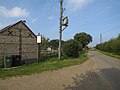
 Ebridge Lane Cottages - geograph.org.uk - 6744702.jpg 1,024 × 690; 209 KB
-
 Ebridge Mill Lock - geograph.org.uk - 6849694.jpg 1,024 × 768; 259 KB
-
 Ebridge Mill Pond on the North Walsham-Dilham Canal, Norfolk - geograph.org.uk - 2854241.jpg 2,272 × 1,704; 1.39 MB
-
 Ebridge Mill reflections - geograph.org.uk - 6849703.jpg 1,024 × 768; 190 KB
-
 Entering Ridlington - geograph.org.uk - 6709213.jpg 1,024 × 768; 392 KB
-
 Entrance and driveway to White House Barn - geograph.org.uk - 6689266.jpg 1,024 × 768; 445 KB
-
 Entrance road to Bacton Wood Carpark - geograph.org.uk - 6696761.jpg 1,024 × 768; 331 KB
-
 Entrance sign for Ebridge Farm - geograph.org.uk - 6690066.jpg 1,024 × 768; 344 KB
-
 Entrance to arable field - geograph.org.uk - 6727676.jpg 1,024 × 768; 217 KB
-
 Entrance to footpath - geograph.org.uk - 6715815.jpg 1,024 × 768; 369 KB
-
 Entrance to Manor House - geograph.org.uk - 6755686.jpg 1,024 × 768; 362 KB
-
 Entrance to Old Hall Farm Witton - geograph.org.uk - 6677813.jpg 1,024 × 768; 376 KB
-
 Entrance to River Farm - geograph.org.uk - 6693610.jpg 1,024 × 768; 250 KB
-
 Faded North Walsham and Dilham canal sign - geograph.org.uk - 6687427.jpg 1,024 × 768; 232 KB
-
 Farm buildings at Nash's Farm - geograph.org.uk - 6907609.jpg 1,024 × 768; 188 KB
-
 Farm pond with ducks - geograph.org.uk - 6702623.jpg 1,024 × 768; 333 KB
-
 Farm seen through hedge - geograph.org.uk - 6696760.jpg 1,024 × 768; 361 KB
-
 Farm track and Footpath in Ridlington - geograph.org.uk - 6720416.jpg 1,024 × 768; 221 KB
-
 Fenced off pond - geograph.org.uk - 6717903.jpg 1,024 × 768; 360 KB
-
 Field by North Walsham Road - geograph.org.uk - 5128302.jpg 1,600 × 1,200; 579 KB
-
 Field of Fodder Beet - geograph.org.uk - 6725639.jpg 1,024 × 768; 240 KB
-
 Flooded Water Meadows - geograph.org.uk - 6712807.jpg 1,024 × 768; 291 KB
-
 Flooded Water Meadows seen from Footpath - geograph.org.uk - 6712799.jpg 1,024 × 768; 331 KB
-
 Footpath beside ploughed field - geograph.org.uk - 6715993.jpg 1,024 × 768; 223 KB
-
 Footpath beside winter cereal crop - geograph.org.uk - 6727683.jpg 1,024 × 768; 187 KB
-
 Footpath from Happisburgh Road - geograph.org.uk - 6275229.jpg 1,600 × 1,067; 410 KB
-
 Footpath past Mill Common House - geograph.org.uk - 5553633.jpg 1,600 × 1,200; 444 KB
-
 Footpath through stubble field - geograph.org.uk - 5553746.jpg 1,600 × 1,200; 332 KB
-
 Footpath to Witton Heath - geograph.org.uk - 6027711.jpg 1,600 × 1,200; 457 KB
-
 Forest track Bacton Wood - geograph.org.uk - 6686209.jpg 1,024 × 768; 375 KB
-
 Forest track leading to roadside parking - geograph.org.uk - 6686205.jpg 1,024 × 768; 368 KB
-
 Forestry operation Timber loading - geograph.org.uk - 6779576.jpg 1,024 × 768; 288 KB
-
 From corner of wet meadow towards Canal - geograph.org.uk - 6736817.jpg 1,024 × 768; 376 KB
-
 Frosty track - geograph.org.uk - 6737723.jpg 1,024 × 768; 305 KB
-
 Gated building plot - geograph.org.uk - 6702618.jpg 1,024 × 768; 204 KB
-
 Gateway to the sun and Horse field - geograph.org.uk - 6718516.jpg 1,024 × 768; 219 KB
-
 Grass field at Nash's Farm - geograph.org.uk - 6907608.jpg 1,024 × 768; 178 KB
-
 Grass triangle at road junction - geograph.org.uk - 5553744.jpg 1,600 × 1,200; 347 KB
-
 Grass triangle at the end of Broom Lane - geograph.org.uk - 5553814.jpg 1,600 × 1,200; 280 KB
-
 Happisburgh Road - geograph.org.uk - 6276398.jpg 1,600 × 1,067; 451 KB
-
 Happisburgh Road in Ridlington - geograph.org.uk - 6715793.jpg 1,024 × 768; 276 KB
-

-
 Happisburgh road Ridlington - geograph.org.uk - 6709448.jpg 1,024 × 768; 383 KB
-
 Happisburgh Road, Ridlington - geograph.org.uk - 5978501.jpg 1,600 × 1,064; 804 KB
-
 Heading home - geograph.org.uk - 6721786.jpg 1,024 × 768; 301 KB
-
 Heading towards Bacton - geograph.org.uk - 6701936.jpg 1,024 × 768; 247 KB
-
 Heath Cottage being renovated - geograph.org.uk - 6723671.jpg 1,024 × 768; 320 KB
-
 Heath Road - geograph.org.uk - 6720491.jpg 1,024 × 667; 178 KB
-
 Horse in field - geograph.org.uk - 6706704.jpg 1,024 × 768; 308 KB
-
 Horse paddock and road sign - geograph.org.uk - 5553636.jpg 1,600 × 1,200; 407 KB
-
 Horse Paddocks seen from Mill Common Road - geograph.org.uk - 6791142.jpg 1,024 × 768; 209 KB
-
 House beside Broom Lane - geograph.org.uk - 1048887.jpg 640 × 480; 93 KB
-
 Houses on North Walsham Road - geograph.org.uk - 5553829.jpg 1,600 × 1,200; 340 KB
-
 Information sign for Park Farm - geograph.org.uk - 6702626.jpg 1,024 × 768; 304 KB
-

-
 Junction of four minor rural roads - geograph.org.uk - 6704412.jpg 1,024 × 768; 247 KB
-
 Junction of Mill Common Road with C417 - geograph.org.uk - 6704289.jpg 1,024 × 768; 332 KB
-
 Junction of minor roads - geograph.org.uk - 6709436.jpg 1,024 × 768; 215 KB
-

-
 Large windowless buildings on Nash's Farm - geograph.org.uk - 5853773.jpg 3,456 × 2,592; 3.69 MB
-
 Locked gates - geograph.org.uk - 6709310.jpg 1,024 × 768; 243 KB
-

-
 Looking across Lock Basin to Canal entry - geograph.org.uk - 6736799.jpg 1,024 × 768; 204 KB
-
 Looking along Ebridge Lane - geograph.org.uk - 6744676.jpg 1,024 × 768; 205 KB
-
 Looking along Kitlings Beck road - geograph.org.uk - 6689278.jpg 1,024 × 768; 306 KB
-
 Looking along North Walsham Road - geograph.org.uk - 6709306.jpg 1,024 × 768; 301 KB
-
 Looking along North Walsham road C503 - geograph.org.uk - 6690042.jpg 1,024 × 768; 326 KB
-
 Looking down Driveway to River Farm - geograph.org.uk - 6736615.jpg 1,024 × 768; 270 KB
-
 Looking down Mill Common Road - geograph.org.uk - 6696764.jpg 1,024 × 768; 354 KB
-
 Looking down the hill - geograph.org.uk - 6732361.jpg 1,024 × 768; 382 KB
-
 Looking down track to River Farm - geograph.org.uk - 6736593.jpg 1,024 × 768; 321 KB
-
 Looking down Well Street - geograph.org.uk - 6702612.jpg 1,024 × 768; 236 KB
-
 Looking East on Mill Common Road - geograph.org.uk - 6704298.jpg 1,024 × 768; 254 KB
-
 Looking in North Walsham direction - geograph.org.uk - 6702445.jpg 1,024 × 768; 158 KB
-
 Looking North along C147 - geograph.org.uk - 6686217.jpg 1,024 × 683; 329 KB
-
 Looking North east on road to Happisburgh - geograph.org.uk - 6679811.jpg 1,024 × 768; 364 KB
-
 Looking North on Old Hall road - geograph.org.uk - 6689257.jpg 1,024 × 768; 367 KB
-
 Looking North on The Street Ridlington - geograph.org.uk - 6720464.jpg 1,024 × 768; 321 KB
-
 Looking South along C147 - geograph.org.uk - 6686227.jpg 1,024 × 768; 260 KB
-
 Looking South along Old Hall road - geograph.org.uk - 6689260.jpg 1,024 × 768; 319 KB
-
 Looking South on Old Hall Road - geograph.org.uk - 6696757.jpg 1,024 × 768; 336 KB
-
 Looking South towards Ebridge Mill - geograph.org.uk - 6687378.jpg 1,024 × 768; 192 KB
-

-
 Looking towards Crostwight Heath - geograph.org.uk - 6734565.jpg 1,024 × 768; 324 KB
-
 Looking towards Ebridge Lane Cottages - geograph.org.uk - 6744710.jpg 1,024 × 768; 174 KB
-
 Looking towards Happisburgh on C413 - geograph.org.uk - 6715925.jpg 1,024 × 768; 200 KB
-
 Looking towards junction of minor roads - geograph.org.uk - 6704309.jpg 1,024 × 768; 240 KB
-
 Looking towards Nash's Farm on Nash's lane - geograph.org.uk - 6907595.jpg 1,024 × 768; 260 KB
-
 Looking towards North Walsham and Dilham Canal - geograph.org.uk - 6734167.jpg 1,024 × 768; 196 KB
-

-
 Looking towards Plantation Road - geograph.org.uk - 6782753.jpg 1,024 × 768; 422 KB
-
 Looking towards River Farm - geograph.org.uk - 6689293.jpg 1,024 × 768; 206 KB
-
 Looking towards River Farm - geograph.org.uk - 6744679.jpg 1,024 × 768; 190 KB
-
 Looking towards The Round Wood - geograph.org.uk - 6689270.jpg 1,024 × 768; 190 KB
-
 Looking towards Verona Plantation - geograph.org.uk - 6701921.jpg 1,024 × 768; 186 KB
-
 Looking up hill on C 503 - geograph.org.uk - 6690047.jpg 1,024 × 768; 350 KB
-
 Looking west across horse meadows - geograph.org.uk - 6690090.jpg 1,024 × 768; 264 KB
-
 Looking West over fence - geograph.org.uk - 6727710.jpg 1,024 × 768; 348 KB
-
 Main road in Ridlington - geograph.org.uk - 6720448.jpg 1,024 × 768; 173 KB
-
 Meadow with Birch tree line - geograph.org.uk - 6734631.jpg 1,024 × 768; 235 KB
-
 Memorial plaque on seat in Bacton Wood - geograph.org.uk - 6708174.jpg 1,024 × 768; 178 KB
-
 Mid-November sunshine - geograph.org.uk - 1051517.jpg 640 × 480; 131 KB
-
 Mill Common Road - geograph.org.uk - 5553626.jpg 1,600 × 1,200; 310 KB
-
 Mill Common Road - geograph.org.uk - 5553629.jpg 1,600 × 1,348; 290 KB
-
 Mill Common Road - geograph.org.uk - 6790482.jpg 1,024 × 768; 301 KB
-
 Mill Common Road - geograph.org.uk - 6791139.jpg 1,024 × 768; 243 KB
-
 Minor country road near Old Hall Farm - geograph.org.uk - 6678819.jpg 1,024 × 768; 327 KB
-
 Minor Rural Road - geograph.org.uk - 6755687.jpg 1,024 × 768; 198 KB
-
 Minor rural road to Happisburgh - geograph.org.uk - 6704423.jpg 1,024 × 768; 279 KB
-
 Minor woodland path - geograph.org.uk - 6717892.jpg 1,024 × 768; 387 KB
-
 Model yachting, North Walsham and Dilham Canal - geograph.org.uk - 5878496.jpg 1,024 × 768; 230 KB
-

-
 Mountain bikers' playground - geograph.org.uk - 649215.jpg 480 × 640; 102 KB
-
 Mountain bikers' playground - geograph.org.uk - 649219.jpg 480 × 640; 115 KB
-
 Muddy Woodland path - geograph.org.uk - 6736824.jpg 1,024 × 768; 362 KB
-
 Nash's Lane near Nash's Farm - geograph.org.uk - 6907593.jpg 1,024 × 768; 267 KB
-
 Natural Arch over cleared path - geograph.org.uk - 6737725.jpg 1,024 × 768; 335 KB
-
 North on Old Hall Road towards crossroads - geograph.org.uk - 6696755.jpg 1,024 × 768; 324 KB
-
 North on Plantation Road in Spring - geograph.org.uk - 6836836.jpg 1,024 × 768; 351 KB
-
 North towards Park Farm - geograph.org.uk - 6702727.jpg 1,024 × 768; 247 KB
-
 North Walsham and Dilham Canal - geograph.org.uk - 5553835.jpg 1,600 × 1,200; 469 KB
-
 North Walsham Road - geograph.org.uk - 5128299.jpg 1,600 × 1,200; 617 KB
-
 North Walsham Road - geograph.org.uk - 649187.jpg 640 × 480; 93 KB
-
 North Walsham Road Ridlington - geograph.org.uk - 6709450.jpg 1,024 × 768; 283 KB
-
 North Walsham ^ Dilham Canal - geograph.org.uk - 6736545.jpg 1,024 × 768; 362 KB
-
 North Walsham ^ Dilham Canal Basin - geograph.org.uk - 6736560.jpg 1,024 × 768; 186 KB
-
 North Walsham ^ Dilham Canal downstream of Lock - geograph.org.uk - 6736573.jpg 768 × 1,024; 360 KB
-

-

-
 Northeast across open grassy area - geograph.org.uk - 6681900.jpg 1,024 × 768; 343 KB
-
 Northeast on Ebridge Lane - geograph.org.uk - 6744673.jpg 1,024 × 768; 198 KB
-
 Northeast on Heath Road - geograph.org.uk - 6720498.jpg 1,024 × 768; 254 KB
-
 Northeast on minor rural road - geograph.org.uk - 6702736.jpg 1,024 × 768; 297 KB
-
 Northeast on Woodland path - geograph.org.uk - 6732164.jpg 1,024 × 768; 356 KB
-
 Now horse paddocks - geograph.org.uk - 5553637.jpg 1,600 × 1,093; 315 KB
-
 Oak lined North Walsham road - geograph.org.uk - 6689253.jpg 768 × 1,024; 408 KB
-
 Old concrete ramp by Ebridge Mill lock - geograph.org.uk - 3929378.jpg 640 × 480; 225 KB
-
 Old Hall Road junction with North Walsham Road - geograph.org.uk - 5553827.jpg 1,600 × 1,200; 447 KB


