Category:Withnell
Jump to navigation
Jump to search
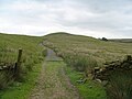
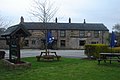
English: Withnell is a village and civil parish in the Borough of Chorley, Lancashire, England. According to the 2001 census it had a population of 3,631. Withnell is about five miles (8 km) north-east of Chorley itself and about away from Blackburn. It constituted an urban district from 1894 to 1974. It was originally called 'Withinhull' around 1160, later appearing as 'Withinhulle' in the 1332 Subsidy Rolls of Lancashire, meaning 'a hill where willow trees grow'. It borders the villages of Brinscall and Abbey Village. (→Withnell)
Nederlands: Withnell is een plaats en civil parish in het bestuurlijke gebied Chorley, in het Engelse graafschap Lancashire met 3.631 inwoners. (→Withnell)
Polski: Withnell – wieś w Anglii, w hrabstwie Lancashire, w dystrykcie Chorley. Leży 33 km na północny zachód od miasta Manchester i 293 km na północny zachód od Londynu. W 2001 miejscowość liczyła 3631 mieszkańców. (→Withnell)
village in Lancashire, United Kingdom  | |||||
| Upload media | |||||
| Instance of | |||||
|---|---|---|---|---|---|
| Location | Chorley, Lancashire, North West England, England | ||||
 | |||||
Subcategories
This category has the following 4 subcategories, out of 4 total.
Media in category "Withnell"
The following 200 files are in this category, out of 488 total.
(previous page) (next page)-

-

-

-
 A bend in Bolton Road (A675) - geograph.org.uk - 3372228.jpg 1,200 × 900; 303 KB
-
 A fan club that I'd gathered - geograph.org.uk - 2338500.jpg 4,283 × 2,800; 4.82 MB
-
 A field boundary - geograph.org.uk - 2338303.jpg 4,592 × 3,056; 5.87 MB
-
 A footbridge shown on the OS - geograph.org.uk - 2338538.jpg 4,592 × 3,056; 5.5 MB
-
 A footbridge which is not supposed to be used - geograph.org.uk - 2379061.jpg 3,872 × 2,592; 7.46 MB
-
 A free standing stile on The Witton Weavers Way - geograph.org.uk - 2972430.jpg 4,223 × 2,811; 7.43 MB
-
 A junction with the A675 - geograph.org.uk - 2347939.jpg 4,592 × 3,056; 7.11 MB
-
 A lonely sorry looking tree - geograph.org.uk - 2338569.jpg 4,592 × 3,056; 5.06 MB
-
 A nicely paved path to the summit of Great Hill - geograph.org.uk - 2337502.jpg 4,592 × 3,056; 6.18 MB
-
 A path through the woods - geograph.org.uk - 2336921.jpg 4,239 × 2,522; 6.44 MB
-
 A sharp bend, Brinscall - geograph.org.uk - 5538105.jpg 1,024 × 684; 289 KB
-
 A splash of colour - geograph.org.uk - 2816248.jpg 2,048 × 1,536; 1.4 MB
-
 A stile near The Witton Weavers Way - geograph.org.uk - 2972356.jpg 4,592 × 2,581; 6.69 MB
-
 A tight squeeze - geograph.org.uk - 5079175.jpg 1,280 × 828; 779 KB
-
 A unknown farm, south of Abbey Village - geograph.org.uk - 2320948.jpg 800 × 600; 293 KB
-
 A View Along The Towing Path - geograph.org.uk - 3876035.jpg 2,560 × 1,920; 4.24 MB
-

-
 A674 Finnington Lane - geograph.org.uk - 4339188.jpg 640 × 480; 79 KB
-
 A675 at Abbey Village boundary sign - geograph.org.uk - 4685800.jpg 640 × 480; 53 KB
-
 A675 Belmont Road - geograph.org.uk - 2347900.jpg 4,592 × 2,447; 6.4 MB
-
 A675 heading south - geograph.org.uk - 3372215.jpg 640 × 480; 47 KB
-
 A675 near Higher Roddlesworth Farm - geograph.org.uk - 4685788.jpg 640 × 481; 33 KB
-
 A675 north of Abbey Village - geograph.org.uk - 4685806.jpg 640 × 479; 51 KB
-
 A675 northbound at Watson's Farm - geograph.org.uk - 4685783.jpg 640 × 481; 49 KB
-

-
 A675, Bolton Road - geograph.org.uk - 3031364.jpg 800 × 601; 854 KB
-
 Abbey Mill, Abbey Village - geograph.org.uk - 2311535.jpg 480 × 640; 78 KB
-
 Abbey Mill, Abbey Village - geograph.org.uk - 2311578.jpg 480 × 640; 77 KB
-
 Abbey Mill, Abbey Village - geograph.org.uk - 2311584.jpg 640 × 480; 107 KB
-
 Abbey Village - geograph.org.uk - 2347923.jpg 4,592 × 3,056; 4.67 MB
-
 Abbey Village - geograph.org.uk - 3031369.jpg 800 × 601; 811 KB
-
 Abbey Village Post Office - geograph.org.uk - 3372223.jpg 640 × 480; 73 KB
-
 Abbey Village Primary School - geograph.org.uk - 3372224.jpg 1,024 × 728; 164 KB
-
 Abbey Village Wastewater Pumping Station - geograph.org.uk - 2311661.jpg 640 × 480; 151 KB
-
 Alghero's Restaurant - geograph.org.uk - 4491843.jpg 3,985 × 2,068; 3.22 MB
-

-
 Archer's Rough - geograph.org.uk - 3476401.jpg 1,024 × 682; 554 KB
-
 At Calf Hey Bridge - geograph.org.uk - 4233423.jpg 3,878 × 2,633; 6.68 MB
-
 Beardwood Tree Services - geograph.org.uk - 2336880.jpg 4,592 × 2,265; 5.36 MB
-
 Benchmark at the canalside - geograph.org.uk - 2816256.jpg 1,536 × 2,048; 1.37 MB
-
 Biffa Landfill Facility - geograph.org.uk - 3099560.jpg 640 × 481; 521 KB
-
 Biffa Landfill Site, Withnell - geograph.org.uk - 3099564.jpg 640 × 481; 591 KB
-
 Big field, Withnell - geograph.org.uk - 5538095.jpg 1,024 × 576; 284 KB
-
 Black headed gull - geograph.org.uk - 5411021.jpg 1,280 × 958; 1.47 MB
-
 Bluebell Bank - geograph.org.uk - 1088851.jpg 640 × 480; 104 KB
-
 Boardman's Heights Reservoir, Pike Lowe - geograph.org.uk - 3283035.jpg 1,600 × 1,200; 1.42 MB
-

-

-
 Bolton Road (A675) - geograph.org.uk - 3372204.jpg 640 × 480; 49 KB
-
 Bolton Road (A675) - geograph.org.uk - 3372217.jpg 640 × 480; 69 KB
-
 Bolton Road (A675) - geograph.org.uk - 3372234.jpg 640 × 480; 55 KB
-
 Bolton Road (A675) - geograph.org.uk - 3372238.jpg 640 × 480; 89 KB
-
 Bolton Road (A675), Abbey Village - geograph.org.uk - 3372225.jpg 1,200 × 900; 243 KB
-
 Bolton Road (A675), Roddlesworth - geograph.org.uk - 3031361.jpg 800 × 601; 853 KB
-
 Bolton Road - geograph.org.uk - 4491797.jpg 4,291 × 3,025; 4.83 MB
-
 Bolton Road, Abbey Village - geograph.org.uk - 2311580.jpg 640 × 480; 124 KB
-
 Bolton Road, Abbey Village - geograph.org.uk - 2311583.jpg 640 × 480; 109 KB
-
 Bolton Road, Abbey Village - geograph.org.uk - 2311637.jpg 640 × 480; 172 KB
-
 Bolton Road, Abbey Village - geograph.org.uk - 2311723.jpg 640 × 480; 113 KB
-
 Boundary Stone - geograph.org.uk - 3062939.jpg 640 × 481; 614 KB
-
 Bridge 93 on The Leeds and Liverpool Canal - geograph.org.uk - 2972313.jpg 4,592 × 3,056; 7.68 MB
-
 Bridge Number 91A - geograph.org.uk - 3867569.jpg 2,560 × 1,920; 2.91 MB
-
 Bridlepath - geograph.org.uk - 3099563.jpg 640 × 481; 520 KB
-
 Brimmicroft Bridge - geograph.org.uk - 3080046.jpg 4,000 × 3,000; 4.21 MB
-
 Brindle , M65 Motorway - geograph.org.uk - 6359928.jpg 6,000 × 4,000; 5.19 MB
-
 Brinscall - geograph.org.uk - 1888665.jpg 1,600 × 1,200; 536 KB
-
 Brinscall - geograph.org.uk - 3675189.jpg 3,869 × 2,028; 1.16 MB
-

-
 Brinscall Cricket Club - geograph.org.uk - 2474721.jpg 1,600 × 1,200; 419 KB
-
 Brinscall Cricket Club - Ground - geograph.org.uk - 2474727.jpg 1,600 × 1,200; 296 KB
-
 Brinscall Hall - geograph.org.uk - 2895030.jpg 3,767 × 2,550; 4.14 MB
-
 Brinscall Post Office and Village Store - geograph.org.uk - 3031471.jpg 800 × 600; 761 KB
-
 Brinscall Quarry - geograph.org.uk - 2291544.jpg 640 × 480; 158 KB
-
 Brinscall Quarry, Sign - geograph.org.uk - 2291552.jpg 640 × 480; 183 KB
-
 Brinscall Village - geograph.org.uk - 2083192.jpg 1,632 × 1,224; 465 KB
-
 Brown Hill from the A675 - geograph.org.uk - 2711319.jpg 4,000 × 3,000; 3.8 MB
-
 Buckholes Lane - geograph.org.uk - 3031479.jpg 800 × 601; 860 KB
-
 Burial mound^ - geograph.org.uk - 1297035.jpg 640 × 360; 103 KB
-
 Bury Lane - geograph.org.uk - 525719.jpg 640 × 480; 81 KB
-
 Bury Lane, Withnell - geograph.org.uk - 3033118.jpg 800 × 600; 708 KB
-
 Bury Lane, Withnell - geograph.org.uk - 3033123.jpg 800 × 600; 653 KB
-
 Bury Lane, Withnell - geograph.org.uk - 5538098.jpg 1,024 × 576; 261 KB
-
 Bus shelter, Abbey Village - geograph.org.uk - 4598302.jpg 3,308 × 2,060; 1.01 MB
-

-
 Bus stop on Finnington Lane (A674) - geograph.org.uk - 5957405.jpg 640 × 480; 53 KB
-

-
 Butterworth Brow, Brinscall - geograph.org.uk - 2291548.jpg 640 × 480; 159 KB
-
 Calf Hey Brook - geograph.org.uk - 3099521.jpg 640 × 480; 630 KB
-
 Canal food - geograph.org.uk - 2816246.jpg 2,048 × 1,536; 1.41 MB
-
 Canal overflow - geograph.org.uk - 2816269.jpg 2,048 × 1,536; 1.38 MB
-
 Canal towing path - geograph.org.uk - 4853736.jpg 640 × 480; 468 KB
-
 Canal west of Brimicroft Farm - geograph.org.uk - 4275458.jpg 1,600 × 1,200; 541 KB
-
 Canalside by the benchmark - geograph.org.uk - 2816263.jpg 1,536 × 2,048; 1.4 MB
-
 Car Park at The Oak Royal Golf Club - geograph.org.uk - 5659615.jpg 3,264 × 1,836; 2.57 MB
-
 Cattle grazing - geograph.org.uk - 5411008.jpg 1,280 × 960; 1.12 MB
-
 Central Quarry - geograph.org.uk - 3675176.jpg 3,393 × 2,551; 1.76 MB
-
 Children's playground, Abbey Village - geograph.org.uk - 3372220.jpg 1,200 × 900; 300 KB
-
 Chorley Road at Bury Lane - geograph.org.uk - 3761507.jpg 640 × 480; 54 KB
-
 Chorley Road nears the M65 - geograph.org.uk - 3761509.jpg 640 × 480; 42 KB
-
 Chorley Road towards Blackburn - geograph.org.uk - 5957374.jpg 640 × 480; 117 KB
-
 Churchill Street, Brinscall - geograph.org.uk - 2291524.jpg 640 × 480; 110 KB
-
 Close up, Elizabeth II postbox on Chorley Road (A674) - geograph.org.uk - 5960661.jpg 1,497 × 2,790; 908 KB
-

-
 Cockerel at Stanworth Farm - geograph.org.uk - 2290257.jpg 480 × 640; 144 KB
-
 Cold Within Hill - geograph.org.uk - 2218820.jpg 1,600 × 1,200; 1.52 MB
-
 Compass Point Wall - geograph.org.uk - 2254368.jpg 1,200 × 802; 286 KB
-
 Course of Disused Railway, Withnell - geograph.org.uk - 3031390.jpg 800 × 601; 1.12 MB
-
 Cows at the Canal - geograph.org.uk - 3093264.jpg 640 × 480; 591 KB
-
 Cows resting above the Stanworth Valley - geograph.org.uk - 2377828.jpg 3,872 × 2,592; 4.82 MB
-
 Darwen Jubilee Tower - geograph.org.uk - 6307816.jpg 1,600 × 1,198; 342 KB
-
 Dick Lane - geograph.org.uk - 2600334.jpg 2,592 × 3,888; 2.33 MB
-
 Dick Lane, Brinscall - geograph.org.uk - 2895007.jpg 4,000 × 3,000; 6.76 MB
-
 Down to the sluice - geograph.org.uk - 2816277.jpg 1,536 × 2,048; 1.28 MB
-

-
 Earthworks at Rake Brook reservoir - geograph.org.uk - 5607131.jpg 5,202 × 3,465; 2.18 MB
-
 Edge End Terrace - geograph.org.uk - 3099547.jpg 640 × 481; 414 KB
-
 Edge End Terrace - geograph.org.uk - 4491833.jpg 2,965 × 1,948; 2.26 MB
-
 Elizabeth II postbox on Chorley Road (A674) - geograph.org.uk - 5960660.jpg 2,848 × 2,136; 1.43 MB
-
 Elizabeth II postbox on Chorley Road (A674), Higher Wheelton - geograph.org.uk - 5960667.jpg 2,848 × 2,136; 1.45 MB
-
 Entering Lancashire - geograph.org.uk - 3099517.jpg 640 × 480; 482 KB
-
 Entrance to Astley Hall or Whitenell Hall - geograph.org.uk - 5659617.jpg 3,264 × 1,836; 2.73 MB
-
 Entrance to Ollerton Hall - geograph.org.uk - 2311403.jpg 640 × 480; 191 KB
-

-
 Ewes and lambs at Roddlesworth - geograph.org.uk - 2370742.jpg 640 × 480; 151 KB
-

-
 Farm building, Watson's Farm - geograph.org.uk - 3372236.jpg 1,200 × 749; 220 KB
-
 Farm track bridge on the Leeds Liverpool Canal - geograph.org.uk - 6431518.jpg 1,024 × 768; 278 KB
-
 Farmland at Withnell - geograph.org.uk - 3099559.jpg 640 × 481; 479 KB
-

-
 Farmland off Bolton Road - geograph.org.uk - 3372216.jpg 1,200 × 900; 287 KB
-
 Farmland off Stanworth Brow - geograph.org.uk - 3372212.jpg 1,200 × 900; 224 KB
-
 Farmland on the canal bank - geograph.org.uk - 5079173.jpg 3,998 × 2,996; 6.75 MB
-
 Farmland towards the M65 - geograph.org.uk - 3372199.jpg 640 × 480; 57 KB
-
 Farmland, Watson's Farm - geograph.org.uk - 3372237.jpg 640 × 480; 56 KB
-
 Field entrance off Chorley Road - geograph.org.uk - 5957379.jpg 640 × 480; 92 KB
-

-
 Field entrance off Finnington Lane - geograph.org.uk - 3372206.jpg 640 × 480; 80 KB
-
 Finnington Bridge - geograph.org.uk - 3093173.jpg 640 × 481; 699 KB
-
 Finnington Bridge moorings - geograph.org.uk - 4275462.jpg 1,600 × 1,200; 698 KB
-
 Finnington Lane (A674) - geograph.org.uk - 3093167.jpg 640 × 480; 440 KB
-
 Finnington Lane (A674) - geograph.org.uk - 3372210.jpg 640 × 480; 56 KB
-
 Footbridge below Red Lea Farm - geograph.org.uk - 2376010.jpg 3,872 × 2,592; 6.88 MB
-
 Footbridge in Birch Clough - geograph.org.uk - 3031354.jpg 800 × 601; 1 MB
-
 Footbridge near Laund Fold - geograph.org.uk - 1255352.jpg 640 × 480; 129 KB
-
 Footbridge on Reelers Trail - geograph.org.uk - 2434095.jpg 4,000 × 3,000; 5.66 MB
-
 Footbridge over the River Rod - geograph.org.uk - 5607148.jpg 5,202 × 3,465; 3.74 MB
-
 Footpath from Great Hill towards Winter Hill - geograph.org.uk - 5433340.jpg 1,600 × 900; 272 KB
-
 Footpath from Ollerton Fold - geograph.org.uk - 3080064.jpg 4,000 × 3,000; 5.18 MB
-
 Footpath in Withnell - geograph.org.uk - 4942913.jpg 1,280 × 960; 1.71 MB
-
 Footpath off Bolton Road - geograph.org.uk - 3372202.jpg 640 × 480; 58 KB
-
 Footpath to Gorton's Farm - geograph.org.uk - 3476400.jpg 1,024 × 682; 586 KB
-
 Ford across the River Rod - geograph.org.uk - 5607140.jpg 5,202 × 3,465; 4.54 MB
-
 Ford below Rake Brook Reservoir - geograph.org.uk - 5641121.jpg 4,032 × 3,024; 5.93 MB
-
 Former Abbey Village Railway Station - geograph.org.uk - 2311727.jpg 640 × 480; 151 KB
-
 Former bank on Railway Road, Brinscall - geograph.org.uk - 2291527.jpg 640 × 480; 120 KB
-

-
 Frisky lambs down Ollerton Lane - geograph.org.uk - 162960.jpg 640 × 427; 96 KB
-
 Garden Street, Abbey Village - geograph.org.uk - 2311530.jpg 640 × 480; 151 KB
-
 Garden Street, Abbey Village - geograph.org.uk - 2434116.jpg 2,709 × 1,957; 2.64 MB
-
 Gate and Stile - geograph.org.uk - 3093165.jpg 640 × 480; 584 KB
-
 Gate on the Witton Weavers Way - geograph.org.uk - 3062980.jpg 640 × 480; 508 KB
-
 Good drying weather - geograph.org.uk - 3080204.jpg 4,000 × 3,000; 5.65 MB
-
 Grazing off Finnington Lane - geograph.org.uk - 3372209.jpg 1,200 × 900; 283 KB
-
 Grazing sheep - geograph.org.uk - 3080012.jpg 4,000 × 3,000; 6.52 MB
-
 Great Hill summit after snow - geograph.org.uk - 6473816.jpg 4,320 × 3,240; 5.22 MB
-
 Greathill.jpg 800 × 600; 99 KB
-
 Half-milestone^ - geograph.org.uk - 2816265.jpg 1,536 × 2,048; 1.32 MB
-

-
 Hare and Hounds, Abbey Village - geograph.org.uk - 3031310.jpg 800 × 600; 724 KB
-
 Hare and Hounds, Abbey Village - geograph.org.uk - 5607170.jpg 5,202 × 3,465; 3.57 MB
-
 Hare ^ Hounds - Abbey Village - geograph.org.uk - 4491818.jpg 4,266 × 3,104; 4.85 MB
-
 Hare ^ Hounds - geograph.org.uk - 3674596.jpg 3,555 × 2,181; 1,003 KB
-
 Hartington Street, Brinscall - geograph.org.uk - 2291540.jpg 640 × 480; 125 KB
-
 Higher Riddlesworth Reservoir - geograph.org.uk - 3675417.jpg 3,806 × 2,297; 995 KB
-
 Higher Roddlesworth Farm - geograph.org.uk - 3372232.jpg 640 × 480; 64 KB
-
 Higher Roddlesworth Farm - geograph.org.uk - 4491803.jpg 2,838 × 1,426; 1.94 MB
-
 Higher Roddlesworth Reservoir - geograph.org.uk - 5387734.jpg 1,600 × 1,200; 336 KB
-
 Higher Roddlesworth Reservoir - geograph.org.uk - 5388144.jpg 1,600 × 1,200; 271 KB
-
 Hillside Methodist Brinscall - geograph.org.uk - 2808556.jpg 2,560 × 1,920; 842 KB
-
 Hillside Methodist Church - geograph.org.uk - 3031462.jpg 800 × 600; 773 KB
-
 Hoghton Arms - geograph.org.uk - 162941.jpg 640 × 427; 79 KB
-
 Hoghton Arms - geograph.org.uk - 1843148.jpg 1,600 × 1,200; 355 KB
-
 Hoghton Arms on Chorley Road - geograph.org.uk - 4500834.jpg 2,000 × 1,472; 346 KB
-
 Horses at Cross Fields - geograph.org.uk - 2972232.jpg 3,825 × 2,136; 5.25 MB
-
 House seen through trees, Kylnclough - geograph.org.uk - 1843168.jpg 1,600 × 1,200; 618 KB
-
 Houses on Finnington Lane - geograph.org.uk - 3093171.jpg 640 × 480; 570 KB
-
 Jacksons Bridge No 87 - geograph.org.uk - 5709883.jpg 800 × 578; 174 KB
-
 Junction 3 on the M65 - geograph.org.uk - 2464771.jpg 4,592 × 3,056; 5.48 MB
-
 Junction 3 on the M65 from the A675 - geograph.org.uk - 2358708.jpg 3,711 × 1,665; 2.77 MB
-
 Junction of the A674 and the road to Withnell - geograph.org.uk - 2711290.jpg 4,000 × 1,997; 4.19 MB
-
 Knowles Farm off Chorley Road - geograph.org.uk - 2311390.jpg 600 × 448; 160 KB
-
 Kylnclough Top Reservoir - geograph.org.uk - 1843141.jpg 1,600 × 1,200; 480 KB
-

-
 Lane near Withnell - geograph.org.uk - 5538096.jpg 1,024 × 576; 469 KB
-
 Leeds and Liverpool Canal - geograph.org.uk - 3062934.jpg 640 × 481; 649 KB
-
 Leeds and Liverpool Canal - geograph.org.uk - 3062949.jpg 640 × 481; 575 KB
-
 Leeds and Liverpool Canal - geograph.org.uk - 3062972.jpg 640 × 481; 483 KB

_Bolton_Road,_Abbey_Village,_Withnell,_Lancashire_-_geograph.org.uk_-_2083195.jpg)
_58_School_Lane,_Brinscall,_Chorley,_Lancashire_-_geograph.org.uk_-_2083187.jpg)
_-_geograph.org.uk_-_3372228.jpg)


_-_geograph.org.uk_-_3372204.jpg)
_-_geograph.org.uk_-_3372217.jpg)
_-_geograph.org.uk_-_3372234.jpg)
_-_geograph.org.uk_-_3372238.jpg)
,_Abbey_Village_-_geograph.org.uk_-_3372225.jpg)
,_Roddlesworth_-_geograph.org.uk_-_3031361.jpg)


_-_geograph.org.uk_-_5957381.jpg)
_-_geograph.org.uk_-_5957405.jpg)


_-_geograph.org.uk_-_5960661.jpg)
,_Higher_Wheelton_-_geograph.org.uk_-_5960668.jpg)


_-_geograph.org.uk_-_5960662.jpg)


_-_geograph.org.uk_-_5960660.jpg)
,_Higher_Wheelton_-_geograph.org.uk_-_5960667.jpg)


_-_geograph.org.uk_-_5957403.jpg)


_-_geograph.org.uk_-_3093167.jpg)
_-_geograph.org.uk_-_3372210.jpg)


