Category:Withington, Manchester
Jump to navigation
Jump to search
suburb of Manchester, England  | |||||
| Upload media | |||||
| Instance of | |||||
|---|---|---|---|---|---|
| Location | Manchester, Greater Manchester, North West England, England | ||||
| Area |
| ||||
| Different from | |||||
 | |||||
English: Withington is situated in the Manchester City Council ward of Withington in the City of Manchester and includes Ladybarn
Subcategories
This category has the following 9 subcategories, out of 9 total.
B
C
- Christie Hospital, Manchester (15 F)
F
- Fog Lane Park (22 F)
L
P
S
T
W
- Withington Hospital (8 F)
- Withington milestone (6 F)
Media in category "Withington, Manchester"
The following 8 files are in this category, out of 8 total.
-
 Car park, Withington Community Hospital - geograph.org.uk - 3164523.jpg 1,600 × 1,064; 239 KB
-
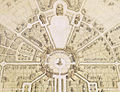 Edgar Wood, Withington masterplan.jpg 522 × 400; 199 KB
-
 EIIR Postbox (M20 617D) - geograph.org.uk - 5222423.jpg 1,000 × 1,614; 1.26 MB
-
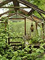 Overgrown Greenhouse.JPG 3,000 × 4,000; 5.16 MB
-
 Platt Brook - geograph.org.uk - 8285.jpg 480 × 640; 215 KB
-
 Red Lion Brook - geograph.org.uk - 4447838.jpg 4,288 × 3,056; 7.09 MB
-
 St Paul's Church, Withington - geograph.org.uk - 6697577.jpg 1,024 × 768; 875 KB
-
 Watertrough.jpg 1,600 × 1,200; 355 KB


_-_geograph.org.uk_-_5222423.jpg)


