Category:Withington, Gloucestershire
Jump to navigation
Jump to search
village and civil parish in Gloucestershire, UK  | |||||
| Upload media | |||||
| Instance of | |||||
|---|---|---|---|---|---|
| Location | Cotswold, Gloucestershire, South West England, England | ||||
| Population |
| ||||
 | |||||
English: Withington is a village in Gloucestershire, England, about eight miles south-east of Cheltenham. The River Coln runs through the village.

Subcategories
This category has the following 6 subcategories, out of 6 total.
C
F
- Foxcote, Gloucestershire (8 F)
K
- The Kings Head, Withington (3 F)
M
- The Mill Inn, Withington (13 F)
Media in category "Withington, Gloucestershire"
The following 200 files are in this category, out of 274 total.
(previous page) (next page)-
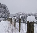
 "Fence bridge" near Thorndale - geograph.org.uk - 2937244.jpg 640 × 480; 126 KB
-
 A bend in the A436 - geograph.org.uk - 3398077.jpg 640 × 480; 94 KB
-
 A brace of pheasants - geograph.org.uk - 4279853.jpg 800 × 451; 306 KB
-
 A bridleway leading to Thorndale Farm - geograph.org.uk - 2723235.jpg 800 × 600; 226 KB
-
 A Cotswold stream, 1 - geograph.org.uk - 4279865.jpg 800 × 451; 222 KB
-
 A Cotswold stream, 2 - geograph.org.uk - 4279867.jpg 800 × 451; 214 KB
-
 A Cotswold stream, 3 - geograph.org.uk - 4279870.jpg 800 × 451; 206 KB
-
 A436 - crossroads near Foxcote - geograph.org.uk - 2511679.jpg 640 × 480; 67 KB
-

-
 A436 at the Kilkenny junction - geograph.org.uk - 2511676.jpg 640 × 480; 61 KB
-
 Abandoned car, Rough Hill Bank - geograph.org.uk - 2045470.jpg 3,008 × 2,000; 1.51 MB
-
 Across the road - geograph.org.uk - 1616284.jpg 640 × 480; 61 KB
-
 Barn at Cassey Compton - geograph.org.uk - 4644023.jpg 1,920 × 1,295; 715 KB
-
 Barn at Cassey Compton - geograph.org.uk - 4644028.jpg 1,920 × 1,440; 814 KB
-
 Barns at Cassey Compton - geograph.org.uk - 4643802.jpg 1,920 × 1,234; 525 KB
-
 Barns near Cassey Compton - geograph.org.uk - 4013255.jpg 1,600 × 1,064; 548 KB
-
 Bend in A436 east of Kilkenny - geograph.org.uk - 3576918.jpg 1,024 × 715; 129 KB
-
 Bottomlands pasture - geograph.org.uk - 1616064.jpg 640 × 480; 72 KB
-

-
 Bridleway along Upcote Plantation - geograph.org.uk - 2561930.jpg 480 × 640; 136 KB
-
 Bridleway at Cassey Compton - geograph.org.uk - 4644074.jpg 1,920 × 1,440; 823 KB
-
 Bridleway in Withington Woods - geograph.org.uk - 2561961.jpg 640 × 480; 118 KB
-
 Bridleway on Foxcote Hill - geograph.org.uk - 3772115.jpg 1,024 × 680; 192 KB
-
 Bridleway to Upcote Farm - geograph.org.uk - 2561919.jpg 640 × 480; 59 KB
-
 Bridleway towards Thorndale - geograph.org.uk - 4013226.jpg 1,600 × 1,064; 621 KB
-
 Cassey Compton - geograph.org.uk - 4013261.jpg 1,600 × 1,064; 539 KB
-
 Cassey Compton - geograph.org.uk - 4013263.jpg 1,600 × 1,064; 684 KB
-
 Cassey Compton - geograph.org.uk - 5511128.jpg 1,024 × 768; 222 KB
-
 Cassey Compton crossroads - geograph.org.uk - 3082523.jpg 5,184 × 3,456; 3.84 MB
-
 Cassey Compton House - geograph.org.uk - 4643382.jpg 1,920 × 1,207; 431 KB
-
 Cassey Compton House - geograph.org.uk - 4643418.jpg 1,920 × 1,356; 617 KB
-
 Cassey Compton House - geograph.org.uk - 4643584.jpg 1,920 × 1,440; 837 KB
-
 Cassey Compton House - geograph.org.uk - 5344351.jpg 640 × 428; 106 KB
-
 Coln Valley - geograph.org.uk - 154246.jpg 640 × 480; 79 KB
-
 Coln valley at Cassey Compton - geograph.org.uk - 4642480.jpg 2,816 × 2,112; 1.04 MB
-
 Coln valley at Cassey Compton - geograph.org.uk - 4643326.jpg 1,920 × 1,406; 716 KB
-
 Cotswold farmland - geograph.org.uk - 885789.jpg 640 × 426; 85 KB
-
 Cotswold lane at Cassey Compton - geograph.org.uk - 2863927.jpg 4,752 × 3,168; 3.83 MB
-
 Cotswold stone cottages in Withington - geograph.org.uk - 2882564.jpg 3,648 × 2,736; 3.89 MB
-
 Cotswold valley - geograph.org.uk - 3779816.jpg 1,024 × 680; 206 KB
-
 Cottages on High Street - geograph.org.uk - 4928415.jpg 800 × 595; 141 KB
-
 Country lane to Colesbourne - geograph.org.uk - 2043505.jpg 640 × 426; 85 KB
-
 Country road beside Hilcot Wood - geograph.org.uk - 2045381.jpg 3,008 × 2,000; 1.5 MB
-
 Country road passing through Pinchley Wood - geograph.org.uk - 3779811.jpg 680 × 1,024; 315 KB
-
 Country road, west of Withington - geograph.org.uk - 3772121.jpg 1,024 × 680; 213 KB
-
 Crossroads at Hilcot - geograph.org.uk - 3779806.jpg 1,024 × 680; 314 KB
-
 Crossroads, Cassey Compton - geograph.org.uk - 4642460.jpg 1,920 × 1,375; 595 KB
-
 Derelict farm buildings near Withington - geograph.org.uk - 4013222.jpg 1,600 × 1,064; 795 KB
-
 Disused Railway Bridge - geograph.org.uk - 1515571.jpg 640 × 480; 159 KB
-
 Disused railway bridge - geograph.org.uk - 2845071.jpg 2,448 × 3,264; 3.74 MB
-
 Driveway to Staple Farm, Colesbourne - geograph.org.uk - 129387.jpg 640 × 426; 116 KB
-
 Dropping down to Hilcot crossroads - geograph.org.uk - 1510570.jpg 640 × 480; 116 KB
-
 Edge of Chedworth Woods - geograph.org.uk - 4641839.jpg 1,920 × 1,440; 796 KB
-
 Edge of Hilcot Wood - geograph.org.uk - 4279862.jpg 800 × 451; 198 KB
-
 Electricity pylon - geograph.org.uk - 3778704.jpg 680 × 1,024; 221 KB
-
 Electricity pylons above Cassey Compton - geograph.org.uk - 5511154.jpg 1,024 × 768; 191 KB
-
 Electricity pylons above Cassey Compton - geograph.org.uk - 5511156.jpg 600 × 800; 106 KB
-
 Electricity pylons, Cassey Compton - geograph.org.uk - 5511152.jpg 768 × 1,024; 207 KB
-
 Entering Withington - geograph.org.uk - 2808215.jpg 800 × 600; 119 KB
-
 Farm at Cassey Compton - geograph.org.uk - 2863934.jpg 4,752 × 3,168; 4.17 MB
-
 Farm entrance on the A436, Andoversford - geograph.org.uk - 5861481.jpg 1,990 × 1,456; 1.48 MB
-
 Farm road and right of way - geograph.org.uk - 5511115.jpg 1,024 × 768; 296 KB
-
 Farm track near Elwell - geograph.org.uk - 244641.jpg 640 × 480; 148 KB
-
 Farmer's bridge over the River Coln - geograph.org.uk - 2844664.jpg 3,264 × 2,448; 2.72 MB
-
 Farmland above the Coln valley - geograph.org.uk - 882428.jpg 640 × 426; 79 KB
-
 Farmland above Withington - geograph.org.uk - 3772136.jpg 1,024 × 680; 202 KB
-
 Farmland around Cassey Compton - geograph.org.uk - 5511138.jpg 800 × 600; 137 KB
-
 Farmland east of Kilkenny - geograph.org.uk - 3398075.jpg 640 × 480; 90 KB
-
 Farmland in the Coln valley - geograph.org.uk - 5515589.jpg 1,024 × 768; 234 KB
-
 Farmland near Upper Coberley - geograph.org.uk - 3833729.jpg 2,592 × 1,944; 2.22 MB
-
 Farmland south of Withington - geograph.org.uk - 3833792.jpg 2,592 × 1,944; 1.88 MB
-
 Farmland west of Withington - geograph.org.uk - 3833755.jpg 2,592 × 1,944; 1.51 MB
-
 Fence beside a bridleway - geograph.org.uk - 3773384.jpg 1,024 × 680; 227 KB
-
 Field and hedgerow - geograph.org.uk - 4279855.jpg 800 × 451; 252 KB
-
 Field and pylon, Upper Coberley - geograph.org.uk - 4400262.jpg 1,920 × 1,440; 666 KB
-
 Field at Cassey Compton - geograph.org.uk - 4643820.jpg 1,920 × 1,249; 549 KB
-
 Field at Cassey Compton - geograph.org.uk - 4643880.jpg 1,920 × 1,150; 313 KB
-
 Field, wood and power line - geograph.org.uk - 4279353.jpg 800 × 600; 239 KB
-
 Fields above Withington - geograph.org.uk - 3535243.jpg 2,592 × 1,944; 1.54 MB
-
 Footbridge over the River Coln - geograph.org.uk - 2844641.jpg 3,264 × 2,448; 3.55 MB
-
 Footpath in Chedworth Woods - geograph.org.uk - 3082498.jpg 5,184 × 3,456; 3.79 MB
-
 Footpath joins bridleway - geograph.org.uk - 2561966.jpg 640 × 480; 100 KB
-
 Footpath through coppiced woods near Withington - geograph.org.uk - 2845048.jpg 3,264 × 2,448; 3.67 MB
-
 Footpath to Cassey Compton - geograph.org.uk - 4642388.jpg 1,920 × 2,414; 1,008 KB
-
 Foresters have been hard at work - geograph.org.uk - 2844562.jpg 3,264 × 2,448; 3.51 MB
-
 Former farmhouse at Lower Hilcot - geograph.org.uk - 1546149.jpg 640 × 535; 77 KB
-
 Fulford House - geograph.org.uk - 1616288.jpg 640 × 480; 134 KB
-
 Gas pipe marker - geograph.org.uk - 3772110.jpg 1,024 × 680; 183 KB
-
 Grassland above Colesbourne - geograph.org.uk - 1557772.jpg 640 × 480; 120 KB
-
 Guardian of the gate , Foxcote - geograph.org.uk - 2937276.jpg 640 × 480; 81 KB
-
 Gulf Plantation - geograph.org.uk - 1500754.jpg 640 × 480; 59 KB
-
 Harvest and wall restoration - geograph.org.uk - 4399561.jpg 480 × 640; 103 KB
-
 Hilcot Brook - geograph.org.uk - 1500789.jpg 480 × 640; 145 KB
-
 Hilcot Brook - geograph.org.uk - 2045425.jpg 640 × 426; 144 KB
-
 Hilcot Brook - geograph.org.uk - 3779814.jpg 1,024 × 680; 225 KB
-
 Hilcot Brook heading towards Colesbourne - geograph.org.uk - 1546157.jpg 640 × 480; 122 KB
-
 Hill Barn (farmhouse) - geograph.org.uk - 2561943.jpg 640 × 480; 88 KB
-
 House near Lower Hilcot Farm - geograph.org.uk - 4013204.jpg 1,600 × 1,064; 851 KB
-
 Hunting country - geograph.org.uk - 1616089.jpg 640 × 480; 86 KB
-
 Ivy covered cottage, Withington - geograph.org.uk - 244633.jpg 640 × 480; 123 KB
-
 Junction on Kings Head Lane near Cassey Compton - geograph.org.uk - 4013270.jpg 1,600 × 1,064; 576 KB
-
 Junction on the A436, Andoversford - geograph.org.uk - 5544778.jpg 2,043 × 1,438; 1.34 MB
-
 Junction, Upper Coberley - geograph.org.uk - 4399888.jpg 1,920 × 1,349; 666 KB
-
 Kestrel at Cassey Compton - geograph.org.uk - 4643605.jpg 2,073 × 2,388; 848 KB
-
 Kissing gate on a footpath - geograph.org.uk - 5511118.jpg 1,024 × 768; 325 KB
-
 Landscaped ground at Hilcot - geograph.org.uk - 2045414.jpg 3,008 × 2,000; 1.48 MB
-
 Lane intersection with The White Way - geograph.org.uk - 2883174.jpg 3,648 × 2,736; 1.52 MB
-
 Lane through Foulwell Wood - geograph.org.uk - 2881982.jpg 3,553 × 2,713; 2.02 MB
-
 Leftover bales - geograph.org.uk - 4279864.jpg 800 × 451; 198 KB
-
 Like soldiers with Busbys - geograph.org.uk - 5218223.jpg 800 × 716; 91 KB
-
 Lions Lodge cottage - geograph.org.uk - 1559707.jpg 640 × 640; 132 KB
-
 Little Colesbourne - geograph.org.uk - 2881964.jpg 3,648 × 2,695; 2.42 MB
-
 Little Colesbourne - Withington, Gloucestershire - geograph.org.uk - 6090578.jpg 1,024 × 639; 160 KB
-
 Looking east along the Coln Valley - geograph.org.uk - 3083638.jpg 5,184 × 3,456; 3.22 MB
-
 Looking towards Casey Compton - geograph.org.uk - 2883152.jpg 3,648 × 2,736; 2.21 MB
-
 Looking up to Withington Woods - geograph.org.uk - 2844530.jpg 3,264 × 2,448; 2.82 MB
-
 Lots of jumps - geograph.org.uk - 1616111.jpg 640 × 480; 61 KB
-
 Lower Hilcot Farm - geograph.org.uk - 2043485.jpg 640 × 426; 94 KB
-
 Millstone at The Mill Inn Withington - geograph.org.uk - 4027458.jpg 1,600 × 1,064; 794 KB
-
 Minor Road in Withington Woods - geograph.org.uk - 4027388.jpg 1,600 × 1,064; 870 KB
-
 Minor Road towards Upper Coberley - geograph.org.uk - 4013177.jpg 1,600 × 1,064; 520 KB
-
 Minor road towards Withington - geograph.org.uk - 4013206.jpg 1,600 × 1,064; 458 KB
-
 Muddy bridleway - geograph.org.uk - 4279347.jpg 800 × 451; 201 KB
-

-
 Old Iron Straining post - geograph.org.uk - 1515616.jpg 480 × 640; 153 KB
-
 Old Railway Bridge Abutment - geograph.org.uk - 1515576.jpg 640 × 480; 127 KB
-
 Old ruined cottage - geograph.org.uk - 1500781.jpg 640 × 480; 98 KB
-
 Old Well - geograph.org.uk - 1546107.jpg 640 × 480; 167 KB
-
 Pasture and pylon, Withington - geograph.org.uk - 1557799.jpg 640 × 480; 128 KB
-
 Pastures, Foxcote - geograph.org.uk - 1557785.jpg 640 × 480; 147 KB
-
 Pastures, Withington - geograph.org.uk - 1557803.jpg 640 × 480; 138 KB
-
 Pastures, Withington - geograph.org.uk - 1557804.jpg 640 × 480; 129 KB
-
 Pastures, Withington - geograph.org.uk - 1557817.jpg 640 × 480; 130 KB
-
 Path crosses bridleway - geograph.org.uk - 1616118.jpg 640 × 480; 67 KB
-
 Path in Withington Woods - geograph.org.uk - 2561951.jpg 480 × 640; 122 KB
-
 Path junction in Withington Woods - geograph.org.uk - 2561957.jpg 640 × 480; 131 KB
-

-
 Pinswell Plantation - geograph.org.uk - 4400050.jpg 1,920 × 2,469; 1.89 MB
-
 Pinswell Plantation - geograph.org.uk - 4400061.jpg 1,920 × 1,440; 1.26 MB
-
 Pipeline course and pylons - geograph.org.uk - 2043531.jpg 3,008 × 2,000; 1.48 MB
-
 Pond on Shipton golf course. - geograph.org.uk - 1616313.jpg 640 × 480; 65 KB
-
 Poorly maintained road, Hilcot - geograph.org.uk - 2045402.jpg 640 × 426; 99 KB
-
 Public bridleway at Upper Coberley - geograph.org.uk - 2043465.jpg 3,008 × 2,000; 1.47 MB
-
 Pylon and power lines - geograph.org.uk - 130421.jpg 640 × 426; 83 KB
-
 Pylon near to Withington Woods - geograph.org.uk - 2844543.jpg 2,448 × 3,264; 2.42 MB
-
 Pylons and power cable, Cassey Compton - geograph.org.uk - 5511147.jpg 768 × 1,024; 255 KB
-
 Pylons north of Staple Farm - geograph.org.uk - 1610521.jpg 640 × 480; 63 KB
-
 Railway bridge AND 5507 - geograph.org.uk - 5324643.jpg 640 × 480; 164 KB
-
 Railway bridge on White Way - geograph.org.uk - 4641804.jpg 1,920 × 1,440; 933 KB
-
 Reservoir cover - geograph.org.uk - 2100210.jpg 640 × 480; 125 KB
-
 Restoration of Dry Stone Wall - geograph.org.uk - 343708.jpg 640 × 480; 171 KB
-
 River Coln - geograph.org.uk - 5324684.jpg 640 × 480; 146 KB
-
 River Coln and Withington Manor House Lake - geograph.org.uk - 2845124.jpg 3,264 × 2,448; 3.71 MB
-

-
 River Coln near Cassey Compton - geograph.org.uk - 2844650.jpg 3,264 × 2,448; 3.6 MB
-
 River Coln near Cassey Compton - geograph.org.uk - 2844654.jpg 3,264 × 2,448; 3.57 MB
-
 River Coln near Withington - geograph.org.uk - 2844670.jpg 3,264 × 2,448; 2.69 MB
-
 River Coln near Withington - geograph.org.uk - 2845111.jpg 2,448 × 3,264; 3.76 MB
-

-
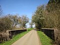
 Road bridge over River Coln - geograph.org.uk - 5218254.jpg 1,182 × 761; 282 KB
-
 Road Bridge over the River Coln - geograph.org.uk - 1513016.jpg 640 × 412; 85 KB
-

-
-

-
 Road junction above Withington - geograph.org.uk - 5120702.jpg 1,024 × 768; 155 KB
-
 Road junction west of Withington - geograph.org.uk - 1610523.jpg 640 × 480; 68 KB
-
 Road north of Withington - geograph.org.uk - 1610533.jpg 640 × 480; 54 KB
-
 Road past Staple Farm - geograph.org.uk - 1610513.jpg 640 × 480; 132 KB
-
 Road through Foulwell wood - geograph.org.uk - 1546115.jpg 640 × 480; 145 KB
-
 Road to Compton Abdale - geograph.org.uk - 5515580.jpg 1,024 × 768; 215 KB
-
 Road to Kilkenny - geograph.org.uk - 4279876.jpg 800 × 451; 195 KB
-
 Rolling Cotswold farmland - geograph.org.uk - 3773377.jpg 1,024 × 680; 238 KB
-
 Rutted bridleway near Upper Coberley - geograph.org.uk - 4400220.jpg 1,920 × 2,560; 1.53 MB
-
 Sheep in the Coln Valley - geograph.org.uk - 3082530.jpg 5,184 × 3,456; 4.32 MB
-
 Sheep sheltering in the rain in the Coln valley - geograph.org.uk - 5300695.jpg 5,184 × 3,456; 6.4 MB
-
 Shipton Golf Course - geograph.org.uk - 2888185.jpg 640 × 480; 92 KB
-
 Shipton Golf Course - geograph.org.uk - 2888200.jpg 640 × 480; 132 KB
-
 Site of former keepers cottage - geograph.org.uk - 1546176.jpg 640 × 480; 161 KB
-

-
 Snow landscape at sundown - geograph.org.uk - 1152786.jpg 640 × 480; 39 KB
-
 St Michael and All Angels church, Withington - geograph.org.uk - 3535249.jpg 2,592 × 1,944; 1.39 MB
-
 Staple Cottages - geograph.org.uk - 1559719.jpg 640 × 480; 122 KB
-
 Steep hill down to Lower Hilcot - geograph.org.uk - 1546127.jpg 640 × 480; 144 KB
-
 Stile off the White Way into Chedworth Woods - geograph.org.uk - 3082503.jpg 5,184 × 3,456; 3.65 MB
-
 Stoned track below Hill Barn - geograph.org.uk - 2561948.jpg 640 × 480; 137 KB
-
 Stubble above Colesbourne - geograph.org.uk - 1557776.jpg 640 × 480; 132 KB
-
 Stubble field on Withington Hill - geograph.org.uk - 3772129.jpg 1,024 × 680; 249 KB
-
 The A436 approaching Kilkenny - geograph.org.uk - 5544784.jpg 2,253 × 1,687; 1.14 MB
-
 The Alligator fools no one - geograph.org.uk - 2845096.jpg 3,264 × 2,448; 3.66 MB
-
 The beer garden at the Mill Inn - geograph.org.uk - 2721696.jpg 800 × 600; 326 KB
-
 The beer garden at the Mill Inn - geograph.org.uk - 2722139.jpg 800 × 600; 333 KB
-
 The bit left standing - geograph.org.uk - 2561935.jpg 640 × 480; 112 KB
-
 The Coln Valley near Woodbridge - geograph.org.uk - 6497321.jpg 1,799 × 1,199; 341 KB
-
 The dam, Colesbourne Park - geograph.org.uk - 2266577.jpg 640 × 480; 145 KB
-
 The Frogmill Inn - View from roof terrace - geograph.org.uk - 4714346.jpg 1,306 × 1,000; 1.19 MB
-
 The Gloucestershire Way - geograph.org.uk - 4279875.jpg 800 × 451; 203 KB
-
 The Gloucestershire Way to Needlehole - geograph.org.uk - 2045449.jpg 3,008 × 2,000; 1.5 MB
-
 The Hilcot Brook - geograph.org.uk - 1610503.jpg 640 × 480; 154 KB
-
 The hills north east of Cassey Compton - geograph.org.uk - 2844629.jpg 3,264 × 2,448; 2.53 MB
-
 The lake, Colesbourne Park - geograph.org.uk - 2267480.jpg 640 × 480; 108 KB


_-_geograph.org.uk_-_2561943.jpg)


