Category:Withiel
Jump to navigation
Jump to search
civil parish and village in mid Cornwall, England  | |||||
| Upload media | |||||
| Instance of | |||||
|---|---|---|---|---|---|
| Location | Cornwall, South West England, England | ||||
| Population |
| ||||
 | |||||
English: Withiel is a village and civil parish in Cornwall, England, United Kingdom. The name Withiel is derived from the Cornish word Gwydhyel, meaning wooded place.
Subcategories
This category has the following 5 subcategories, out of 5 total.
C
- St Clement's Church, Withiel (2 F)
R
- Retire (1 F)
- Ruthern Bridge (2 F)
T
- Tremore Bridge (2 F)
W
- Withielgoose Mills (1 F)
Media in category "Withiel"
The following 65 files are in this category, out of 65 total.
-
 A30 near Roche - geograph.org.uk - 4037593.jpg 640 × 319; 27 KB
-
 Access road to Hendra Farm - geograph.org.uk - 2849168.jpg 800 × 600; 320 KB
-
 An empty lane, looking west - geograph.org.uk - 4177136.jpg 640 × 480; 156 KB
-

-
 Bridge at Prince Park Farm - geograph.org.uk - 2849172.jpg 800 × 600; 495 KB
-
 Cornwall , The A30 - geograph.org.uk - 4612239.jpg 4,288 × 2,848; 4.77 MB
-
 Cornwall , The A30 - geograph.org.uk - 4612241.jpg 4,288 × 2,848; 4.8 MB
-
 Crossroad near Inchs - geograph.org.uk - 5596382.jpg 640 × 480; 39 KB
-
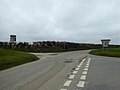
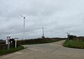
 Crossroads and wind turbine - geograph.org.uk - 4177135.jpg 640 × 480; 95 KB
-
 Farm buildings at Lanjew - geograph.org.uk - 5597447.jpg 640 × 480; 68 KB
-

-
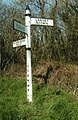
 Finger post on the junction at Bosneives - geograph.org.uk - 4855063.jpg 640 × 427; 110 KB
-
 Ford at Lawellen - geograph.org.uk - 5139495.jpg 6,000 × 4,000; 6.67 MB
-
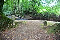
 Ford At Withielgoose Mills - geograph.org.uk - 5139463.jpg 6,000 × 4,000; 7.81 MB
-
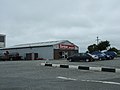 Former tile warehouse - geograph.org.uk - 2442254.jpg 800 × 600; 340 KB
-

-
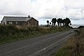
 Houses at Tremorebridge - geograph.org.uk - 4177134.jpg 640 × 480; 157 KB
-
 Hustyn Downs - geograph.org.uk - 847073.jpg 640 × 426; 166 KB
-
 Junction near Inchs - geograph.org.uk - 3981993.jpg 640 × 480; 59 KB
-
 Junction of lanes near Retire - geograph.org.uk - 3981987.jpg 640 × 480; 101 KB
-

-

-
-

-

-

-
 Once a stile - geograph.org.uk - 30937.jpg 480 × 640; 186 KB
-
 Postbox at Retire - geograph.org.uk - 5596465.jpg 640 × 480; 114 KB
-
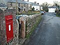 Postbox, Withiel - geograph.org.uk - 1664630.jpg 640 × 480; 114 KB
-
 Retire Common - geograph.org.uk - 998691.jpg 640 × 480; 94 KB
-
-
 Road junction near Retire - geograph.org.uk - 5596464.jpg 640 × 480; 99 KB
-
 Ruthernbridge Ford - geograph.org.uk - 5139474.jpg 6,000 × 4,000; 6.23 MB
-
 St Breock, St Breock Downs - geograph.org.uk - 47191.jpg 640 × 433; 124 KB
-
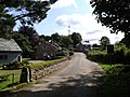
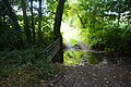
 Stream and road near Withielgoose - geograph.org.uk - 689611.jpg 640 × 480; 132 KB
-
 Sulphur Shelf Fungus^ - geograph.org.uk - 225823.jpg 494 × 640; 92 KB
-

-
 The Saints Way near Trevidgeowe - geograph.org.uk - 2849165.jpg 800 × 600; 541 KB
-
 The Saints' Way near Withiel - geograph.org.uk - 5370488.jpg 4,608 × 3,456; 3.99 MB
-
 Tregustick Ford - geograph.org.uk - 5139450.jpg 6,000 × 4,000; 7.53 MB
-
 Vegetation on Retire Common - geograph.org.uk - 1060611.jpg 640 × 480; 116 KB
-
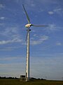 Wind turbine, Withiel - geograph.org.uk - 6135558.jpg 768 × 1,024; 81 KB
-
 Withiel - geograph.org.uk - 1629321.jpg 640 × 480; 77 KB
-
 Withiel, St Clement's church - geograph.org.uk - 5370494.jpg 4,608 × 3,456; 4.02 MB
-
 Withiel.jpg 350 × 263; 12 KB
-
 Cattle Feeding Stations - and a cow - geograph.org.uk - 225205.jpg 640 × 427; 89 KB
-
 Fishing lakes at Gwennymoor - geograph.org.uk - 715958.jpg 640 × 480; 91 KB
-
 Hay Meadow by Lanjew Farm - geograph.org.uk - 30935.jpg 640 × 480; 142 KB
-
 Higher Kernick Farm - geograph.org.uk - 223967.jpg 640 × 427; 112 KB
-
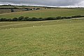
 Hilltop Pasture - geograph.org.uk - 224026.jpg 640 × 427; 107 KB
-
 Honeysuckle and Blackberries - geograph.org.uk - 225796.jpg 640 × 520; 139 KB
-
 House on St Breock Downs - geograph.org.uk - 225860.jpg 640 × 427; 66 KB
-
 Lambs on the hill - geograph.org.uk - 430942.jpg 640 × 480; 79 KB
-
 Land around Lantuel Farm - geograph.org.uk - 225846.jpg 640 × 427; 97 KB
-
 Narrow land from St Wenn - geograph.org.uk - 223980.jpg 640 × 427; 104 KB
-
 Old Goods Trailer - geograph.org.uk - 225215.jpg 640 × 427; 114 KB
-
 Pasture and Conifers - geograph.org.uk - 224031.jpg 640 × 427; 83 KB
-
 Ploughing - geograph.org.uk - 225256.jpg 640 × 427; 65 KB
-
 Rough track and footpath - geograph.org.uk - 689638.jpg 640 × 480; 158 KB
-
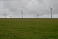 St Breock Wind Farm - geograph.org.uk - 225852.jpg 640 × 427; 54 KB
-
 Stream near Tregolls - geograph.org.uk - 225785.jpg 640 × 427; 119 KB
-
 The Road through Lancorla Farm - geograph.org.uk - 225208.jpg 640 × 427; 102 KB
-
-
 Tregolls - geograph.org.uk - 224013.jpg 640 × 427; 87 KB
-
 Two Tracks - geograph.org.uk - 224015.jpg 640 × 427; 87 KB


