Category:Wistaston
Jump to navigation
Jump to search
English: Wistaston is a civil parish and village in the unitary authority of Cheshire East and the ceremonial county of Cheshire, in north-west England. It is approximately two miles west of Crewe town centre and three miles east of Nantwich town centre.

village and civil parish in Cheshire East, UK  | |||||
| Upload media | |||||
| Instance of | |||||
|---|---|---|---|---|---|
| Location | Cheshire East, Cheshire, North West England, England | ||||
| Population |
| ||||
 | |||||
Subcategories
This category has only the following subcategory.
M
Media in category "Wistaston"
The following 125 files are in this category, out of 125 total.
-
 "The Woodside" from Woodside Lane - geograph.org.uk - 280924.jpg 640 × 427; 430 KB
-
 2, Wistaston Green Close - geograph.org.uk - 3505382.jpg 640 × 480; 90 KB
-

-
 Alvaston Farm - geograph.org.uk - 2974103.jpg 640 × 480; 76 KB
-
 Alvaston Hall Hotel - geograph.org.uk - 2974100.jpg 640 × 480; 57 KB
-
 Alvaston Hall, near Nantwich - geograph.org.uk - 5898180.jpg 1,024 × 776; 260 KB
-
 Alvaston Manor - geograph.org.uk - 2027231.jpg 800 × 600; 287 KB
-
 Bandstand, Queen's Park, Crewe - geograph.org.uk - 247621.jpg 640 × 479; 89 KB
-
 Beech Drive, where are the flowers^ - geograph.org.uk - 3505378.jpg 640 × 480; 105 KB
-
 Bird on a branch, Alvaston Hall - geograph.org.uk - 2976178.jpg 640 × 480; 29 KB
-
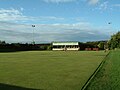
 Bowling Green, Alvaston Hall - geograph.org.uk - 2974117.jpg 640 × 480; 56 KB
-
 Brook near Wistaston - geograph.org.uk - 350664.jpg 493 × 640; 135 KB
-
 Broughton Lane junction - geograph.org.uk - 2130594.jpg 1,512 × 2,016; 1.12 MB
-
 Bus stop on Crewe Road (A534) - geograph.org.uk - 5224998.jpg 640 × 480; 84 KB
-

-
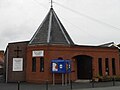
 Church of Jesus Christ of Latter-Day Saints, Wistaston.JPG 4,608 × 3,456; 3.36 MB
-
 Crewe Road (A534) - geograph.org.uk - 5225002.jpg 640 × 480; 75 KB
-
 Crewe Road (A534) - geograph.org.uk - 5226197.jpg 640 × 480; 79 KB
-
 Crewe Road, Wistaston - geograph.org.uk - 5226018.jpg 2,848 × 2,136; 1.42 MB
-
 Dane Bank Avenue, Crewe - geograph.org.uk - 5185807.jpg 640 × 480; 64 KB
-
 Detached house on Holly Place - geograph.org.uk - 5225006.jpg 640 × 480; 82 KB
-
 Elizabeth II postbox on Wistaston Green Road - geograph.org.uk - 5186419.jpg 2,136 × 2,848; 1.37 MB
-
 Entering Wistaston - geograph.org.uk - 5225021.jpg 640 × 480; 84 KB
-
 Entrance to Red Hall - geograph.org.uk - 2974112.jpg 640 × 480; 72 KB
-
 Fairbrook, Wistaston Green - geograph.org.uk - 3505390.jpg 640 × 480; 83 KB
-
 Field Lane, Wistaston Green - geograph.org.uk - 3505384.jpg 640 × 480; 99 KB
-
 Field off Wistaston Green Road - geograph.org.uk - 5185780.jpg 640 × 480; 59 KB
-
 Footbridge over brook, near Wistaston - geograph.org.uk - 350786.jpg 640 × 470; 177 KB
-
 George VI postbox on Crewe Road - geograph.org.uk - 5226196.jpg 2,848 × 2,136; 1.45 MB
-
 George VI postbox on Crewe Road, Wistaston - geograph.org.uk - 5226017.jpg 978 × 1,948; 331 KB
-
 Golf course, Alvaston Hall, Nantwich - geograph.org.uk - 5902109.jpg 1,024 × 660; 278 KB
-
 Grey squirrel, Alvaston Hall, near Nantwich - geograph.org.uk - 5898145.jpg 1,024 × 682; 116 KB
-
 House on Crewe Road (A534) - geograph.org.uk - 5225000.jpg 640 × 480; 68 KB
-
 House on the A534, Crewe - geograph.org.uk - 5224997.jpg 640 × 480; 90 KB
-
 Houses on Wistaston Green Road - geograph.org.uk - 5185798.jpg 640 × 480; 67 KB
-
 Joey the Swan recreation area - geograph.org.uk - 2130615.jpg 2,016 × 1,512; 1.52 MB
-
 Joey's Island - geograph.org.uk - 1764052.jpg 640 × 480; 184 KB
-
 Jubilee Bridge, Wistaston - geograph.org.uk - 1760916.jpg 640 × 480; 96 KB
-
 Lane to Robinsons Corner - geograph.org.uk - 2974108.jpg 640 × 480; 68 KB
-
 Lucy's Cakes, Wistaston.JPG 4,608 × 3,456; 3.69 MB
-
 Memorial Hall plaque.JPG 1,600 × 1,200; 408 KB
-
 Millennium project at 'Joey the Swan', in Wistaston, Cheshire.jpg 640 × 427; 365 KB
-
 Millennium Rock - geograph.org.uk - 1764076.jpg 640 × 480; 219 KB
-
 New Greenway - geograph.org.uk - 2374341.jpg 1,280 × 960; 674 KB
-

-
 Pond, golf course, Alvaston Hall, Nantwich - geograph.org.uk - 5902104.jpg 1,024 × 611; 285 KB
-
 Roadway to Wistaston Hall - geograph.org.uk - 280934.jpg 640 × 427; 442 KB
-
 Rookery Lodge, Middlewich Road - geograph.org.uk - 494203.jpg 640 × 480; 110 KB
-
 Service station on the A534 - geograph.org.uk - 5224994.jpg 640 × 480; 52 KB
-

-
 Small mere in woodland by Wistaston Green - geograph.org.uk - 365668.jpg 497 × 640; 148 KB
-
 Spring at last - geograph.org.uk - 1764031.jpg 640 × 480; 206 KB
-

-
 Telephone exchange, Crewe Road, Wistaston.JPG 4,608 × 3,456; 3.45 MB
-
 The Limes, Alvaston Hall, near Nantwich - geograph.org.uk - 5898560.jpg 1,024 × 781; 302 KB
-
 The Mornflake Oats plant, Crewe - geograph.org.uk - 118838.jpg 640 × 480; 90 KB
-
 The Rising Sun - geograph.org.uk - 2027207.jpg 800 × 600; 241 KB
-
 The Rising Sun pub - geograph.org.uk - 2130463.jpg 1,558 × 1,092; 655 KB
-

-
 The Rising Sun, near Marshfield Bank - geograph.org.uk - 365350.jpg 640 × 472; 124 KB
-
 The Woodside public house - geograph.org.uk - 2283615.jpg 2,000 × 1,333; 326 KB
-
 Time Capsule Plaque - geograph.org.uk - 1764061.jpg 640 × 480; 209 KB
-
 View NE from Ropegreen Bridge - geograph.org.uk - 373159.jpg 640 × 450; 157 KB
-
 Waiting for God - geograph.org.uk - 1607802.jpg 640 × 426; 231 KB
-
 Wells Green Methodist Church (1).JPG 4,608 × 3,456; 3.37 MB
-
 Wells Green Methodist Church (2).JPG 4,608 × 3,456; 3.27 MB
-
 Whitegates, House, Wistaston Green - geograph.org.uk - 5185797.jpg 640 × 480; 62 KB
-
 Wistaston - Westfield Infant School.jpg 640 × 452; 143 KB
-
 Wistaston Bowling Club.JPG 1,600 × 1,200; 404 KB
-
 Wistaston Brook - geograph.org.uk - 365567.jpg 480 × 640; 150 KB
-
 Wistaston Brook - geograph.org.uk - 365647.jpg 480 × 640; 170 KB
-

-
 Wistaston Green Road - geograph.org.uk - 5185782.jpg 640 × 480; 65 KB
-
 Wistaston Green Road - geograph.org.uk - 5186423.jpg 2,848 × 2,136; 1.25 MB
-
 Wistaston Green Road, Crewe - geograph.org.uk - 2130411.jpg 2,016 × 1,512; 1.54 MB
-
 Wistaston in Bloom - Church Hall.JPG 1,600 × 1,200; 643 KB
-
 Wistaston in Bloom - Memorial Hall (2).JPG 1,600 × 1,200; 631 KB
-
 Wistaston in Bloom - opp Memorial Hall (1).JPG 1,200 × 1,600; 599 KB
-
 Wistaston in Bloom - Wistonia Centre (4).JPG 1,600 × 1,200; 614 KB
-
 Wistaston Village Fete 2005 (21).JPG 1,600 × 1,200; 405 KB
-
 Wistaston Village Fete 2005 (9).JPG 1,600 × 1,200; 419 KB
-
 Wistaston Walks - geograph.org.uk - 1760934.jpg 640 × 480; 177 KB
-
 Wistaston Walks Information - geograph.org.uk - 1760903.jpg 640 × 480; 113 KB
-
 WistastonChurchLane.jpg 498 × 354; 56 KB
-
 WJTC - 25th anniversary (10).JPG 1,280 × 960; 348 KB
-
 WJTC - 30th anniversary (41).JPG 2,048 × 1,536; 1.48 MB
-
 Woodland near Wistaston Brook - geograph.org.uk - 365619.jpg 480 × 640; 168 KB
-
 Ye Olde Manor public house, Crewe - geograph.org.uk - 5224991.jpg 640 × 480; 69 KB
-
 Detached houses, Rope Lane, Wistaston - geograph.org.uk - 373337.jpg 640 × 425; 121 KB
-

-
 Farmland at Broughton Farm - geograph.org.uk - 373281.jpg 640 × 426; 143 KB
-
 Fashions come and go but stile... - geograph.org.uk - 1421817.jpg 600 × 400; 268 KB
-
 Footbridge over Wistaston Brook - geograph.org.uk - 365637.jpg 571 × 640; 170 KB
-
 Gainsborough Junior School - geograph.org.uk - 280920.jpg 640 × 427; 357 KB
-
 Housing estate, W Wistaston - geograph.org.uk - 350773.jpg 640 × 450; 125 KB
-
 Kings Grove School, Buchan Grove - geograph.org.uk - 280923.jpg 640 × 427; 386 KB
-
 Lake at Queen's Park, Crewe - geograph.org.uk - 247623.jpg 640 × 479; 84 KB
-
 Marshfield Bridge over Valley Brook - geograph.org.uk - 365408.jpg 480 × 640; 165 KB
-
 Marys Gate, Wistaston - geograph.org.uk - 350704.jpg 640 × 379; 104 KB
-
 Millennium Rock at "Joey the Swan" - geograph.org.uk - 280931.jpg 640 × 427; 432 KB
-
 Oak by Brook Farm track - geograph.org.uk - 373240.jpg 640 × 458; 169 KB
-
 Pasture by Brook Farm - geograph.org.uk - 373172.jpg 640 × 427; 128 KB
-
 Pasture west of Wistaston - geograph.org.uk - 350727.jpg 640 × 480; 115 KB
-
 Pedestrian bridge by Ropegreen Bridge - geograph.org.uk - 373139.jpg 640 × 427; 130 KB
-
 Queen's Park, Crewe - geograph.org.uk - 247625.jpg 640 × 479; 84 KB
-
 Queens Park clock tower in the Spring - geograph.org.uk - 381661.jpg 480 × 640; 43 KB
-
 Reflections in mere - geograph.org.uk - 373330.jpg 427 × 640; 161 KB
-
 Rookery Lodge, near Marshfield Bank - geograph.org.uk - 364289.jpg 640 × 480; 137 KB
-
 Sandringham Drive, Wistaston - geograph.org.uk - 350686.jpg 640 × 416; 106 KB
-
 Semis on Berkeley Crescent, Wistaston - geograph.org.uk - 372940.jpg 640 × 376; 131 KB
-
 South Cheshire College - geograph.org.uk - 280911.jpg 640 × 427; 380 KB
-
 Springtime on Gresty Lane - geograph.org.uk - 373198.jpg 478 × 640; 147 KB
-
 St. Mary's R.C. Primary School - geograph.org.uk - 280913.jpg 640 × 427; 378 KB
-
 St. Thomas More Catholic High - geograph.org.uk - 280915.jpg 640 × 427; 396 KB
-
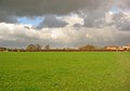 Storm clouds west of Wistaston - geograph.org.uk - 350747.jpg 640 × 449; 98 KB
-

-
 Swill Brook - geograph.org.uk - 373226.jpg 451 × 640; 170 KB
-
 Valley Road, Wistaston - geograph.org.uk - 280925.jpg 640 × 427; 426 KB
-

-
 Wells Green traffic lights, Wistaston - geograph.org.uk - 373341.jpg 640 × 548; 124 KB
-
 Wistaston Brook Bridge at "Joey the Swan" - geograph.org.uk - 280927.jpg 640 × 427; 415 KB
-
 Wistaston Green Bridge - geograph.org.uk - 364349.jpg 640 × 494; 146 KB
-
 Wistaston Green Bridge, south east - geograph.org.uk - 365534.jpg 480 × 640; 156 KB
-
 Wistaston Junior School - geograph.org.uk - 350638.jpg 640 × 406; 129 KB
-
 Woodland near Marshfield Bridge - geograph.org.uk - 365490.jpg 525 × 640; 168 KB


_-_geograph.org.uk_-_5224998.jpg)


_-_geograph.org.uk_-_5225002.jpg)
_-_geograph.org.uk_-_5226197.jpg)


_-_geograph.org.uk_-_5225000.jpg)


.JPG)
.JPG)


.JPG)
.JPG)
.JPG)
.JPG)
.JPG)


.JPG)
.JPG)


_-_geograph.org.uk_-_280919.jpg)


