Category:Wisconsin Highway 171
Jump to navigation
Jump to search
 | number: | (one hundred seventy-one) |
|---|---|---|
| State highways in Wisconsin: | 152 · 153 · 154 · 155 · 156 · 157 · 158 · 160 · 161 · 162 · 164 · 165 · 167 · 169 · 170 · 171 · 172 · 173 · 175 · 178 · 179 · 180 · 181 · 182 · 186 · 187 · 188 · 190 · 191 |
state highway in Crawford and Richland counties in Wisconsin, United States | |||||
| Upload media | |||||
| Instance of | |||||
|---|---|---|---|---|---|
| Location |
| ||||
| Transport network | |||||
| Owned by | |||||
| Maintained by | |||||
| Length |
| ||||
| Terminus | |||||
| |||||
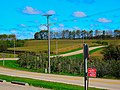
English: Media related to Wisconsin Highway 171, a 33.39-mile (53.74 km) state highway in Crawford and Richland counties in Wisconsin, United States.
Subcategories
This category has only the following subcategory.
Media in category "Wisconsin Highway 171"
The following 15 files are in this category, out of 15 total.
-
 AkanWisconsinTownHallWIS171.jpg 1,936 × 1,288; 1.67 MB
-
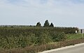 AppleOrchardsGaysMillsWisconsinWIS171.jpg 1,934 × 1,224; 983 KB
-
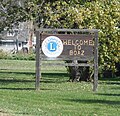 BoazWisconsinCityWelcomeSignWIS171.jpg 656 × 632; 327 KB
-
 BoazWisconsinHousingWIS171.jpg 1,874 × 1,152; 1,004 KB
-
 BoazWisconsinSignWIS171.jpg 1,868 × 1,118; 898 KB
-
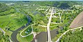 Gays Mill, Wisconsin aerial-2.jpg 6,808 × 3,486; 19.04 MB
-
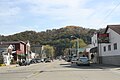 GaysMillsWisconsinDowntownEastWIS171.jpg 1,936 × 1,288; 1.11 MB
-
 GaysMillsWisconsinDowntownWestWIS171.jpg 1,936 × 1,288; 1.34 MB
-
 WIS 171.svg 600 × 600; 2 KB
-
 WIS131TurningGaysMillsWisconsin.jpg 1,936 × 1,288; 1.52 MB
-
 WIS171EastTerminusUS14.jpg 1,810 × 1,146; 830 KB
-
 Wisconsin State Highway 171 - panoramio (1).jpg 5,184 × 3,888; 8.83 MB
-
 Wisconsin State Highway 171 - panoramio (2).jpg 5,184 × 3,888; 7.02 MB
-
 Wisconsin State Highway 171 - panoramio (3).jpg 4,852 × 3,730; 6.65 MB
-
 Wisconsin State Highway 171 - panoramio.jpg 5,184 × 3,888; 7.87 MB


.jpg)
.jpg)
.jpg)
