Category:Wisbech and Upwell Tramway
Jump to navigation
Jump to search
standard gauge tramway in East Anglia, England .jpg) | |||||
| Upload media | |||||
| Instance of | |||||
|---|---|---|---|---|---|
| Location |
| ||||
| Date of official opening |
| ||||
| Date of official closure |
| ||||
 | |||||
Subcategories
This category has the following 3 subcategories, out of 3 total.
G
Media in category "Wisbech and Upwell Tramway"
The following 112 files are in this category, out of 112 total.
-
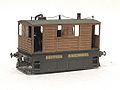 3mm scale Y6 tram locomotive.jpg 1,046 × 785; 373 KB
-
 A derelict shed - geograph.org.uk - 1261524.jpg 600 × 592; 157 KB
-
 A farm in the fens - geograph.org.uk - 1261531.jpg 640 × 480; 109 KB
-
 A footpath gate - geograph.org.uk - 1267004.jpg 640 × 480; 120 KB
-
 A relic from the Wisbech Canal - geograph.org.uk - 1241690.jpg 640 × 526; 163 KB
-

-
 A shop no more - geograph.org.uk - 1261523.jpg 640 × 480; 108 KB
-

-

-
 Basin Road by (former) Basin Bridge - geograph.org.uk - 1242077.jpg 640 × 480; 90 KB
-
 Bridge No 35 - geograph.org.uk - 1240985.jpg 640 × 480; 96 KB
-
 Chapel Lane - geograph.org.uk - 1267558.jpg 640 × 480; 95 KB
-

-
 Dial House Farm - geograph.org.uk - 1261473.jpg 640 × 534; 133 KB
-
 Dial House Farm - the sun dial (detail) - geograph.org.uk - 1261478.jpg 587 × 620; 130 KB
-
 Dial House Farm - the sun dial - geograph.org.uk - 1261477.jpg 509 × 640; 142 KB
-
 Dilapidated shed - geograph.org.uk - 1242070.jpg 640 × 480; 147 KB
-
 Farm shed at Dial House Farm - geograph.org.uk - 1261480.jpg 640 × 525; 102 KB
-
 Farm shop by Inglethorpe Hall - geograph.org.uk - 1267063.jpg 640 × 480; 148 KB
-
 Farmhouse on Wisbech Road (A1122) - geograph.org.uk - 1242024.jpg 630 × 522; 123 KB
-

-
 Flowering Magnolia - geograph.org.uk - 1241257.jpg 620 × 501; 107 KB
-
 Footpath to Collett's Bridge - geograph.org.uk - 1267567.jpg 640 × 480; 146 KB
-
 Footpath to Elm - geograph.org.uk - 1266964.jpg 640 × 527; 106 KB
-
 Gate onto the green - geograph.org.uk - 1267582.jpg 640 × 480; 121 KB
-
 GER G15 No. 0125.jpg 471 × 301; 41 KB
-
 Houses on Small Lode - geograph.org.uk - 1241241.jpg 640 × 480; 110 KB
-
 Kelvedon (Low Level) station, 1950 (geograph 5128586).jpg 2,279 × 1,192; 1.57 MB
-
 Kirkams Lane - geograph.org.uk - 1266911.jpg 640 × 480; 99 KB
-
 Low Side - geograph.org.uk - 1241442.jpg 640 × 480; 96 KB
-
 Nothing remains - geograph.org.uk - 1241223.jpg 640 × 562; 109 KB
-
 Old red telephone box - geograph.org.uk - 1241604.jpg 480 × 640; 96 KB
-
 Outwell Road - geograph.org.uk - 1261386.jpg 480 × 640; 77 KB
-
 Path linking A1101 with A1122 - geograph.org.uk - 1241681.jpg 480 × 640; 116 KB
-
 Pony grazing by the old canal - geograph.org.uk - 1267018.jpg 640 × 480; 114 KB
-
 Remains of a farm shop - geograph.org.uk - 1261520.jpg 640 × 550; 106 KB
-
 Roundabout north of Outwell - geograph.org.uk - 1261383.jpg 640 × 487; 61 KB
-
 St Peter's Church - geograph.org.uk - 1241017.jpg 640 × 480; 93 KB
-
 St Peter's Church - geograph.org.uk - 1241020.jpg 640 × 517; 92 KB
-
 St Peter's Church - the north side - geograph.org.uk - 1241024.jpg 504 × 640; 92 KB
-
 St Peter's Church - the south side - geograph.org.uk - 1241025.jpg 640 × 511; 88 KB
-
 The A1101 (Outwell Road) through Elm - geograph.org.uk - 1267604.jpg 640 × 523; 77 KB
-
 The course of the Wisbech Canal - geograph.org.uk - 1266977.jpg 640 × 480; 79 KB
-
 The Five Bells Inn - geograph.org.uk - 1240993.jpg 640 × 480; 68 KB
-

-
 The old Wisbech Canal - geograph.org.uk - 1267010.jpg 480 × 640; 140 KB
-
 The tramway once used to run past here - geograph.org.uk - 1261528.jpg 640 × 480; 124 KB
-
 There once used to be a canal here - geograph.org.uk - 1266958.jpg 640 × 511; 80 KB
-
 Third Class Carriage, North Norfolk Railway (geograph 4608654).jpg 640 × 481; 464 KB
-
 Thomas the Tank - geograph.org.uk - 1278775.jpg 480 × 640; 72 KB
-
 Town Street (B1412) - geograph.org.uk - 1241005.jpg 640 × 480; 94 KB
-
 Track along the former canal - geograph.org.uk - 1266968.jpg 640 × 480; 96 KB
-
 Trafford House - geograph.org.uk - 1261505.jpg 640 × 509; 117 KB
-
 Trains once used to pass here - geograph.org.uk - 1241472.jpg 640 × 519; 83 KB
-
 Upwell Health Centre - geograph.org.uk - 1241236.jpg 640 × 480; 105 KB
-
 Upwell Post Office - geograph.org.uk - 1241001.jpg 473 × 640; 99 KB
-
 View across Well Creek - geograph.org.uk - 1240997.jpg 640 × 480; 102 KB
-
 View along Small Lode - geograph.org.uk - 1241199.jpg 640 × 480; 69 KB
-
 View along the A1101 - geograph.org.uk - 1261445.jpg 616 × 620; 128 KB
-
 View along the old Outwell Road - geograph.org.uk - 1261510.jpg 640 × 480; 63 KB
-
 View north along Isle Road (A1101) - geograph.org.uk - 1242030.jpg 640 × 480; 92 KB
-
 View towards St Peter's Church - geograph.org.uk - 1241012.jpg 640 × 480; 114 KB
-
 Well Creek - geograph.org.uk - 1240990.jpg 480 × 640; 133 KB
-

-

-
-

-

-

-

-

-

-

-

-

-
-

-

-

-
-

-
 Wisbech and Upwell tramway - Dial House - geograph.org.uk - 1261452.jpg 640 × 480; 110 KB
-

-

-

-

-

-

-
 Wisbech and Upwell tramway - Low Side - geograph.org.uk - 1241431.jpg 640 × 480; 106 KB
-

-

-

-

-

-

-

-
-

-

-

-

-

-

-

-

-

-

-

-

-

-

-
 Y6 Tram (8523411627).jpg 696 × 588; 301 KB


_-_geograph.org.uk_-_1241229.jpg)

_Basin_Bridge_-_geograph.org.uk_-_1242077.jpg)


_-_geograph.org.uk_-_1267639.jpg)

_-_geograph.org.uk_-_1261478.jpg)


_-_geograph.org.uk_-_1242024.jpg)


_station,_1950_(geograph_5128586).jpg)


_through_Elm_-_geograph.org.uk_-_1267604.jpg)


.jpg)

_-_geograph.org.uk_-_1241005.jpg)


_-_geograph.org.uk_-_1242030.jpg)


_crossing_-_geograph.org.uk_-_1242074.jpg)


.jpg)