Category:Winterbourne Gunner
Jump to navigation
Jump to search
village in Wiltshire, UK  | |||||
| Upload media | |||||
| Instance of |
| ||||
|---|---|---|---|---|---|
| Location | Winterbourne, Wiltshire, South West England, England | ||||
| official website | |||||
 | |||||
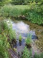
English: Winterbourne Gunner is a small village in the UK but seems larger, as it joins on to Winterbourne Dauntsey, which itself is joined on to Winterbourne Earls. It is located in Wiltshire in England about five miles northeast of Salisbury situated on the A338. The Defence CBRN Centre is located to the southeast of the village and the River Bourne runs close by. The friendly village benefits from a small but well run junior/infants school which is a short walk into Winterbourne Earls and the village has a post office with a small shop.
Subcategories
This category has the following 2 subcategories, out of 2 total.
D
- Defence CBRN Centre (16 F)
S
Media in category "Winterbourne Gunner"
The following 13 files are in this category, out of 13 total.
-
 Chalkstream.jpg 450 × 600; 94 KB
-
 Concrete Barriers near High Post - geograph.org.uk - 337735.jpg 640 × 480; 103 KB
-
 Cusse's Gorse - geograph.org.uk - 448087.jpg 640 × 480; 90 KB
-
 Farmland with trees, Gomeldon - geograph.org.uk - 513109.jpg 640 × 480; 143 KB
-
 Figsbury Ring car park - geograph.org.uk - 61355.jpg 640 × 481; 135 KB
-
 Hops (Humulus lupulus), West Gomeldon (geograph 2061898).jpg 480 × 640; 72 KB
-
 Recycling Area at Winterbourne Gunner - geograph.org.uk - 311455.jpg 640 × 480; 158 KB
-
 River Bourne in Winterbourne Gunner, Wiltshire.jpg 4,000 × 2,664; 3.98 MB
-
 Thatched Post Office - geograph.org.uk - 311374.jpg 640 × 480; 124 KB
-
 Thorneydown Road - geograph.org.uk - 1707002.jpg 800 × 600; 120 KB
-

-
 Barley, Firsdown - geograph.org.uk - 483885.jpg 640 × 480; 123 KB
-
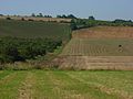 Farmland, Winterbourne Gunner - geograph.org.uk - 513108.jpg 640 × 480; 130 KB


,_West_Gomeldon_(geograph_2061898).jpg)


.jpg)

